|
On the the corner of Watchung and East 7th in the Crescent District of Plainfield , New Jersey is the bright pink Victorian with the slate Mansard roof which now houses the Swain Galleries. Going back in time this was once the home and office of a prominent physician in town; Dr. Ellis W. Hedges. 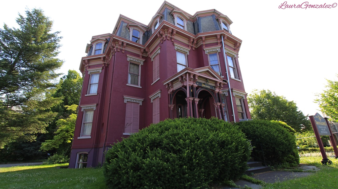 Hedges had come from a family of doctors. His father was Dr. Smith E Hedges who had lived in Plainfield as well. His brother was Dr. B. Von D. Hedges and was also in the medical profession and practiced in New York. He was also very involved in the church across the street acting as an organist for a great many years.   The home is largely unaltered and one of the best examples of a Mansard in the district.  Laura Gonzalez
0 Comments
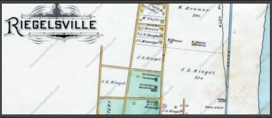 A cute picturesque city on the Delaware, the small town of Riegelsville had a population of 868 at the 2010 census. I visited this small river town in early October, perfect time for a walk around a city rumoured to be haunted . 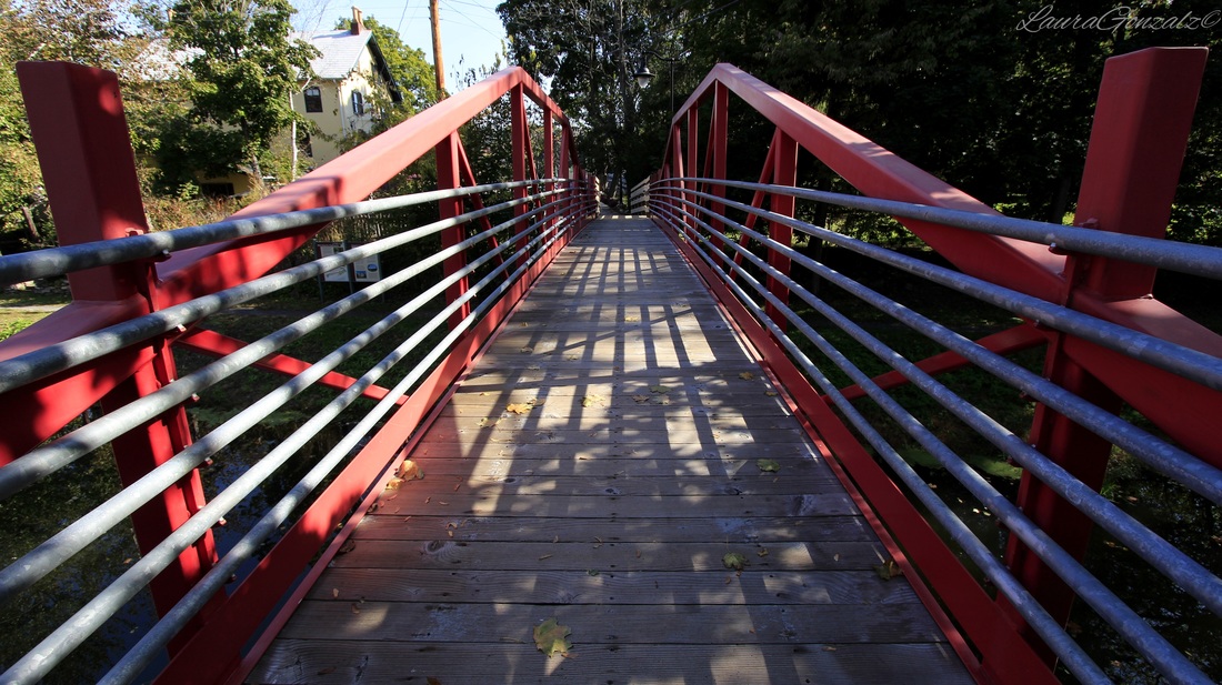 With the completion of the Delaware Canal in 1832, the towns along the Delaware River became industrial cities. Riegelsville was no different. Warehouses and factories lined its banks. Today, Riegelsville is a peaceful and quiet town. Woods and fields border the Delaware Canal; remnants of crumbling stone foundations along its banks are reminders of a busy past. 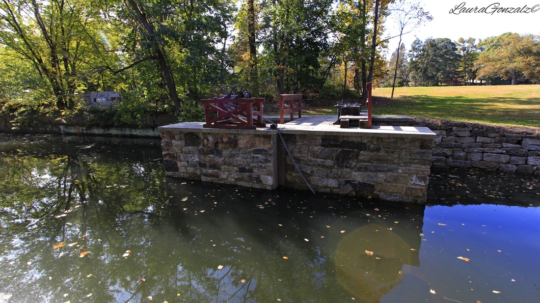 THE FOUNDING OF RIEGELSVILLE In 1774, a Williams Township blacksmith, Wendell Shank, bought riverside acreage that was part of the Durham Iron Works tract, built a log house, a barn and a blacksmith shop. He opened a new public road from the blast furnace in the village of Durham to the river and started a ferry service. It became known as Shank’s Ferry. It relied heavily on traffic headed to and from the Durham Iron Works located nearby. When the iron works went out of business at the end of the 18th century, Shenk’s Ferry went out of business, too. Shenk’s property was seized by the sheriff and sold in 1805. 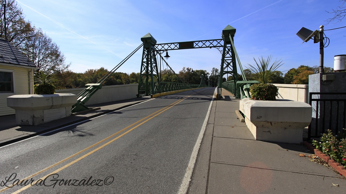 Enter Benjamin Riegel, of the Riegel Family, early landowners in the area. He was a Lower Saucon Township farmer. Buying the property in 1806 and taking over the ferry, he erected buildings and established the Riegel dynasty and changed the town’s name to Riegelsville. His home still stands. 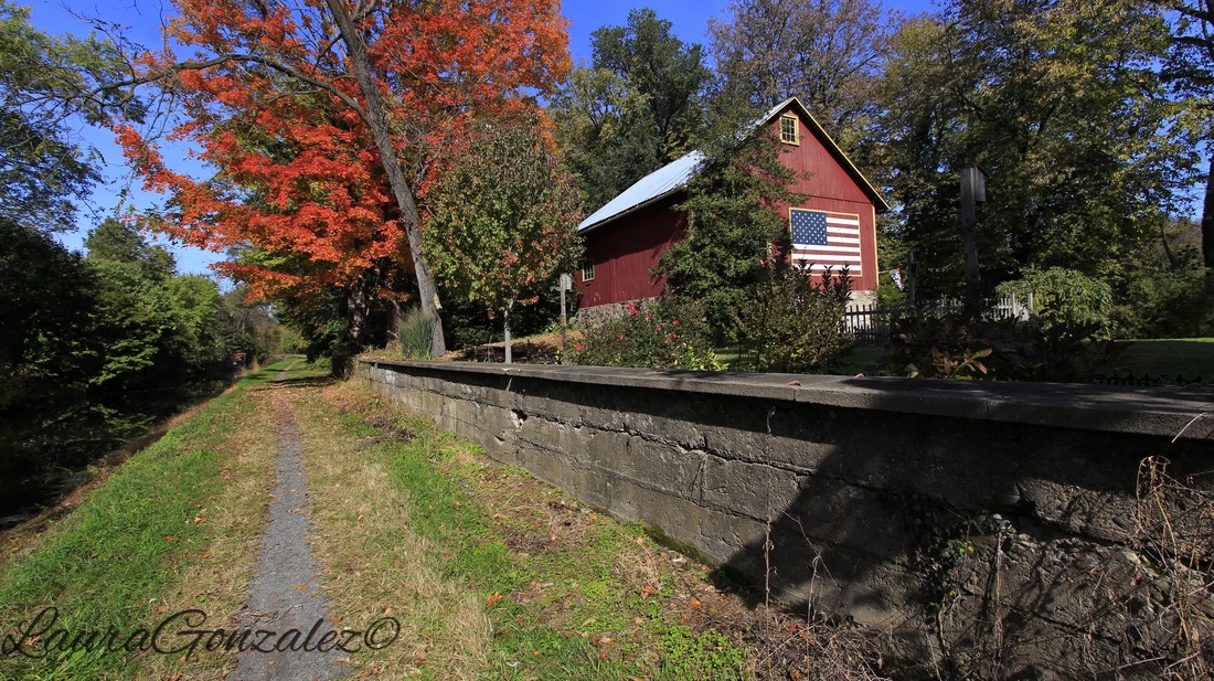 Benjamin Riegel House The Benjamin Riegel House is a two and one half story, five bay, brick structure that was built in 1832. Riegel resided in the house until his death in 1860 as did his widow until 1880. The Benjamin Riegel House was listed on the National Register of Historic Places in 1986. The property has been privately owned by Dr. and Mrs. Neal Azrolan since 2010. 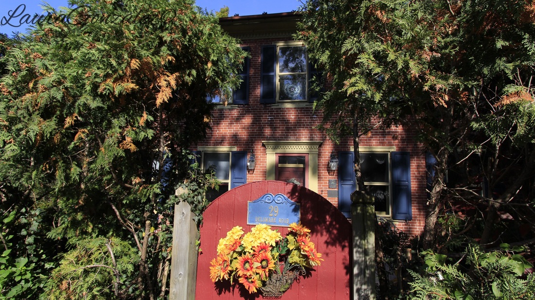 Benjamin Riegel House The Riegel family is known for establishing paper mills in a cluster of small towns along the Musconetcong River in New Jersey, providing jobs for generations on both sides of the Delaware. Riegel was the uncle of a second Benjamin Riegel, who was a miller and lived across the Delaware River in New Jersey at the Delaware’s confluence with the Musconetcong River. This Benjamin Riegel owned a gristmill, sawmill and linseed oil mill; his settlement on the New Jersey side of the river also was named Riegelsville for him. To this day, there are Riegelsvilles on both sides of the Delaware River. 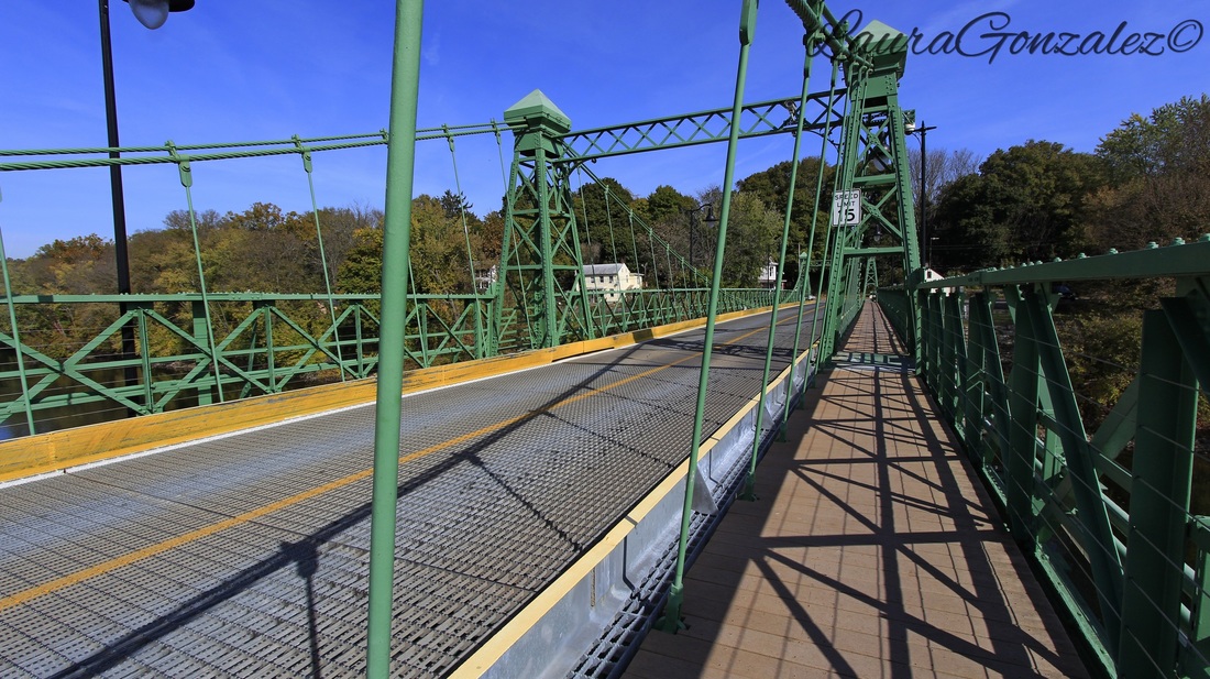 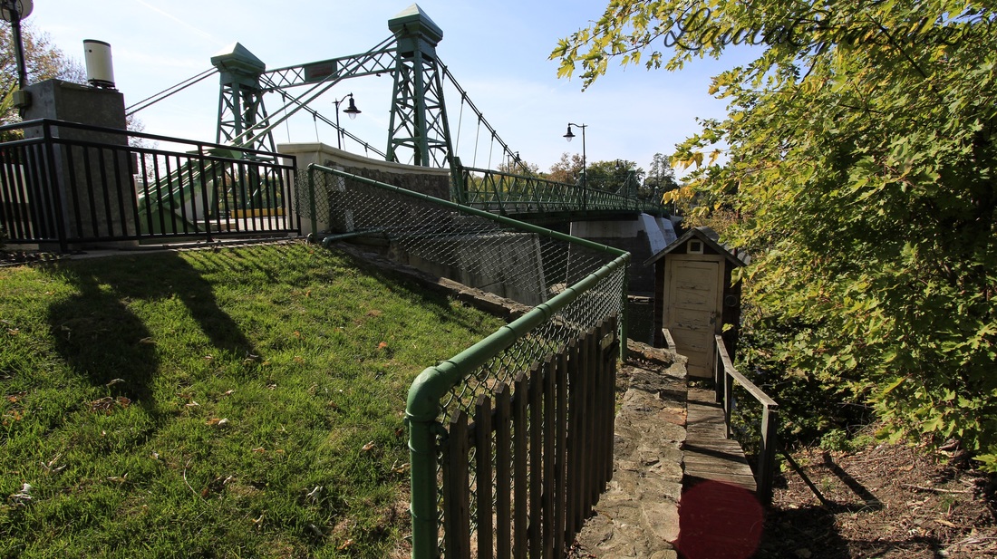 Ferry service across the Delaware was soon abandoned in 1837 when the river bridge was first opened. The Riegelsville-Delaware Bridge was a covered bridge. 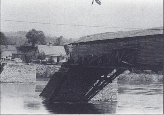 Source:Bridges Over the Delaware River: A History of Crossings A major flood struck the Delaware Valley on January 8, 1841, just three years after the bridge opened, and the span nearest the Jersey shore was destroyed. The bridge was repaired and survived another flood in June 1862. It was during the Pumpkin Flood of 1903, so named for the many gourds that drifted away, the wood from the bridge floated off in the Delaware River. The people of Frenchtown scavenged the wood to rebuild their own bridge that was taken out by the flood. The people of Riegelsville decided to try a cable suspension bridge and hired the most famous suspension bridge builders, John Roebling in 1904 to replace the original bridge. 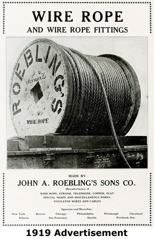 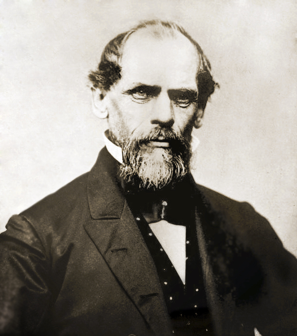 The bridge is owned and operated by the Delaware River Joint Toll Bridge Commission. The Riegelsville suspension bridge collected tolls until it was purchased by the Joint Commission. After 106 years of traffic and floods and other elements it became the target of a $8 million project which had bridge’s floor system and sidewalks replaced, the structure painted, piers and abutments repaired, lighting upgraded and signs improved. The work increased the weight limit on the bridge from 2.5 tons to 3 tons. 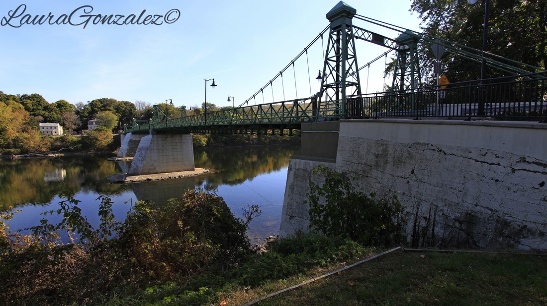 The town of Riegelsville, they say, is home to more ghosts than anywhere else. There are quite a few books written on its haunted history. Rev. Jeffrey A. Wargo, pastor of St. John United Church of Christ and chaplain for Community Fire Co. No. 1, not only is the town priest , he is also the town ghost hunter. He has written two books, “Ghosts in the ‘Ville” and “More Ghosts in the ‘Ville.” His stories record paranormal and other unexplained occurrences at more than 20 places in town. Not only is he protecting its residents from the burning fires of hell, and burning fires in your home but he can be found protecting the town from its ghosts. According to a interview I read of Wargo telling of the area's past “Spirits may be drawn to this ancient place because it was once a Lenape village. The Indians believed it was sacred ground and came here to be cleansed. The local chief was also a shaman”. 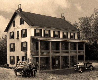 Riegelsville Inn The original, and now historic, Riegelsville Inn that he built in 1838 still stands. It is also the most known haunted spot in town. This historic stone inn has offered food and lodging to Bucks County travelers for over 160 years. Stories of faucets in the bathrooms mysteriously turn themselves on and off. Some have seen the specter of a little girl in the inn, soaking wet and shivering. 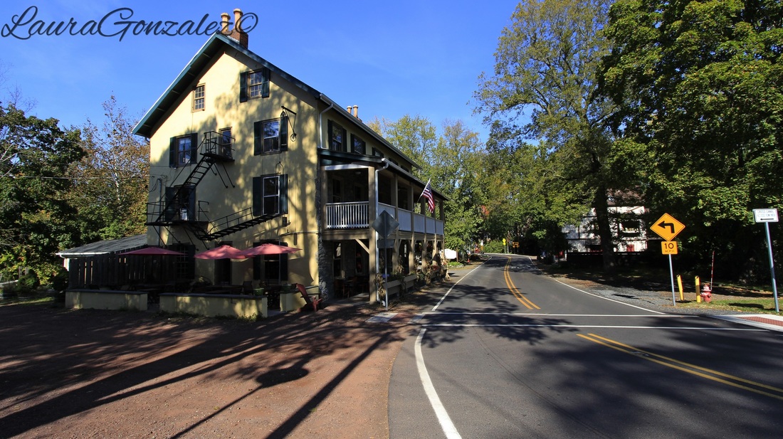 Riegelsville Inn 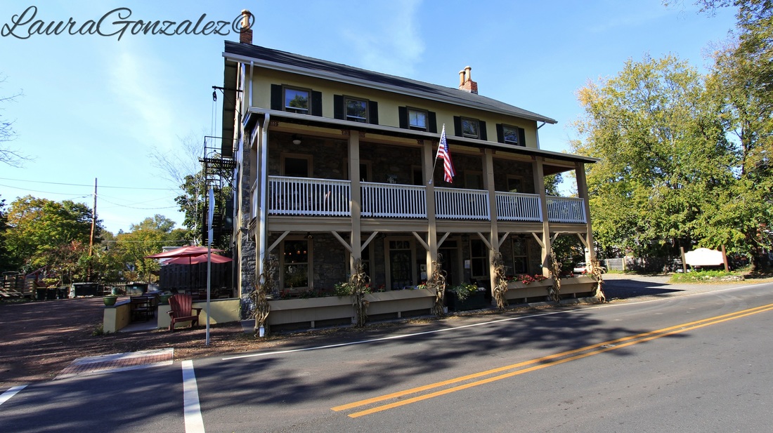 Riegelsville Inn The huge cemetery on the hill is rumored to have had strange sounds coming from it, the clip-clop of horses’ hooves as though a funeral procession is entering the gates of the cemetery. A woman with a parasol has been spotted on a corner near the cemetery, her presence reported by several eye-witnesses.The ghost of Mary Louise Aughinbaugh, who died in 1867, is said to roam around the church property. You can see her grave site here. 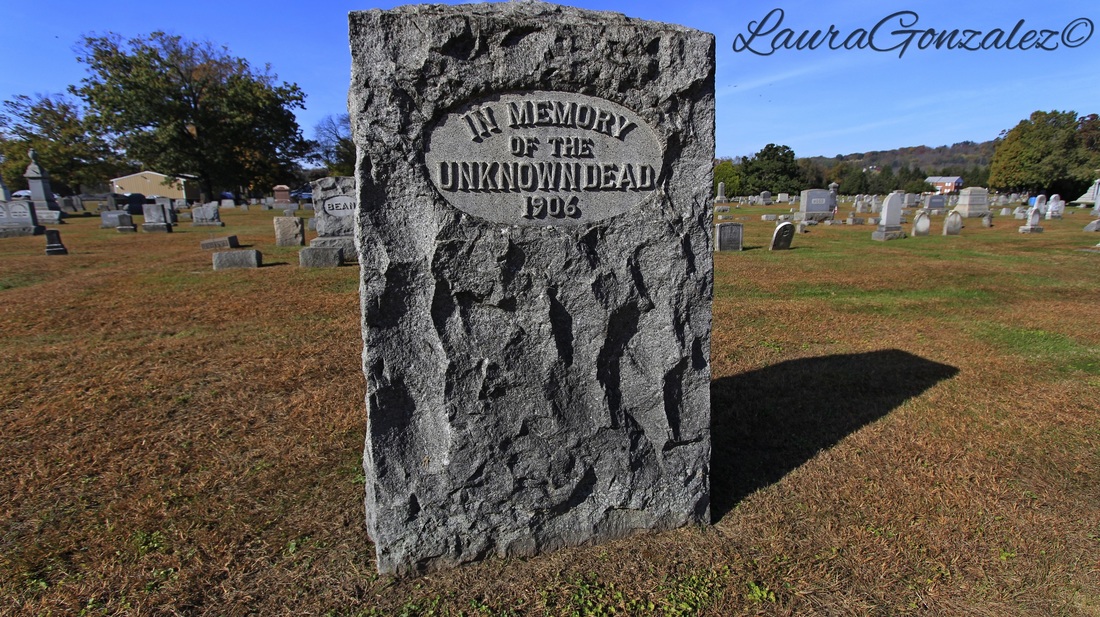 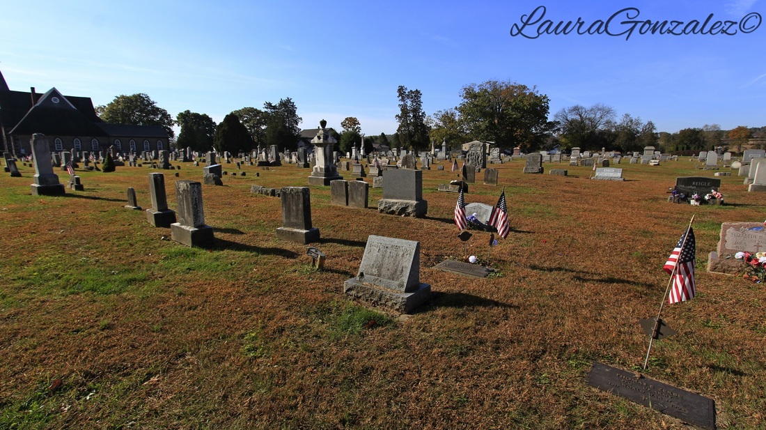  The church office was in a house built in 1858 by Cyrus Stover. It all began in the late 1850s when Cyrus started building a lovely home for his bride, Anna, on a hill above the banks of the Delaware River. Before it was completed, Cyrus went off to fight in the Civil War, and died in battle. His body was brought back to Riegelsville and he was buried in the church cemetery, just a couple hundred yards from his home, which is now the church office. Legend says Stover lingers because he never had the chance to fulfill his vision of sharing the house with his wife. http://pennsylvaniagravestones.org/view.php?id=7736 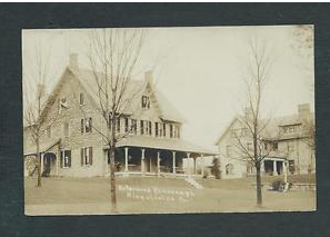 Source: Ebay 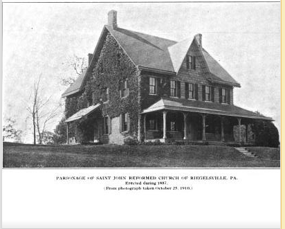 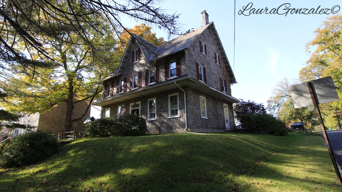 Next door to the Stover house is The Riegelsville Academy and Public Library.The Riegelsville Public Library is found in the same location as it was originally situated when John Leidy Riegel created the building in 1885 as a school for the children of the community. The building was known as the Riegelsville Academy and was known for its preparatory education in the student's futures. The opening of the Durham School in 1901 was the cause of fewer students to attend the Academy, and in 1916 the Academy closed because of poor attendance. The library was located on the second floor of the building occupying two rooms. The management of the library was by the trustees of St. John Reformed Church and the principal acted as librarian.In 1925, a library club was formed, and they removed the wall so that the library would be one large room (1,700 square feet), added more bookcases, and a Mercer tile fireplace. At this time the building was used for meetings, dances, and various community functions.The library was open to the public until the late 1950s or 1960s, when St. John Reformed Church leased the building to the Riegelsville Fire Company. The library was still on the second floor but not used. The deed is dated February 1, 1971 when the Academy Building became property of Riegelsville Borough Council, bought for $1.00 from St. John United Church of Christ.In 1976, a group of concerned citizens became involved in rescuing the library from being dissolved. On September 8, 1976, a resolution was signed by the Borough Council of Riegelsville declaring the Riegelsville Library to be a legal official Government Agency of Riegelsville Borough and authorized Trustees of the Library to operate it. The Board consisted of nine members, who developed Bylaws to run the library.The volunteer group worked on dusting, stacking, and sorting items in the library to prepare for a re-opening. In less than two months, the group set up a story hour on Saturday mornings for children and library hours on Friday evenings for families. At the time of the re-opening, the library housed approximately 2,000 volumes.A little girl has frequently made her presence known to a series of librarians and visitors. Source:http://www.riegelsvillelibrary.info/ 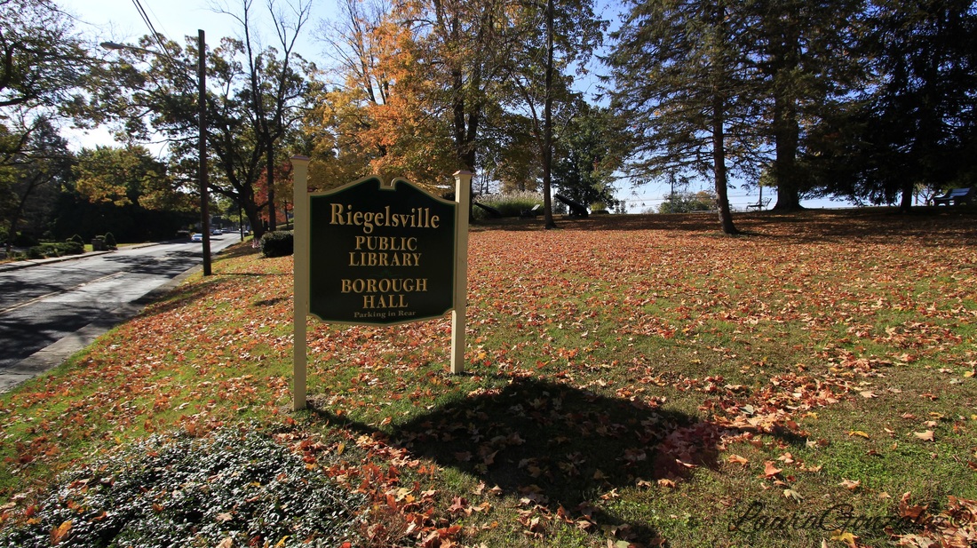 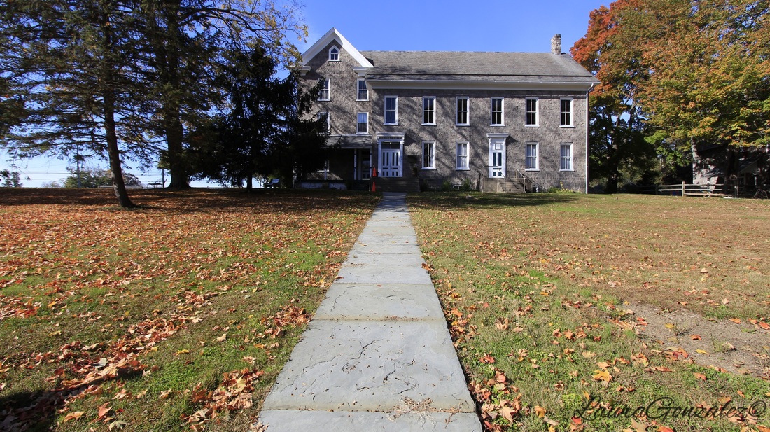 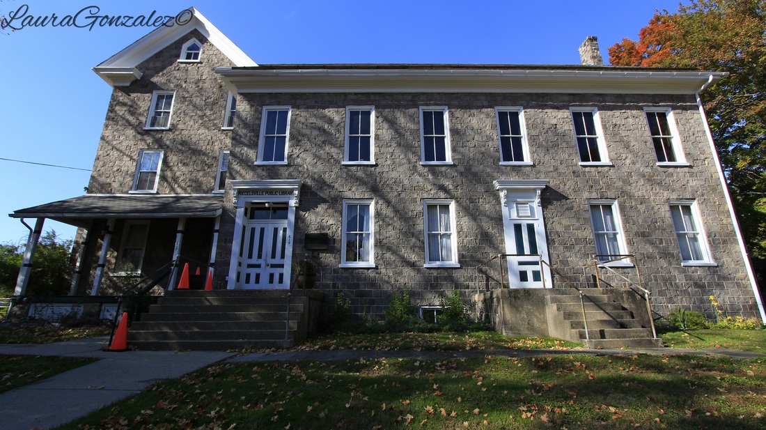 The firehouse is said to be haunted as well. Situated next to the town cemetery, strange occurrences have happened with such frequency that the firefighters would rarely use the restroom alone.Before being a firehouse, this building was a church and a school. Various reports claim that a firefighter named Howie Pursell, who died in 1991, haunts the company. Others say that a female schoolteacher has been seen roaming the halls. You can see his memorial here. 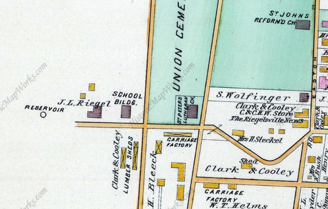 The school building on the left is now the firehouse. 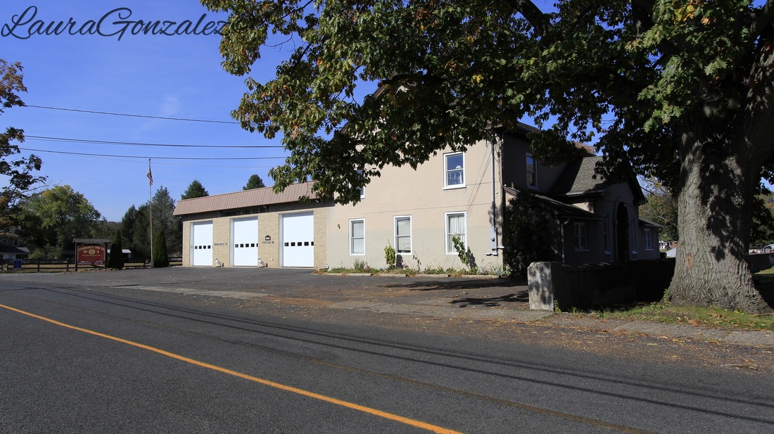 Firehouse 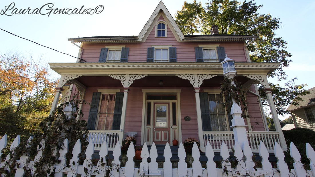 William Walters House This pink house is the William Walters House. Built in 1874-75, this house is embellished with Gothic Revival and Italianate decorative elements. 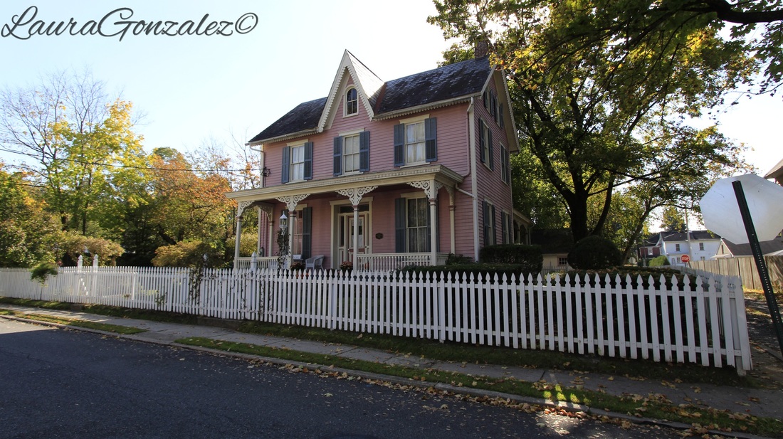 William Walters House MORE PICTURES FROM DELAWARE ROADDelaware Road seems to be the main street in town as it is the street the Riegelsville Bridge empties into as you from the New Jersey Side. 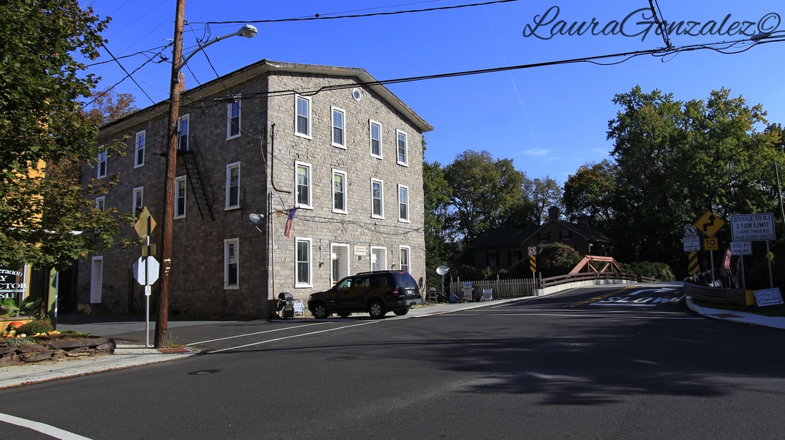 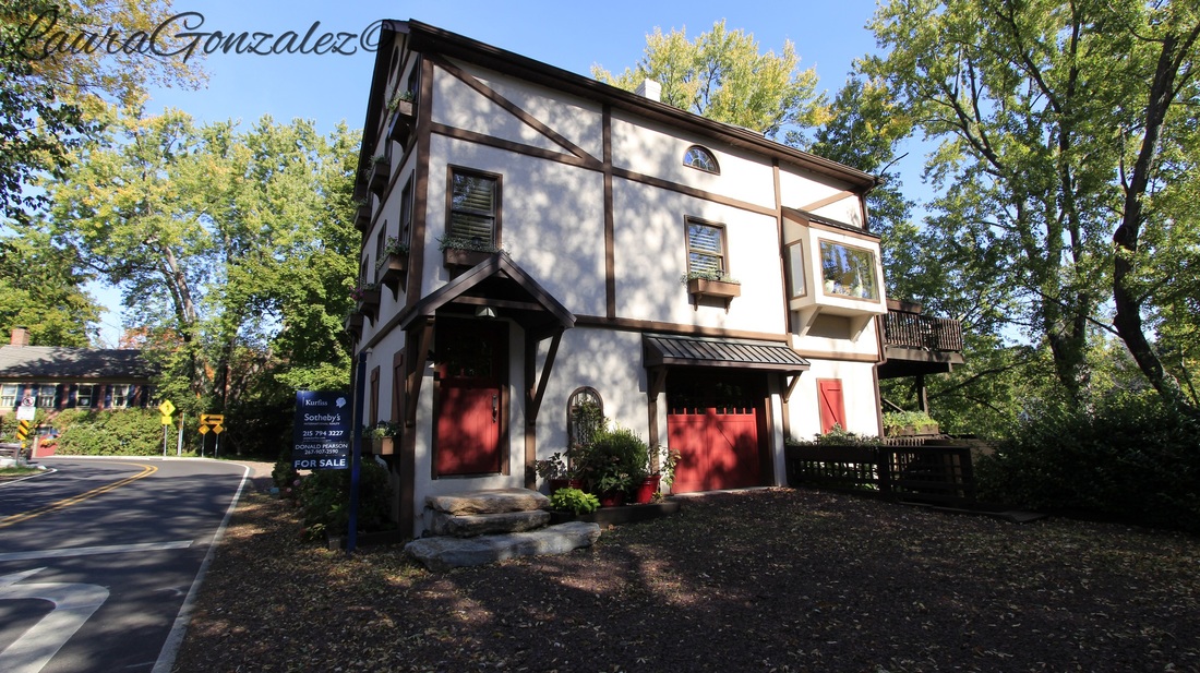 Perched on the Delaware River is 1 Delaware Rd 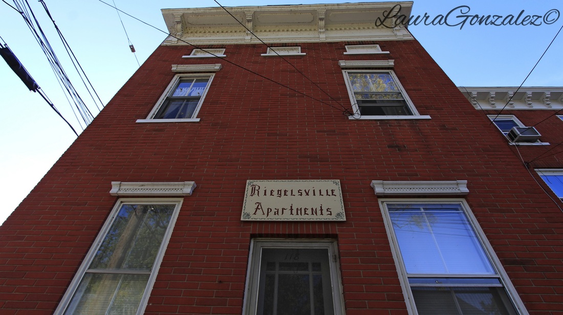 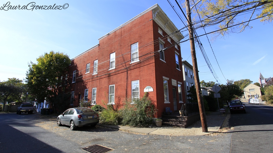 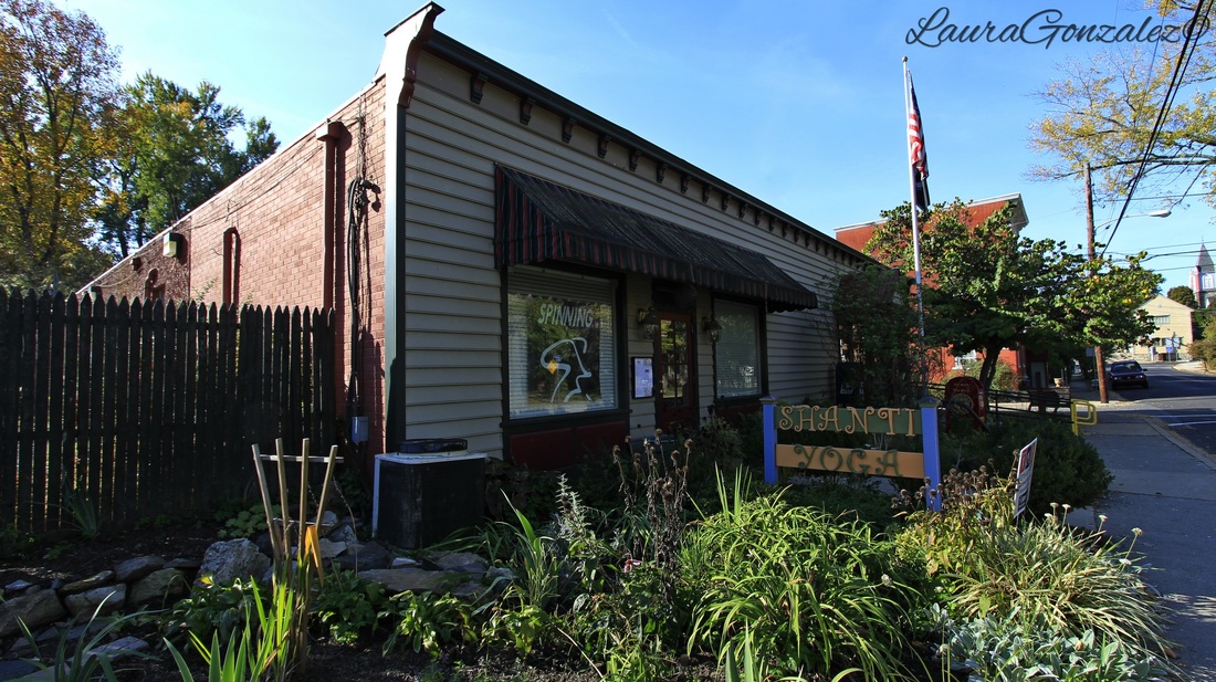 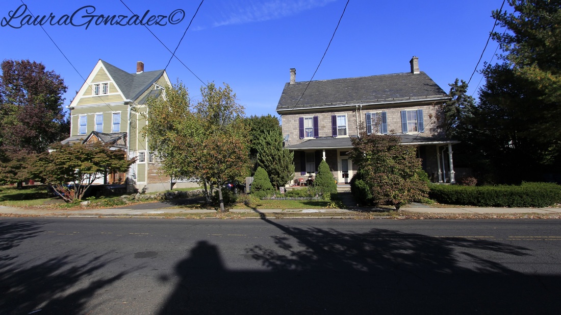 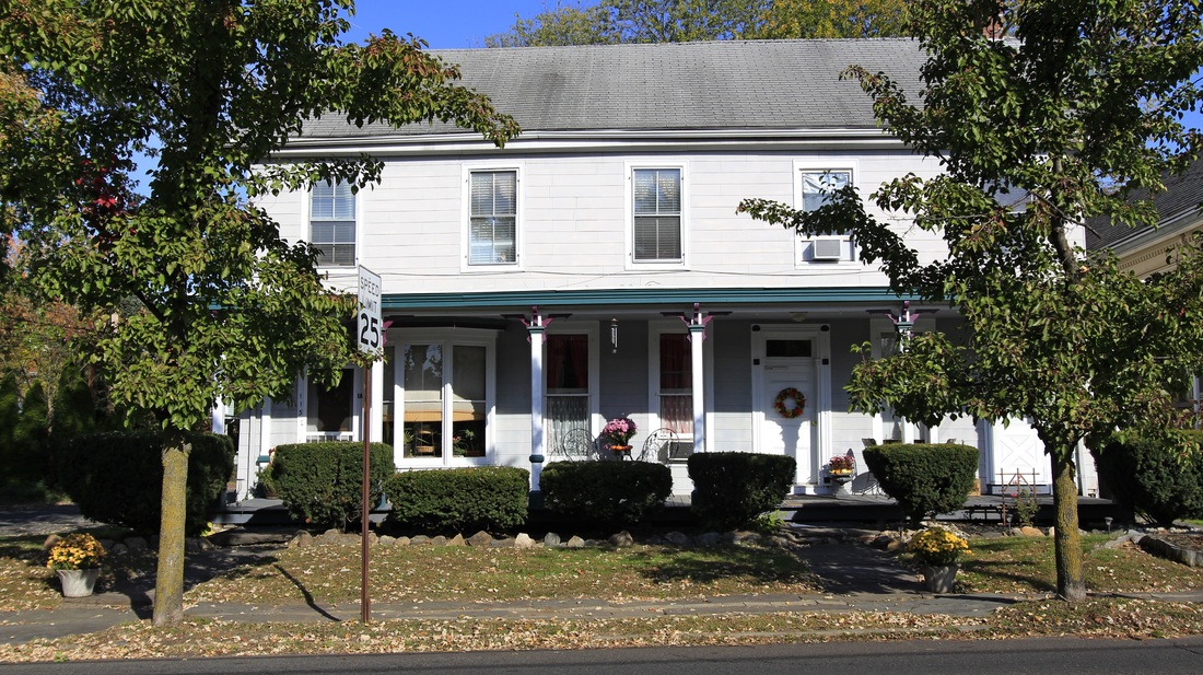 MORE ON EASTON ROADThe other main road in town running north to south is Easton Road. It leads to Easton, P.A. , hence the name.   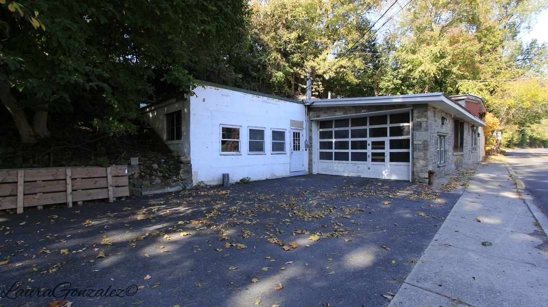 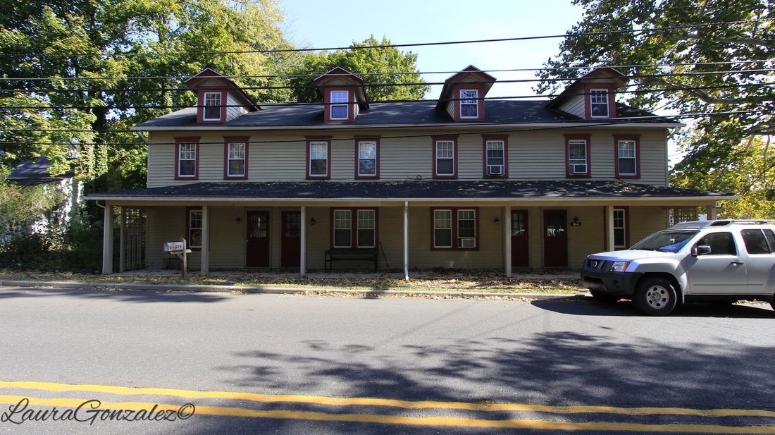 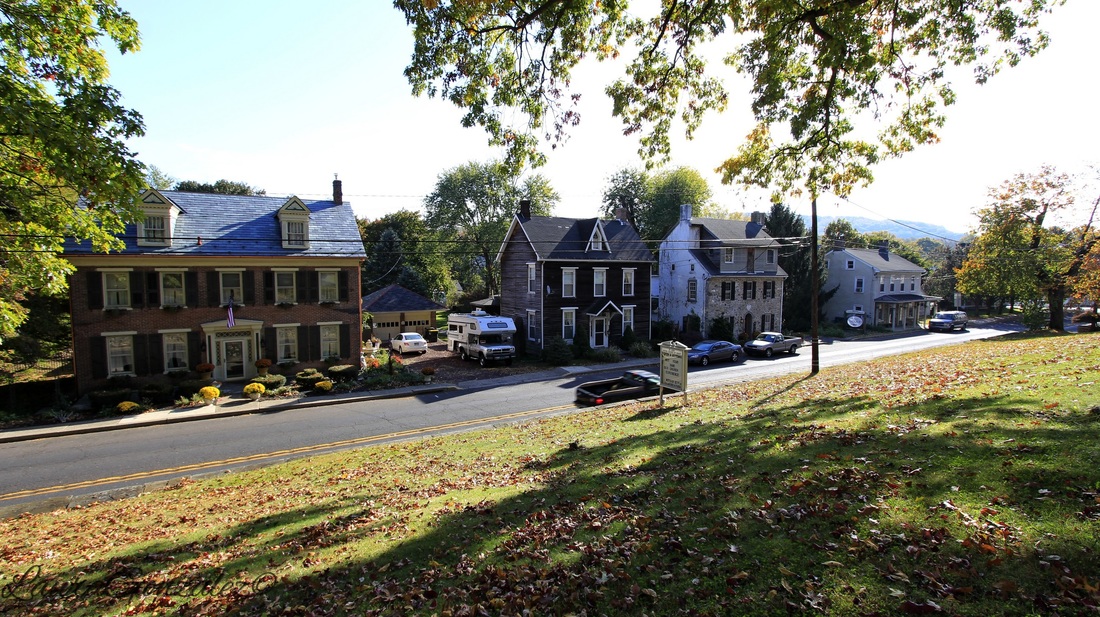 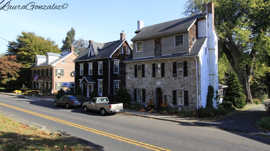   Up a long hill Delaware Road goes.   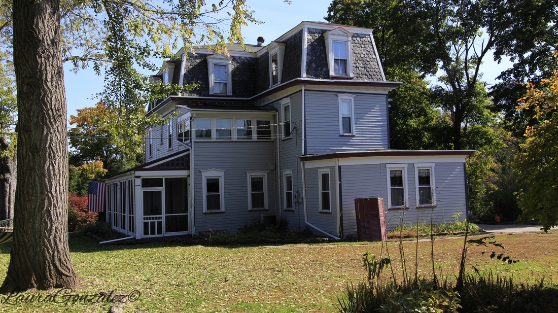 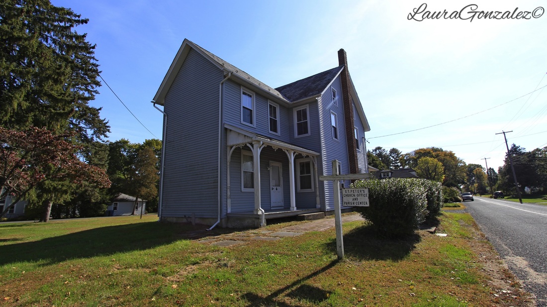 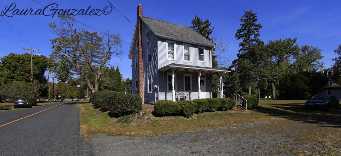  By now you have probally noticed the PennEast Pipeline signs in many of my photos. As per http://stoppenneast.org: The PennEast Pipeline is a proposed gas transmission project of six companies: UGI Utilities ($UGI), AGL Resources ($AGL), NJR Pipeline Company($NJR), Public Service Enterprise Group ($PEG), South Jersey Industries ($SJI), and Spectra Energy ($SEP). The project has faced tremendous opposition from community groups, ratepayers, and landowners along the proposed route. Twenty-four townships in Pennsylvania and New Jersey have passed resolutions opposing the PennEast Pipeline and more are expected to pass resolutions in the near future. Residents and elected officials at all levels of government, including school districts, counties and conservation groups, have overwhelmingly called for the six companies financing the PennEast pipeline to drop the project. In August, more than 400 pipeline opponents marched across the Delaware River. You can get more information here: http://shalejustice.org/penneast-pipeline_/ http://stoppenneast.org http://www.stopthepipeline.org http://www.lehighvalleylive.com/news/index.ssf/2015/07/penneast_pipeline_has_a_ways_t.html https://www.facebook.com/stopthepenneastpipeline Laura Gonzalez
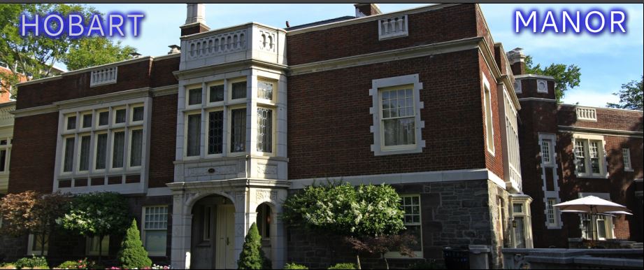 WAYNE NEW JERSEYHobart Manor as it is called now was once called Ailsa Farms. Ailsa Farms was purchased by the state of New Jersey in 1948 from the family of Garret Hobart who was the 24th vice president of the United States who served under William McKinley.. It now is the campus of William Paterson University . The original manor house, built in 1877, was the weekend retreat and summer residence of the Hobart family. 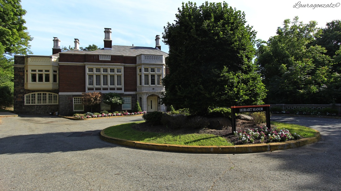 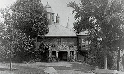 Source: William Paterson University It is a tudor style mansion with 40 rooms and once was the site of very lavish parties for the wealthy.  In 1915 Fred Wentworth and Frederick Vreeland were hired to remodel the estate and it was completed in 1919. . 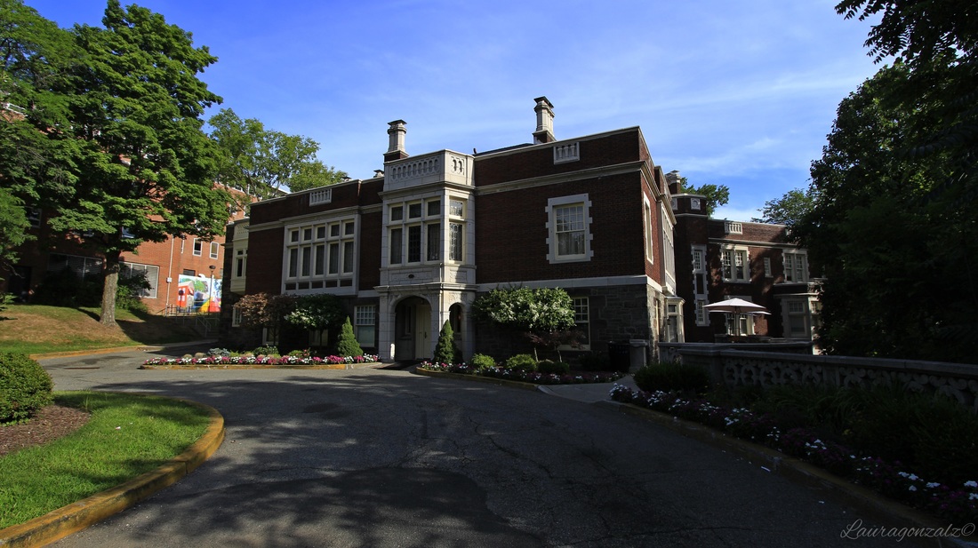    It was originally owned by John McCullough, a Scottish immigrant who made a fortune in the wool industry. In 1902 he returned to his native country he sold it at auction.  The mansion is rumored to be haunted and has attracted the attention of many a ghosthunter and psychics. Laura Gonzalez
August 5th 2015 Developed at the turn of the century, Boulevard East is a scenic road that runs along the Hudson Palisades. Before it was Boulveard East , it was known as Hudson Boulevard. 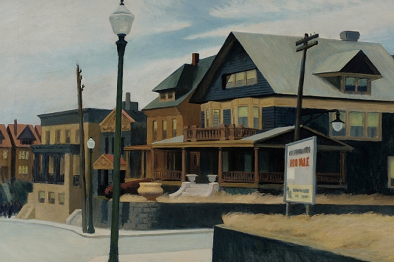 At the corner of 49th and Boulevard East is a set of homes that were depicted in a painting by Edward Hopper. The oil painting is entitled "East Wind Over Weehawken". It was painted during the Great Depression and made its home in the collection of the Pennsylvania Academy of Fine Arts until 2013 when it was sold to an anonymous buyer for $36 million. 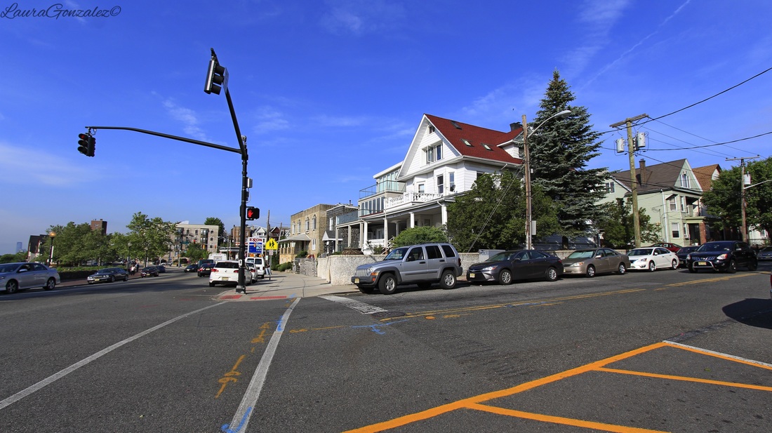 Here is what that corner looks like today. 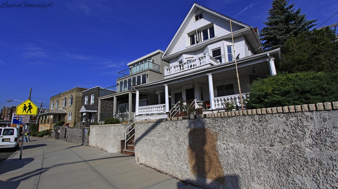 Laura Gonzalez
Located in Northampton County, Pennsylvania is the small quiet town of Slateford, which is located on the edge of the Northampton Slate Belt. Many, many years ago, slate quarries were set up and the town was named Slateford. Immigrants from Wales and England came in the 19th century to work in the quarries. At its peak, in the first decade of the twentieth century, the Slate Belt accounted for about half of the slate produced in the United States.
A local historian, Matthew S. Henry, writing in 1851, stated that a slate quarry "At the northern line of the Township along the Delaware River at the Gap" was incorporated on April 16, 1808, under the title "the President Managers & Co for the purpose of obtaining Slate from quarries within the County of Northampton." This title was changed on April 1, 1836, and again on February 22, 1853, to the Kittatinny Slate Company. The organization of this company was believed to be the first attempt at quarrying slate "in this Country."
Delaware Water Gap , Historic Resource Study
The small Slateford settlement consisted of twelve houses at first, which were erected in 1805 by Hon. James M. Porter, the owner of the Pennsylvania Slate Company. The people of the village were quarry employees as the quarry was located about half a mile northwest of the village. In 1877, ownership of the quarry was transferred to J. L. Williams. When the railroad came to town, 26 homes were in existence. The last quarry closed in 1917.
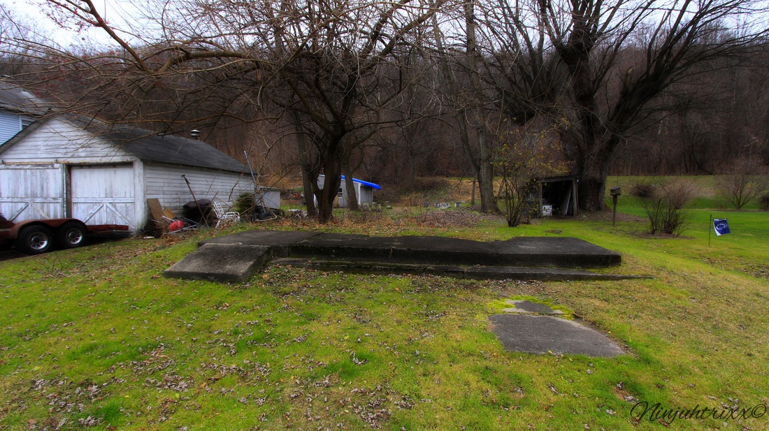
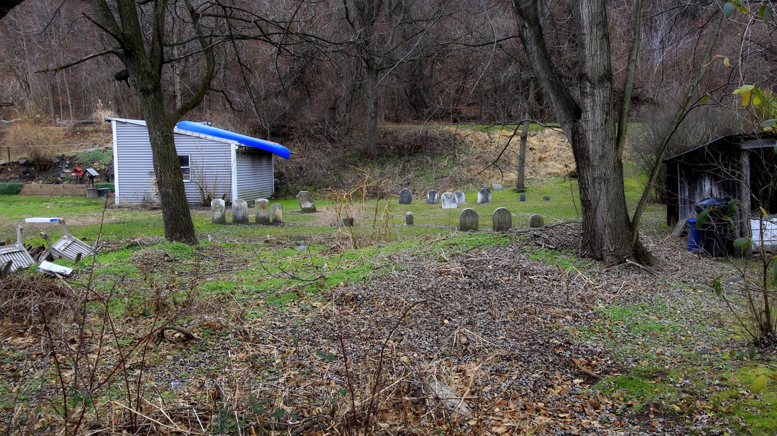
As I walk down the main road something catches my eye, the foundation of the Union church. Most of the stones were moved to Riverview Cemetery when the railroad was put in but somehow these ones were left behind.
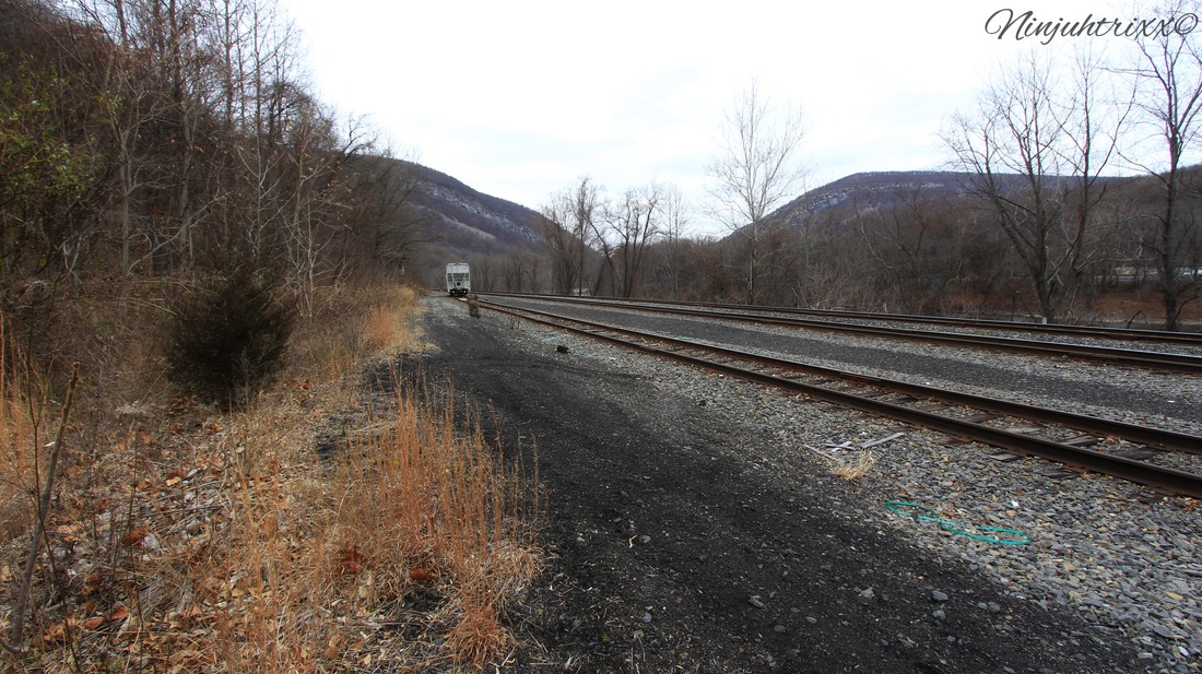
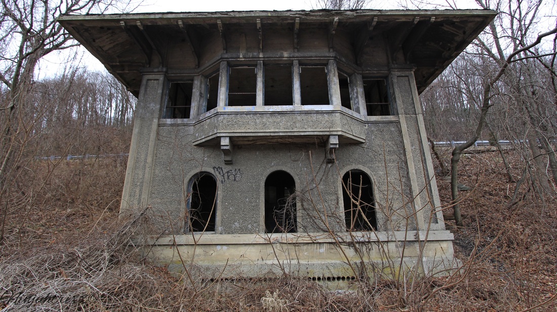
The town is home to Slateford Junction which connected the Lackawanna Railroad to the Lackawanna Cut-Off. The site had an interlocking tower (which still stands) and a small turntable, which didn't get much use. The Slateford turntable was dismantled in the 1930s and filled in after.
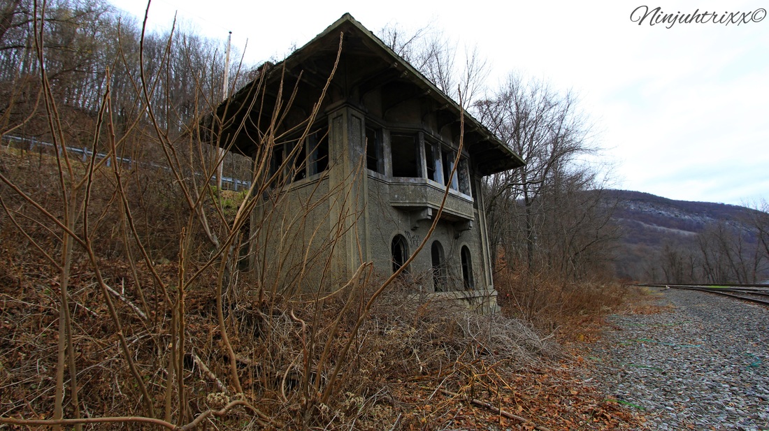
The tower opened on December 20, 1911 and closed on January 11, 1951; its operations were shifted to the tower at East Stroudsburg.
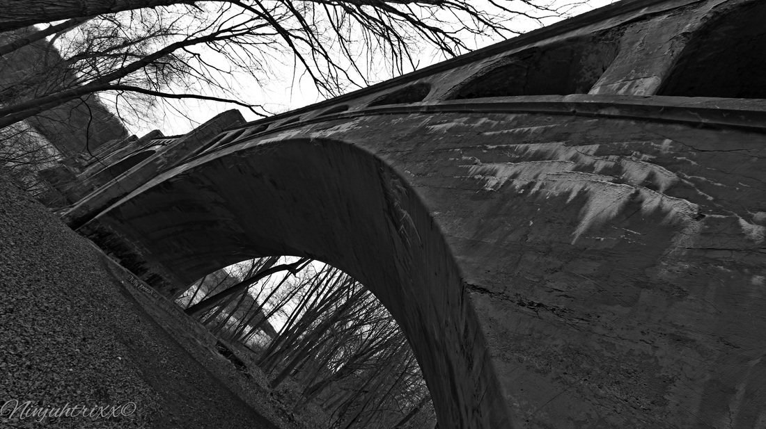
Not to far from the junction is the Delaware River Viaduct.
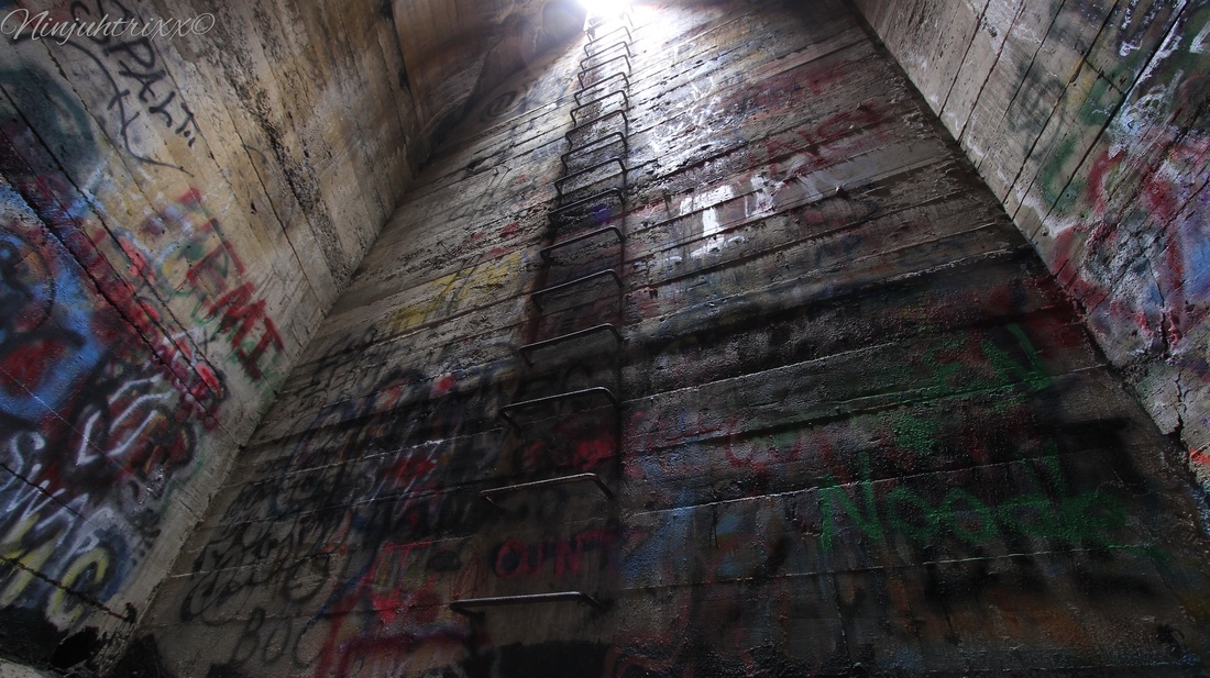
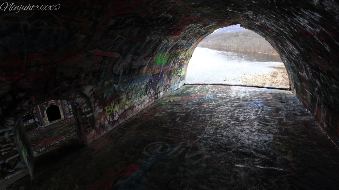
Constructed between August of 1908 to December of 1911, it is often called "Alice in Wonderland", "Alice", or "Wonderland" to those in the urbex community. Standing at 65 feet tall, the structure offers amazing views of the Delaware to those who venture to see it. The inside of one of the chambers is called "Hitlers Closet", which one makes a choice of two views at different heights . Of the four concrete arch viaducts constructed by the Delaware, Lackawanna & Western Railroad on straightening projects during the early twentieth century, the Delaware River Viaduct is the only one with a curving, skew alignment. Smith & McCormick of Easton, Pa was the builder.
From Wikipedia:
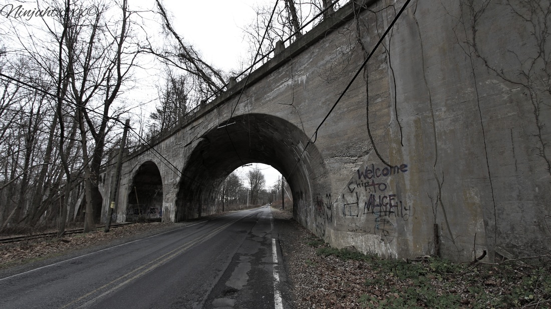
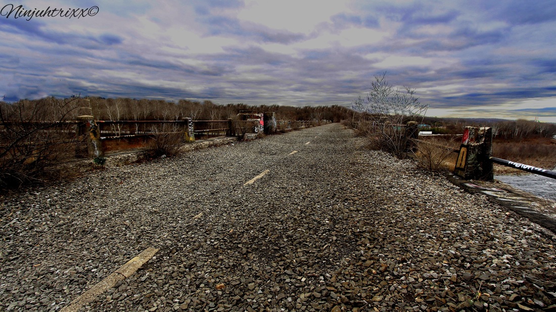
The Lackawanna Cut-Off (also known as the New Jersey Cut-Off or Hopatcong-Slateford Cut-Off) is a railroad line that was built by the Delaware, Lackawanna & Western Railroad (DL&W) between 1908 and 1911. Noted for its large cuts and fills, and two large concrete viaducts, the line was part of a 400-mile (640 km) main line between Hoboken, New Jersey, and Buffalo, New York. The Cut-Off ran west for 28.5 miles (45.9 kms) from Port Morris Junction — near the south end of Lake Hopatcong in New Jersey, about 45 miles (72 km) west-northwest of New York City — to Slateford Junction near the Delaware Water Gap in Pennsylvania.The Cut-Off was 11 miles (18 km) shorter than the Lackawanna Old Road, the rail line it superseded; it had a much better grade profile (0.55% vs. 1.1%); and it had 42 fewer curves, with all but one permitting passenger train speeds of 70 mph (110 km/h) or more.The Cut-Off also had no railroad crossings at the time of its construction. All 73 structures on the line were constructed of reinforced concrete, which was considered a pioneering use of the material. The construction of the roadbed required the movement of millions of tons of fill material using techniques similar to those used on the Panama Canal. 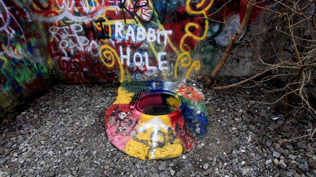
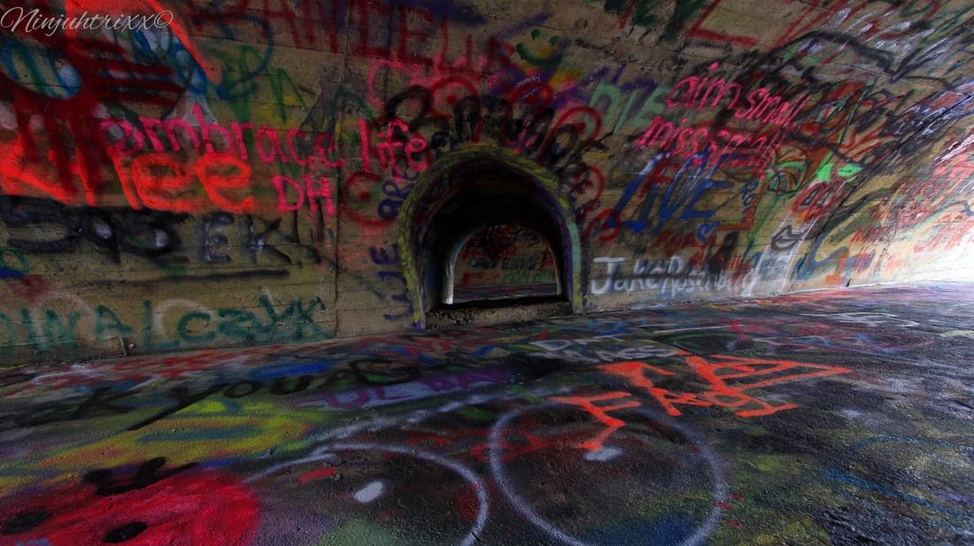

Although the tales of the NJ viaducts being haunted have run rampant, I have found no known evidence to support the legend that a worker, or workers, fell into the concrete during construction and could not be extracted because of the need to keep pouring. It is often confused with the Paulinskill Viaduct, although it is lower and longer in length. It takes the title for the largest reinforced concrete structure built with a continuous pour process. It went through a series of changes in ownership, including the DL&W's merger with the Erie Railroad in 1960, acquisition by a Norfolk & Western Railroad subsidiary in 1968, and by 1976 it was transferred to Conrail where it was abandoned and the tracks ripped up in 1989. It has deteriorated since then and at a faster rate than the Paulinskill.
In the area is also the waterfalls of Slateford. Im told this where the quarry was, although I see no evidence of it existing besides the slate and cuts in the rocks.
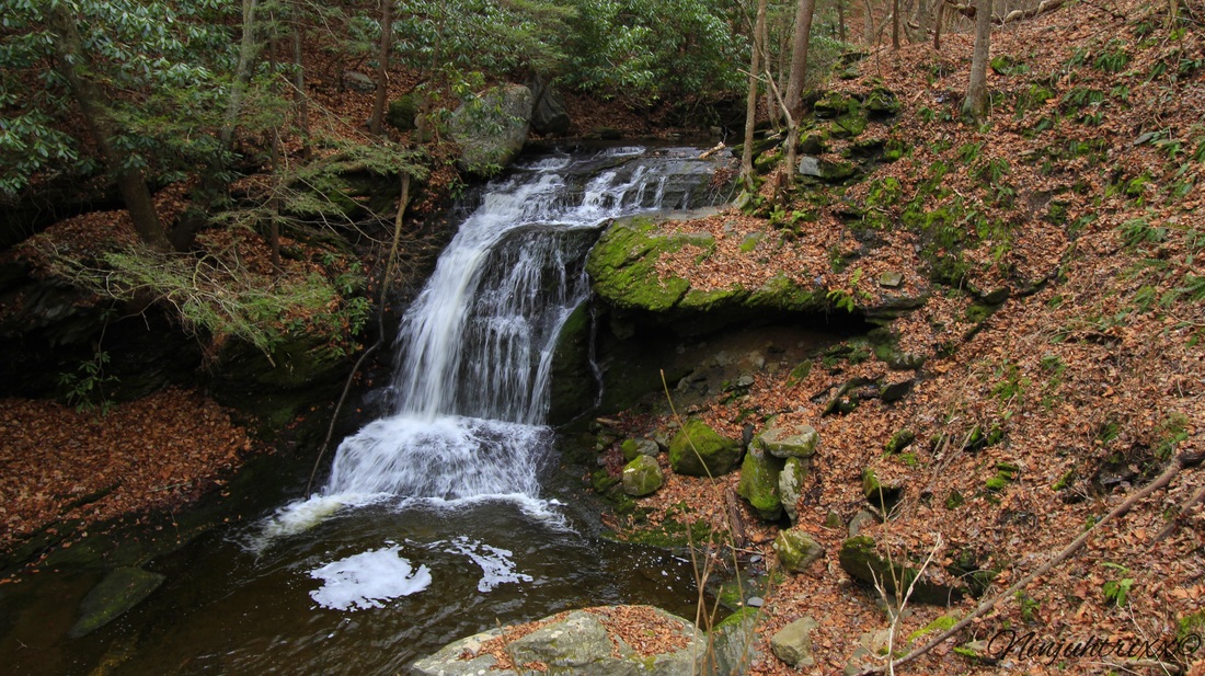
Slateford is a cute small Delaware River town and the waterfalls make it a great day trip. Please note, I do NOT condone trespassing on private property.
More pictures on my flickr!!
Laura Gonzalez
December 16 2015 Located in the Amwell Valley of southern Hunterdon County is Ringoes; the oldest known settlement in Hunterdon County. It lies at the intersection of two of the region's most important early roads: Old York Road and the Trenton/ Pittstown road, also known as County Route 579. Trenton/ Pittstown road is now known as John Ringo Road . The village still boasts buildings that date back to the Revolution. 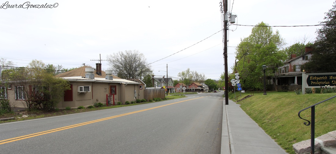 The village grew up around John Ringo's Tavern on Route 179 on the Old York Road. The tavern is where the Hunterdon Chapter of Sons of Liberty was organized in 1766 and where the Hunterdon County Freeholders penned a Resolution that led to the July 2, 1776 formation of the independent State of New Jersey. Philip Ringo, who was a nephew of the first John Ringo, received a deed for a five-acre plot and opened the tavern. Twenty years later, the tavern was handed over to Philip’s son, John (the second), and the business gained its place in local history. John Ringo was an outspoken person and threw himself into the Rebel cause and joined the Sons of Liberty. 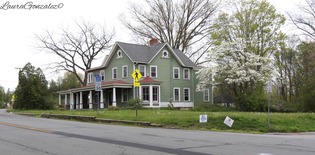 John Ringo's Tavern John Ringo came to the area to hide out from some pirates who were after him for hijacking their ship with their loot. But this wasn't done without good reason. It is said that he was kidnapped by pirates and put to work on a slave ship. With the help of some of the other slaves, they joined together to overtake the pirates. They sailed to New York City, where Ringo sold all the cargo that the pirates had except a heavy chest. After opening the chest, he found it to be filled with gold. This is where the legend of John Ringoes Gold comes from. John Ringo believed the gold to be cursed and refused to spend it and buried the gold in Ringoes. Many still have tried and failed to find the gold. How serious is this? Well here is a quote I found online: "Although this is "just" a legend, when two subdivisions were built over the last few years just behind the site of the John Ringo's Tavern in Ringoes, the land was deed restricted by East Amwell Township NJ to state that any gold found on the property in the process of excavating for the houses would belong to the Township."  Ringoes railroad station is one of the few surviving Hunterdon County examples of an earlier rail station and the only one to retain its original function. 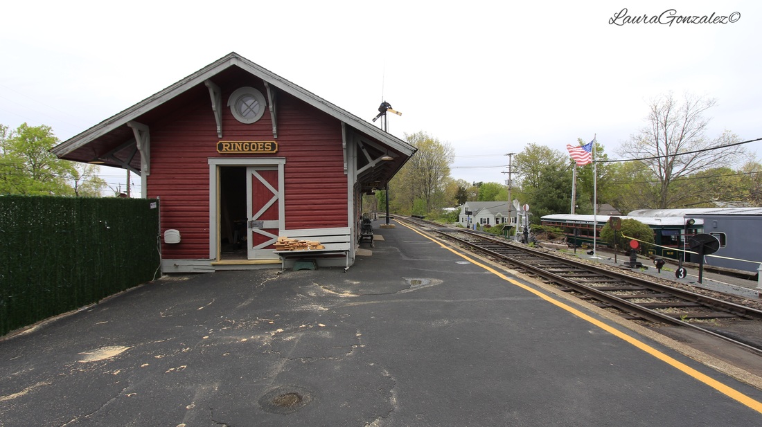 Ringoes is also the location of The BRW also known as the Black River and Western Railroad. It is a short-line railroad which operates vintage steam and diesel powered locomotives with limited freight service and its popular heritage train trips. The Black River & Western Railroad has been running passenger trains, staffed by an all-volunteer crew, since 1965. 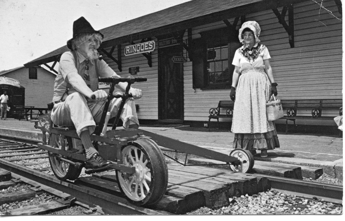 Source: http://eastamwellhistory.org/ 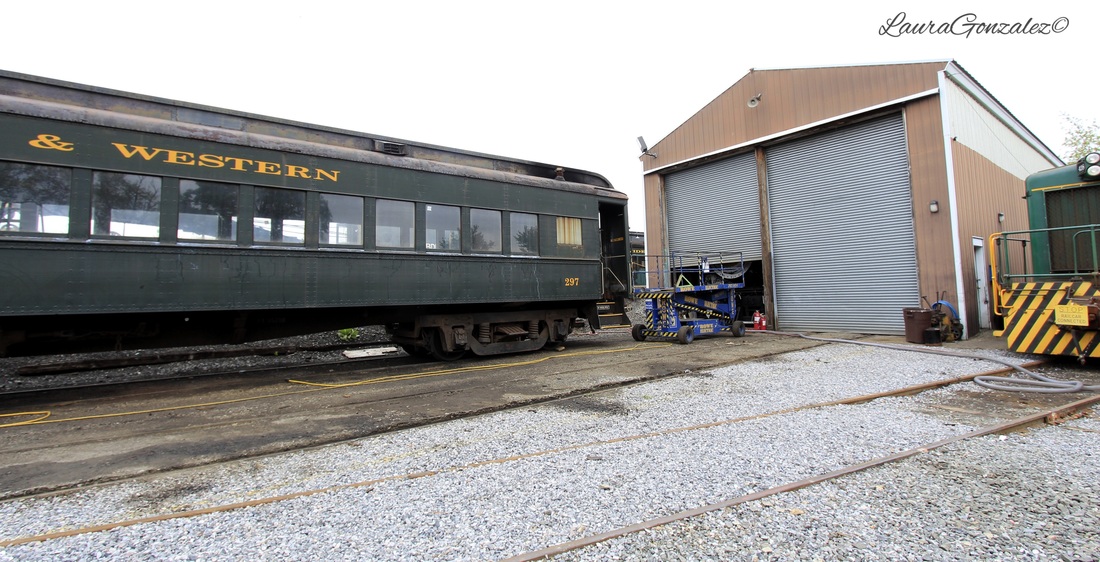 A Queen Anne/ Colonial Revival embellishment at 29 John Ringo Road.  29 John Ringo Road Former "Lower Store." which Elmer Holcombe ran for more than 50 years, it has been around for over a hundred years. 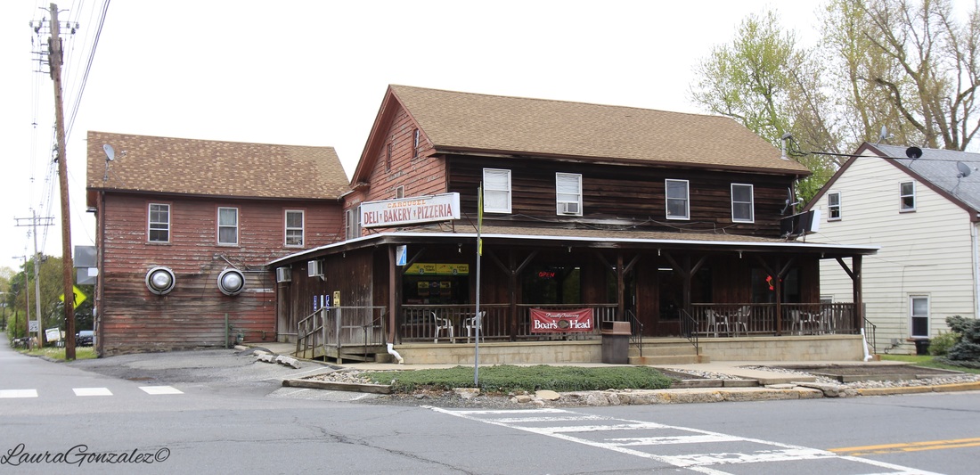 Former "Lower Store." Next door is the former Washington Hotel.  Pool Room at Old Washington Hotel Source:eastamwellhistory. 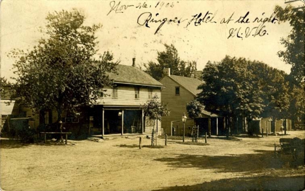 Mom’s Restaurant was once the site of the “Upper Store”, which was a general store. 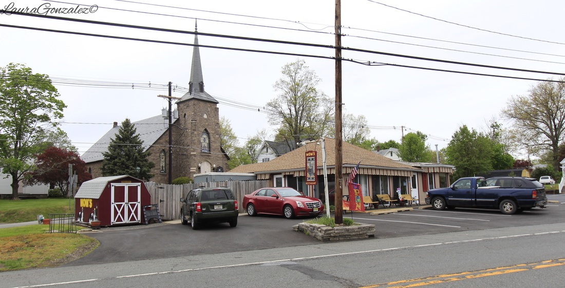 Mom’s Restaurant Here is the Joseph Inslee Tavern which Inslee purchased as a three-acre lot, built this home in 1734 and received a tavern license renewal in 1738. 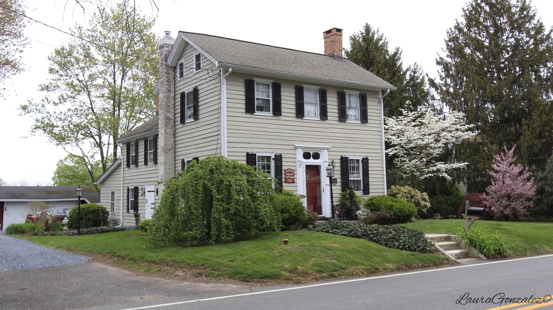 Joseph Inslee Tavern Former Academy of Science and Art, which was founded by local physician Dr. Cornelius W. Larison. the building hosted young men interested in pursuing studies in natural science, mathematics and the arts. 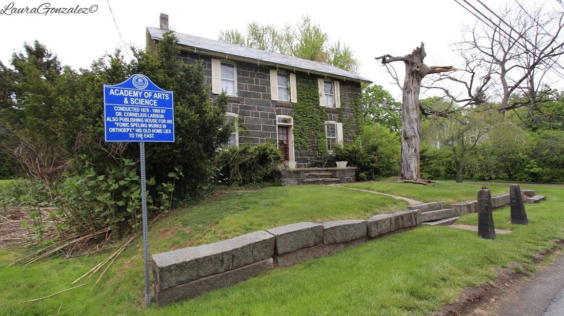 Former Academy of Science and Art The Landis House which was built by Henry Landis who had learned the saddler’s trade in Germantown, Pa. before moving to East Amwell in 1737. A little side note: Henry and his first wife Elizabeth had 10 followed by another 14 chilren with his second wife, Catherine Graff. WOAH! 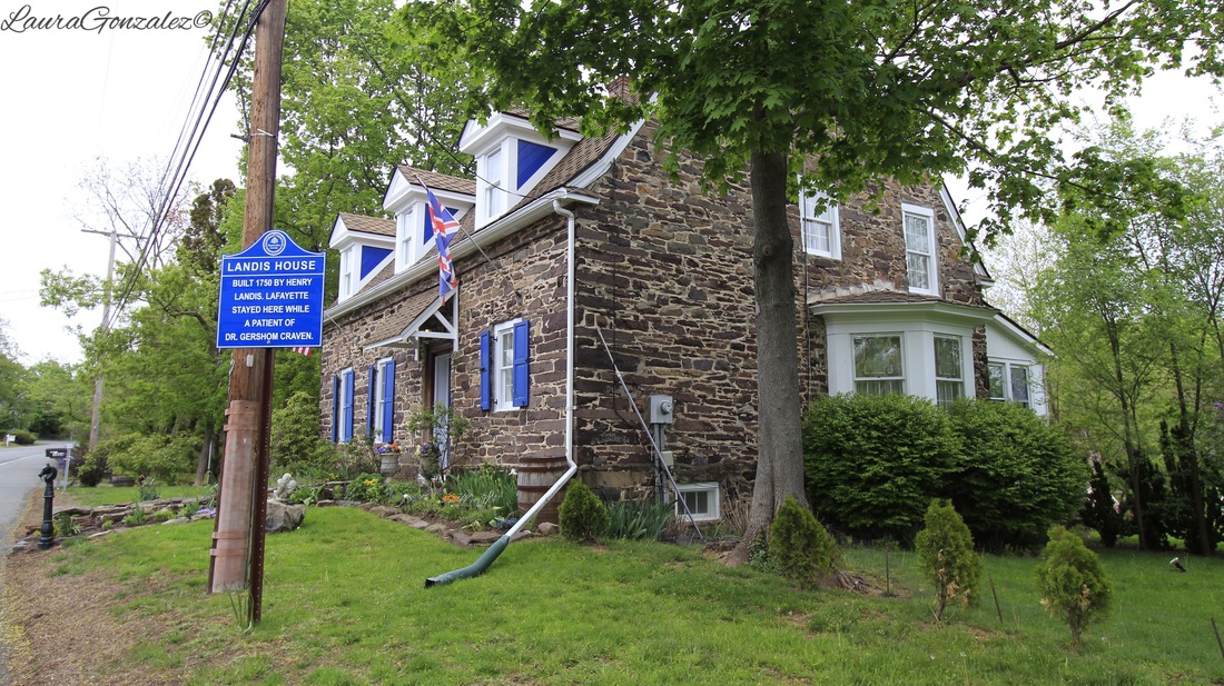 Landis House The Clawson House built in 1800 will be the future home of the East Amwell Historical Society and museum. 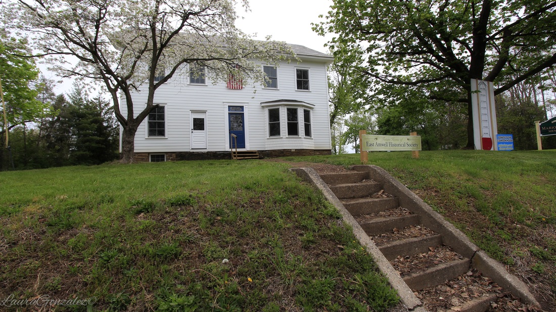 Clawson House The land that would eventually become Clawson Park was once farmed by Harold and Marion Clawson for many years. 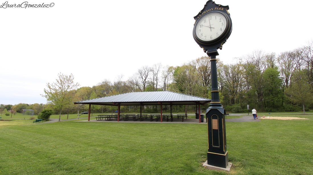 Other pictures from my walk through Ringoes:    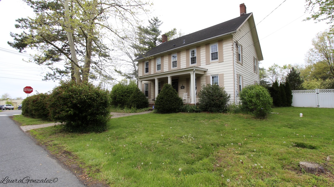  Laura Gonzalez
In the Eastside Park neighborhood of Paterson, New Jersey is an Italian Renaissance style residence built in 1929 for Jacob Weidmann who was one of the central figures in the development of the silk dyeing industry in Paterson. 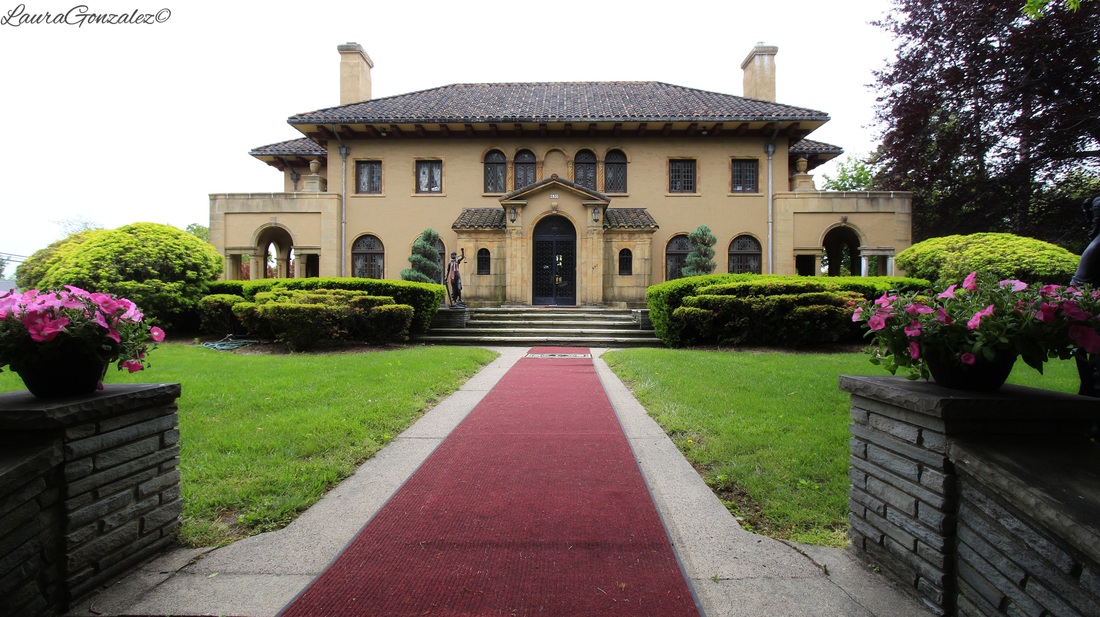 Born in Switzerland in 1845 and then trained by his father before apprenticing in the silk dyeing works of Germany and France, Jacob Weidmann became an American success story. 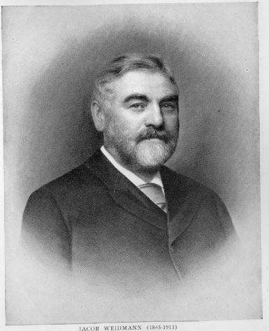 Source: The history of the silk dyeing industry in the United States Edited by Albert H. Heusser At 22, he came to the United States. He secured a job at Cheny Brothers, which was a silk dyers located in Manchester, Connecticut, before relocating to Paterson in 1872 and opening his own mill called the Weidmann Silk Dyeing Company . His success grew due to his reputation for producing the heavy-weighted black silks. 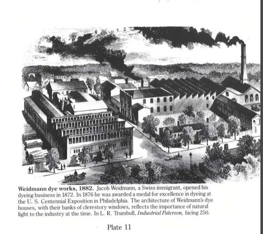 Source: Silk City , Philip B Scranton In 1887, the Weidmann Silk Dyeing Company relocated its works from downtown Paterson to the city's Riverside section after purchasing a fire devastated works from former partner, Claude Greppo. 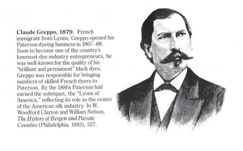 Source: Silk City , Philip B Scranton By the mid-1900s, Weidmann was the largest silk dyeing works in the country employing approximately 3,000 workers. By the time 1909 rolled around, Jacob Weidmann sold a large portion of his company to Gillet et fils of Lyons, France. He died two years later. Laura Gonzalez
This center hall Dutch Colonial style homestead, dating to 1790, overlooks a scenic waterfall in a park-like setting. It sits on the original land grant issued in 1668 by King Charles II of England to Major Nathan Kingsland, one of the first settlers of present-day Nutley, and remained under Kingsland family ownership until 1909. 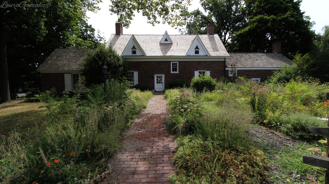 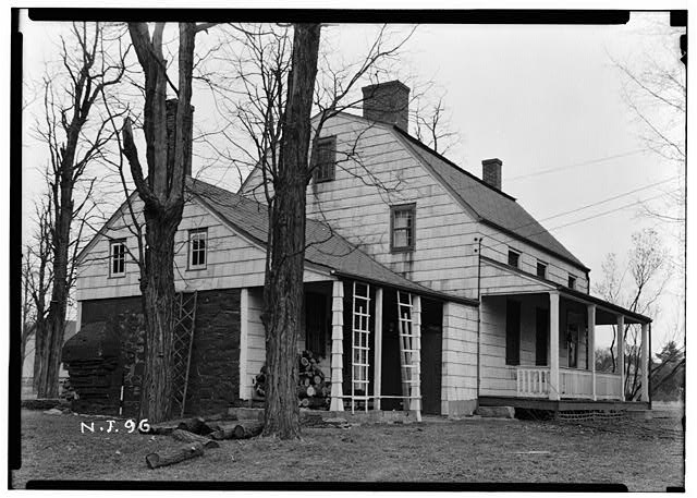 Source: loc.gov 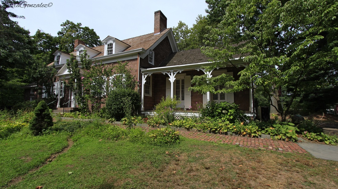 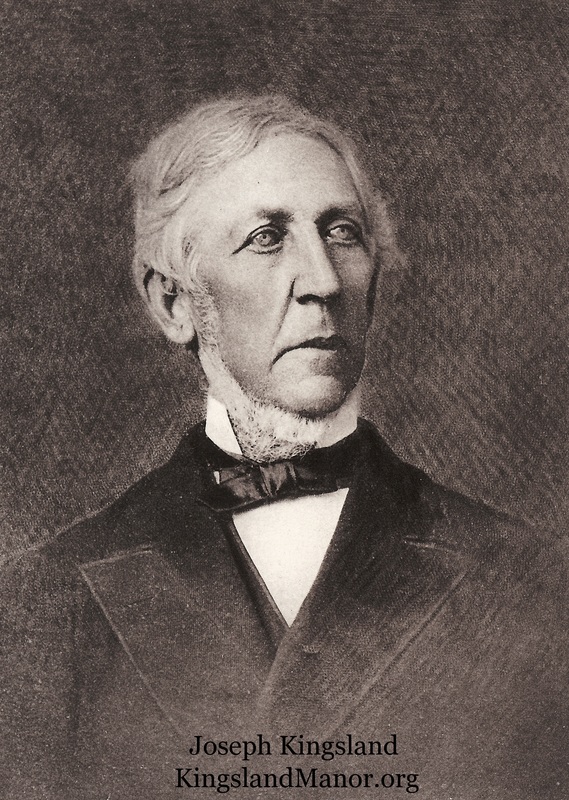 Source:kingslandmanor.org 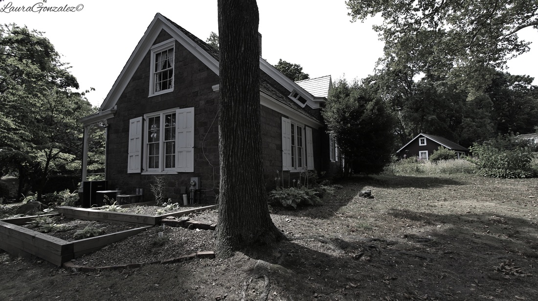 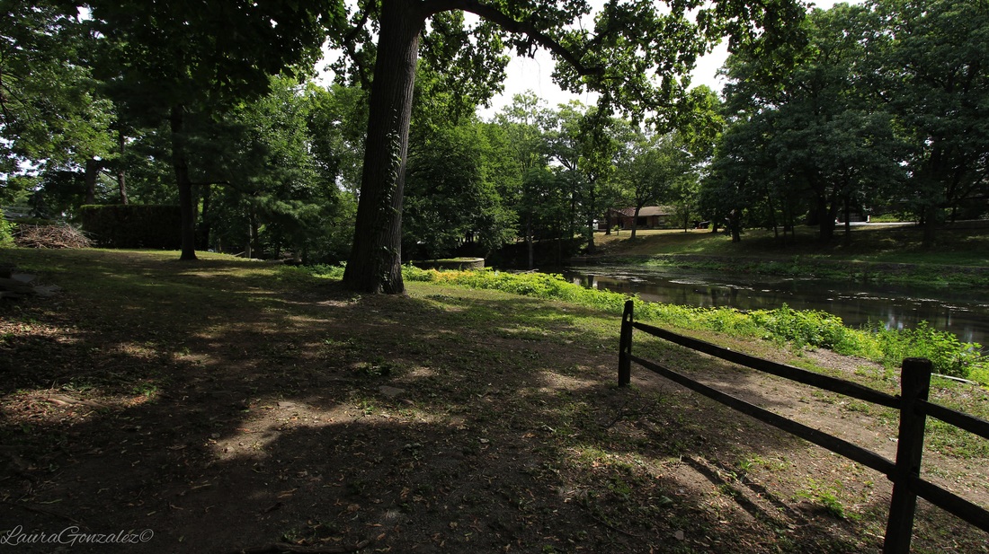 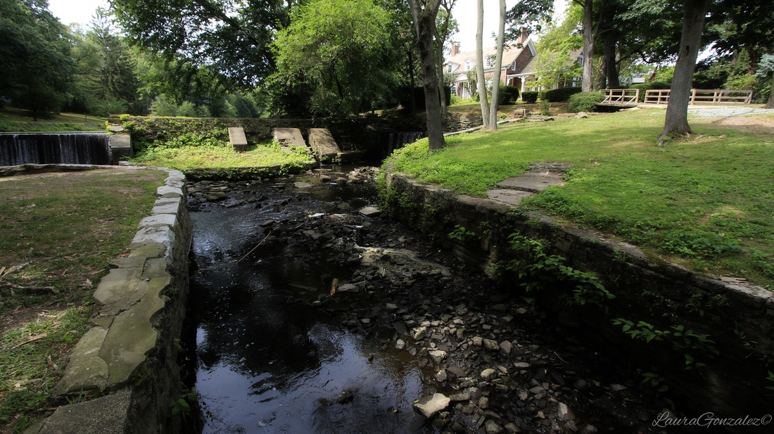  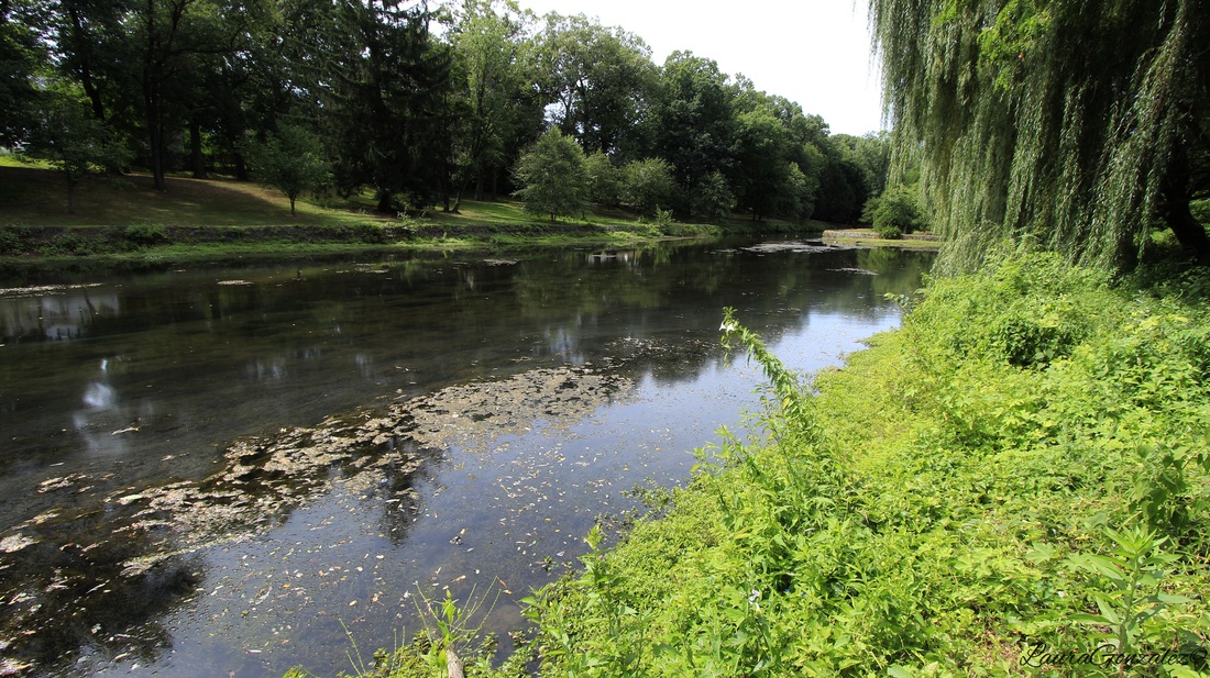 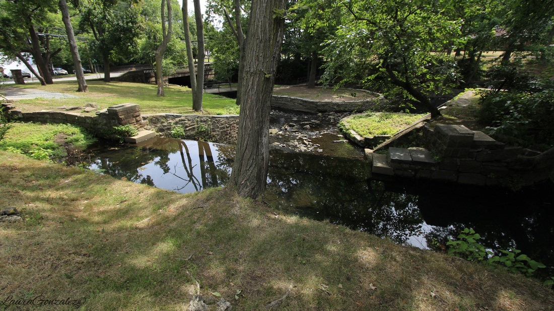 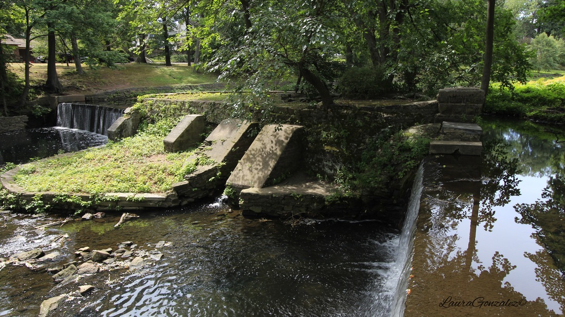  Open house tours are held on the third Sunday of each month from 1 p.m. to 4 p.m and you can get more information on the manor's website. Laura Gonzalez
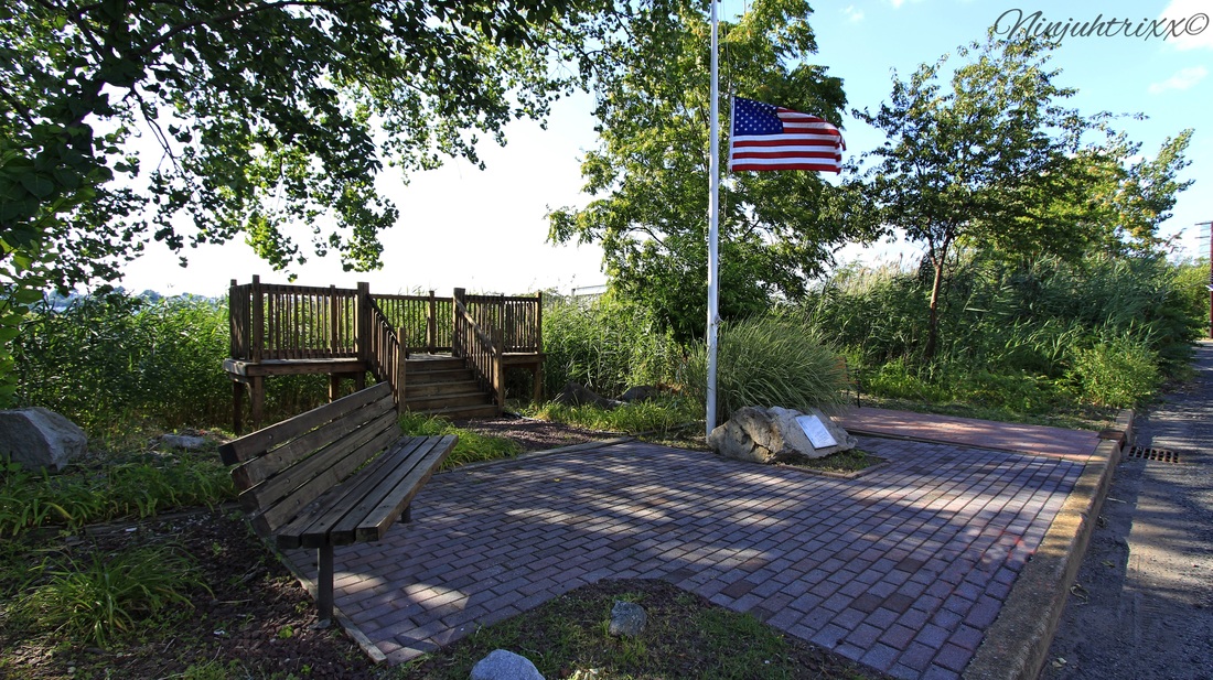
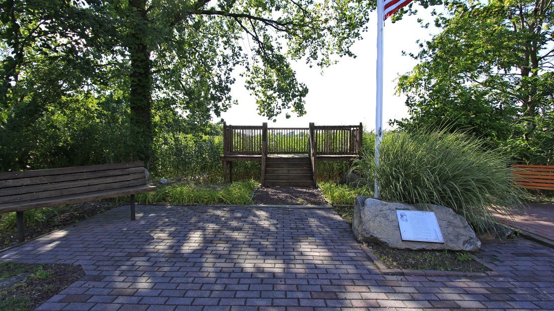
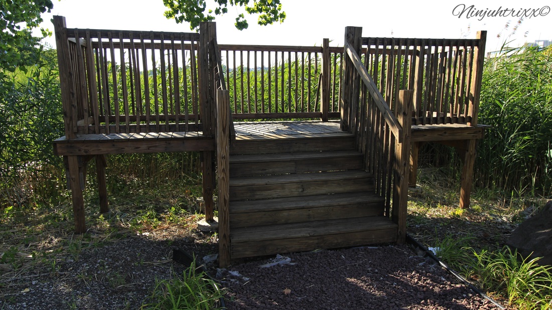
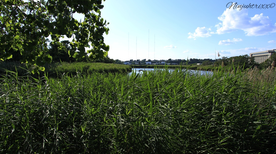
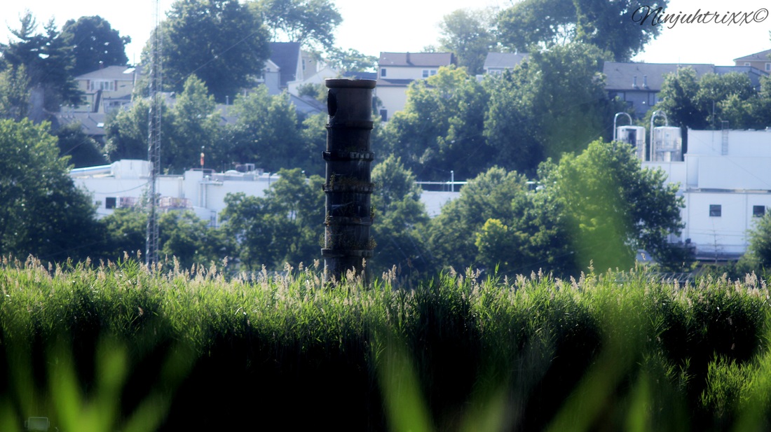
On the side of the road in the industrial part of the meadowlands lies a single smokestack. Most drive by, many don't notice it, nor do they notice the memorial on the side of the road for it. But it's at this site where a major fire took place a century ago.
It was January 11, 1917, when a fire started in Building 30 of the Canadian Car and Foundry Company in Kingsland , which has now been renamed Lyndhurst. All it took was 4 hours to erase the massive plant off the map. The residents of New York City watched across the harbor in horror as 500 000 pieces of explosive shells were set off .
Source:Great Northern Railway Page
Source:Glabarre.com
Canadian car and foundry was a company based in Montreal and although America was not yet involved in the war, it set up a plant in New Jersey for the production of war ammunition.
There was major speculation as to the source of the fire even going as far as to say it was sabotage from the German government. The plant had been set up to assemble weapons for shipment to Russia. It was later discovered that the fire started at the bench of one of the workers, Fiodoe Wozniak who was said to be surrounded by rags. On the bench in front of each employee was a pan of gasoline and a small rotating machine operated by a belt. It is said when the fire started he tossed what looked like water on top of the flames although no one knows where the water came from.
Germany never admitted guilt but paid America reparations.
As per lyndhurst historical society:
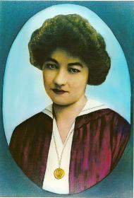
A heroine emerged the day of the fire. Kingsland resident Tessie McNamara, who operated the company switchboard, was credited with saving many lives. As the fire raged on, Tessie stayed at the switchboard that Thursday afternoon. She plugged in each of the buildings and shouted the warning, “Get out or go up!” Thanks to her dedication, no one was killed in the fire. Escaping workers were able to cross the frozen Hackensack River or run up Valley Brook Avenue to safety. The National Special Aid Society later presented Miss McNamara with a check to honor her for her bravery. 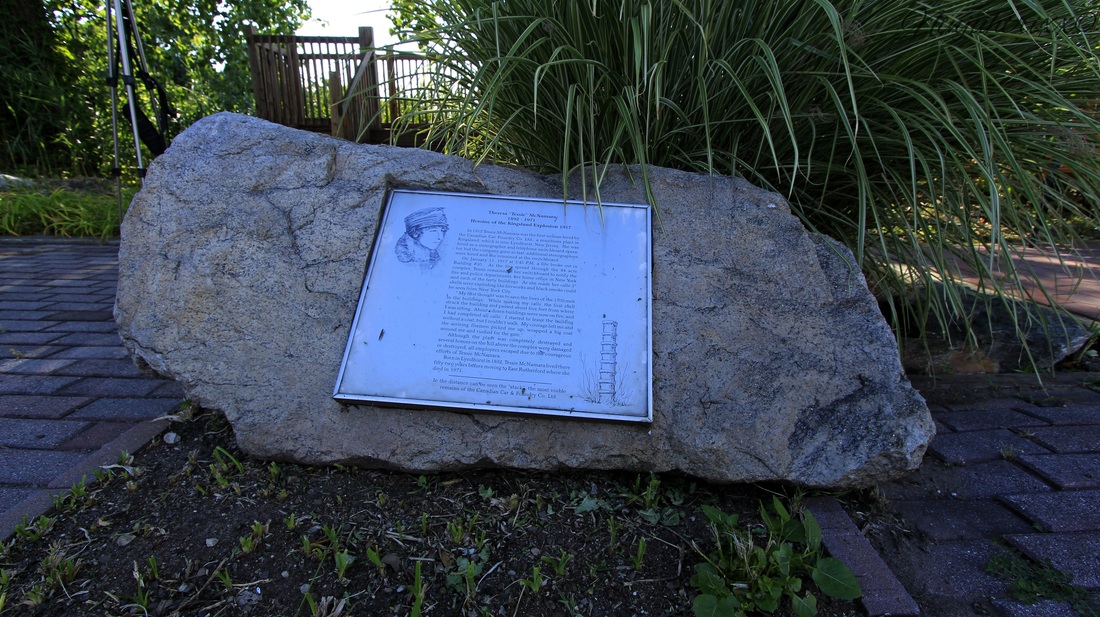
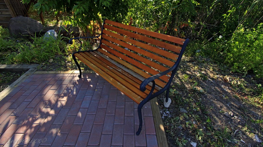
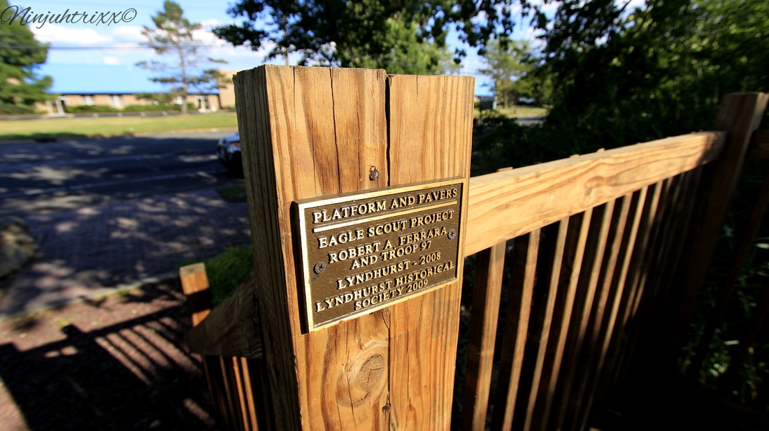
The Lyndhurst Historical Society has created a vest pocket park dedicated to her memory. The park is located on Clay Avenue, between Valley Brook Avenue and Wall Street West.
Source: Lyndhurst Historical Society
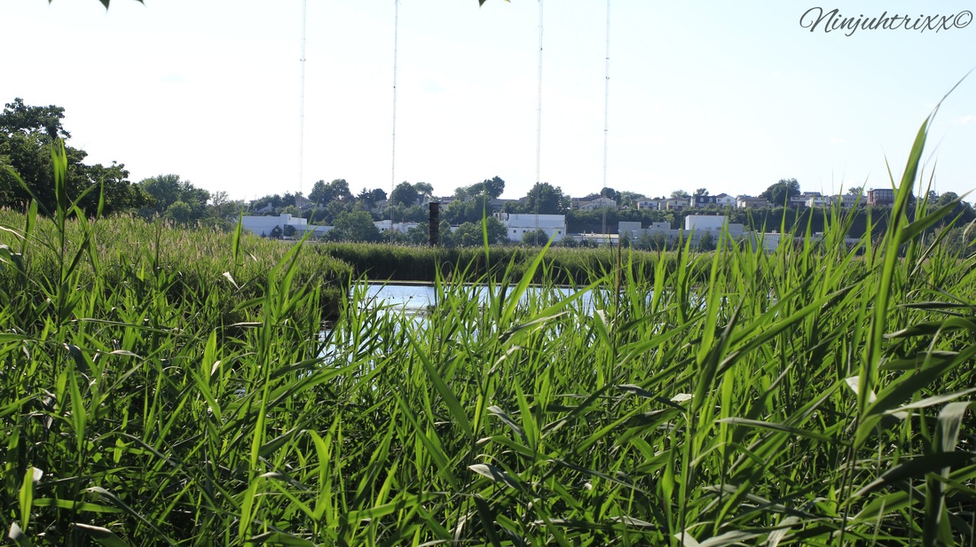
As I step up on the viewing platform and look out into the marsh I notice something jutting out from the water. It is a single smoke stack, the final reminder of the factory and the events which took place.
The destruction at the Kingsland Explosion, found on Youtube, uploaded by Critical Past
Laura Gonzalez
July 20 2015
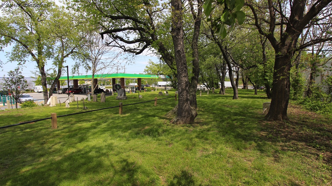
The small cemetery on a hill next to a Quick Chek along Washington Avenue in Carlstadt may be well hidden, but not enough to deter the bad luck the cemetery has endured for the past few decades.
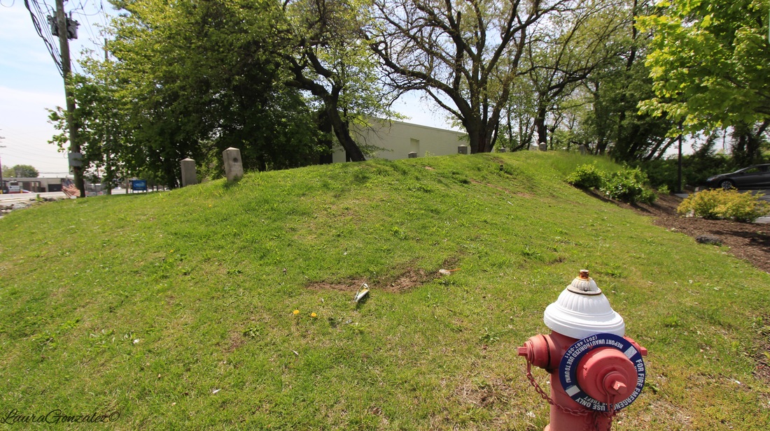
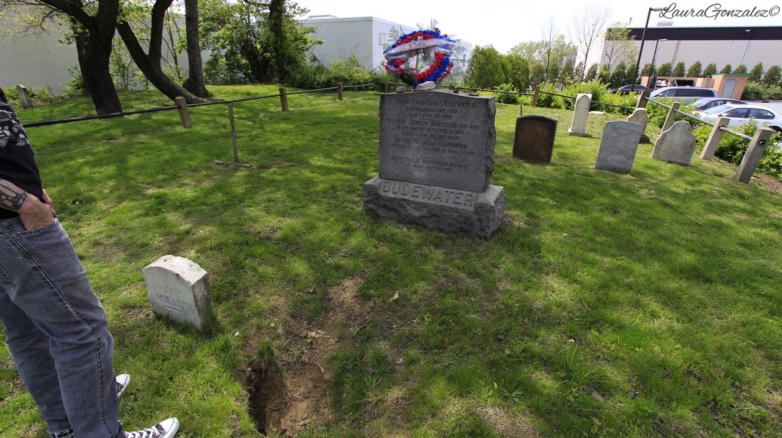
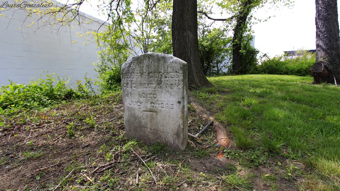
The Outwater cemetery is located in an industrial area in the NJ Meadowlands with a wooden flight of steps leading up from the Quick Chek parking lot. The cemetery dates back to the 18th-century, with the first of the 26 interments within the family cemetery dating back to 1752, and the last in 1892. Just beyond the family cemetery is the final resting place of 18 Hessian soldiers who died fighting for the British during the American Revolution. They now rest in unmarked graves.
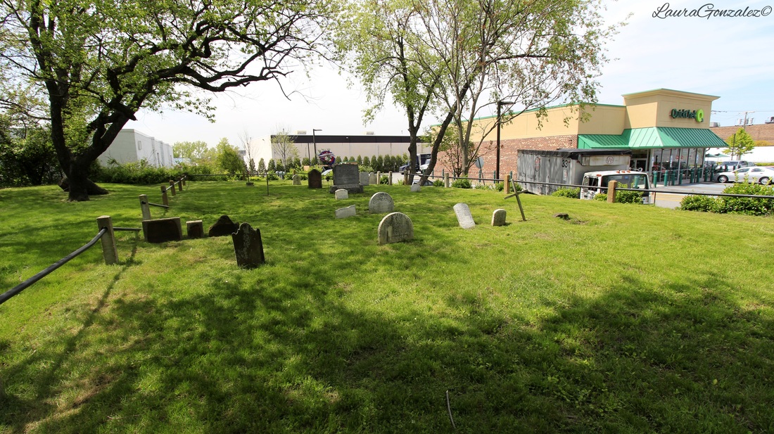
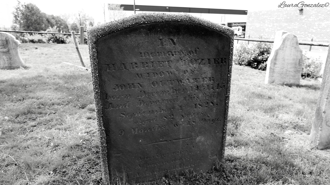
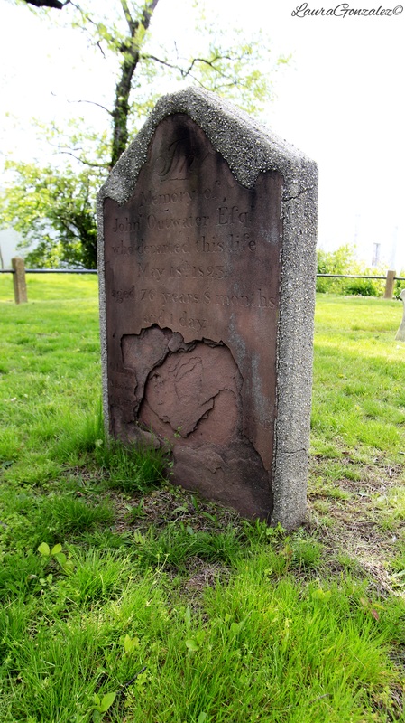
The graves have a history of being disturbed in the past, starting when Captain John Outwater's grave was dug up and his skull stolen. Mayor Will Roseman found the bones scattered amongst the site and took them home and stored them until a casket was donated so they could be reinterred. The skull was never recovered.
From outwatersmilitia:
John Outwater was born on September 17, 1746, just as the Great Awakening began to affect the Bergen County area.15 The American roots of his family extend back to Franz Jacobsen who had emigrated sometime prior to 1657 from Oudewater, Holland to settle in Albany, New York. In Albany, Franz had raised two sons: Thys Franz Outwater and Thomas Franz Outwater. In 1686, Thys left Albany and settled in Tappan, New York where his descendants can be found today. Thys' grandson, Dr. Thomas Outwater, was a noted surgeon in the Revolutionary army.16 Franz's other son, Thomas Franz Outwater, bought a third share of a stretch of land called Moonachie Island between Berry's creek, Indian Path, Losing Creek, and the Hackensack River by 1680.17 Thomas had seven children: Jacob, Thomas, John, Peter, Elizabeth, Jnnneke and Annajie.18 John Outwater, the son of Jacob, was born at Moonachie in 1746.19 The Jacob Outwater family differed little from other Bergen County Dutch families. Their moderate wealth was derived mostly from the sale of farm products in Hackensack and New York. Jacob Outwater served as a Bergen County Judge in Hackensack between 1755 and 1758.20 The Outwater's were also active members of the Reformed Church at Hackensack........ .....Captain John Outwater's Company of the Bergen County Militia Regiment was one of twenty-five companies raised by Act of the New Jersey Assembly in 1776. However, due to the demoralizing retreat of the Continental Army across New Jersey after the Fall of New York and the surrounding American positions, it seems the Company did not actually form until early 1777. When the Company was assembled in Hackensack, the Company elected its Company Commanders: John Outwater as Captain; Adam Boyd, Lieutenant, and Abraham Allen, Ensign. Outwater's Company one of several companies in the Bergen County Militia Regiment, commanded by Colonel Theunis Dey. The Company was composed of Jersey Dutch farmers and tradesmen who attempted to protect their property from British foraging parties. Because of the proximity to the British in New York City and the large Tory or Loyalist population, Bergen County was dangerous for those in rebellion. Unlike other militia, it was often unsafe for these men to return to their homes. Because of this, the men of the Outwater's Company were often on constant duty, much different from the men of New England. Raids into the area from New York City and British held Paulus Hook (now Jersey City) were frequent and often directed towards capturing militia men at home. The militia tried to guard the roads amd rivers as much as possible. When not repelling raiders or invasions, the company concentrated on interdicting Loyalist trade with the British in New York. Goods for the British were often sent down the Hackensack River and the goods and transporters would be seized by Outwater's men. The Justice of the Peace would then award the goods to the captors. Sometimes Outwater's militia guarded prisoners for the Sheriff. In December 1780, the State legislature commissioned the company Outwater's Company, New Jersey State Troops. State Troops were considered a cut above militia; the comparative stability of their long-term enlistment allowed them to be assigned more important and intensive duties. They served as State Troops through 1781. 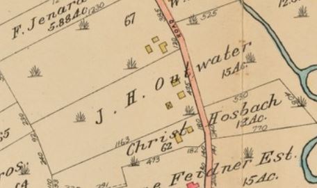
In 2005, local boy scouts took on an Eagle Scout project to renovate the cemetery, clearing a front path, pruning, weeding, restoring cement pillars, repainting the rails and driving sonar stakes into the ground to deter groundhogs. But luck didn't last long, the solar stakes were vandalized and a bronze cross that was placed at the front entrance was stolen.
Last summer, sound tests were conducted on the property to locates the graves of the 18 soldiers as the county is planning on infrastructure improvements to the highway and sidewalks surrounding the area. They found that the project would not affect the final rest of the graves and could go forward.
As of now, the souls of those on the hill overlooking the traffic zooming by will continue to rest as the city around them continues to grow.
Laura Gonzalez
All images © 2012-2016 Laura Gonzalez
|
ABOUT THE AUTHORLaura Gonzalez is a photographer, blogger and historian currently residing in Newark, New Jersey. Archives
April 2021
Categories
All
|
 RSS Feed
