|
Mount Holly is one of the oldest settlements in South Jersey. It found its beginning around 1677 when a gentleman by the name of Walter Reeves settled along the Rancocas. The geography of Mount Holly contributed to its growth through the almost three hundred years since its first settlement. The early town was located in the bottom of a valley on a winding creek which provided power for the early industries. An adjacent hill or mound gave the town a unique position along with its surrounding flat plains that were fine agricultural lands prior to suburbanization. 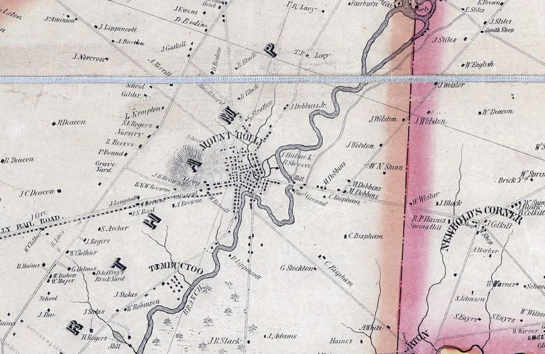 Mount Holly 1849 The commerce of Mount Holly grew from a center to which early settlers brought their produce, grain, lumber, and wool to be turned into items which were useful on their homesteads or were sold or traded for goods they were unable to produce. In time an important economy developed; farm goods were delivered for local resale and export; and manufactured items were imported for resale in local commercial houses. Among the early enterprises were the 1723 "Three Tuns Tavern," a tailor shop belonging to John Woolman, Quaker minister, a store belonging to Stephen Girard, Philadelphia financier. The Farmer's Bank organized in 1814 and is the second oldest bank in New Jersey. Two early newspapers of the community were the "Mount Holly Mirror," established in 1818, and the "Mount Holly Herald," in 1826. 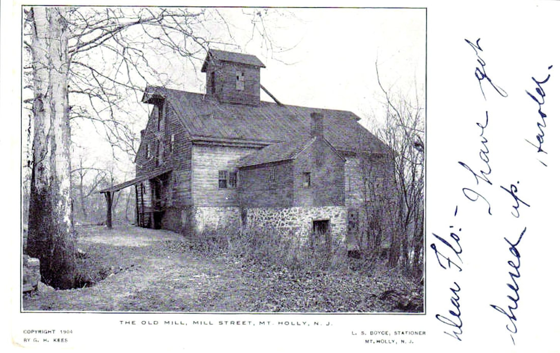 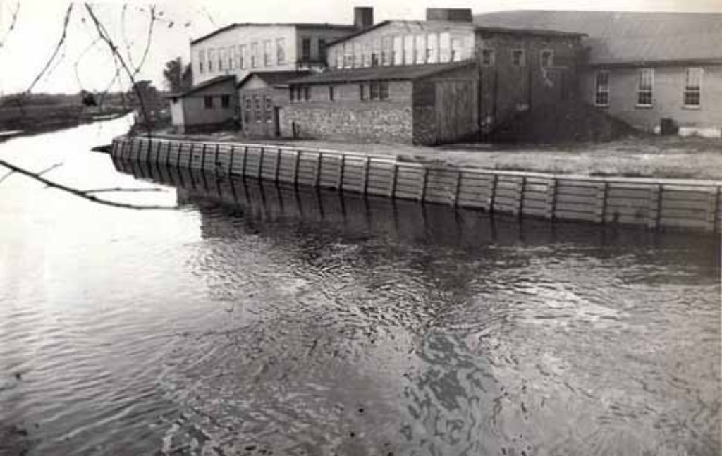 Mount Holly - Rancocas Creek and mill buildings Industry began with the 1720 sawmill, a grist mill in 1723, and an iron works and a fulling mill in 1730. Later industries were a paper mill, plush mill, tapestry will, dye mill, thread mill, carriage factory, and a turbine foundry. Mount Holly supplies some of the labor for the H.B. Smith Machine Company at Smithville, via the Bicycle Railway which ran from Mount Holly to Smithville. Transportation facilities had a definite influence on the growth of Mount Holly. The town, situated on the Rancocas Creek (North Branch), offered the advantage of an open waterway to the Delaware River. This made possible the exchange of commodities with the port of Philadelphia. In 1759 a stage wagon ran from Cooper's Ferry (Camden) to Mount Holly and on across the state to Middletown. The early roads began as bridle paths traveled by settlers on their way to Philadelphia, Burlington, Springfield, and the iron works, and later became streets in the growing town. By 1833 passengers could travel by stage to Burlington and board a boat for Philadelphia or a train to South Amboy. In 1849 train service was possible between Burlington and Mount Holly and in 1867 regular train service was established between Camden and Mount Holly. It is reported that in the busy season more than fifty trains a day stopped at the Mount Holly station. 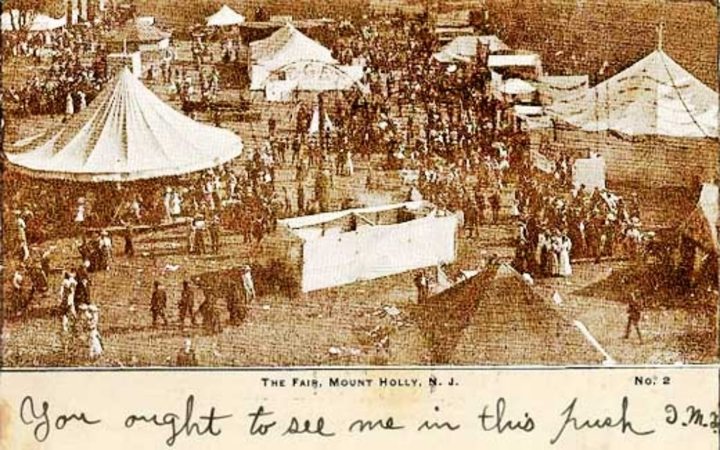 westjerseyhistory.org In 1847, the Burlington County Agricultural Society started the Mount Holly Fair. In 1856, the fairgrounds were built on Route 541 at Woodpecker Lane, what is now the Fairgrounds Plaza in Mount Holly. It featured a grandstand, exhibition buildings and a half-mile racetrack. It was considered the premier fairgrounds on the East Coast, attracting thousands of visitors each year. In 1870, a two-tier grandstand -- the largest in the eastern United States at the time -- was erected and the fair became a popular destination for thousands. It was even visited by presidents and vice presidents, according to the booklet. The fair was discontinued in 1926. It eventually found a new home on the Village Green in Lumberton. It would remain in Lumberton for 53 years, until moving to the then newly created Burlington County Fairgrounds in 2011. 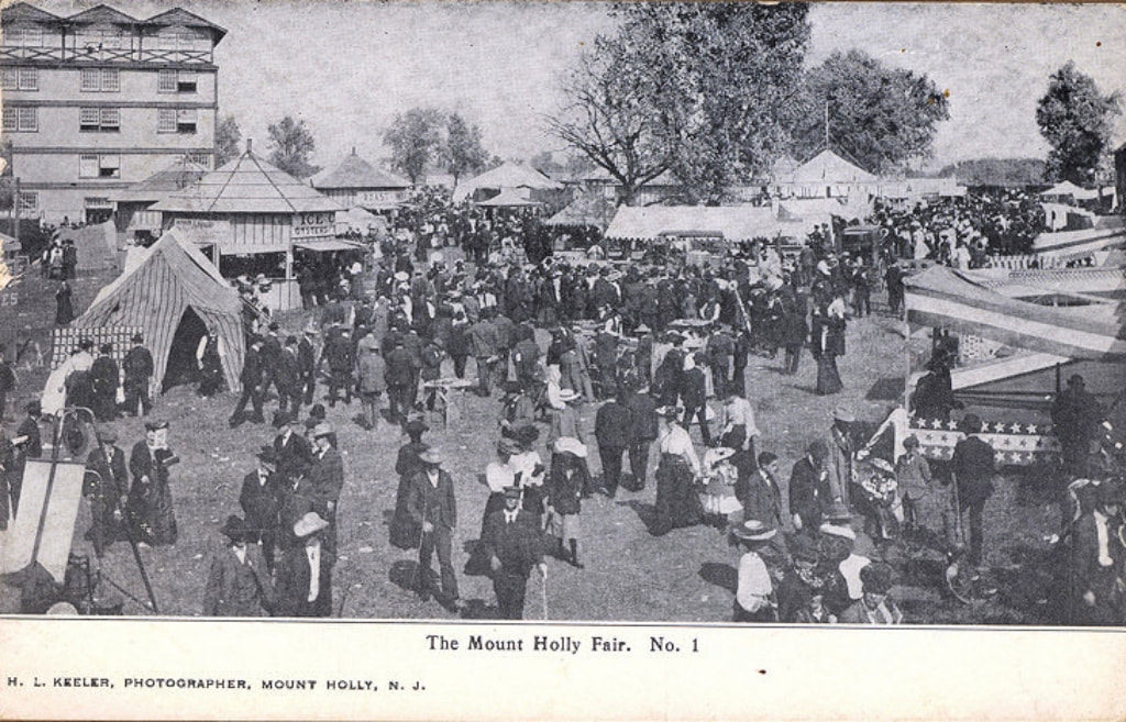 westjerseyhistory.org 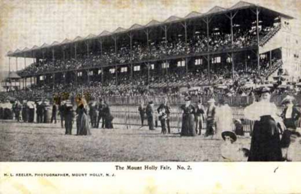 westjerseyhistory.org On September 13, 1892, the Mount Holly and Smithville Bicycle Railroad opened. It was developed by Arthur E. Hotchkiss. In 1892, Arthur Hotchkiss received a patent for a bicycle railroad and contracted with the H. B. Smith Machine Company to manufacture it. The purpose of the railway was to transport Smith Company employees from Mount Holly, via bicycles specifically designed to glide, similar to a monorail, to Smithville . The initial track ran 1.8 miles from Smithville, in a nearly straight line, crossing the Rancocas Creek 10 times, and arrived at Pine Street, Mount Holly. It was completed in time for the Mount Holly Fair in September, 1892, and the purpose of the railway was supposed to have been enabling employees to commute quickly from Mount Holly to the factory at Smithville. Monthly commuter tickets cost $2.00 (equivalent to $57 today). The record speed on the railway was 4.5 minutes , and the average trip took 6–7 minutes. The railway was exhibited at the World's Columbian Exposition in 1893. It only had one track so that it was impossible to pass another rider, and if riders travelling in opposite directions met, one had to pull off onto a siding. By 1897 ridership had declined, and the railway fell into disrepair. 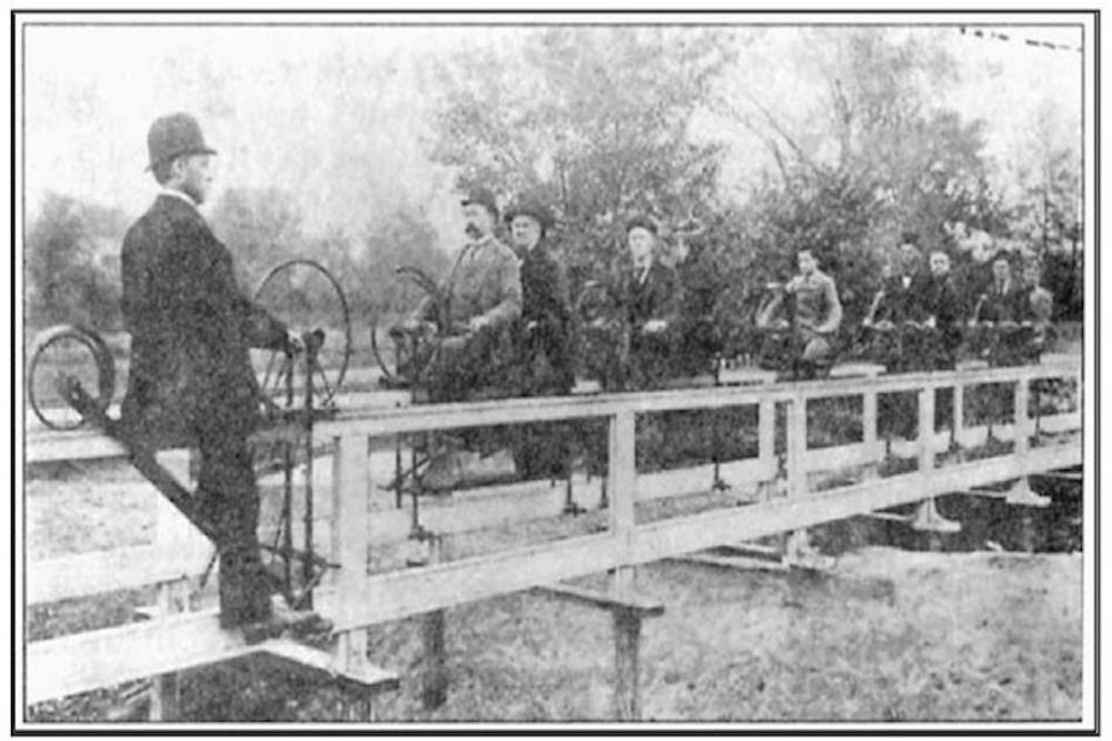 www.veloramaroute.nl  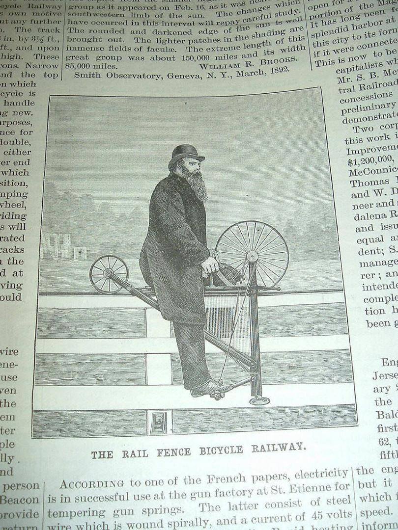 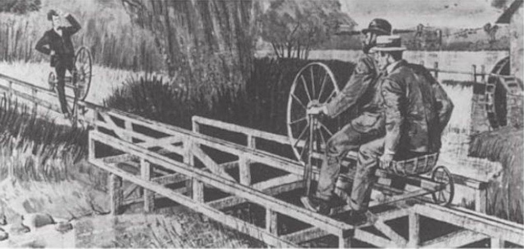 The Burlington & Mount Holly Railroad and Transportation Company, was incorporated in 1836. The railroad ran 7.2 track miles from Burlington, New Jersey to Mount Holly Township, New Jersey. July 4, 1863 Burlington & Mount Holly Railroad & Transportation Company renamed Burlington County Railroad Company. In 1895, the Pennsylvania Railroad used the Burlington & Mount Holly tracks to experiment with 500 volt DC trolley wire; trolley pole electric operation, with two motor passenger cars built by Jackson and Sharp Company at Wilmington, Del. This service was discontinued on October 29, 1901, after the electrical powerhouse in Mount Holly burned. In April 1902, PRR orders demolition of Mount Holly power house and ends experiment of electric trolley operation between Burlington and Mount Holly. This line was the first electrified PRR branch in New Jersey. The Burlington & Mount Holly line was abandoned by the PRR in 1927. County Route 541 in Burlington County is on and or follows the Burlington & Mount Holly Railroad and Transportation Company's right of way. 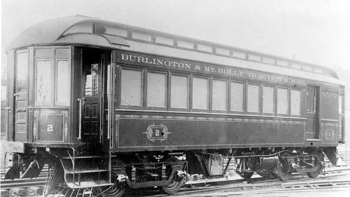 https://www.sjrail.com/wiki/index.php?title=Burlington_&_Mount_Holly_Railroad_and_Transportation_Company Speaking of rails in Mount Holly, I recently had an opportunity to check out the Mount Holly Rail Trail which is located in Creek Island Park. 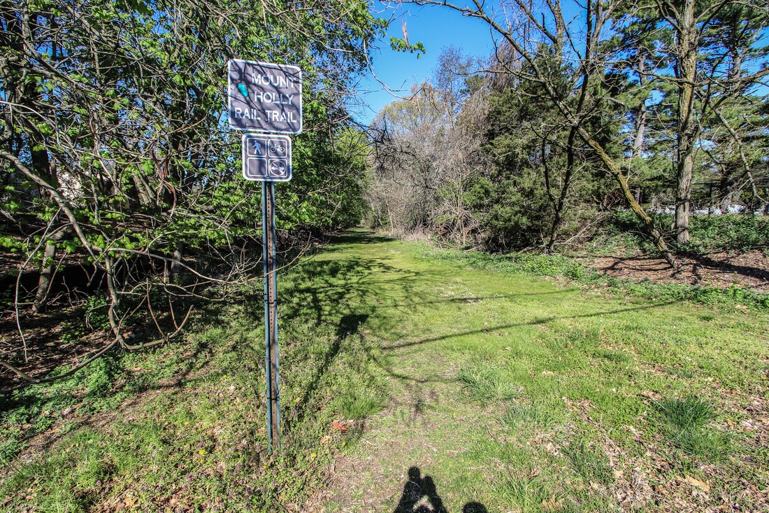 Mount Holly Rail Trail 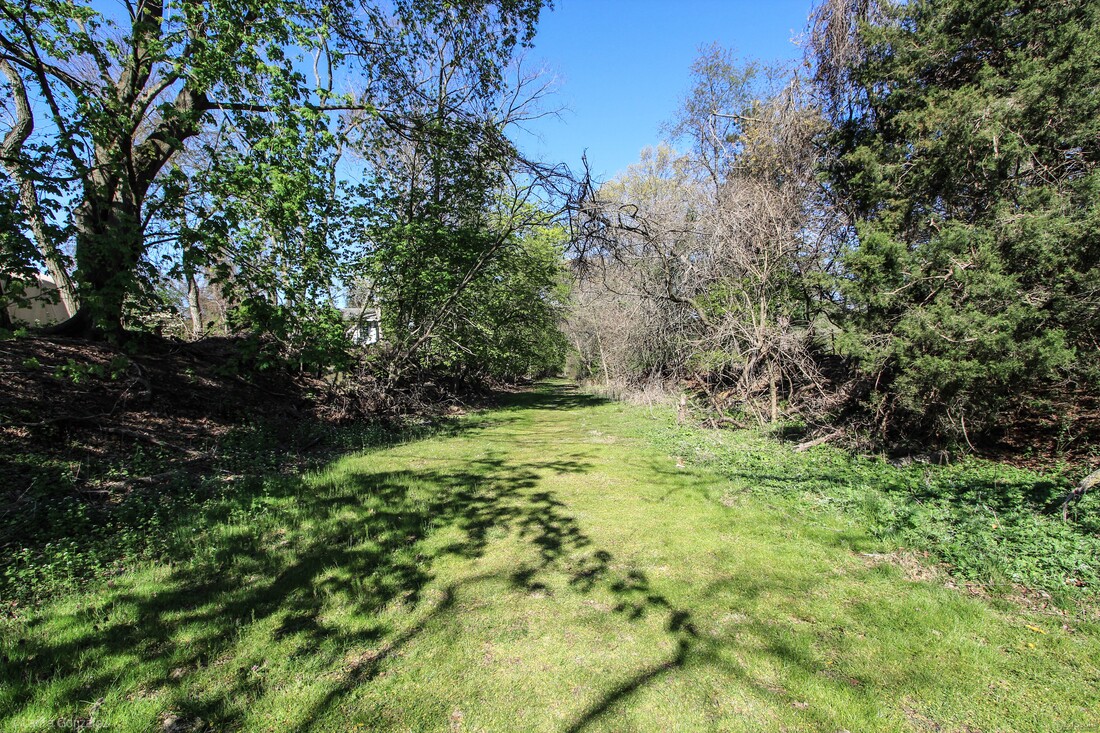 Mount Holly Rail Trail 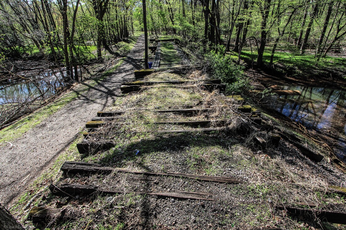 Mount Holly Rail Trail 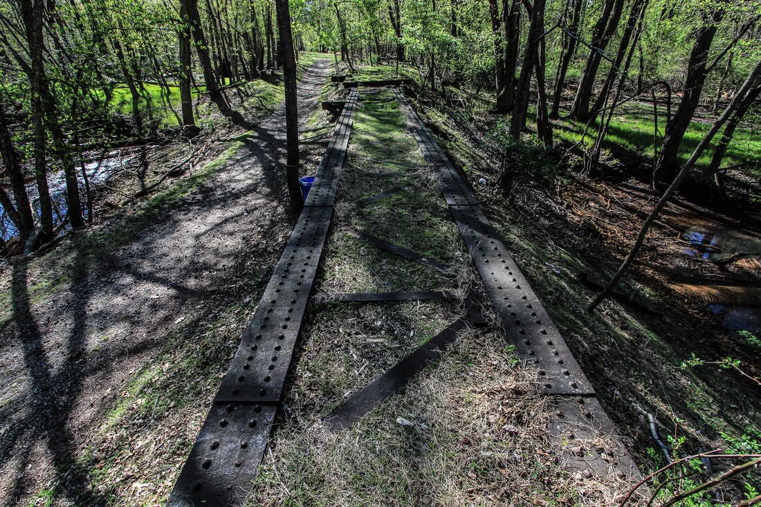 Mount Holly Rail Trail Trailheads at Madison Ave. This hike isn’t very long, about 1/2 mile. There is plenty of interesting stuff to see at this trailhead. 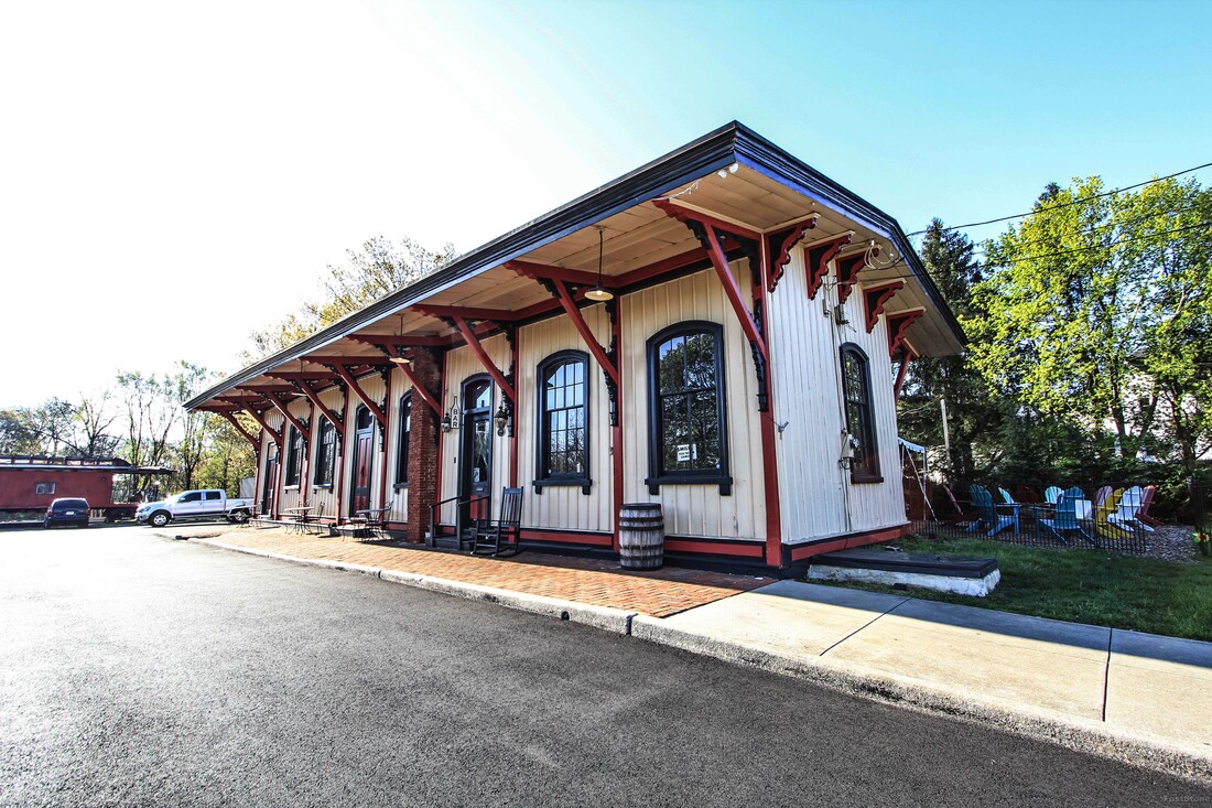 Train Wreck Distillery 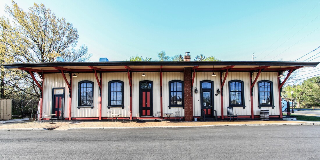 Train Wreck Distillery 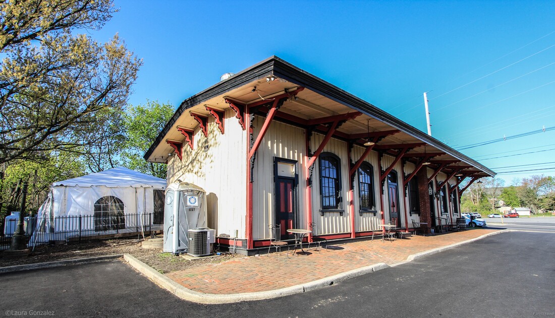 Train Wreck Distillery 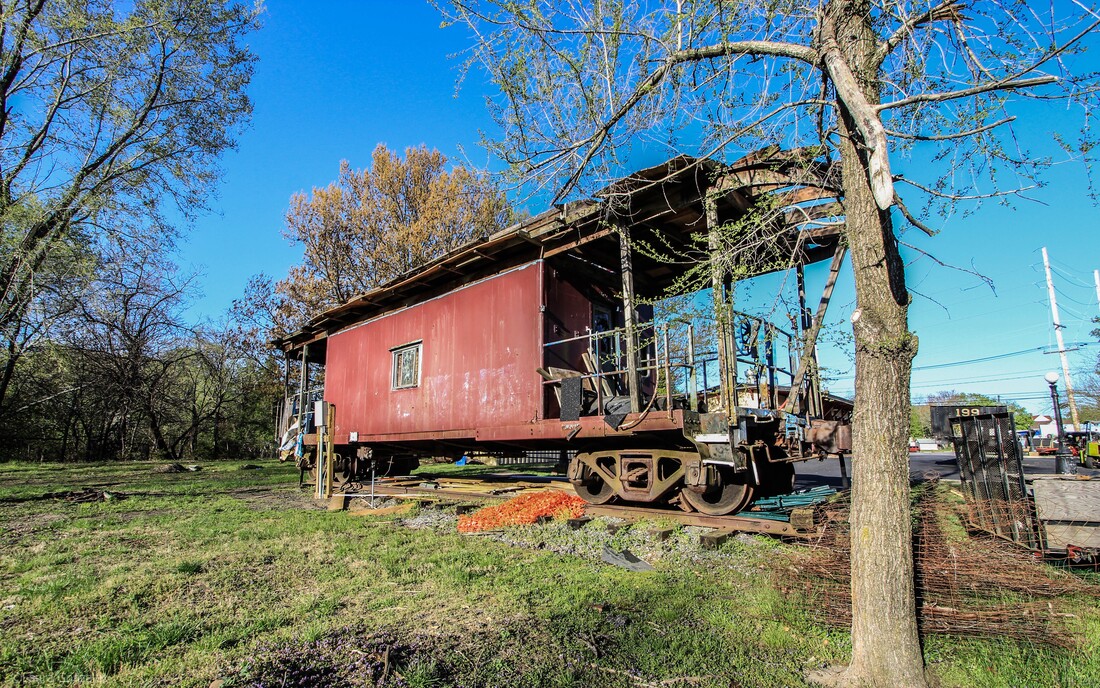 Trailheads at Madison Ave 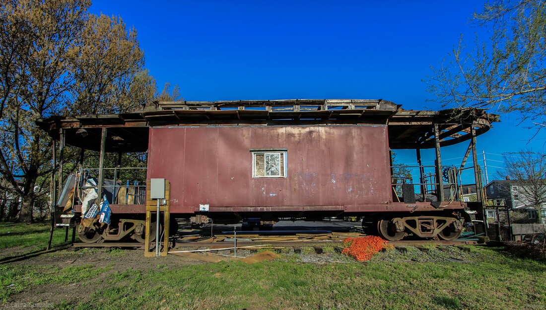 Trailheads at Madison Ave 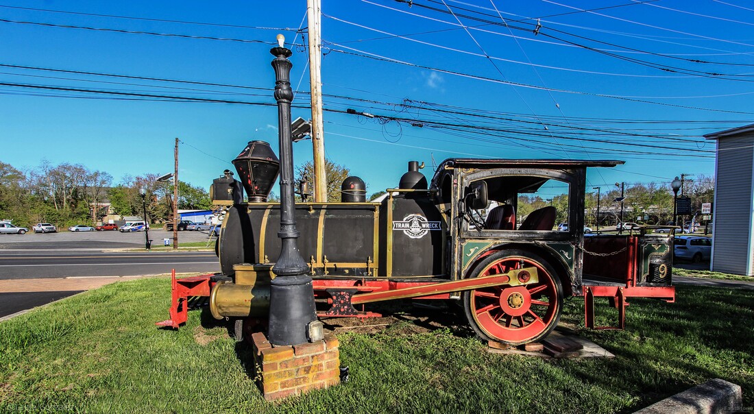 Trailheads at Madison Ave 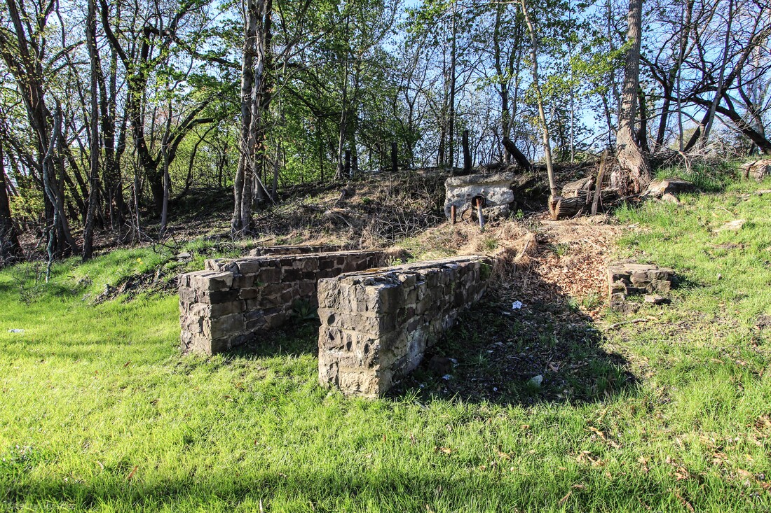 Trailheads at Madison Ave 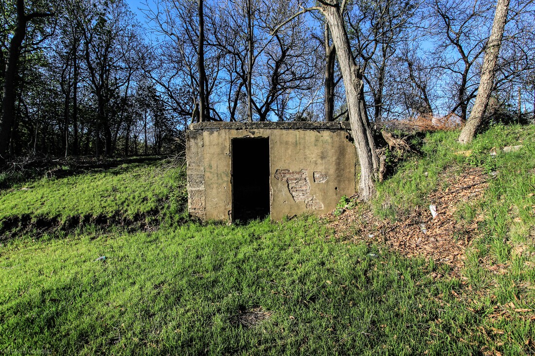 Trailheads at Madison Ave 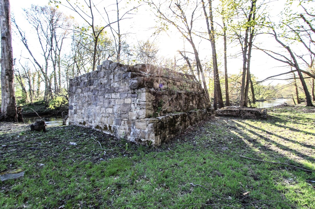 Trailheads at Madison Ave After a nice hike on the rail trail, I decided to check out the sights of Mount Holly. 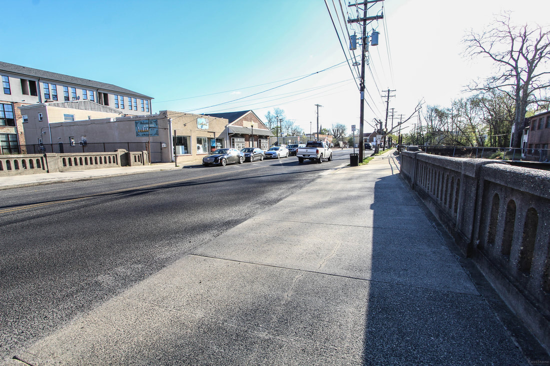 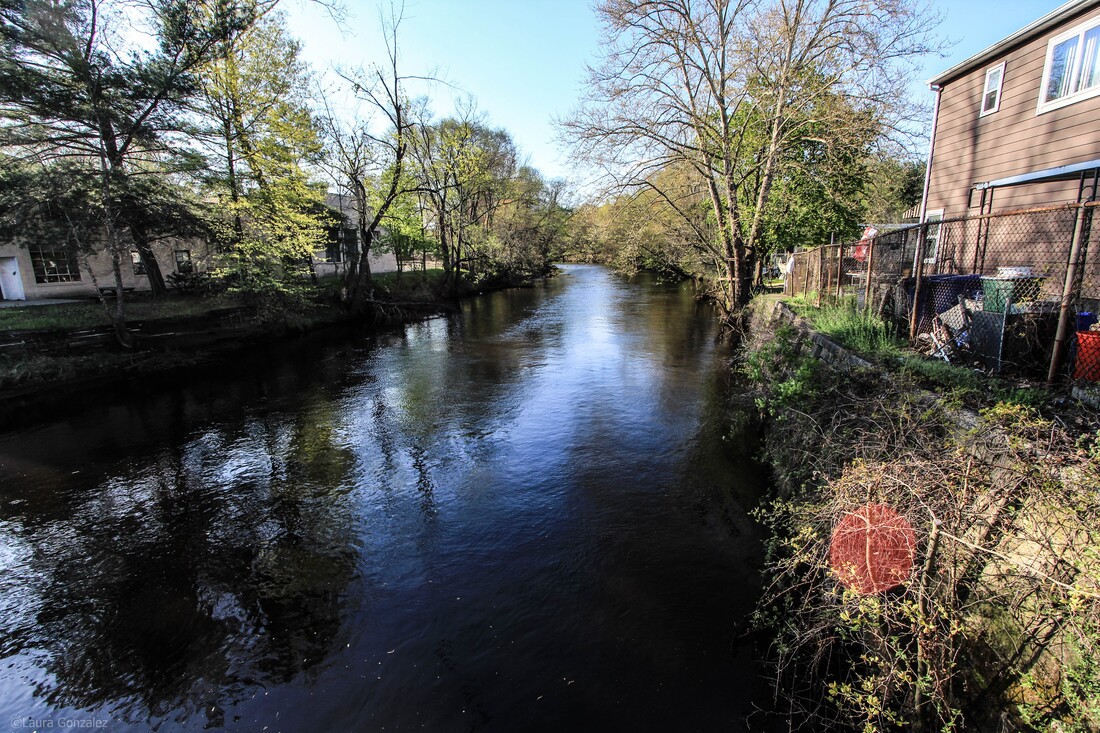 North Branch Rancocas Creek 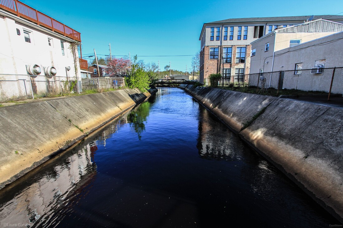 North Branch Rancocas Creek 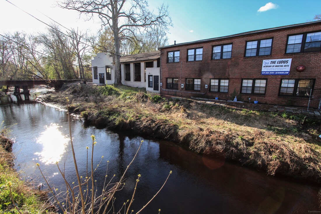 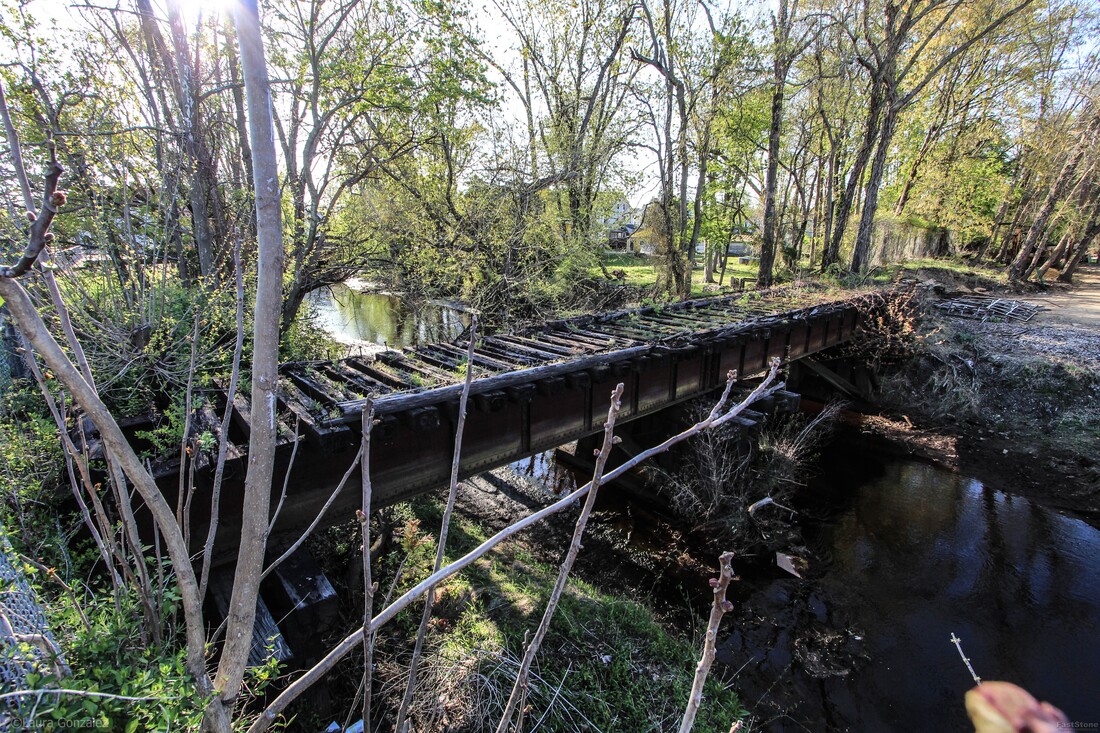 Bridge Ruins  Mount Holly Homes 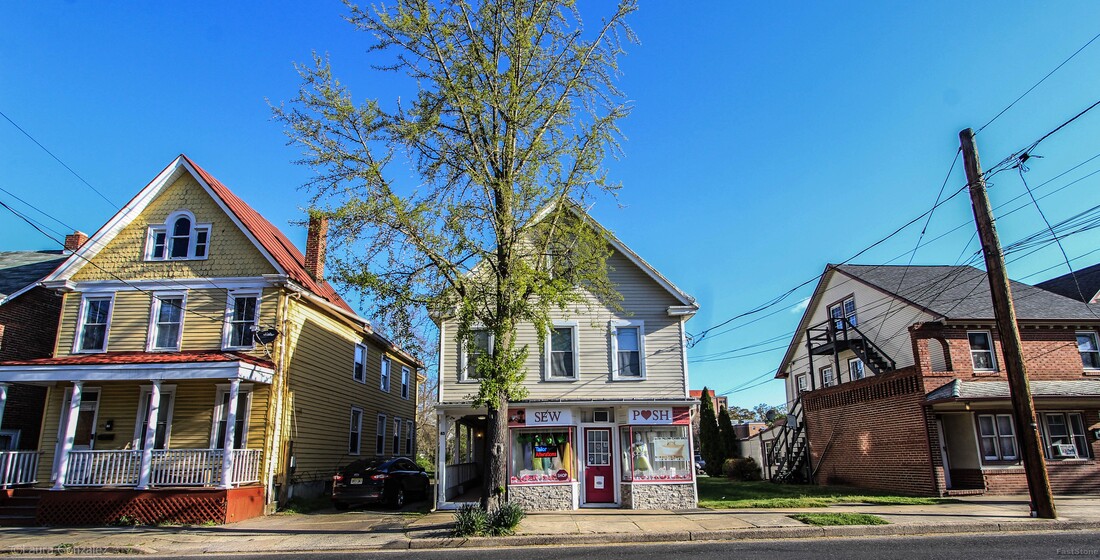 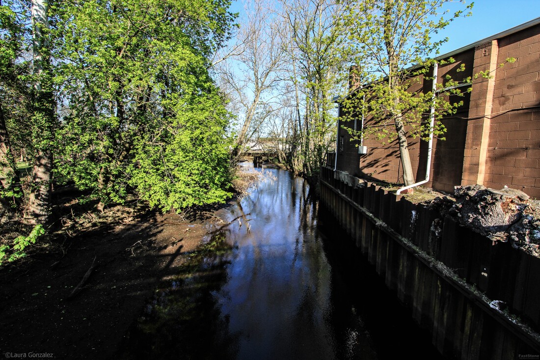 North Branch Rancocas Creek "The North Branch Rancocas Creek is a 31-mile-long tributary of Rancocas Creek in southwestern New Jersey. The creek starts in the Pine Barrens of Brendan T. Byrne State Forest and Fort Dix Military Reservation, near Browns Mills. From its confluence with Rancocas Creek, tidewater extends upstream to the upper end of Mount Holly. The North Branch Rancocas Creek drains an area of 167 square miles. The creek is among the more developed portions of the Rancocas Creek watershed."- wikipedia 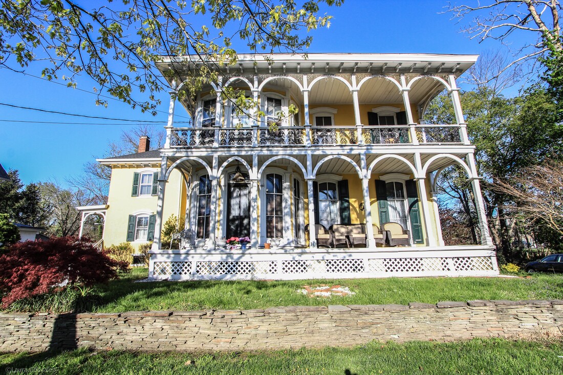 The Frederick Schrayshuen Mansion The Frederick Schrayshuen Mansion C 1870 ....10 Bispham Street Two story central block with one wing, 4/4 windows, floor depth, with Gothic arch; high stone foundation; two story porch, six bay, with cast iron balusters, fancy pierced; plain ashlar simulated walls over brick; inside end and interior chimneys; hip roof on wing and gable roof on central block; scrolled bracket cornices; irregular Z-shaped floor plan. 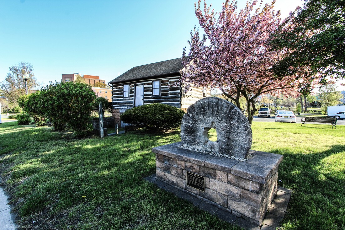 Shinn Log House The Shinn Curtis Log House lies in the heart of an historic section of Mount Holly. The early settler's home of hand-hewn logs originally built in 1712 was encased in a house and was uncovered in 1967 when the surrounding house was demolished. It was in the possession of the Curtis family for 147 years, since 1802, and is now owned by the Mount Holly Historical Society. The building was relocated from what had been Water Street and renamed Rancocas Road. 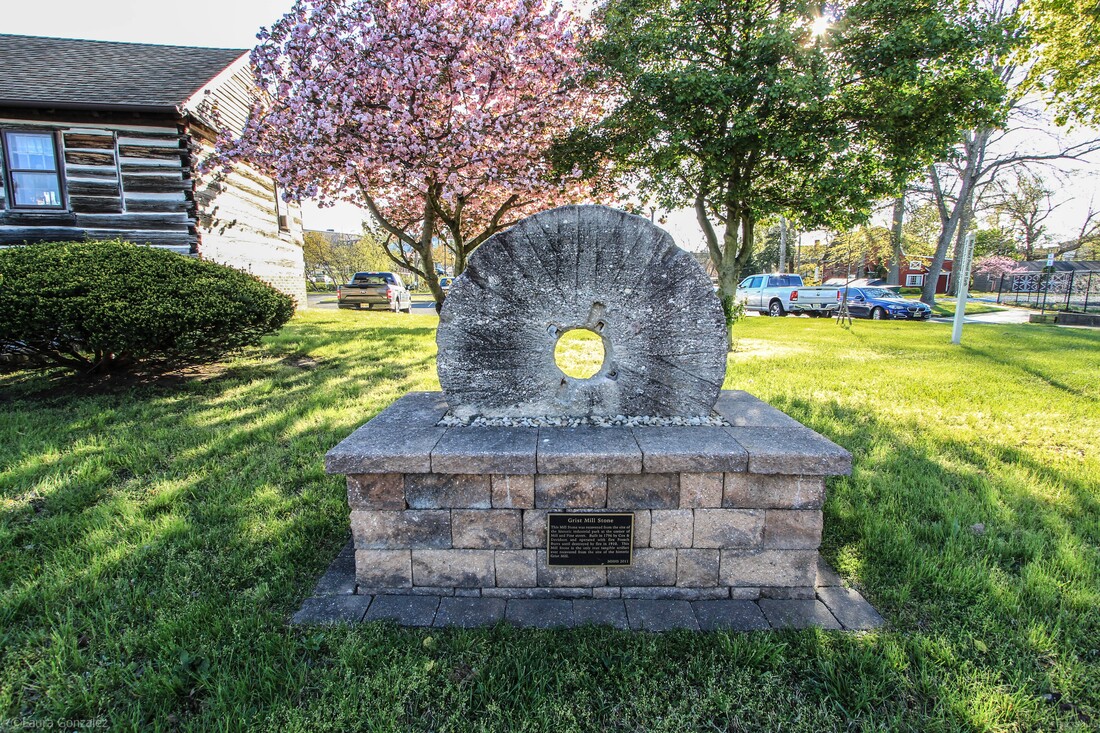 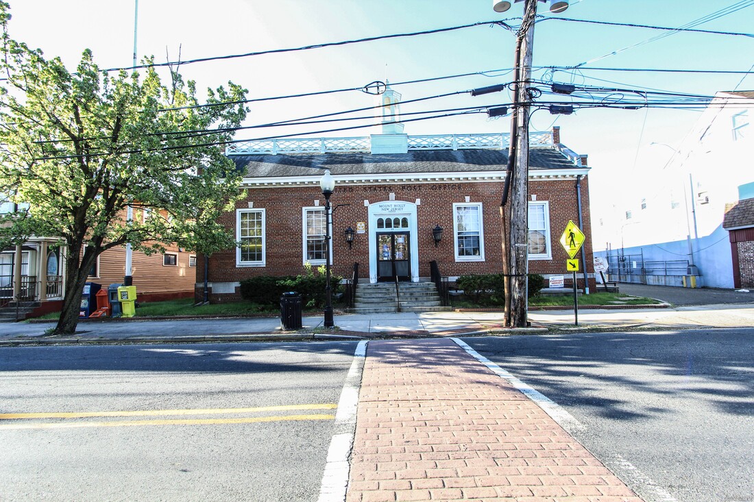 1790 Post Office The inside of this post office is vintage. The foyer looks like a turn of the century train ticket office complete with old wood, trimmed to the hilt, glass windows, stained dark. 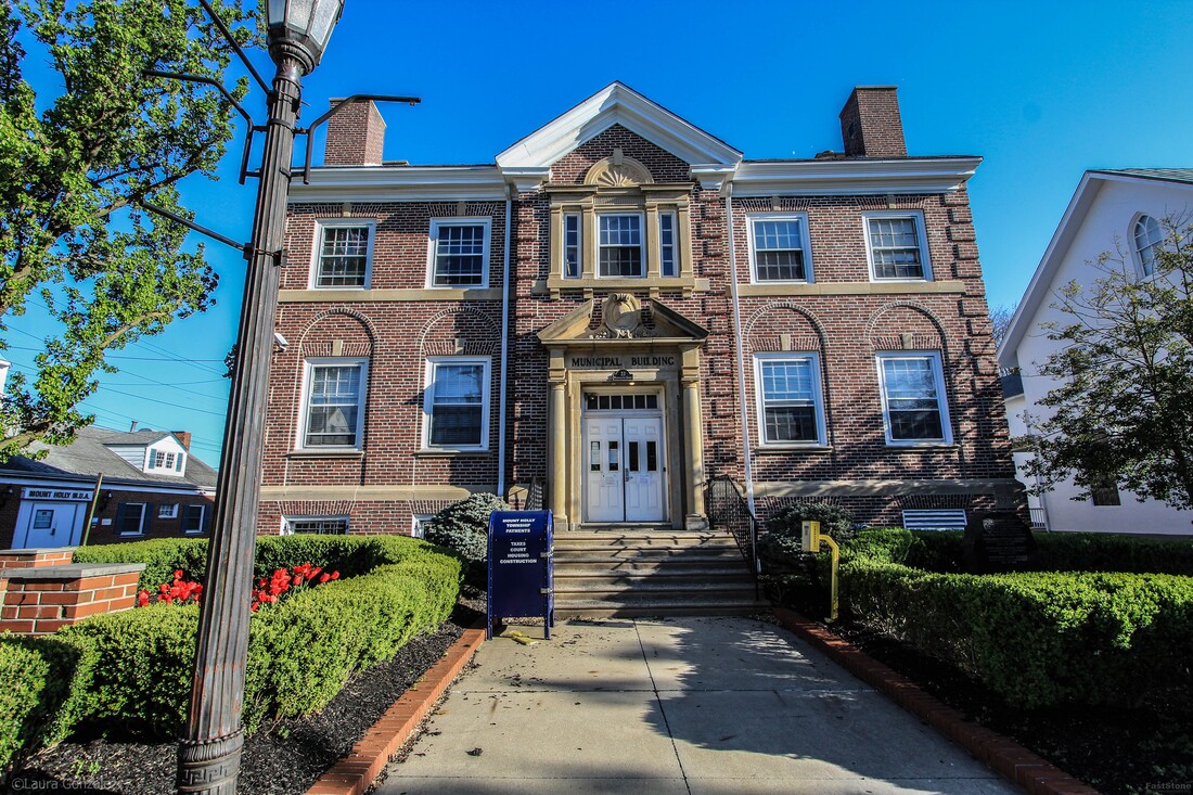 Mount Holly Police The police department faces a side alley, to the rear of the municipal center. There were a bunch of cruisers parked back there. The original structure was built in 1930, and is an amazingly interesting and architecturally relevant structure which is why it is a contributing structure to the historic district. 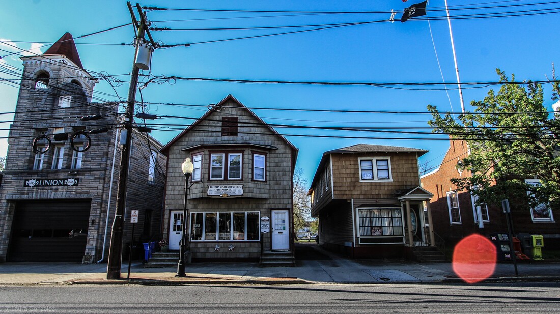 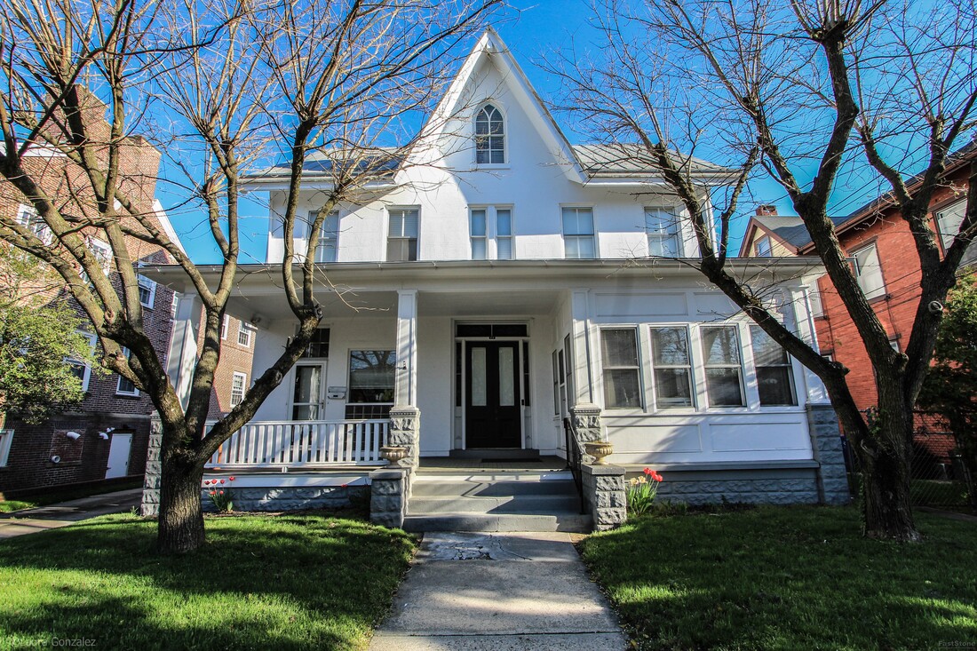 Mount Holly Home 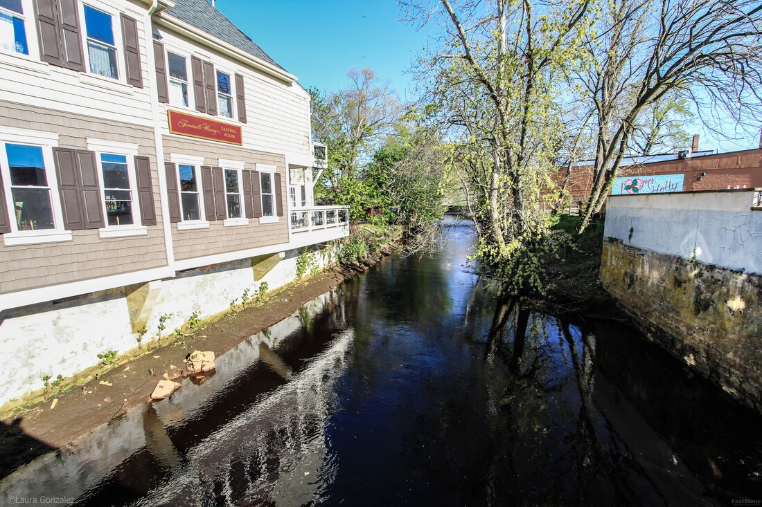 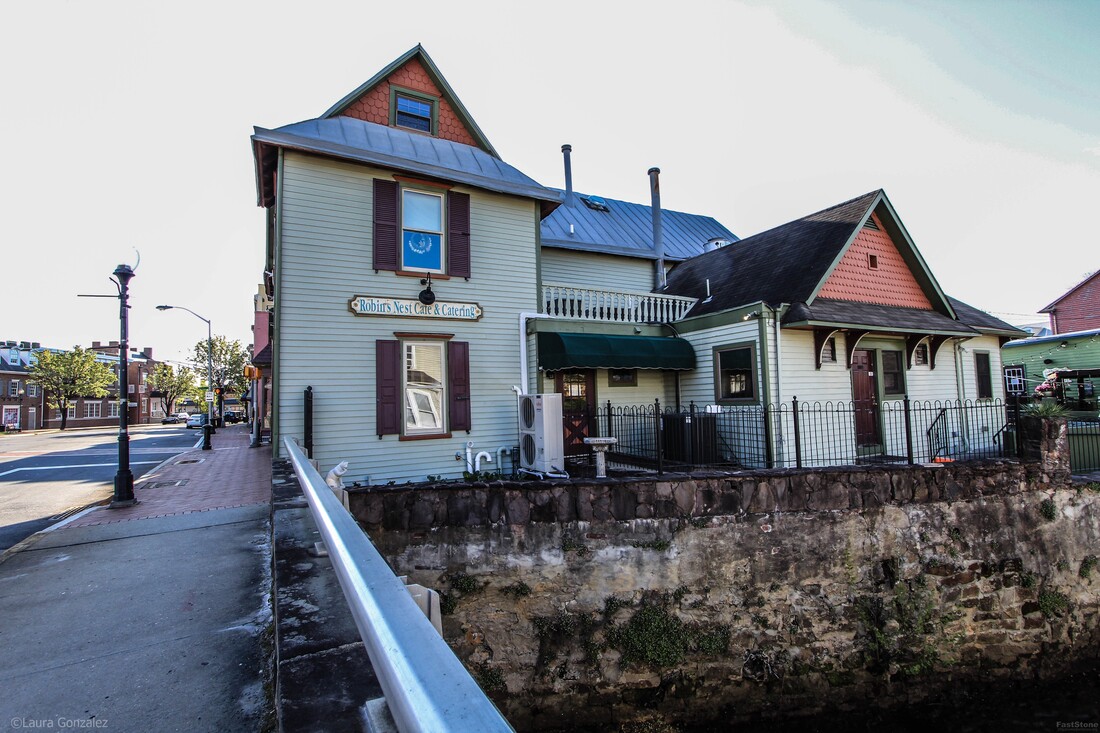 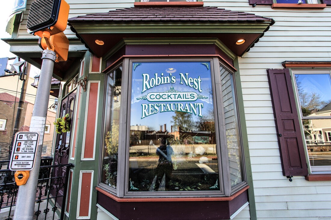 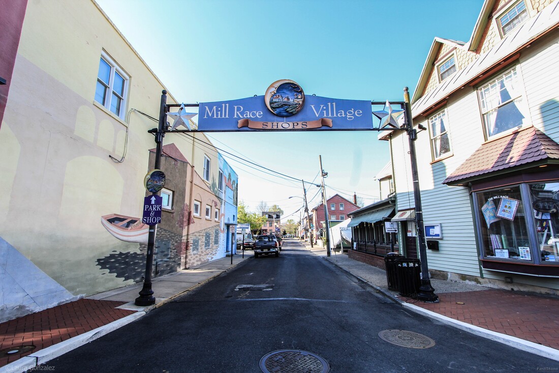 Mill Race Village Shops 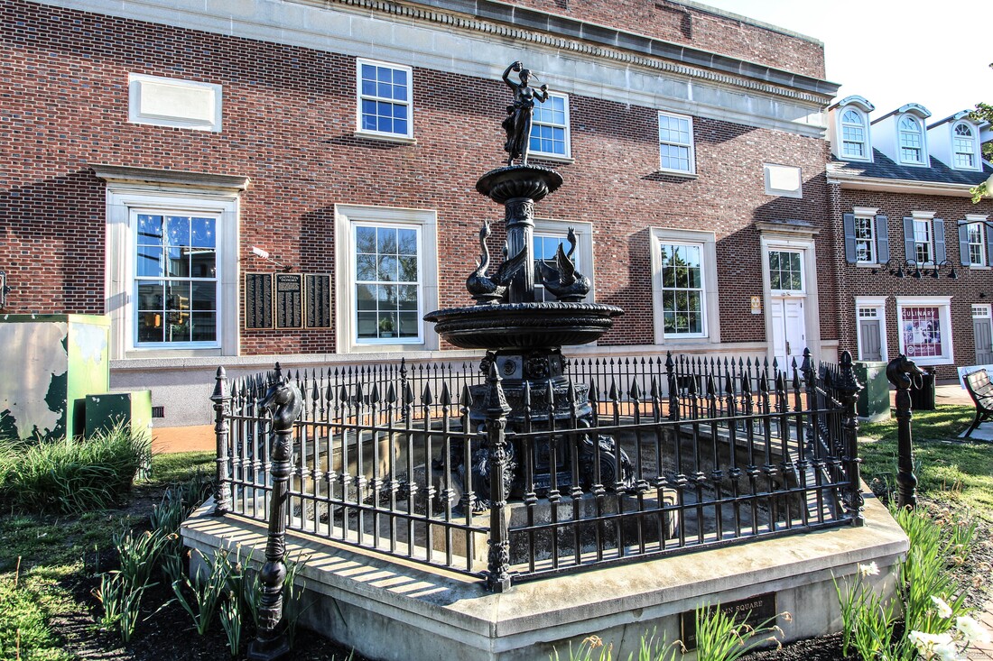 Fountain 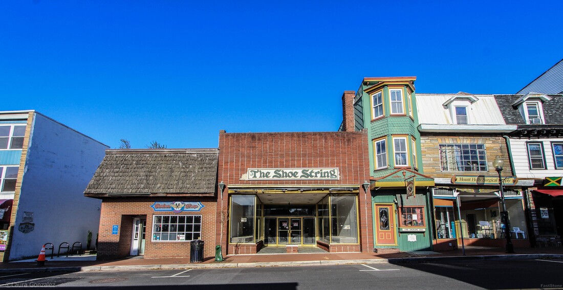 Daniel Smith House The green building to the right of The Shoe String is the Daniel Smith House, Navigator Circa 1790. 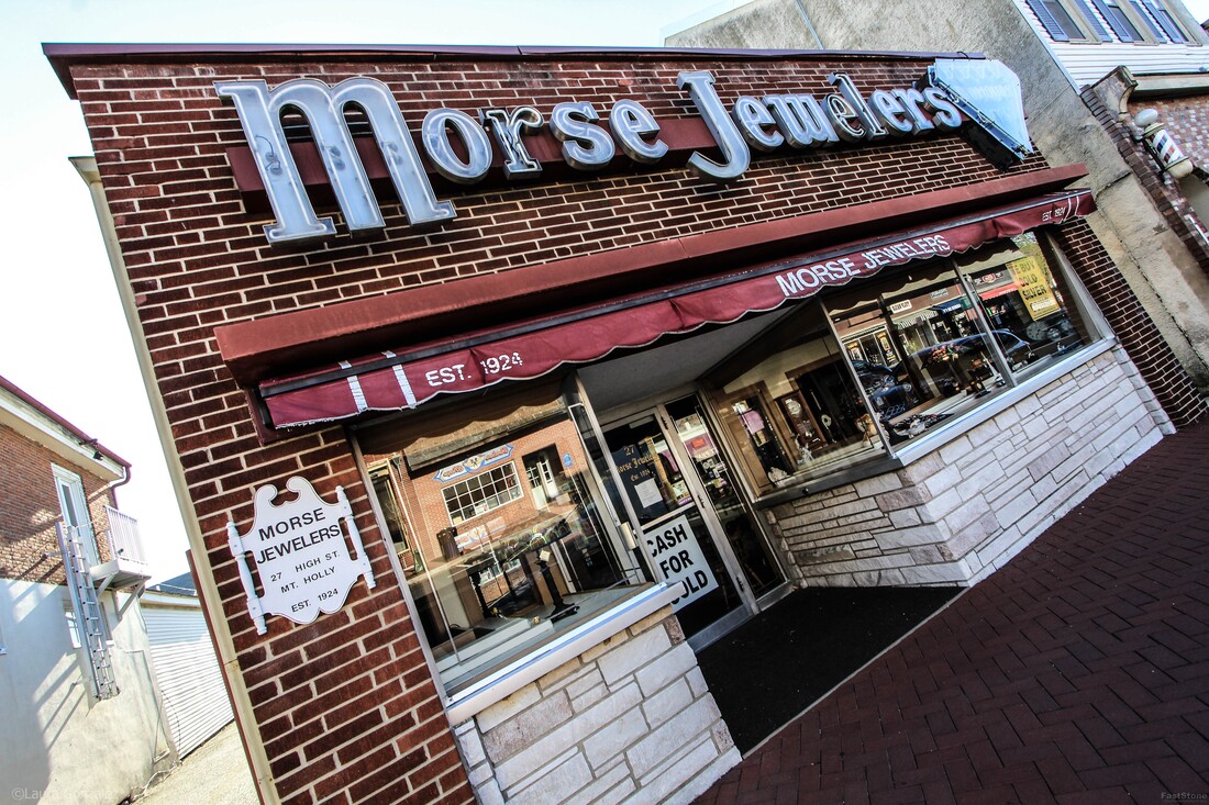 Morse Jewelers 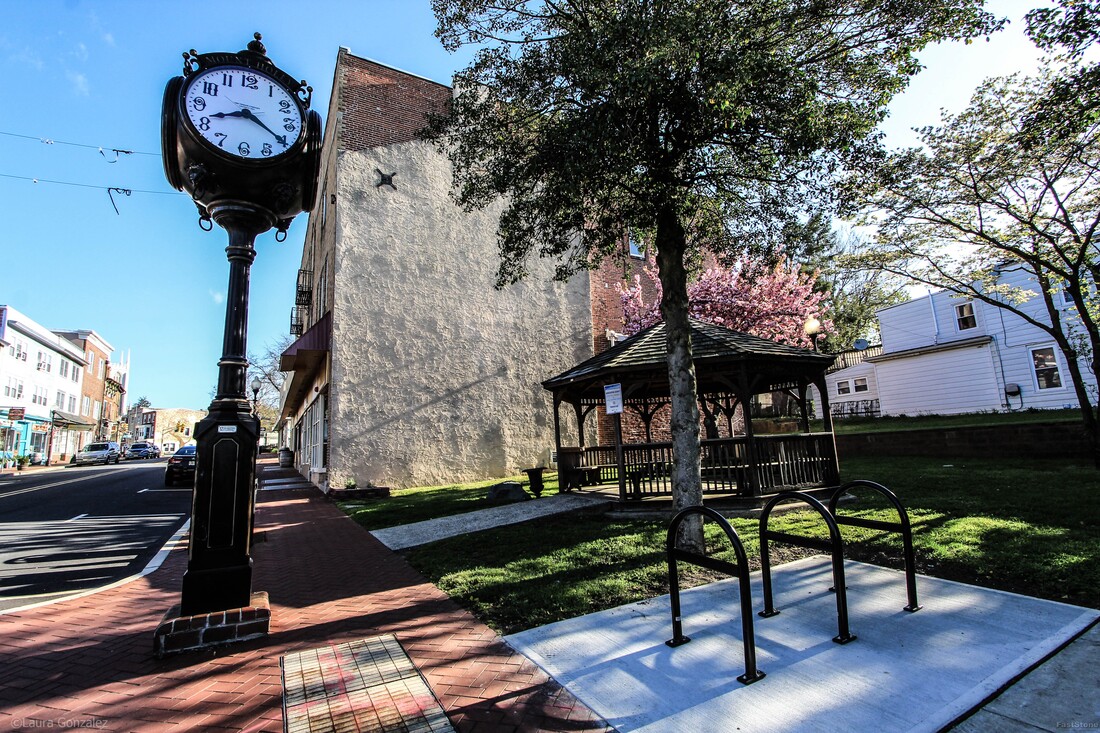 Town Clock The Mount Holly Preservation Society, commissioned a replica town clock. It was placed where the original once stood.  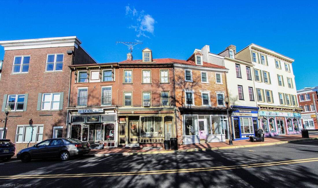 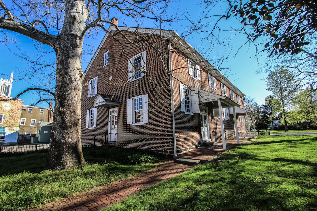 Mount Holly Quaker Meeting House This Friends Meeting House was built in 1775, and so was here at the time of the Battle of Iron Works Hill on December 23, 1776. "The British army occupied Philadelphia from September 26, 1777 until June 18, 1778. Philadelphia had been serving as the American capital, and the British occupation forced Congress to move to York, Pennsylvania, which had a demoralizing effect on the Americans. During that same winter of 1777, General George Washington and his Continental (American) army were camped about twenty miles away from Philadelphia in Valley Forge, Pennsylvania. Valley Forge provided a good strategic location for the army's winter quarters; It was close enough to keep an eye on the British troops in Philadelphia, but in a strong defensive position should the British decide to attack. In early June 1778, the British forces in Philadelphia decided to abandon Philadelphia and march towards New York City, the main British stronghold in America. British forces under General Henry Clinton began their trip on June 18, 1777, when they crossed over the Delaware River into New Jersey, landing at Coopers Ferry (now Camden). Over the following days, they marched through Haddonfield, Cherry Hill, Mount Laurel, and Moorestown. On June 20 they arrived at Mount Holly where they remained until the morning of June 22. While here, their commissary department used the Friends Meeting House. During this time, General Washington and his Continental Army were also on the move. After hearing of the British evacuation of Philadelphia, Washington made the decision to leave Valley Forge. On June 20, they crossed into New Jersey at Coryell's Ferry and marched in pursuit of the British troops, keeping a path miles to the north of them. From Mount Holly, the British troops moved on through Bordentown and Crosswicks. On June 28, they would meet the Continental Army at Monmouth Courthouse, and fight the Battle of Monmouth, the longest continuous battle of the war." -revolutionarywarnewjersey 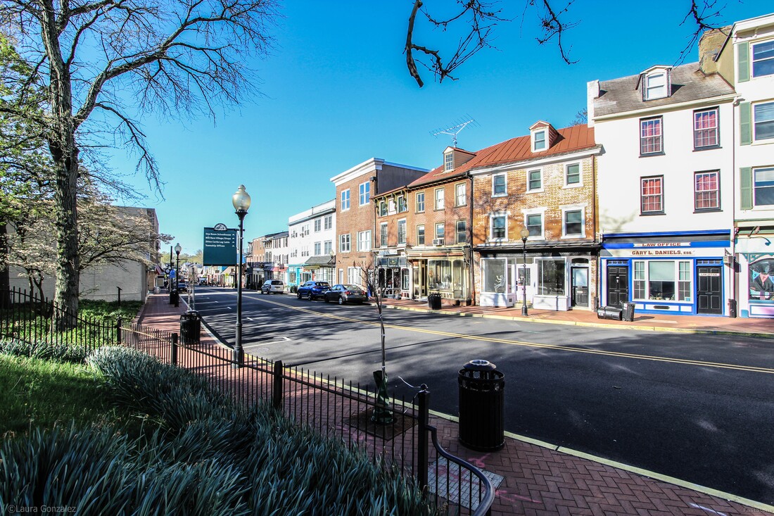 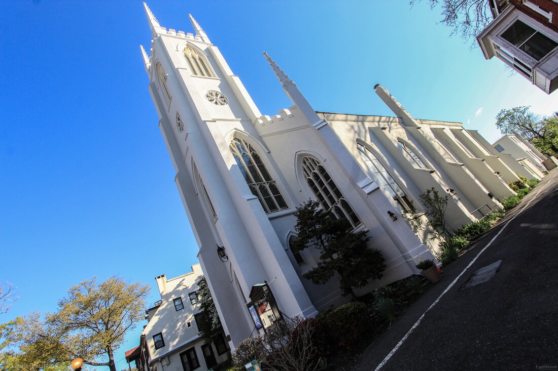 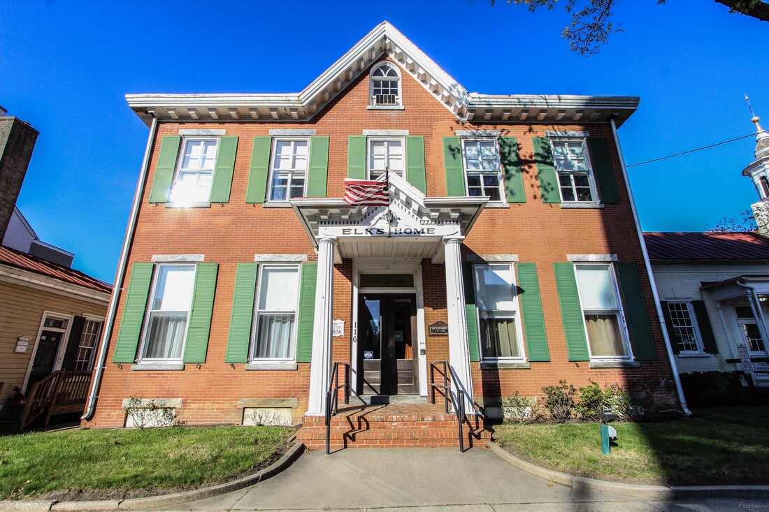 Elks Home This Elks Home lodge is in a Victorian-era home built in 1856.  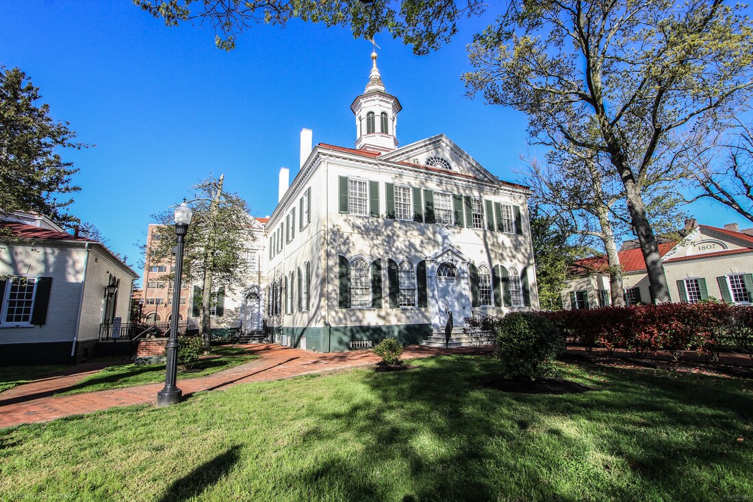 Burlington County Court House This old court House was built in 1796 and modeled after Congress Hall in Philadelphia. It was used full-time until 1959 when a new County office building was opened which included court facilities. The courthouse continues to handle judicial proceedings. 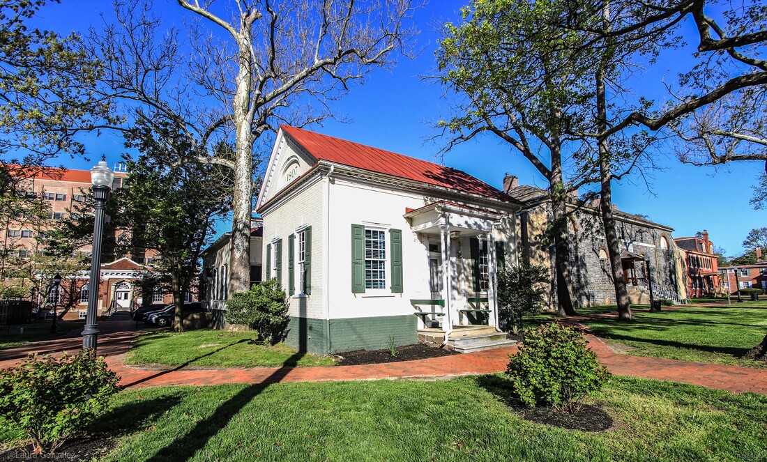 Surrogate's Office and Collector's Office This is one of the smallest government buildings you might ever find. The building is a single room structure painted to resemble the historic 18th century courthouse to the left of it. From the Nomination Form: 15. SURROGATE'S OFFICE AND COLLECTOR'S OFFICE ....1807 ....High Street Two identical one story rectangular offices constructed of Flemish bond brick with moulded brick water tables over brick foundations; one bay entrance porch on each; keystones over 9/9 windows, flanked by paneled shutters; gable roof over box cornices with carved and shaped dentils with moulded architrave frieze same as court house; full length return under gable at sides of buildings from front to back 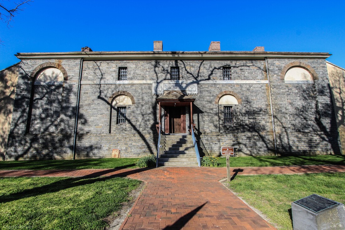 Burlington County Prison The Burlington County Prison Museum is a National Historic Landmark located in historic Mount Holly. Designed by Robert Mills, one of America 's first native-born and trained architects, the Burlington County Prison was completed in 1811. One of Robert Mills' first designs as an independent architect, the interior vaulted ceilings of poured concrete and brick and stone construction made the building virtually fireproof. In fact, it was so well constructed that it remained in constant use until 1965.  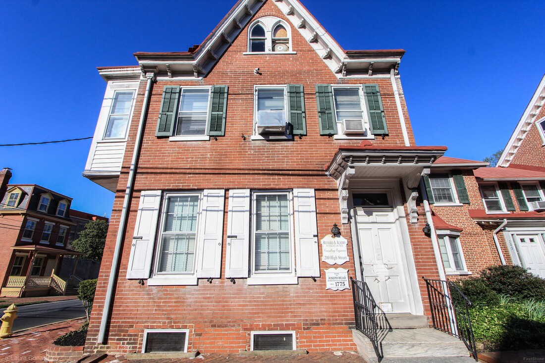 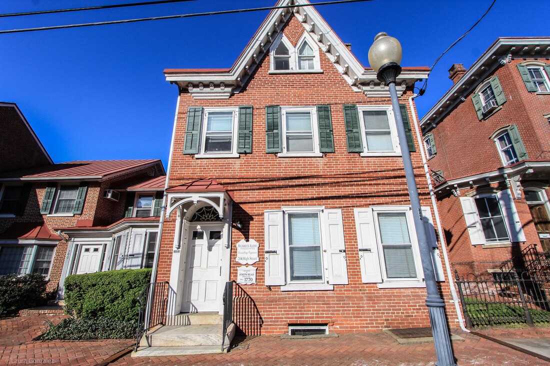 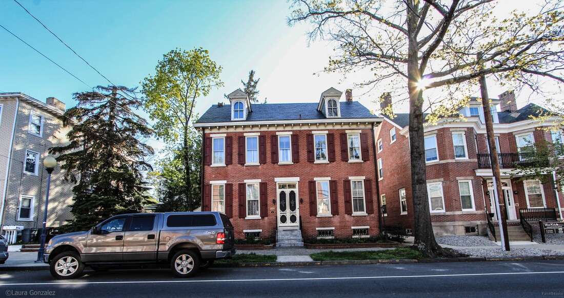 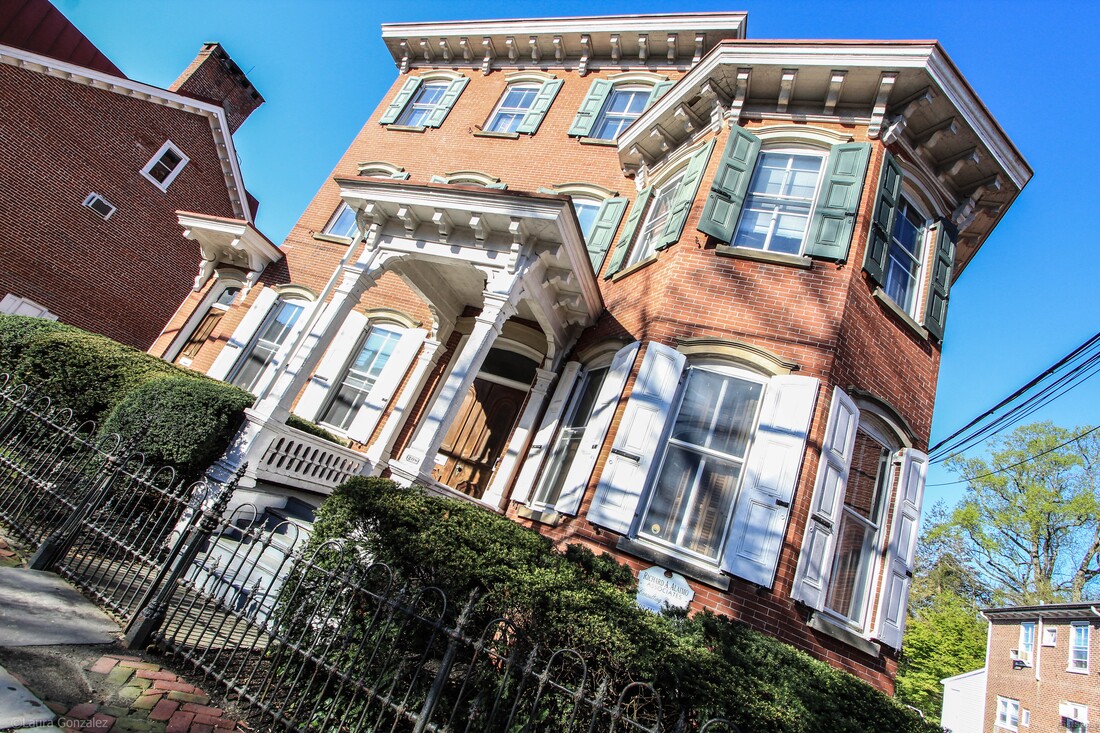 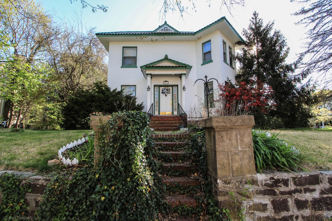 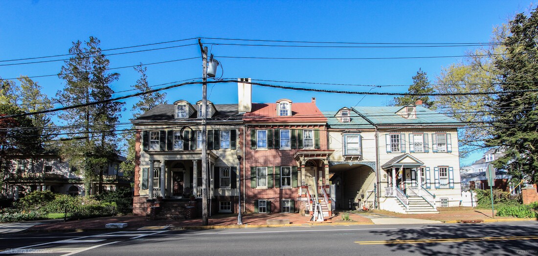 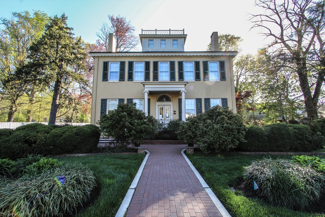 James Langstaff Mansion (Langleland) (1832) 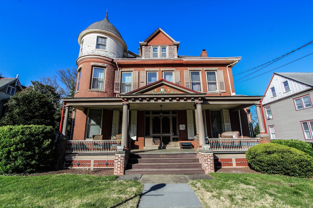 W. Budd Deacon House 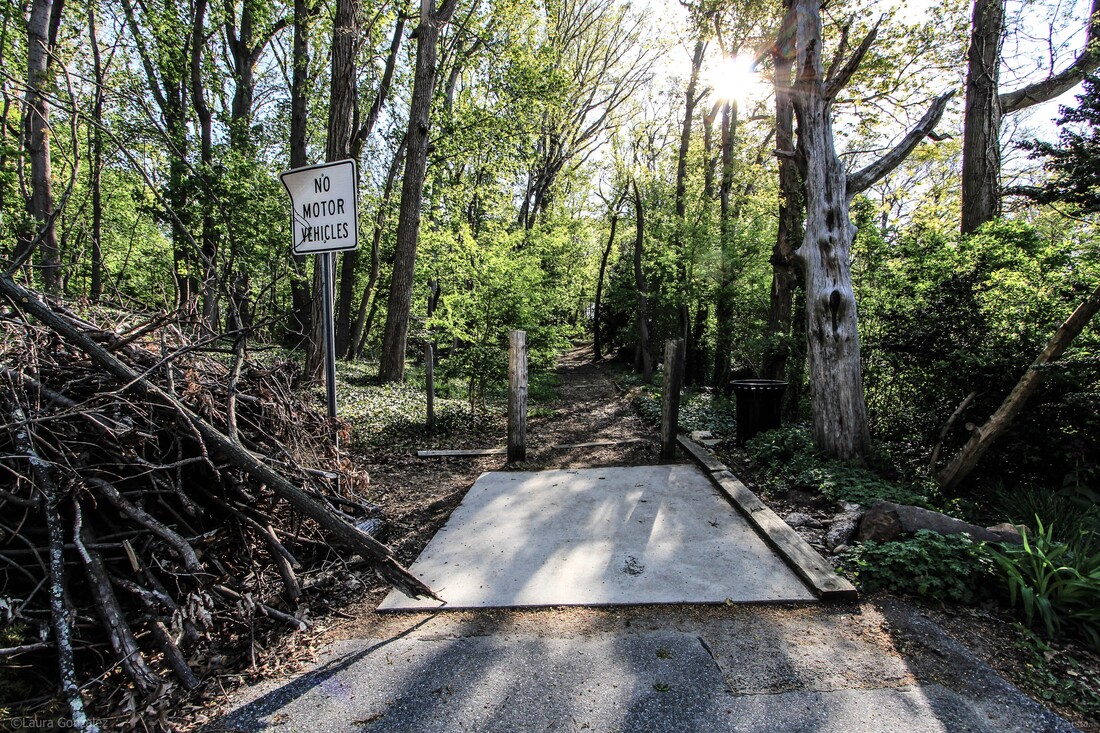 The Mount 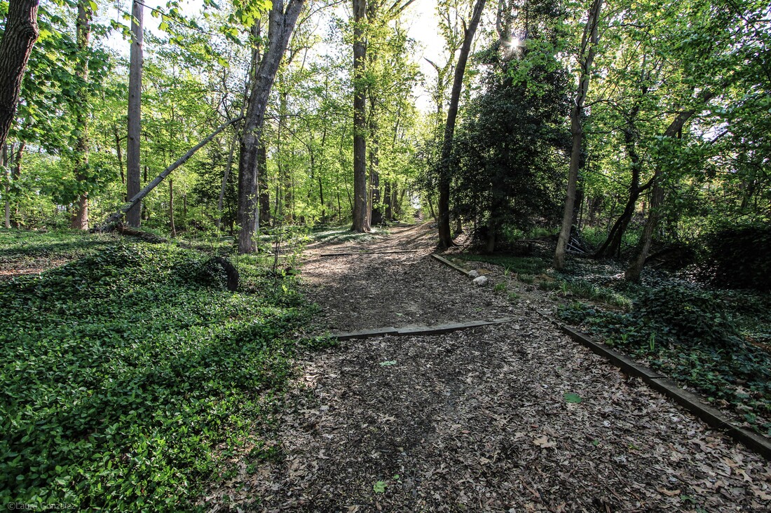 The Mount, Lovers Lane 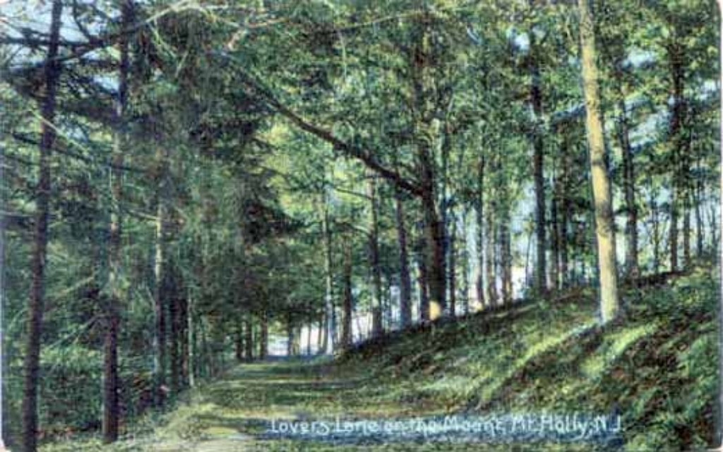 The Mount, Lovers Lane; www.westjerseyhistory.org 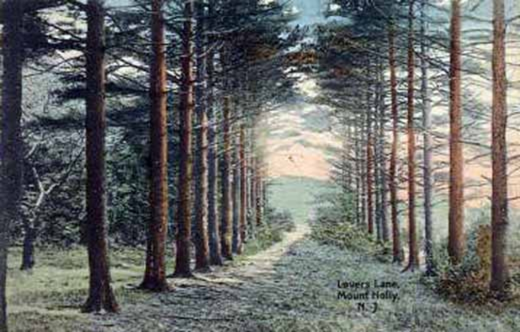 The Mount, Lovers Lane; www.westjerseyhistory.org 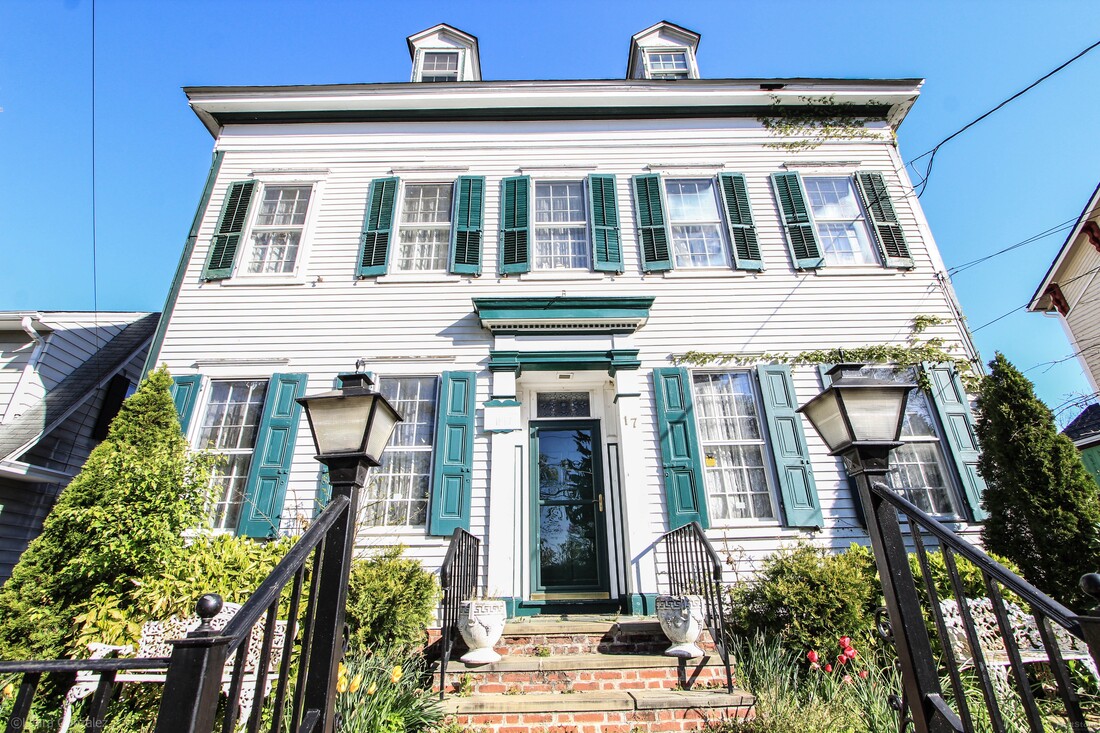 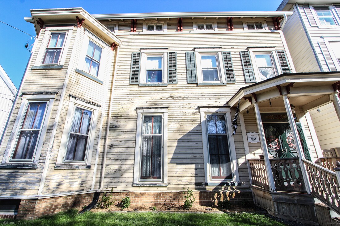 William Rossell House  House of Samuel Shreve ; Manufacturer 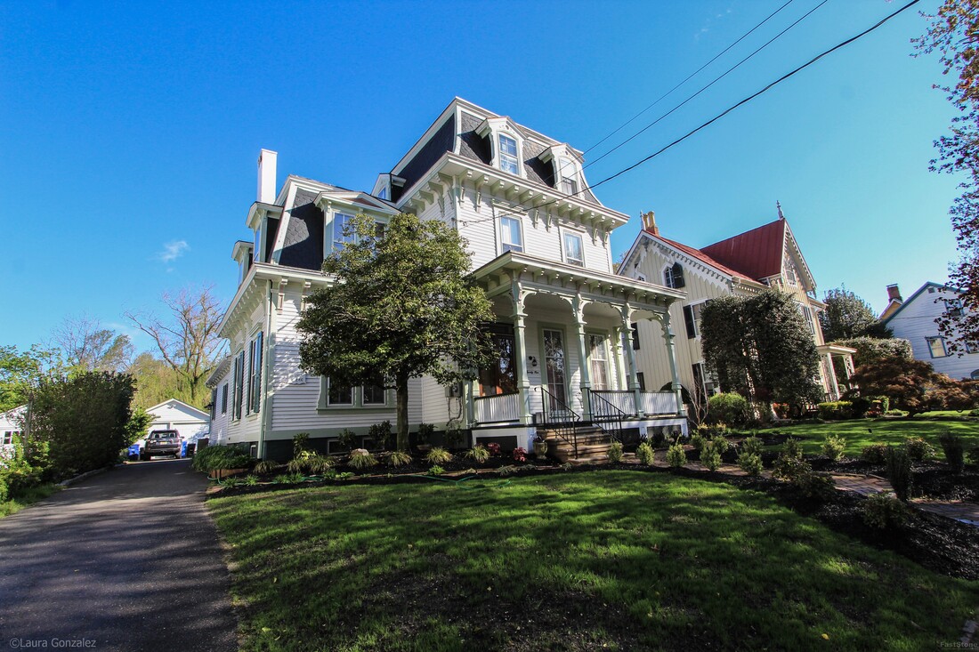 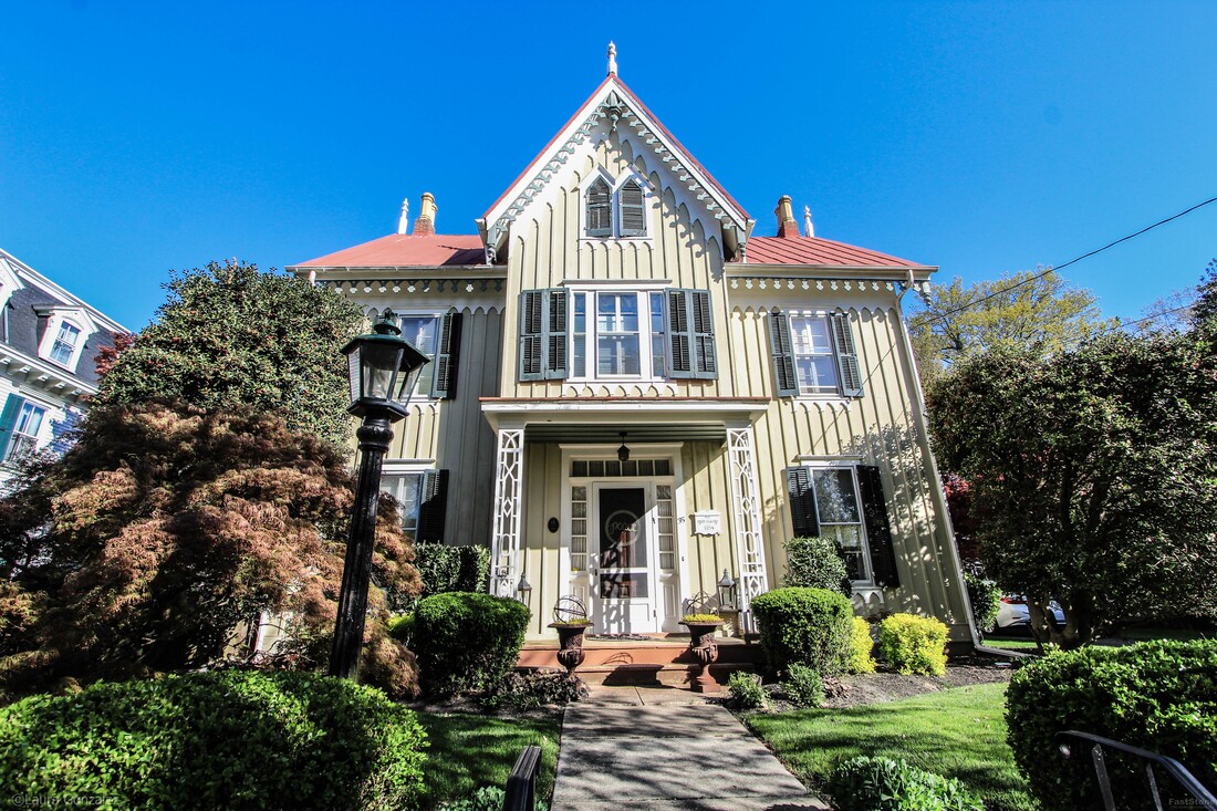 Joseph Head c1854 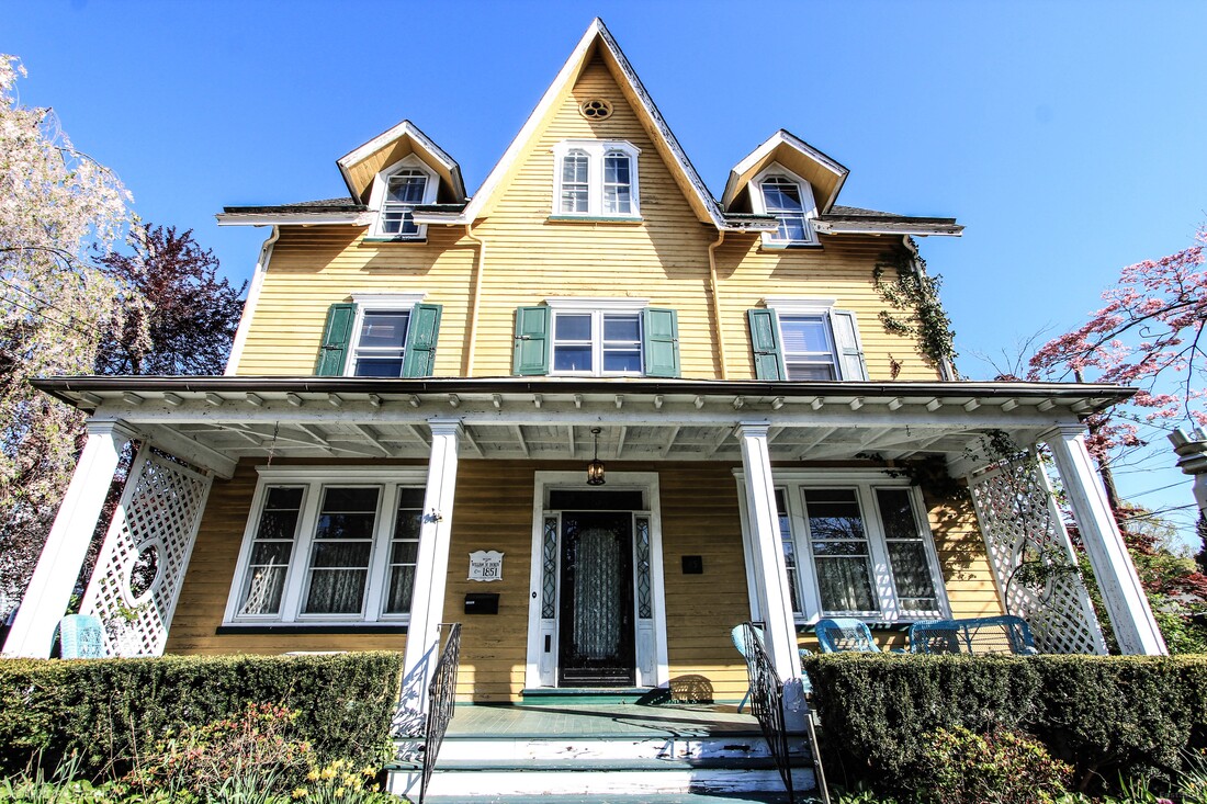 William W. Doren; Candle & Soap Factory Circa 1851 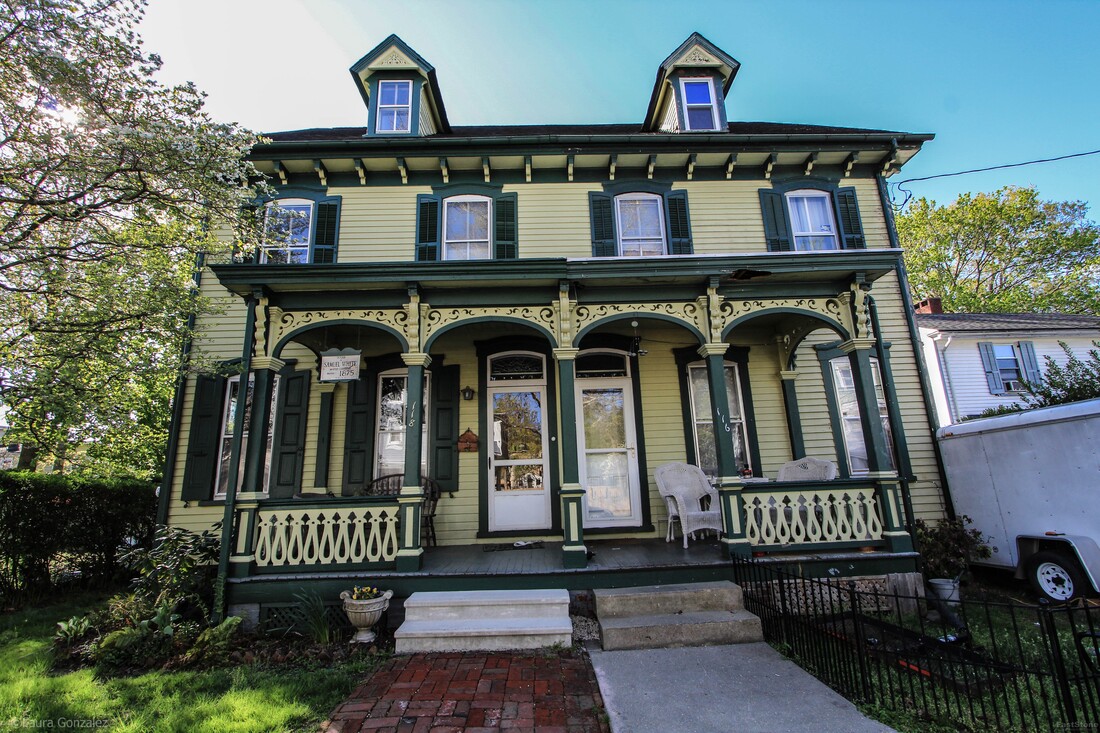 Samuel White; Master carpenter C.1875 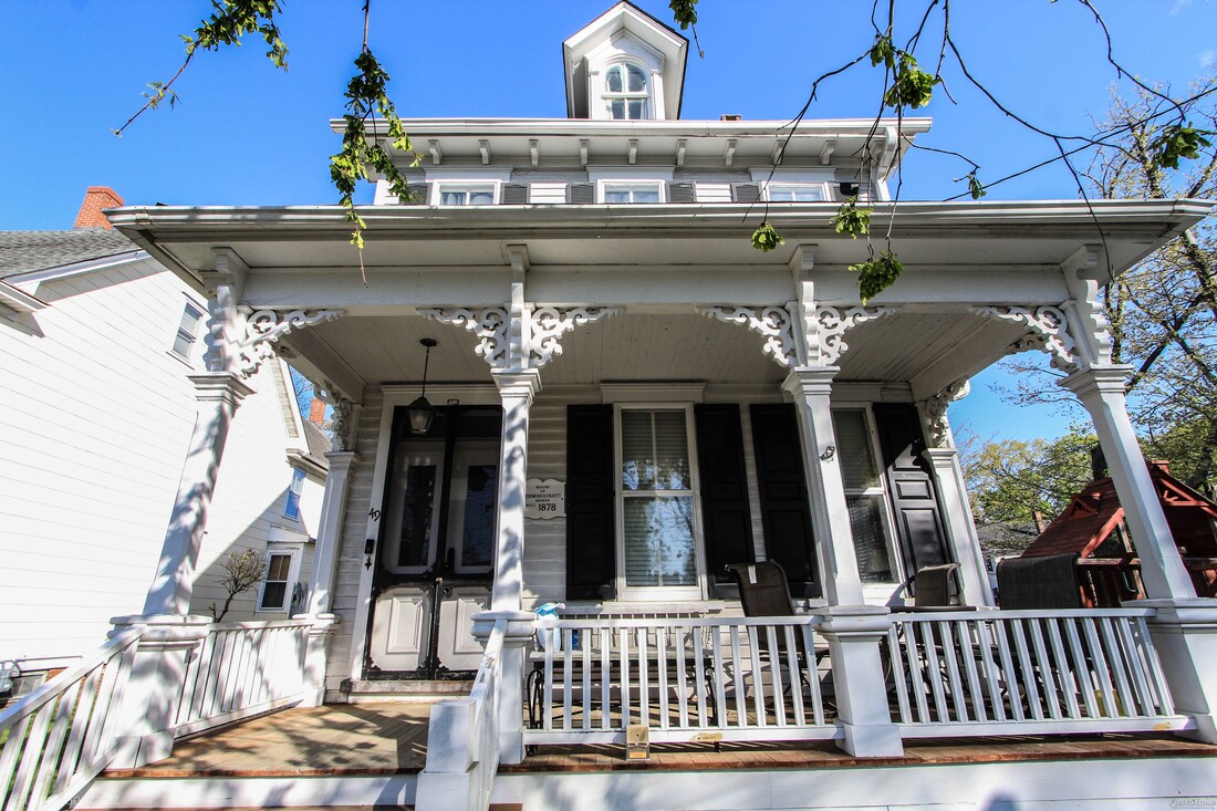 House of Jeremiah H. Colkitt; Banker Circa 1878 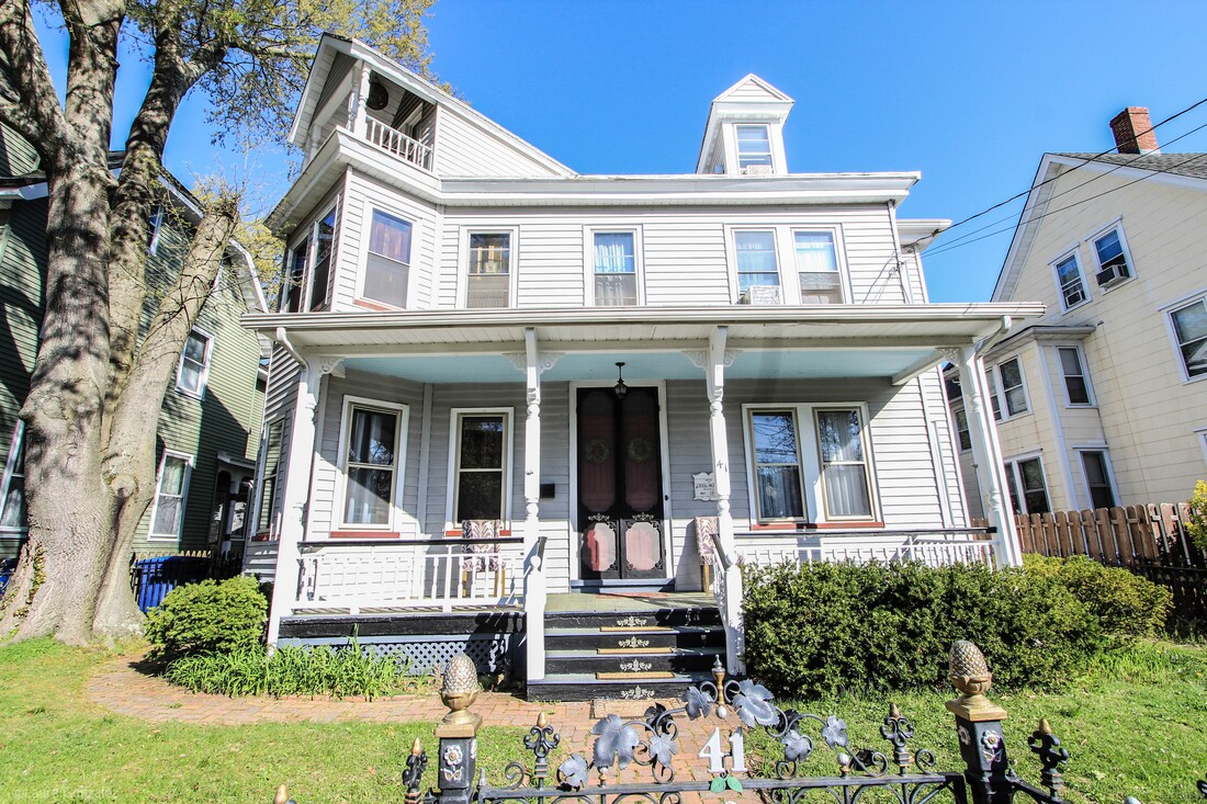 House of Craig Moffett; Pharmacist 1885 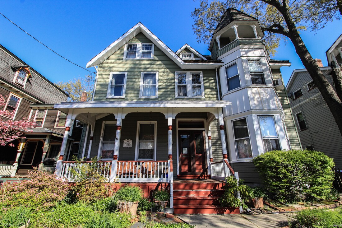 George Rendell 1888 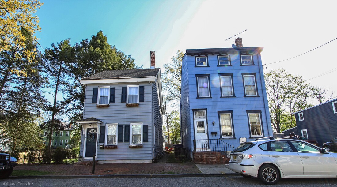 Mount Holly Homes 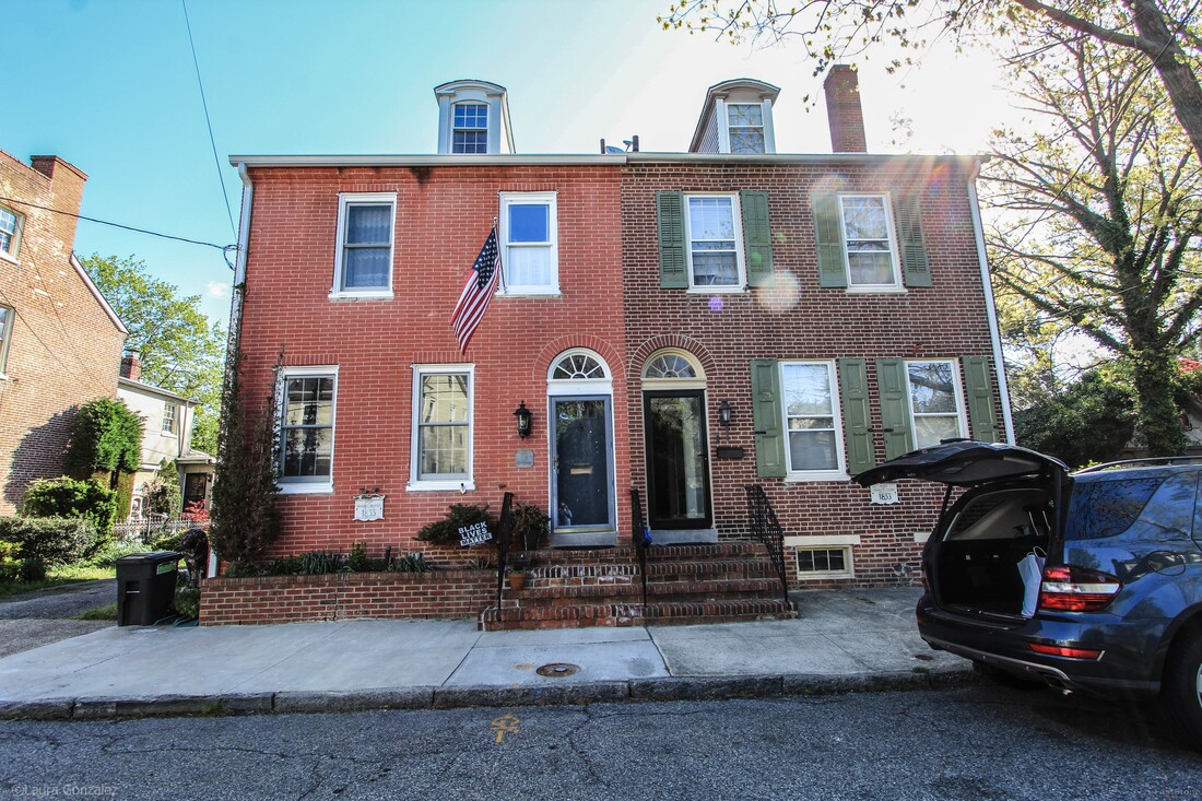 (Left) Absalom E Merritt; Carpenter 1833 ( Right) Samuel F Miller 1833 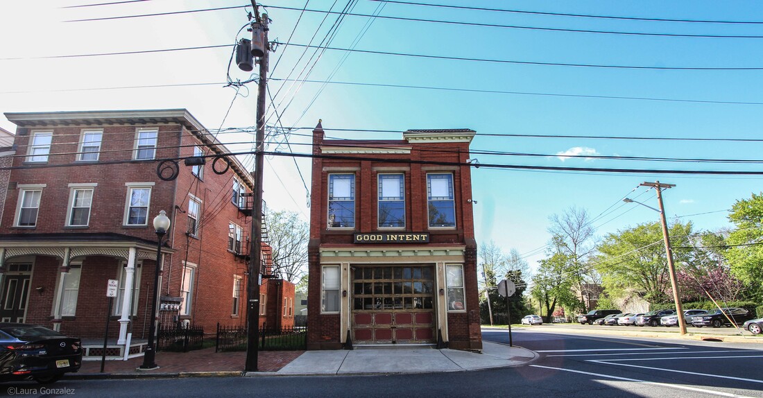 Good Intent Firehouse 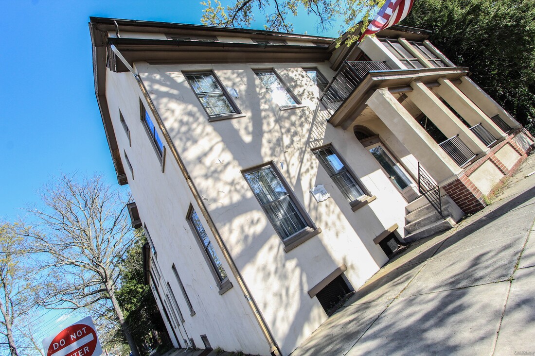 Aquilla S Ridgway; Builder 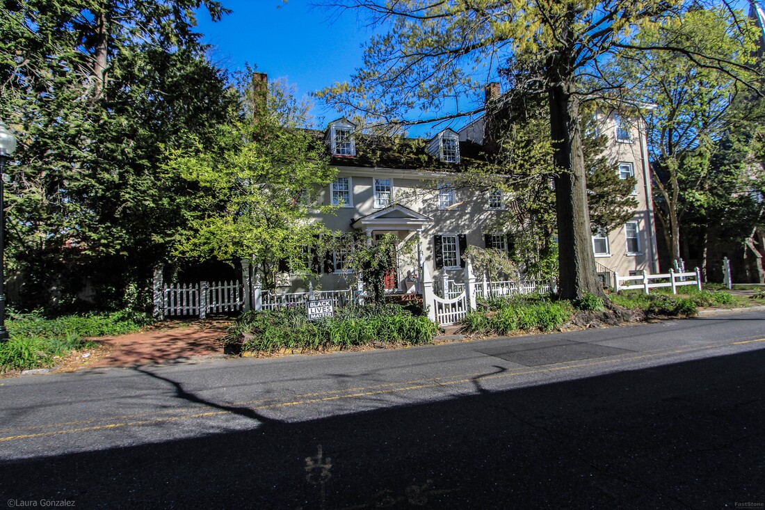 The Carr House 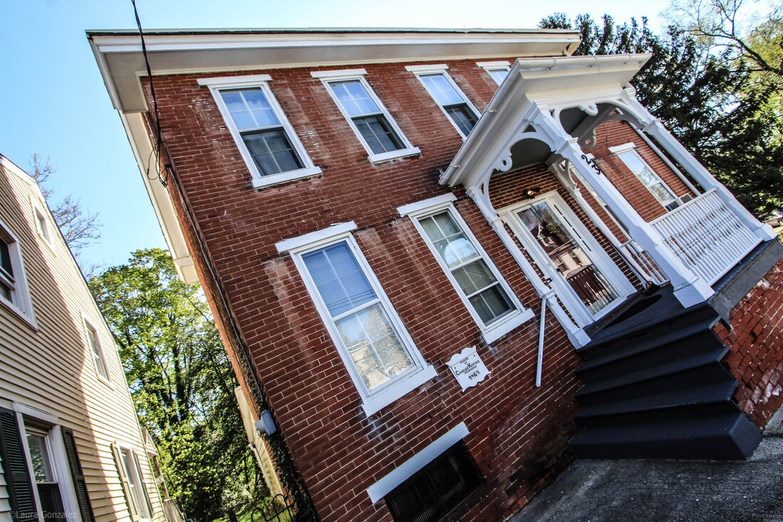 House of Charles Kopcke; Brickmaker C1866 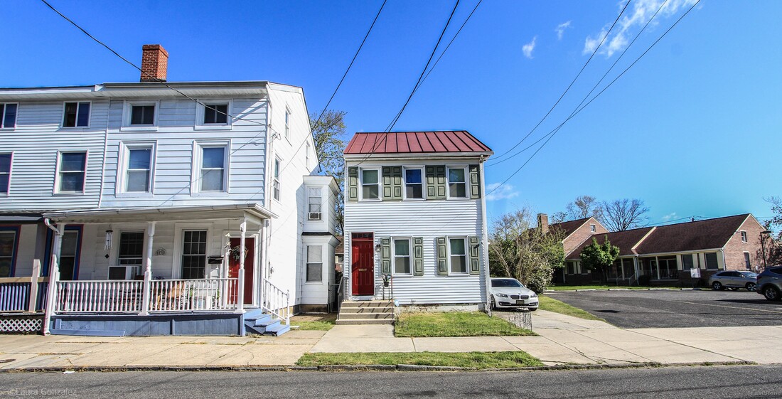 Mount Holly Home 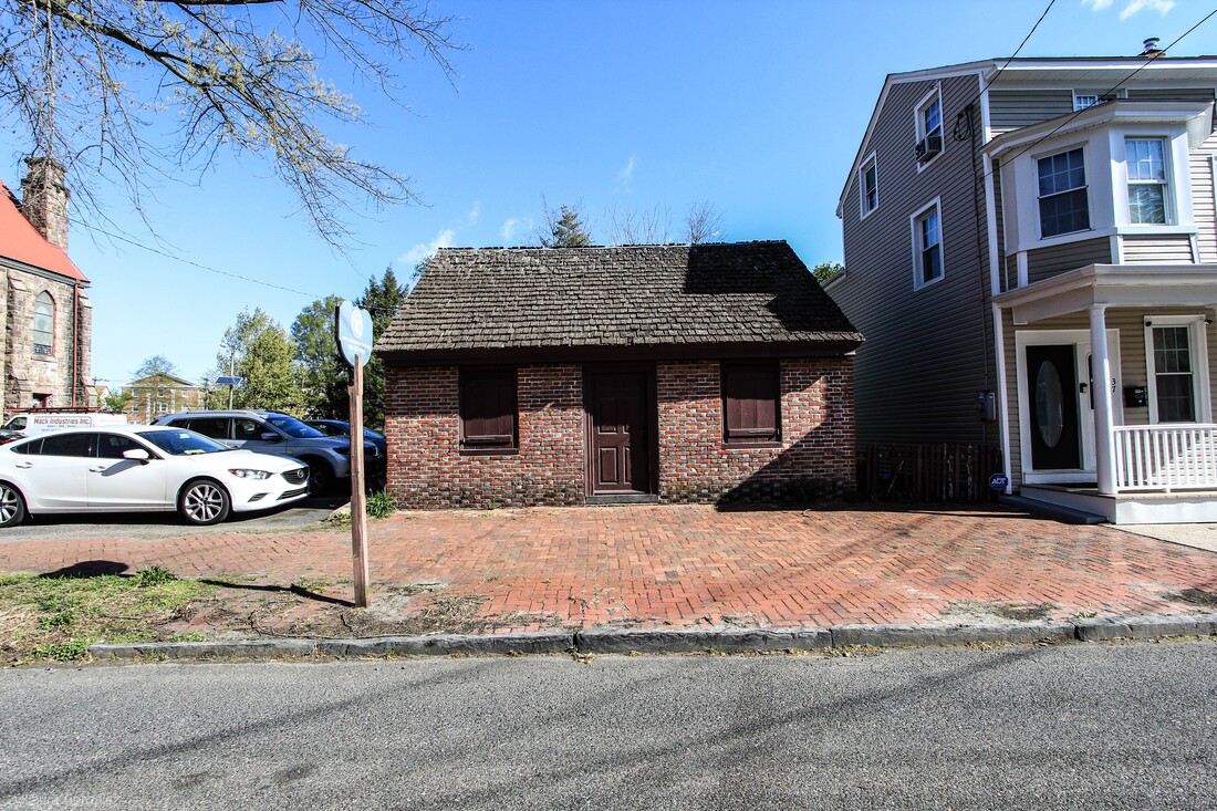 Brainerd Schoolhouse The Brainerd Schoolhouse is a one room schoolhouse, located in Mount Holly Township, Burlington County, New Jersey, United States. Built in 1759, it is the oldest building of its type in the state and now a museum. It is a contributing property to the Mount Holly Historic District. It is owned and operated by The National Society of the Colonial Dames of America 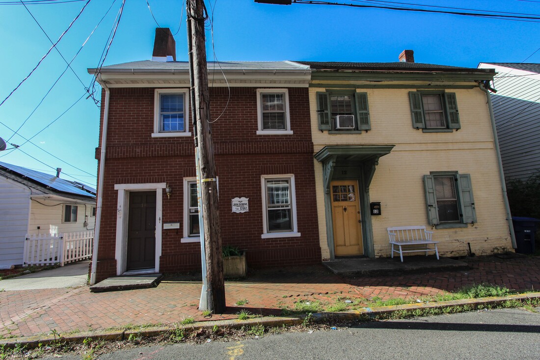 House of John Dobbins, Circa 1782 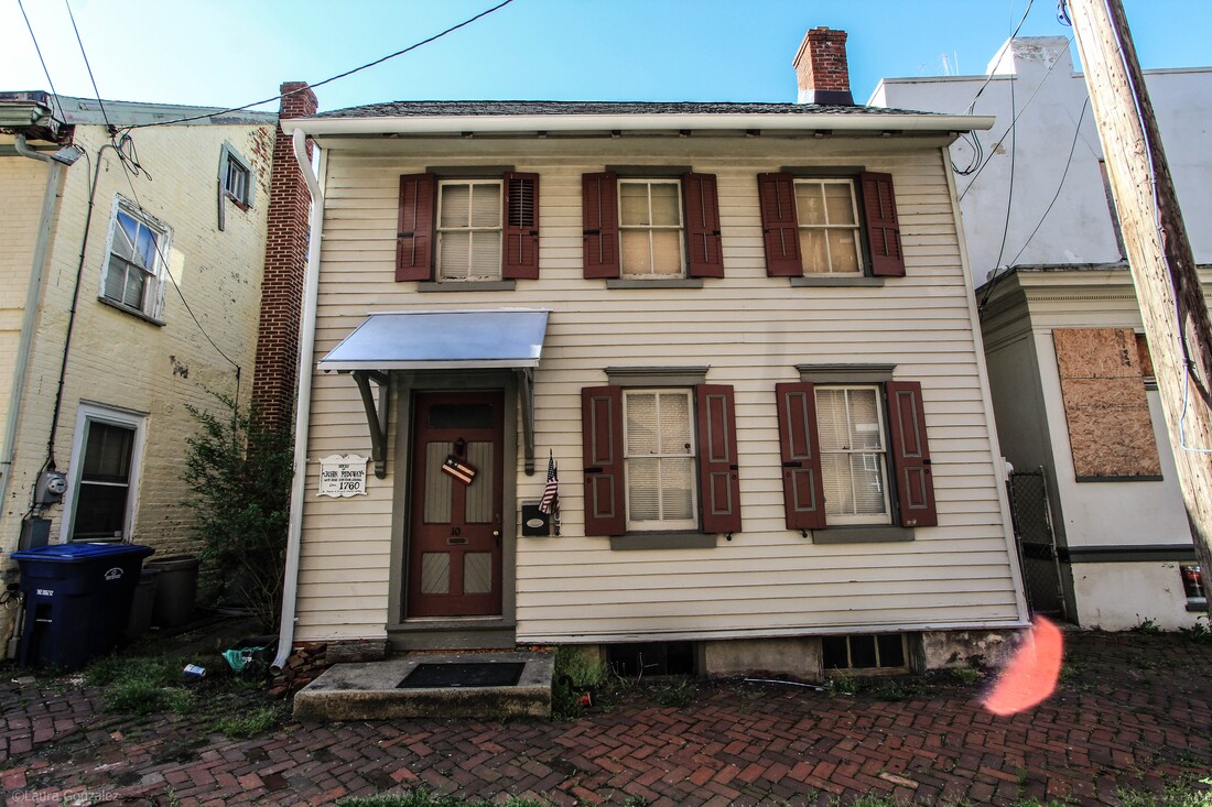 House of John Ridgway; West Jersey Surveyer General; Circa 1760  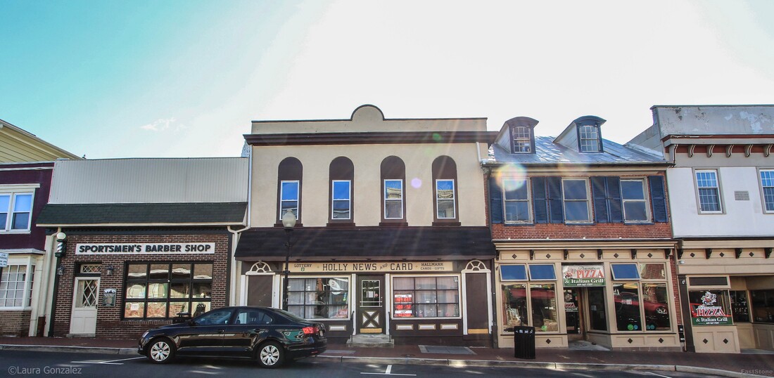 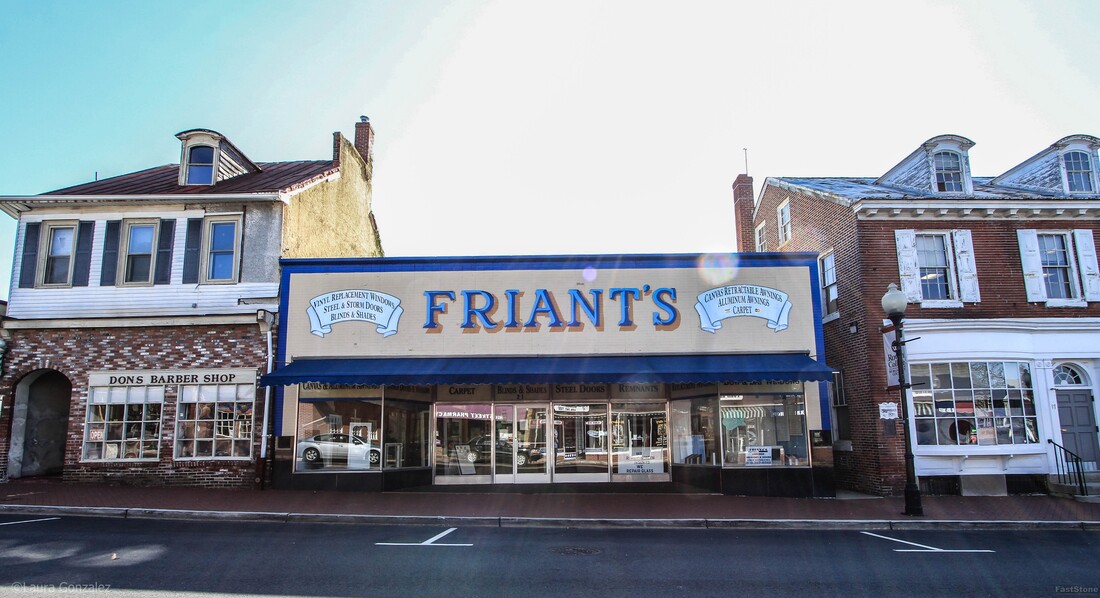 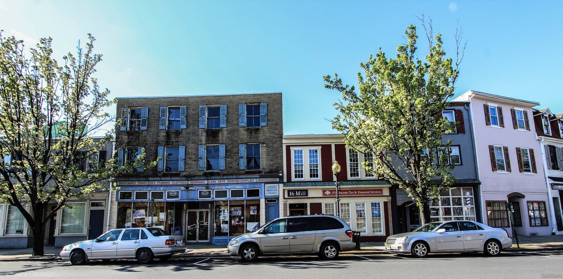 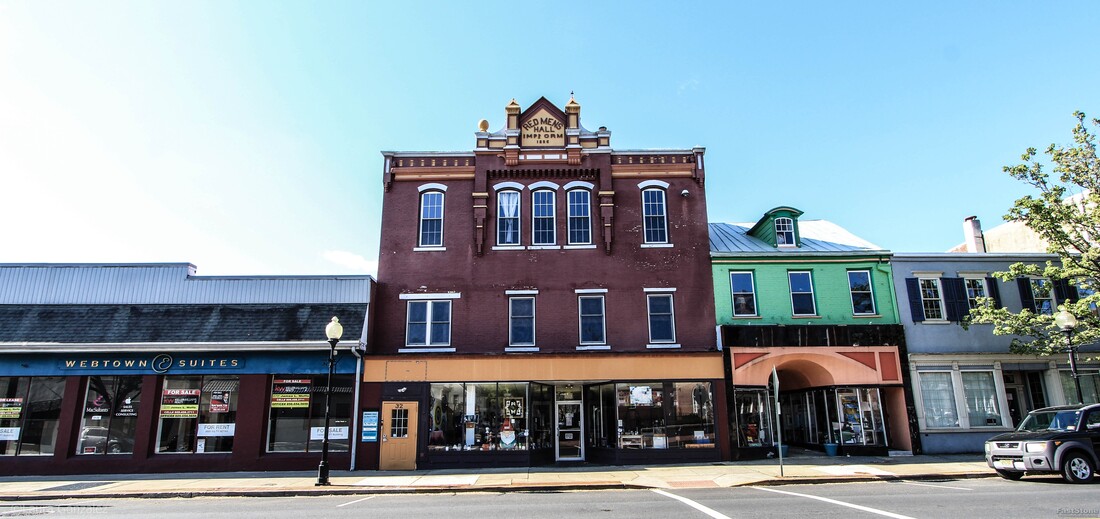 Red Mans Hall 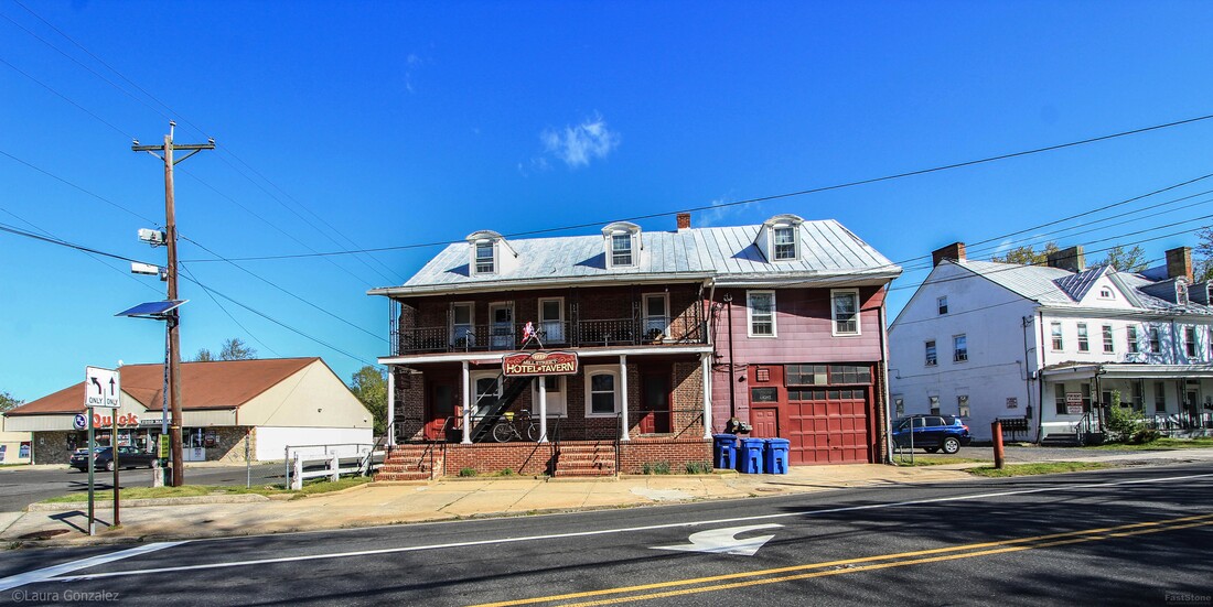 Three Tuns Tavern Located at the intersection of Mill & Pine Streets, the Mill Street Tavern (also known as) is the oldest standing building in town. It has been a tavern & hotel since it opened in 1723. Rumours state it is haunted. Built in 1723 by Samuel Bryant. It has been used as a tavern for the past 250 years. There is some Revolutionary War history connected with this site as well as the Court of Admiralty met here during the last year of the Revolutionary War. The Mill Street Tavern was built about forty years after the first settlers arrived in Mount Holly. There appeared to be a need for a place to rest and libation, so the Three Tuns Tavern was built near the mill in Mount Holly, at that time called Bridgetown because of all the bridges over the various feeders to the Rancocas Creek. Samuel Brian Was the first owner and innkeeper, and few changes have been made to the building since his time. it is of course the oldest Inn in Mt. Holly and was grabbed as quarters by the Hessian soldiers during their occupation here in 1776, the DAR reports. The Mill Street Tavern was built about forty years after the first settlers arrived in Mount Holly. There appeared to be a need for a place to rest and libation, so the Three Tuns Tavern was built near the mill in Mount Holly, at that time called Bridgetown because of all the bridges over the various feeders to the Rancocas Creek. Samuel Brian Was the first owner and innkeeper, and few changes have been made to the building since his time. it is of course the oldest Inn in Mt. Holly and was grabbed as quarters by the Hessian soldiers during their occupation here in 1776, the DAR reports. 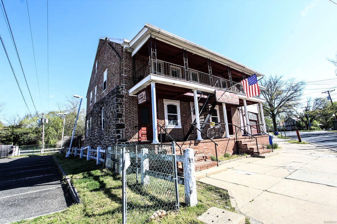 Three Tuns Tavern 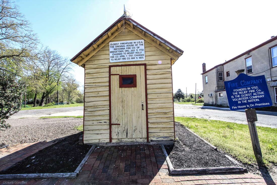 Fire Department Building on Pine Street 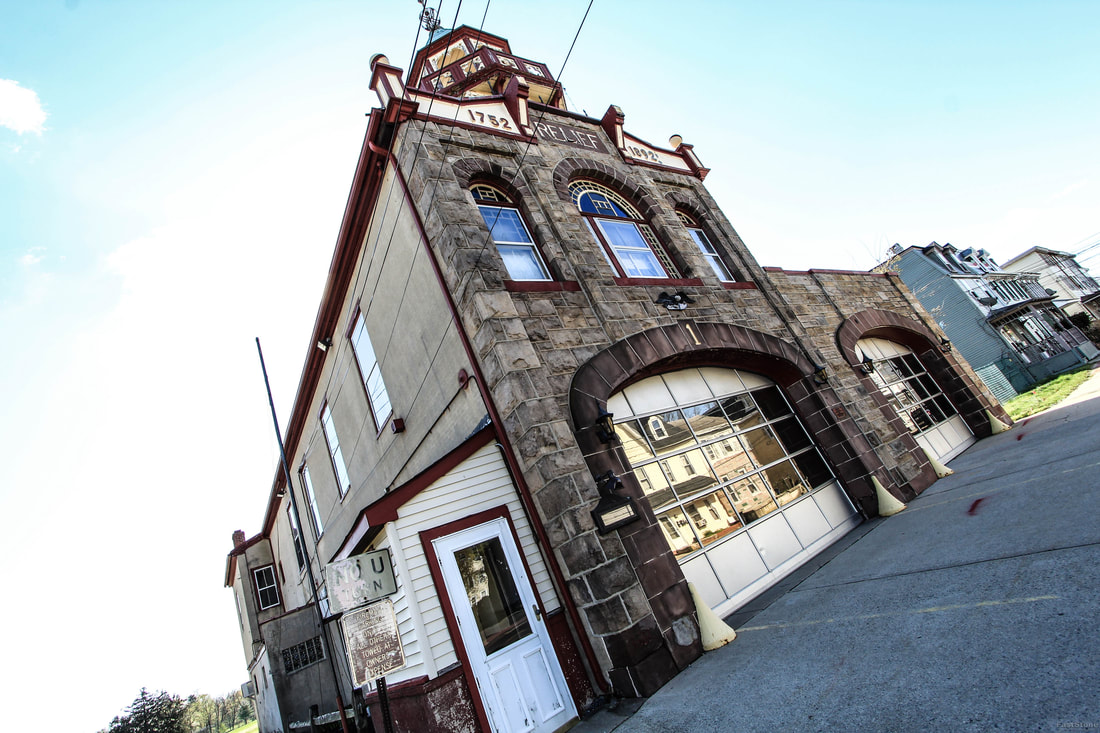 Relief Fire Engine Company No.1 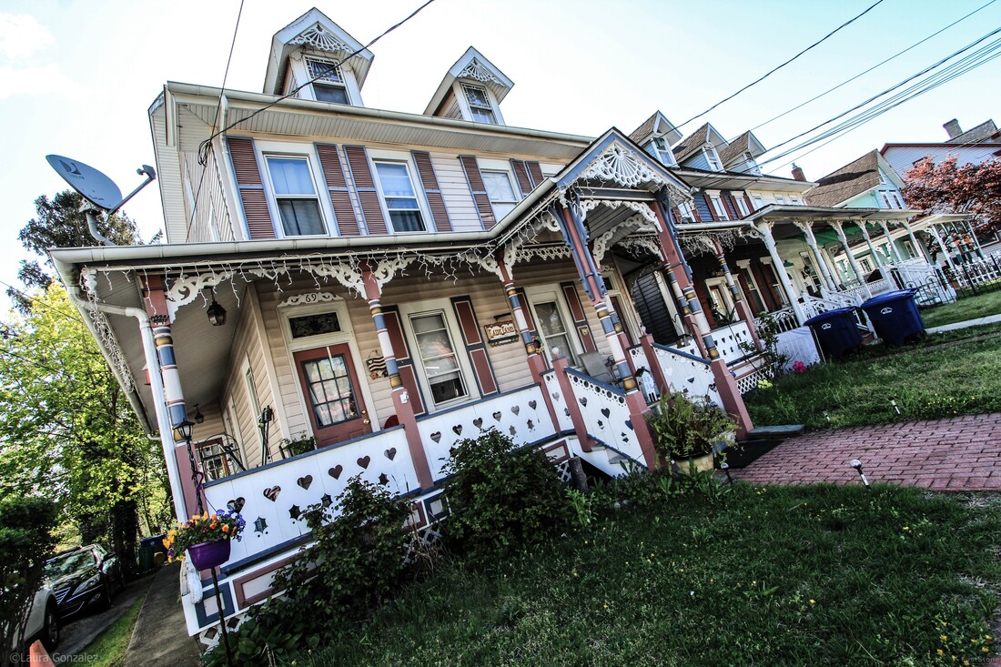 Lady Jane 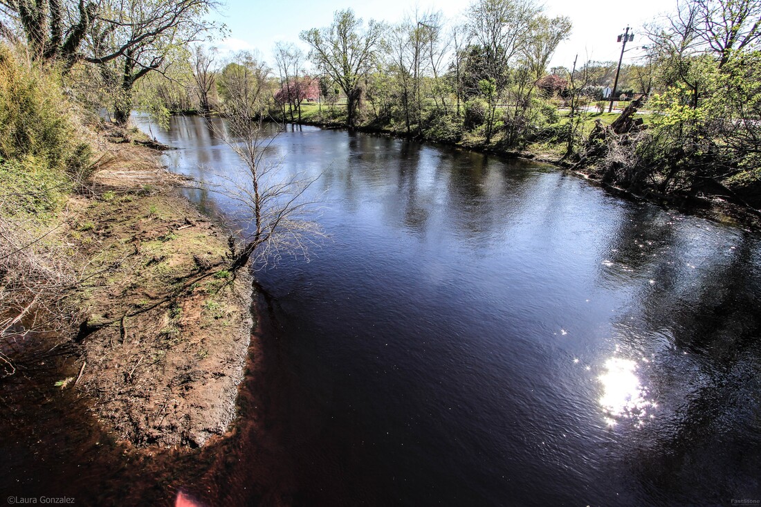 North Branch Rancocas Creek 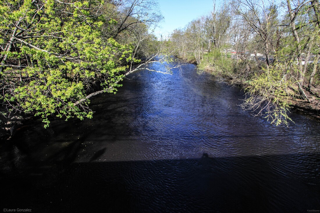 North Branch Rancocas Creek 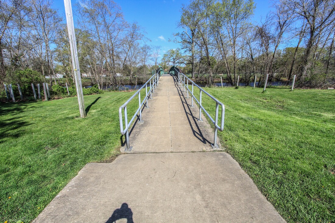 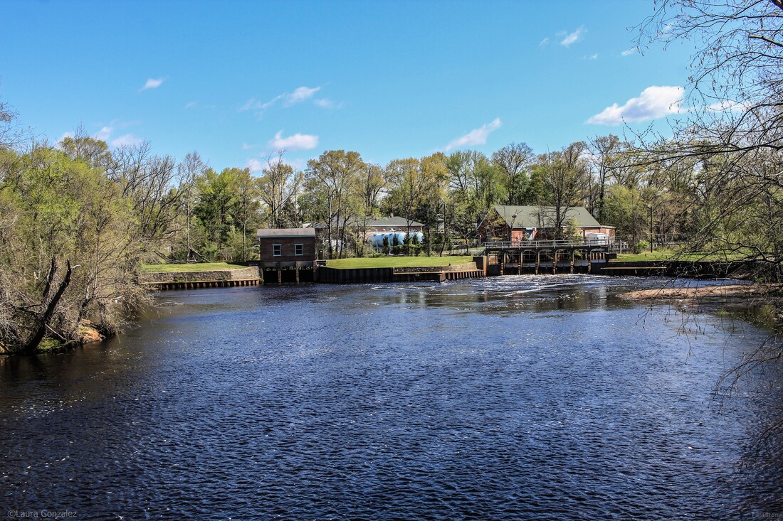 Mill Dam Park & Iron Works Park 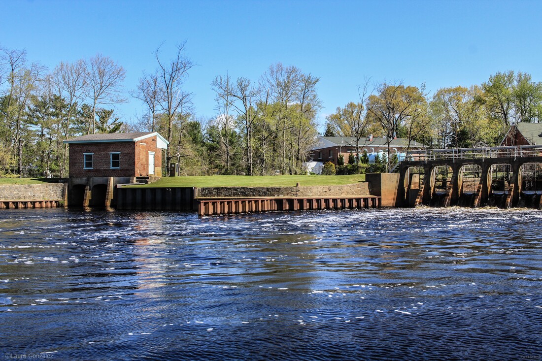 Mill Dam Park & Iron Works Park References:
Facebook Page More Photos Of Mount Holly and Burlington County https://www.livingplaces.com/NJ/Burlington_County/Mount_Holly_Township/Mount_Holly_Historic_District.html westjerseyhistory www.southjersey.com www.burlingtoncountytimes.com https://www.burlingtoncountytimes.com/article/20161026/NEWS/310269672 https://www.burlingtoncountytimes.com/news/20171103/discover-mystery-of-revolutions-mount-holly-widow Forgotten Towns Of Southern New Jersey More Forgotten Towns of Southern New Jersey www.veloramaroute.nl https://en.wikipedia.org/wiki/Hotchkiss_Bicycle_Railroad Burlington and Mount Holly Railroad and Transportation Company https://www.millraceshops.com
0 Comments
Zanesville was named after Ebenezer Zane (1747–1811), who had blazed Zane's Trace, a pioneer trail from Wheeling, Virginia to Maysville, Kentucky through present-day Ohio. In 1797, he remitted land as payment to his son-in-law, John McIntire (1759–1815), at the point where Zane's Trace met the Muskingum River. With the assistance of Zane, McIntire platted the town, opened an inn and ferry by 1799. In 1801, Zanesville was officially renamed, formerly Westbourne, the chosen name for the settlement by Zane. From 1810–1812, the city was the second state capital of Ohio. The National Road courses through Zanesville as U.S. Route 40. The city grew quickly in the 1820s–1850s. 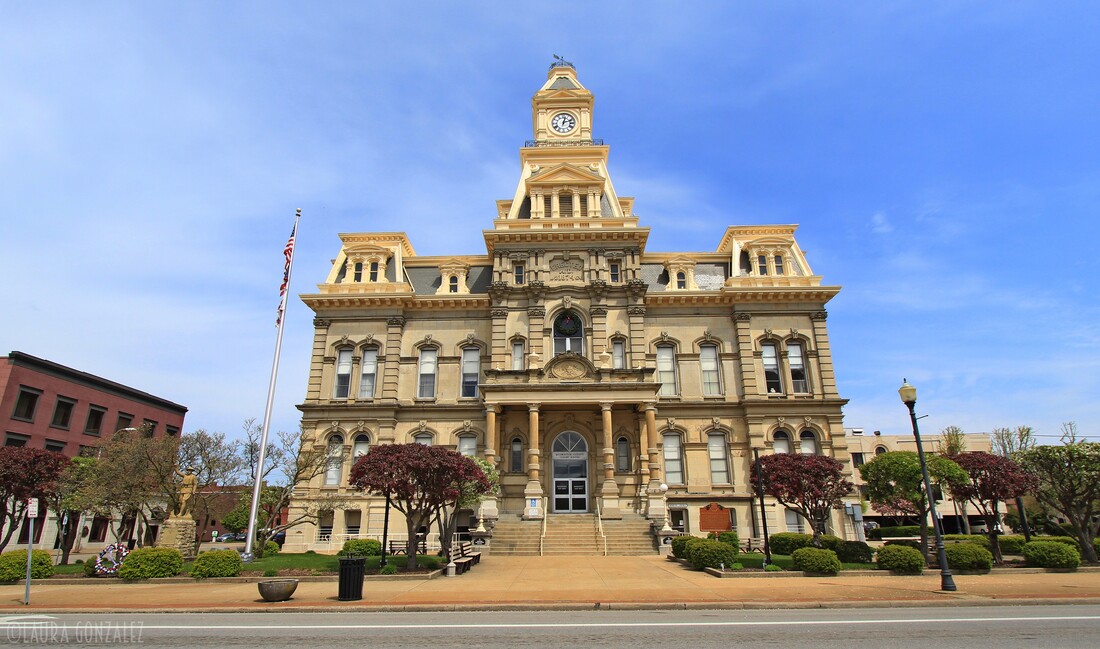 Muskingum County Courthouse 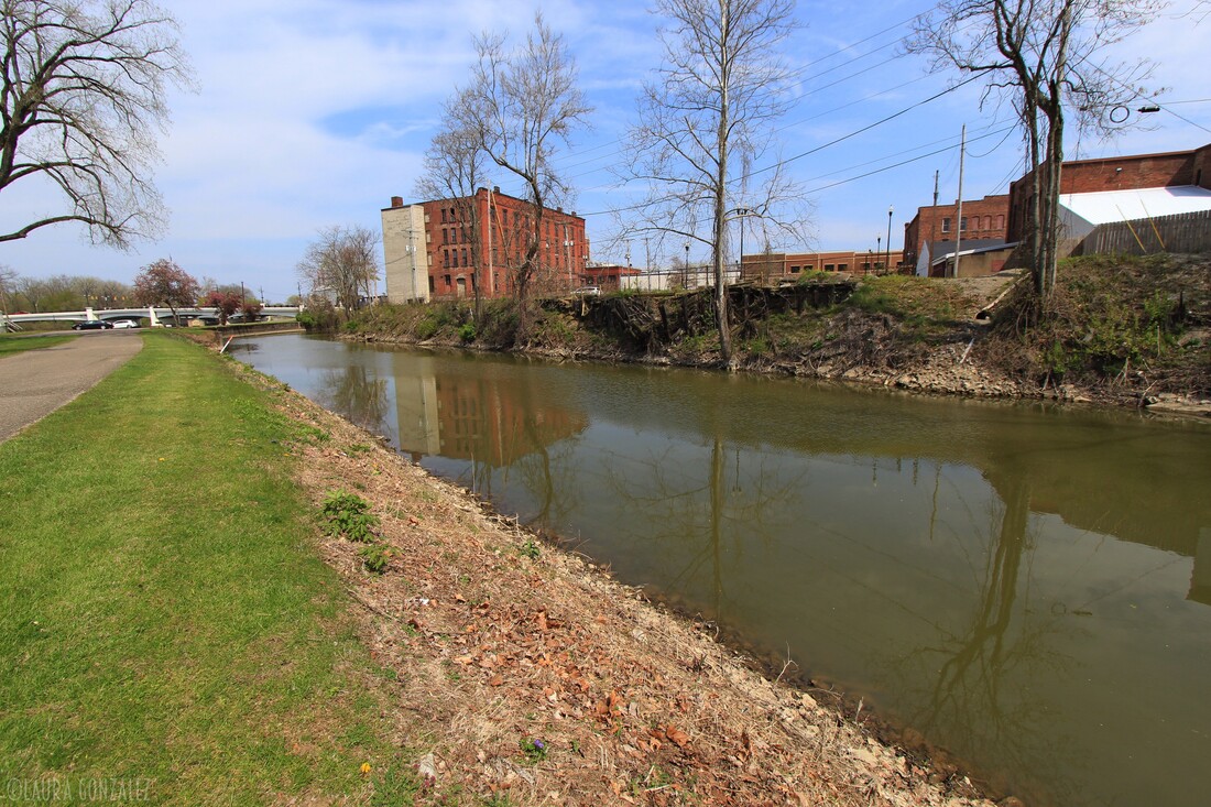 The canal that leads to Lock #10 along the Muskingum River in Zanesville The city increased, largely because of factories producing pottery, bricks, glassware, ball-bearings, soap, steel and many other products from the 1880s until the mid-1950s. The city had a booming downtown economy and increase in the northern area of the town. By the 1950s many factories had closed or moved. Pottery, a major industrial employer, slowly waned in demand because of cheaper Asian companies. After WW-2 the city held its own. During the 1950s until the 1980s nearly one-third of the population abandoned the city. In the 1990s the city/county opened industrial parks and several housing developments were built in the northern parts of the city. 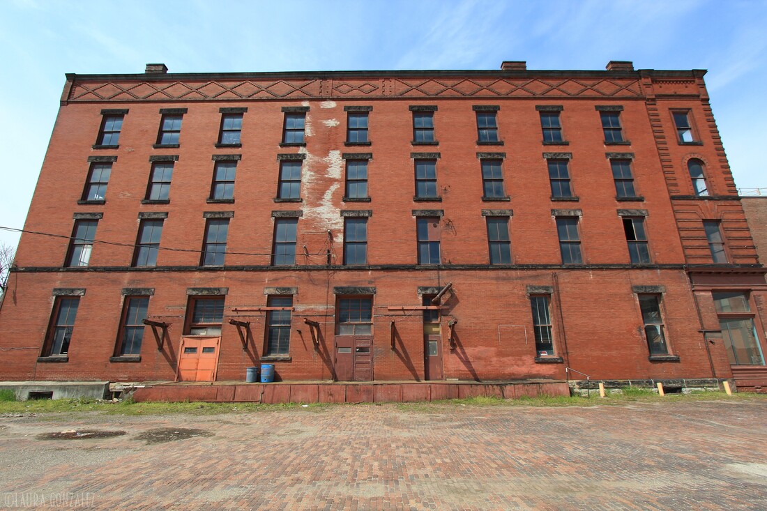 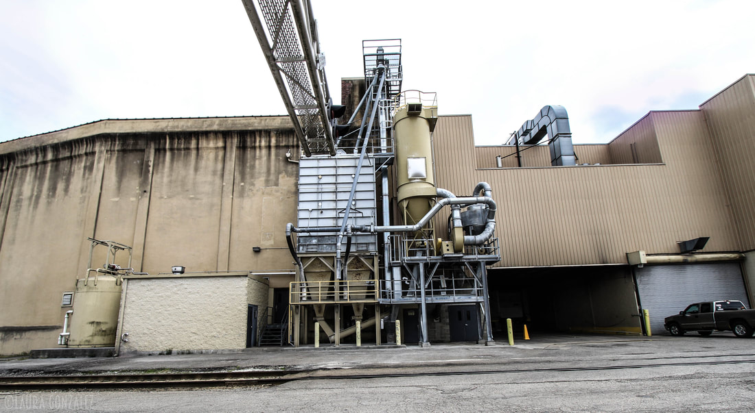 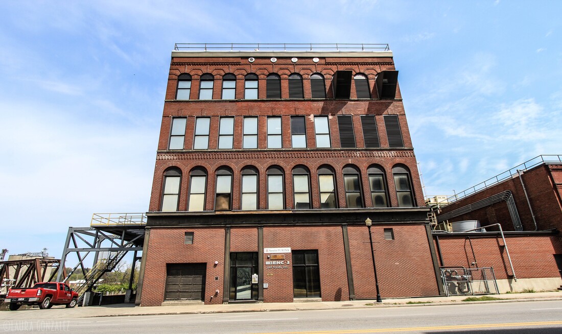 The Zanesville Y-Bridge is a historic Y-shaped three-way bridge that spans the confluence of the Licking and Muskingum Rivers in downtown Zanesville, Ohio. It carries the traffic of U.S. Route 40 (Main Street and West Main Street), as well as Linden Avenue.The first Zanesville Y-Bridge was constructed in 1814. The trestle bridge stood for four years. The second wooden bridge was erected in 1819. New roads were built in the area and traffic increased. A winter flood in 1831–1832 weakened the second bridge to be unsafe for the increased traffic. A third iteration, a wooden covered bridge was completed in 1832 and stood until 1900.The next bridge opened in early 1902. It had concrete balustrade railings which were lost to the 1913 flood and replaced with pipe railings. The fourth bridge was deemed unsafe in 1979. After demolition it was found that only one of the three segments needed actual replacement, the other spans would have needed only surface repairs.The current concrete and steel bridge is the fifth in the series on the same location. It opened in 1984. 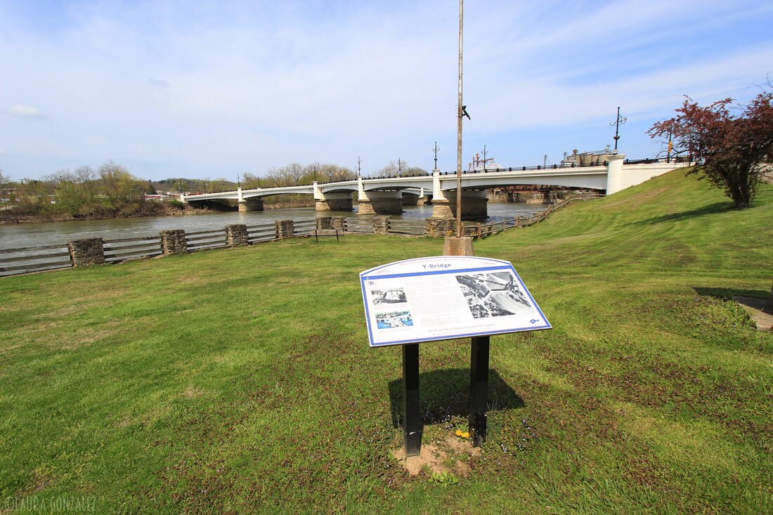 Zanesville Y-Bridge 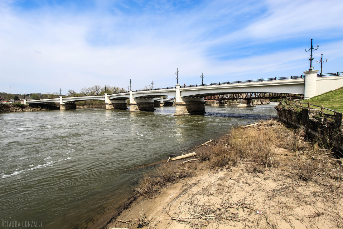 Zanesville Y-Bridge 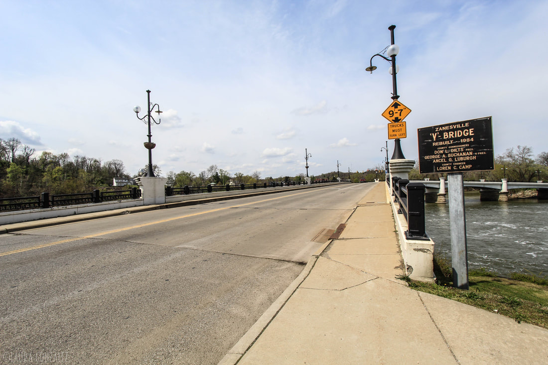 Zanesville Y-Bridge The Muskingum River has been an important pathway throughout much of Ohio's history. Originally the Muskingum River was not navigated easily but in 1836 a new project known as the Muskingum River Improvement began. The project consisted of a system of eleven locks and dams that made the Muskingum River navigable from Marietta to a short feeder canal south of Dresden, Ohio, that connected to the Ohio and Erie Canal. It was completed in 1841. Lock #10 is located in Zanesville. 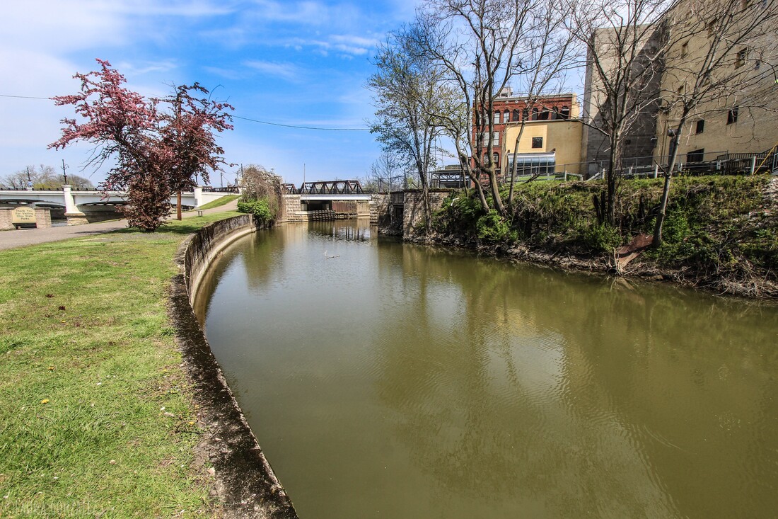 The canal that leads to Lock #10 along the Muskingum River in Zanesville 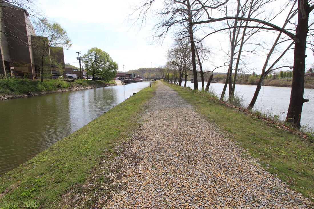 The canal that leads to Lock #10 along the Muskingum River in Zanesville 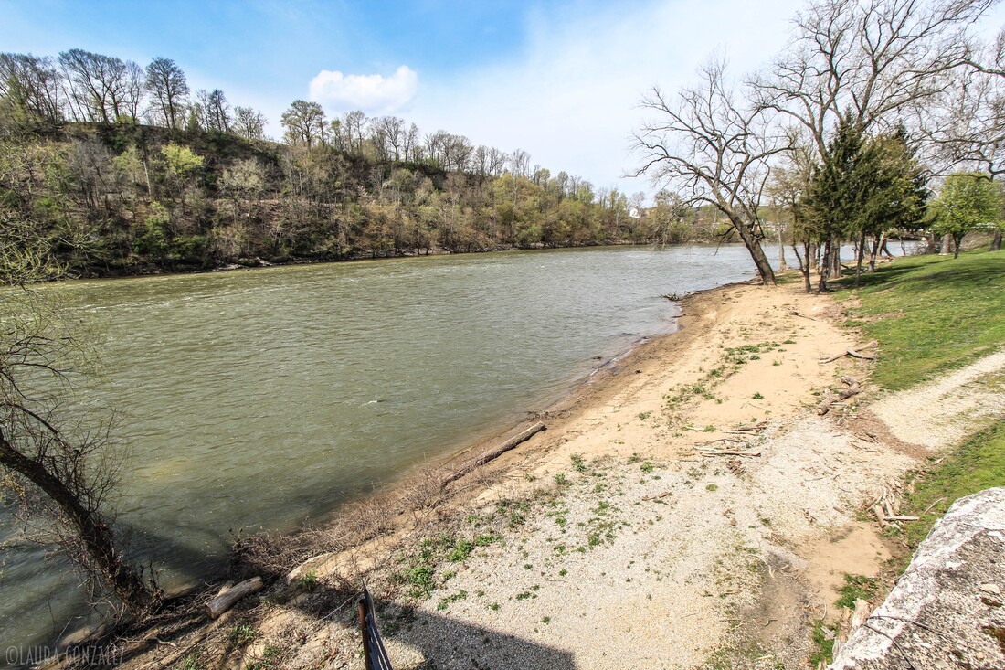 Muskingum River in Zanesville "In late March 1913, an unusually heavy rainstorm moved into Ohio. It rained steadily for five days and the water levels rose rapidly. By the third day of the downpour, levees were overtopped and many towns suffered disastrous flooding. When the flood waters receded, tons of mud and debris covered the streets, homes, businesses and factories of towns like Zanesville, where the Muskingum River had crested 27 feet above flood stage and water was 20 feet deep at several downtown intersections. The death toll for the disaster stood at 361, and property damages were well over $100,000,000 and 65,000 were forced to temporarily leave their homes."- ohiomemory.org 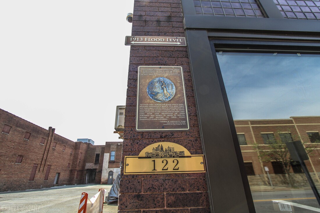 1913 Flood Level 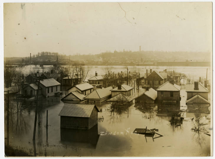 1913 flood damage in Zanesville ohiomemory.org 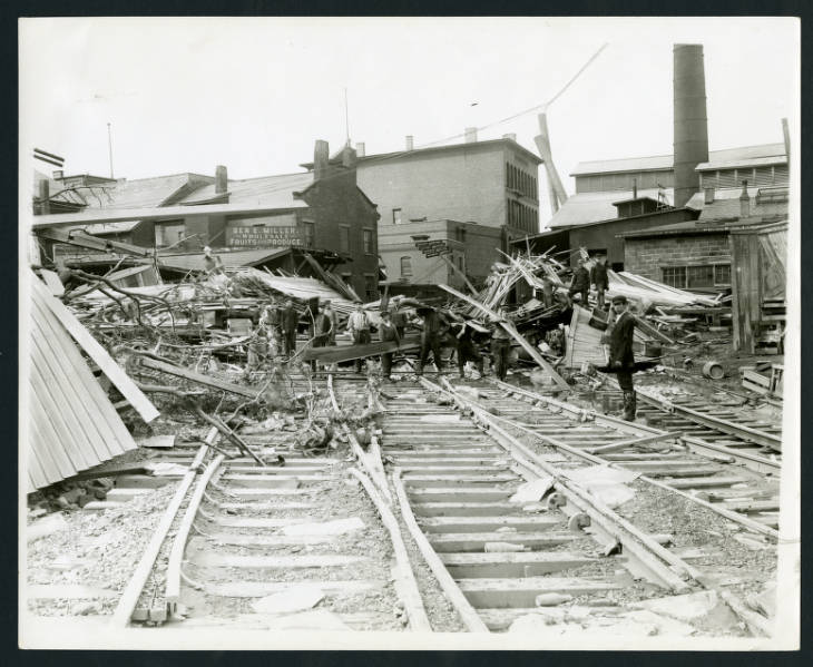 1913 flood damage in Zanesville ohiomemory.org 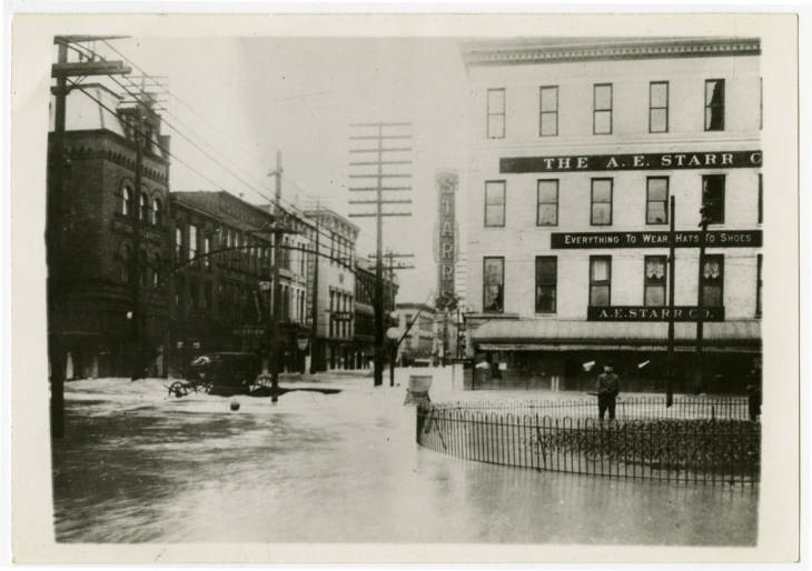 1913 flood damage in Zanesville ohiomemory.org 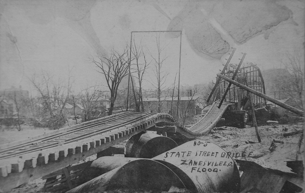 Zanesville State Street Railroad Bridge after 1913 flood Railfanning in Zanesville, Ohio 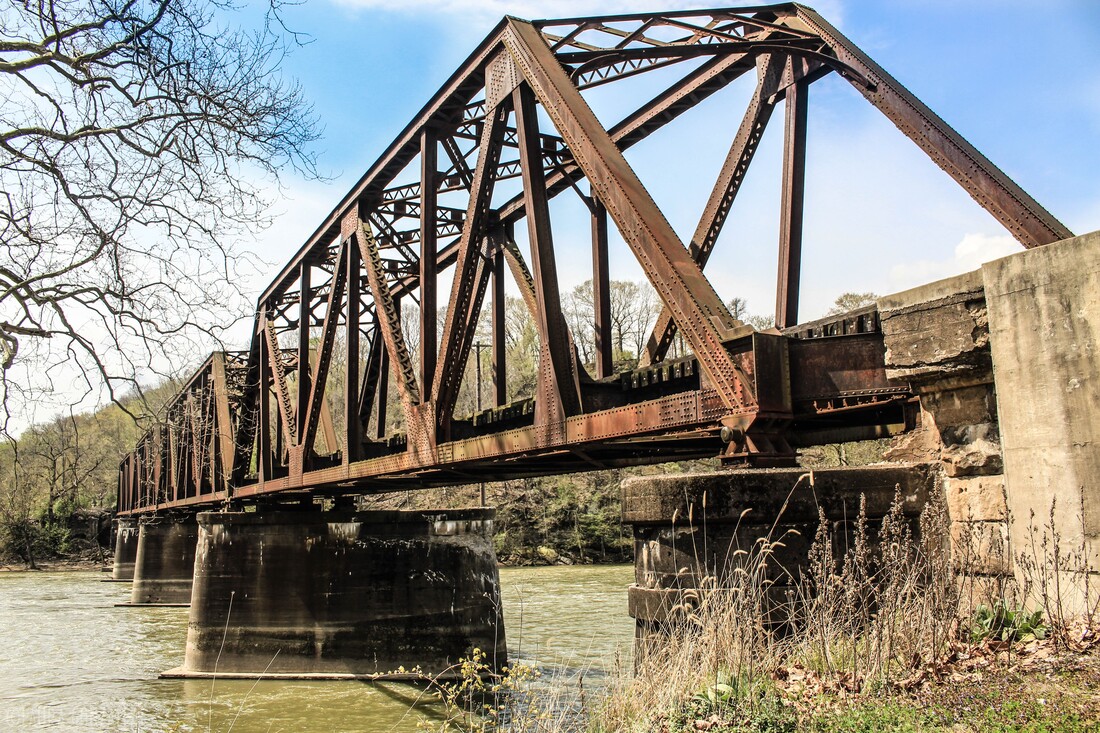 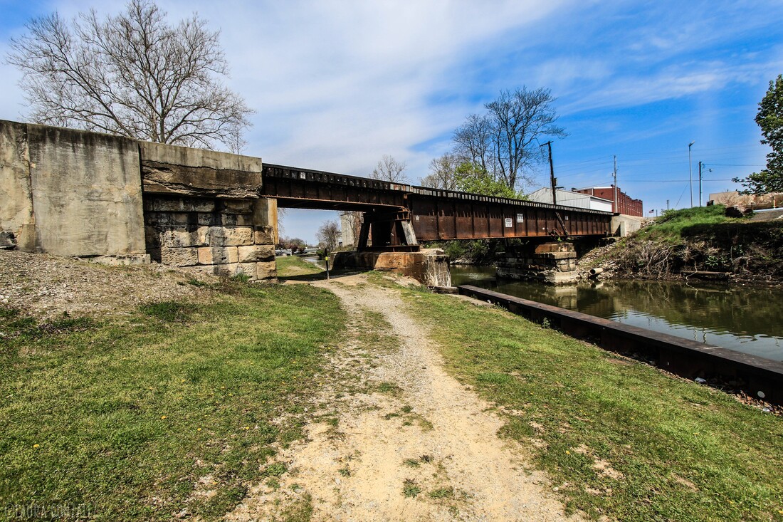 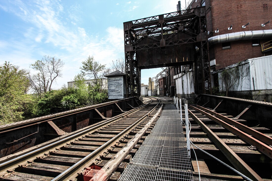 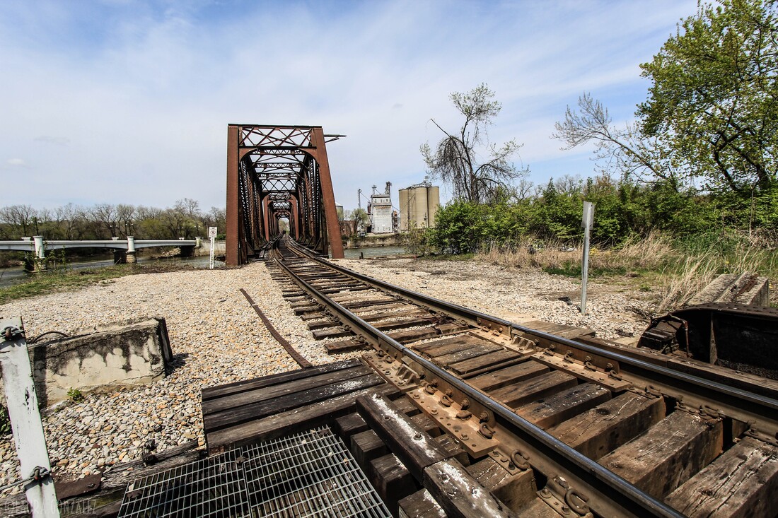 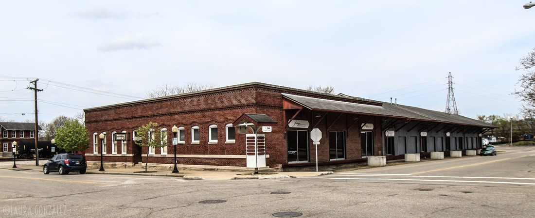 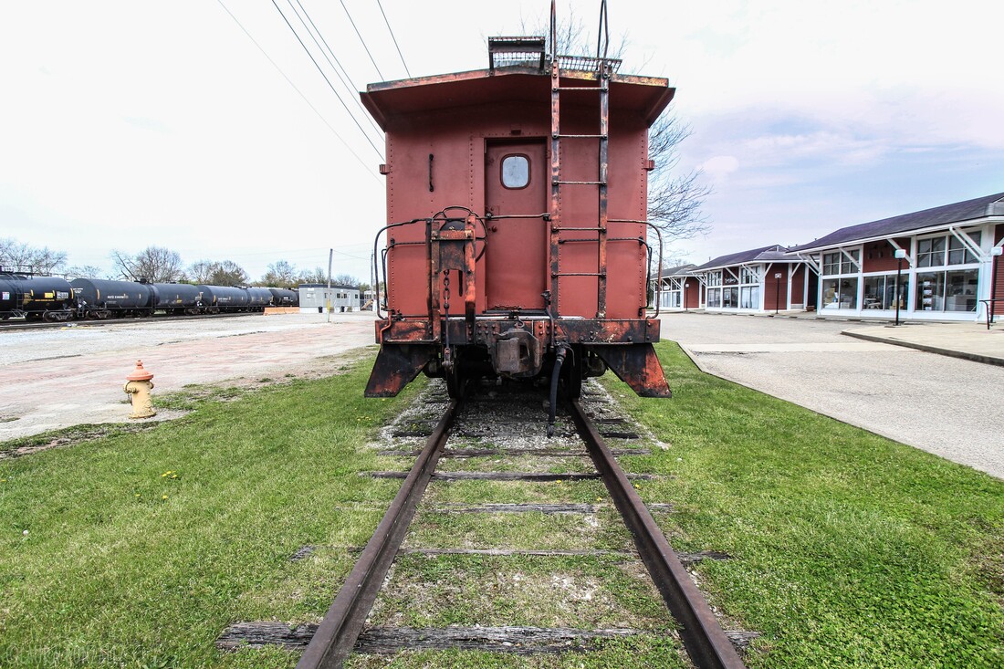 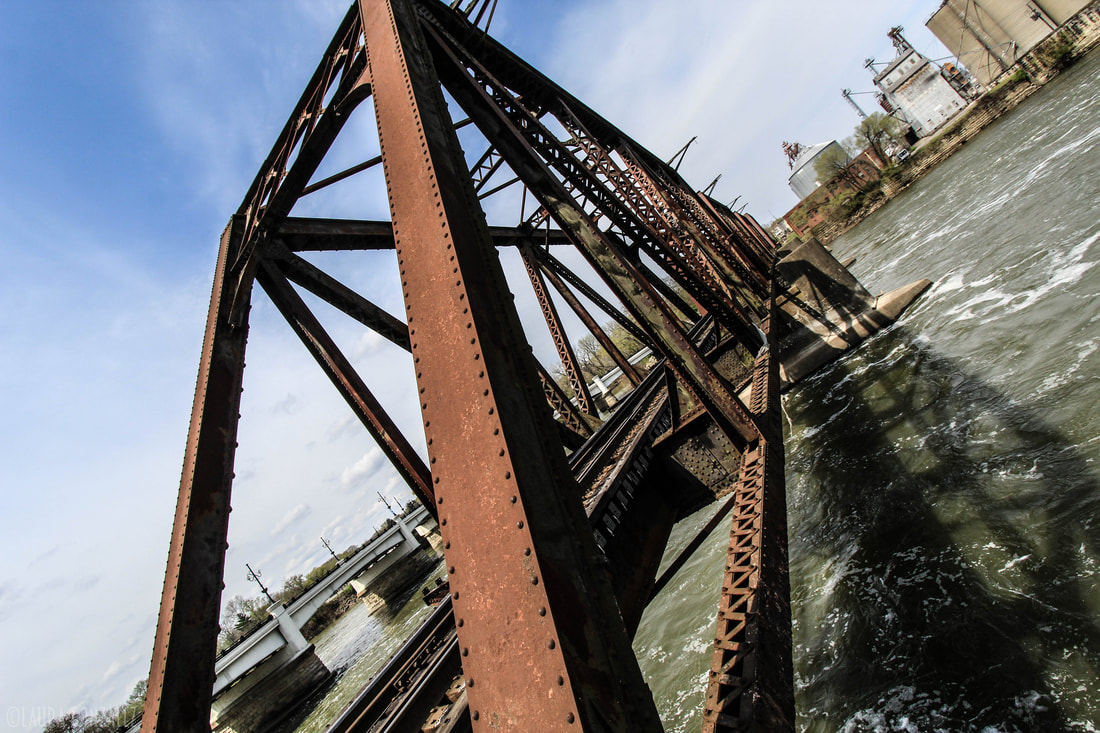 More Pictures of Zanesville, Ohio 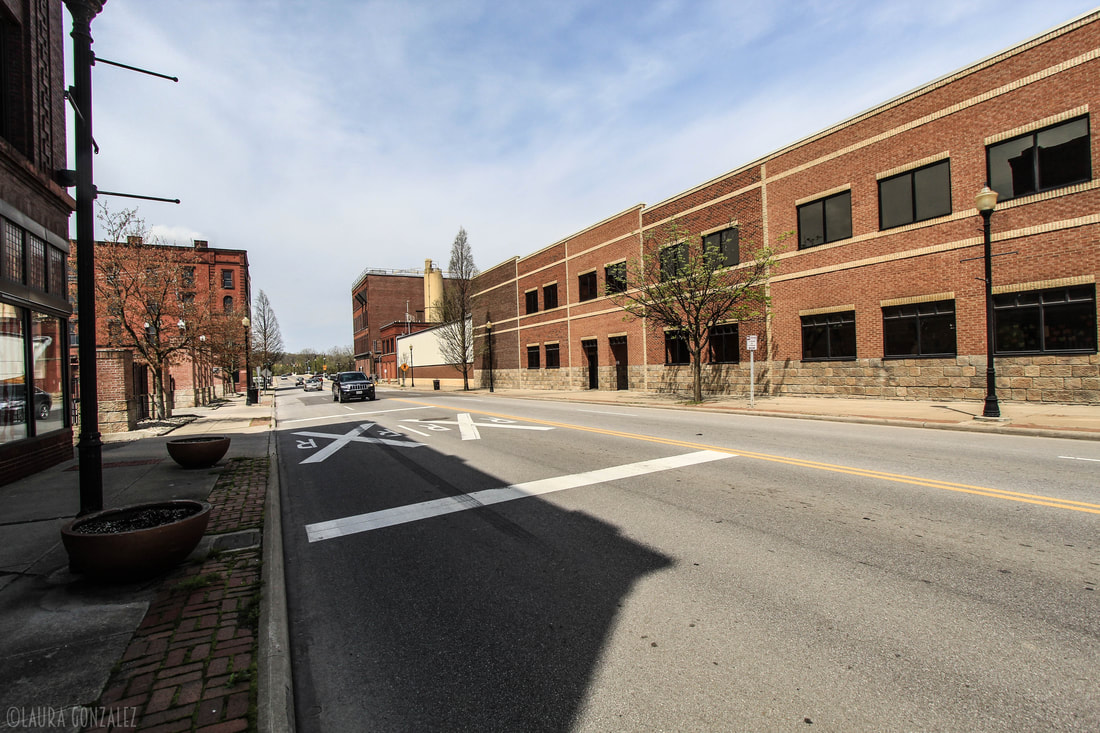 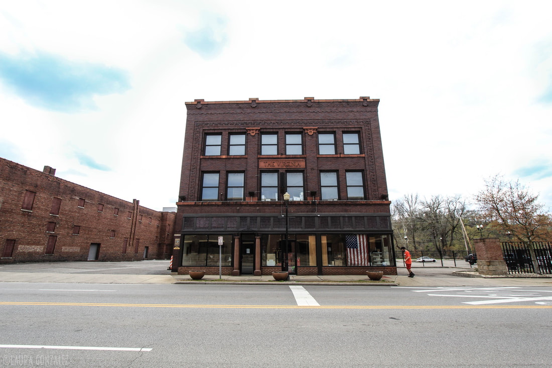 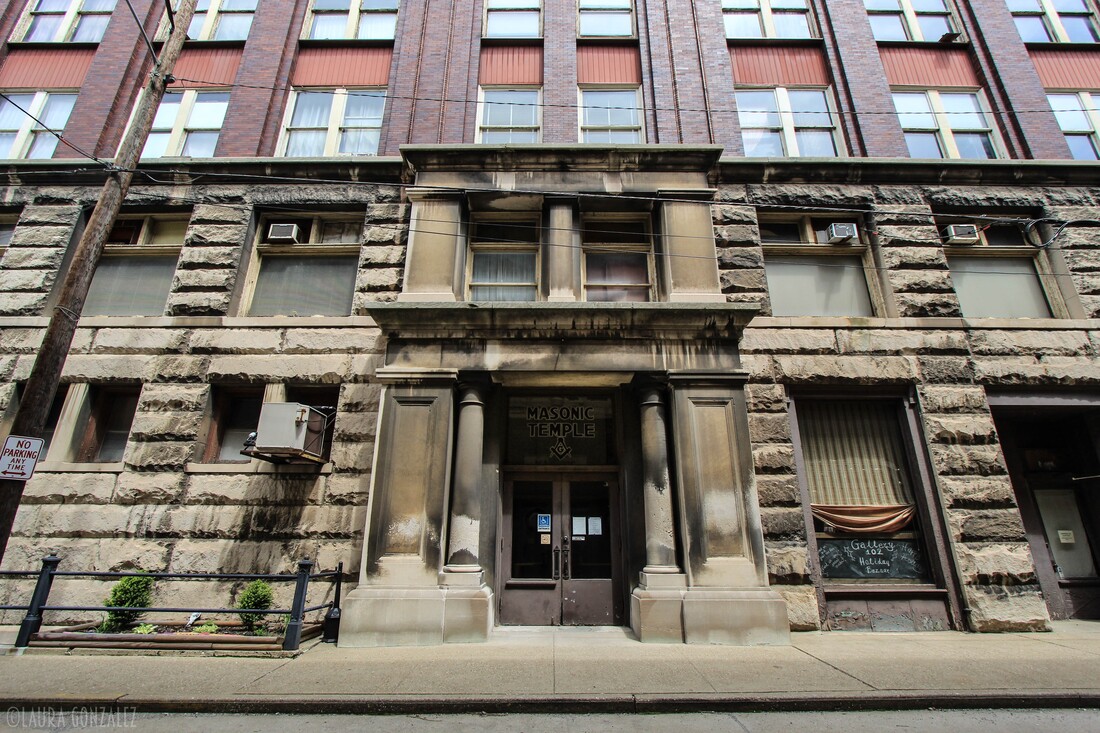 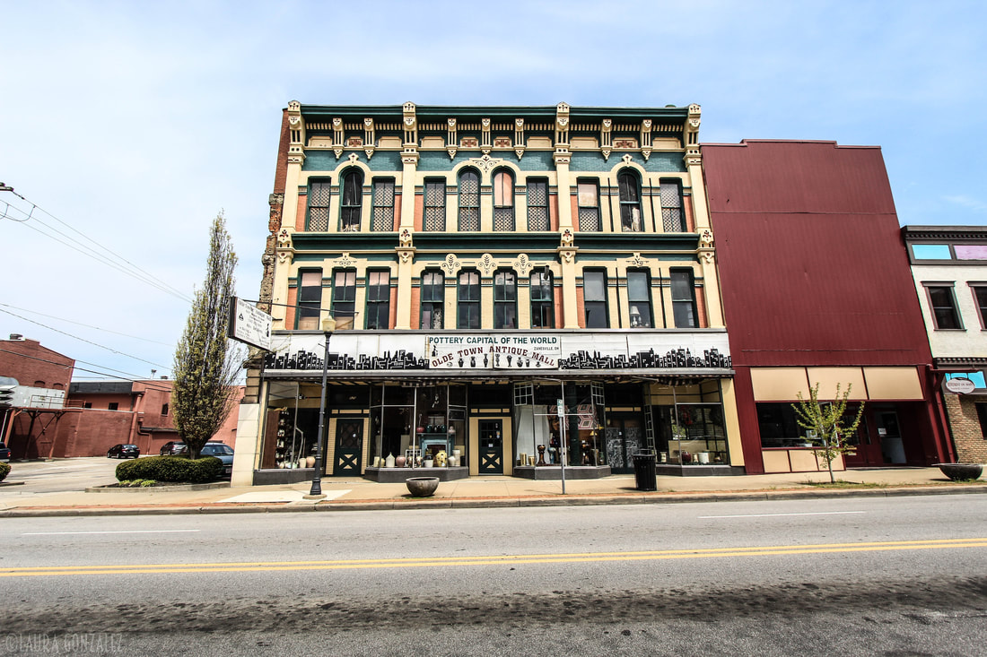  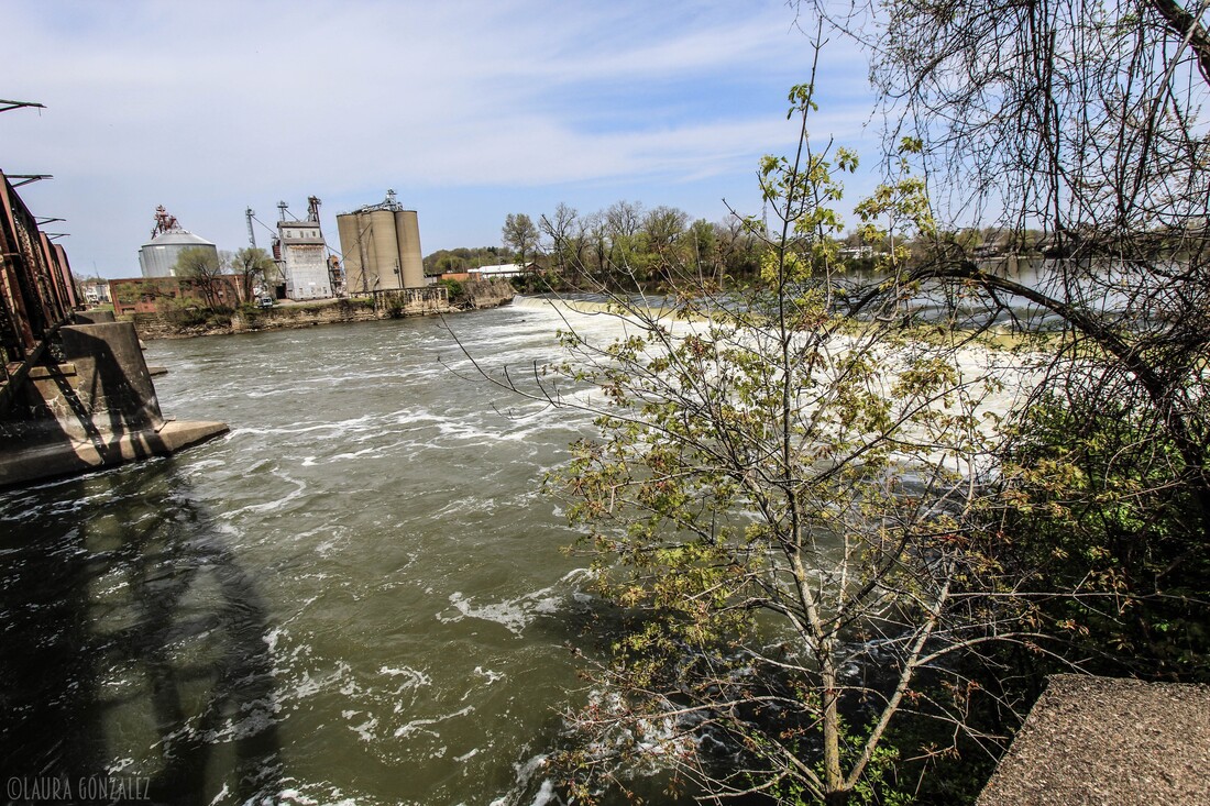  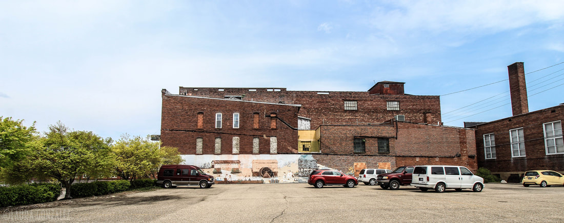 Located at the mouth of the Ashtabula River on Lake Erie, one of the Great Lakes, across from the province of Ontario, Canada is the city of Ashtabula, Ohio. The name Ashtabula is derived from ashtepihəle, which means 'always enough fish to be shared around' in the Lenape language. 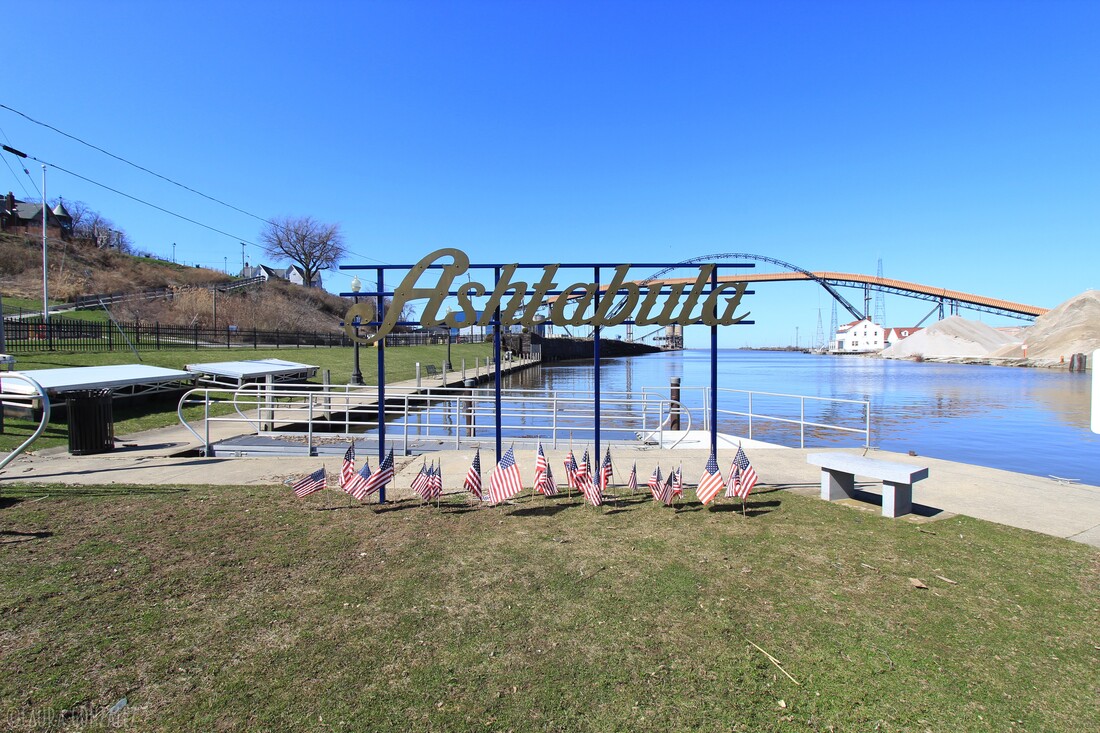 The city became an important destination on the Underground Railroad in the middle 19th century, as refugee slaves could take ships to Canada and freedom. Even in the free state of Ohio, they were at risk of being captured by slavecatchers. Beginning in the late 19th century, the city became a major coal port on Lake Erie at the mouth of the Ashtabula River northeast of Cleveland. Coal and iron were shipped here, the latter from the Mesabi Range in Minnesota. The city attracted immigrants from Finland, Sweden and Italy in the industrial period. Ashtabula hosts an annual Blessing of the Fleet Celebration, usually in late May or early June. As part of the celebration, a religious procession and prayer service is held at Ashtabula Harbor. The city was the site of the FinnFestUSA in 2007, a celebration of Finnish Americans. 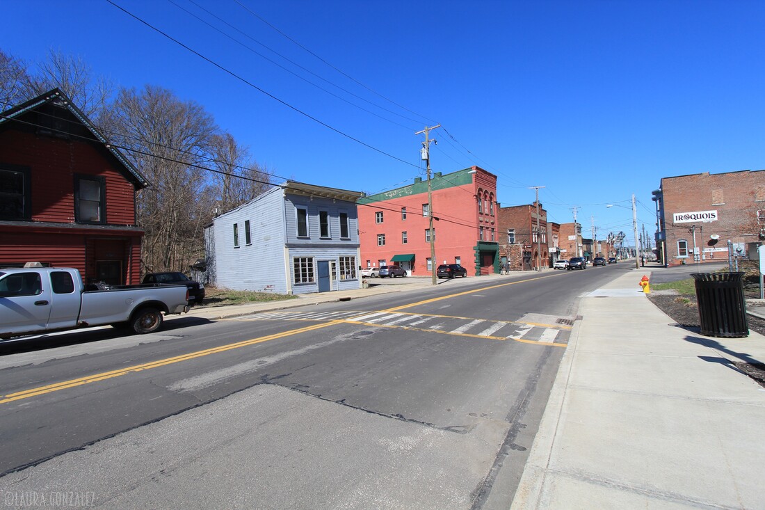 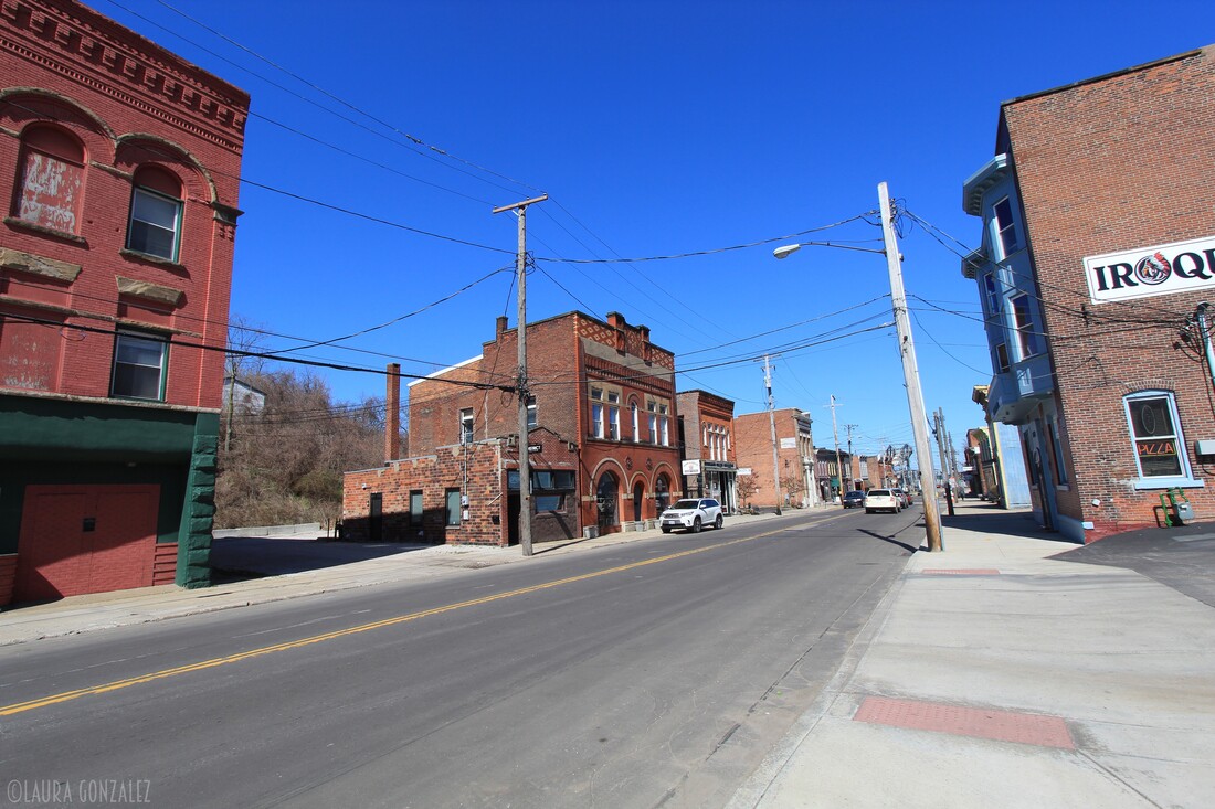 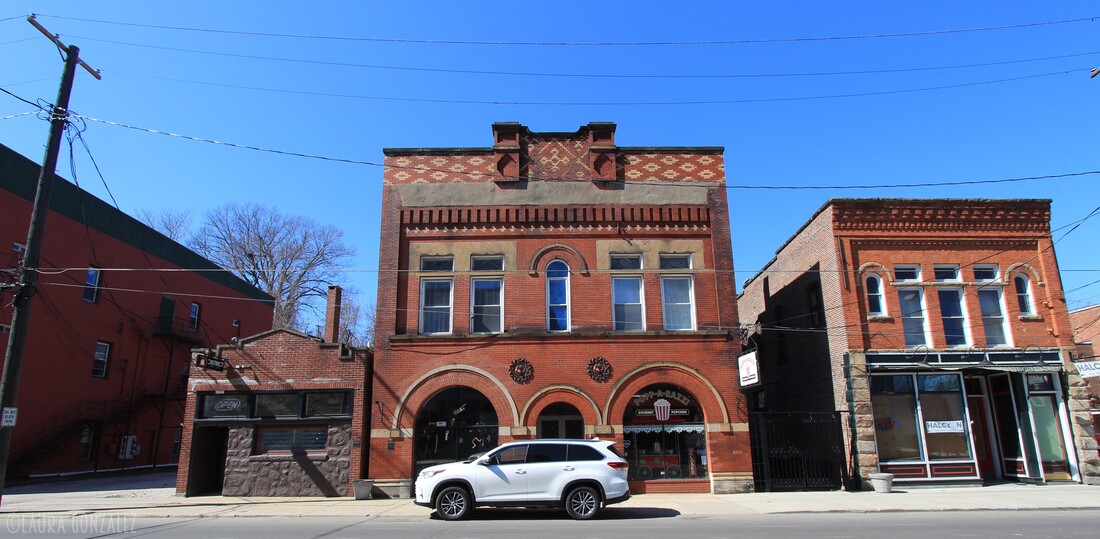 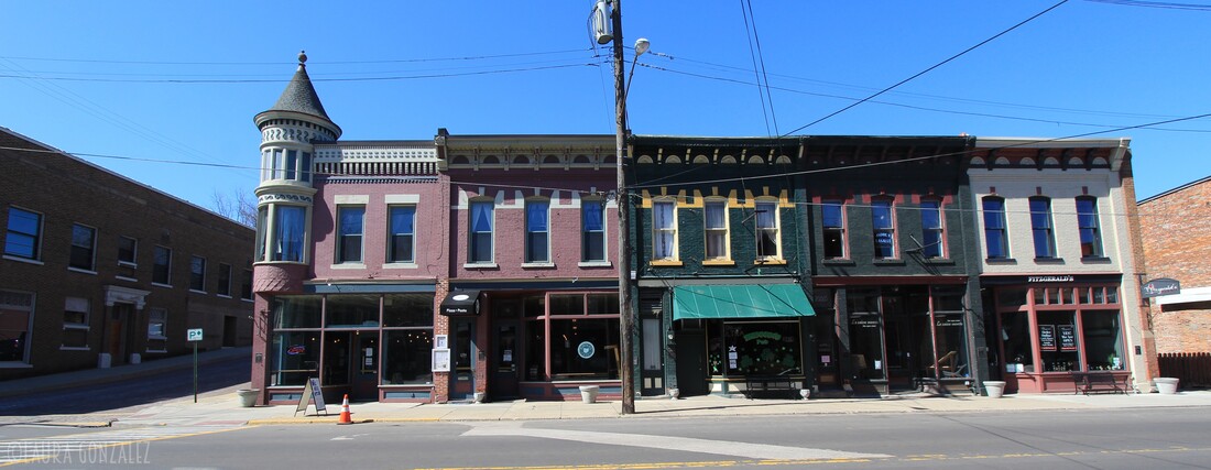 The Ashtabula lift bridge is a Strauss bascule bridge that carries Ohio State Route 531 over the Ashtabula River in the harbor of Ashtabula, Ohio. In 1985, the bridge was listed on the National Register of Historic Places. In 1986, the bridge was restored. 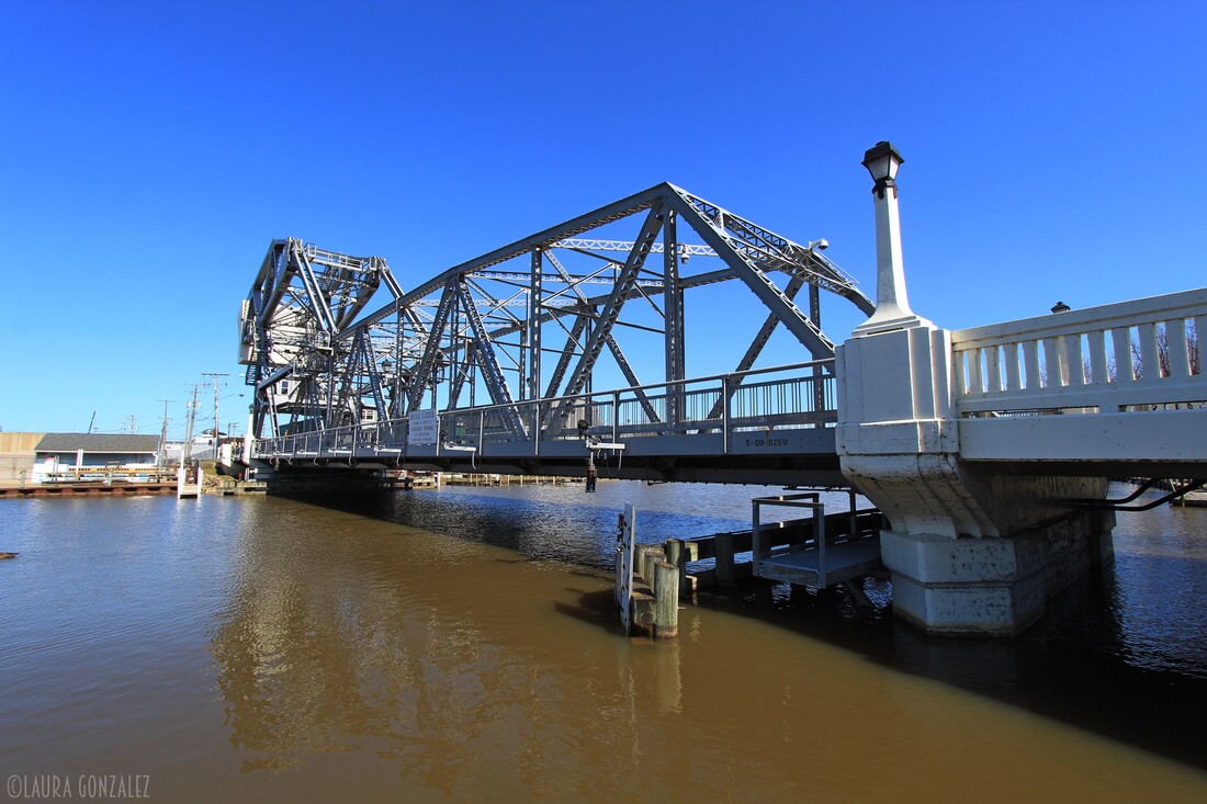 Ashtabula lift bridge 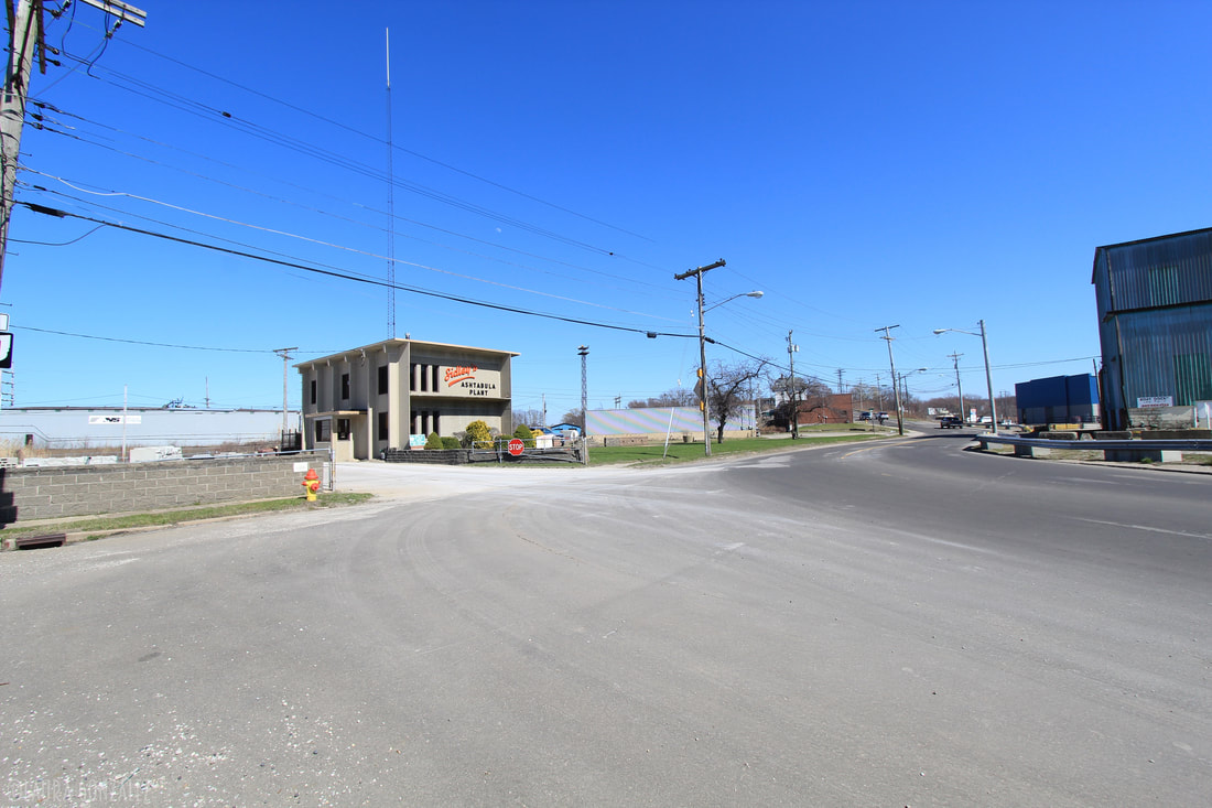 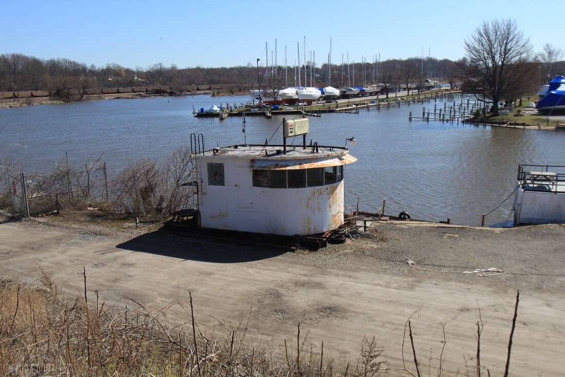 The city's harbor has been important as a large ore and coal port since the end of the 19th century, and integral to the steel manufacturing that was developed around the Great Lakes. Lake steamers and barges, built at shipyards along the Great Lakes and setting new records for size and tonnage, delivered cargoes of iron ore from the Mesabi Range in Minnesota. This continues as a coal port; a long coal ramp is visible in the harbor. Ore shipments are unloaded from 'lakers' (Great Lakes freighters) and shipped to surviving steel mills in Pennsylvania. Industrial jobs have declined since the late 20th century with much steel manufacturing moved offshore.  The grand Classical Revival structure along the river, while driving down Philadelphia's Schuylkill Expressway, is what first captured my eye, as it does to many passing through Philadelphia. 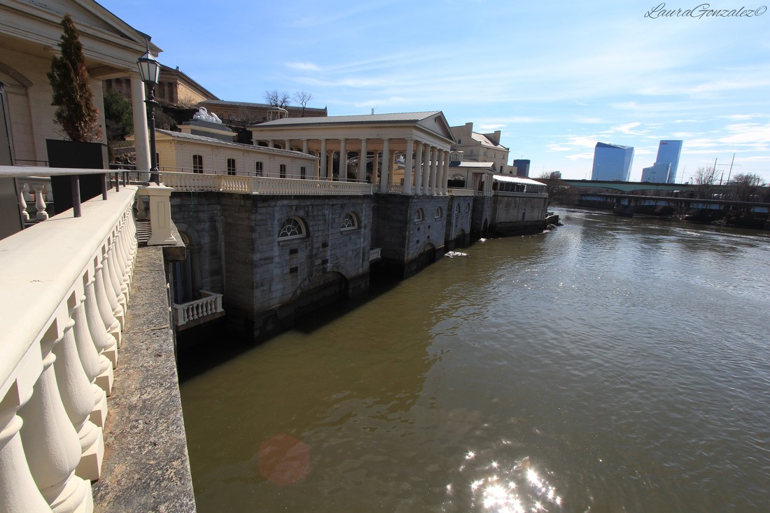 The structure, situated on the east bank of the Schuylkill River, is the Fairmount Water Works, Philadelphia's second municipal waterworks. The first had been located on the site of the present City Hall. After the yellow fever outbreaks of 1793 and 1798 caused widespread panic and thousands fled the city, the need for clean water was evident. The “Watering Committee” was formed in 1799 to provide clean water to the residents. Benjamin Henry Latrobe, an English-born engineer and architect, was hired to design a new water works for the city. Construction on the Centre Square Pump House began in 1799, in a classical Greek and Roman architectural style with Doric columns and a prominent dome. It was completed two years later consisting of steam engines, made partly of wood, and bored-log pipes. It didn't take long for the system to run into problems due to its wood design and the growing needs of the population. 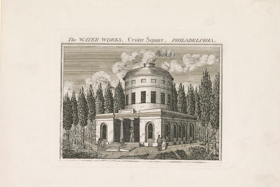 The water works, Centre Square, Philadelphia; Source: www.loc.gov Between 1812 and 1815, on the east bank of the Schuylkill River, the Fairmount Water Works was constructed. Designed by Frederick Graff, a hydraulic engineer who had employed by B. H. Latrobe as his assistant engineer in erecting the first water works, devised an iron-pipe system to be used instead.  Frederick Graff Source: Wikipedia The Water Works initially consisted of a 3 million gallon earthen reservoir atop Faire Mount. 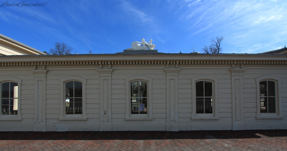 Winning praise around the country for its design, which was disguised by a Classical Revival exterior, it quickly became a popular tourist attraction known for its beauty and its location on the riverside which was praised by visitor Charles Dickens. 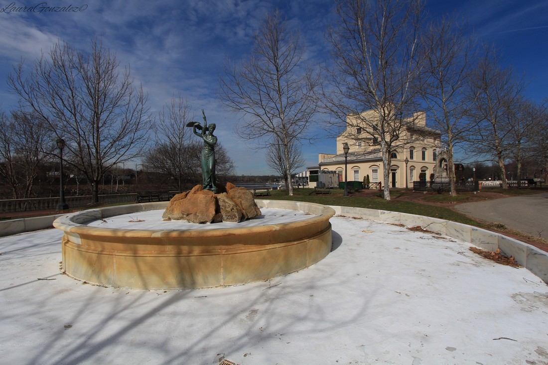 The Fairmount Water Works eventually closed in 1909 and the facility was used for several purposes including an aquarium and an indoor swimming pool. 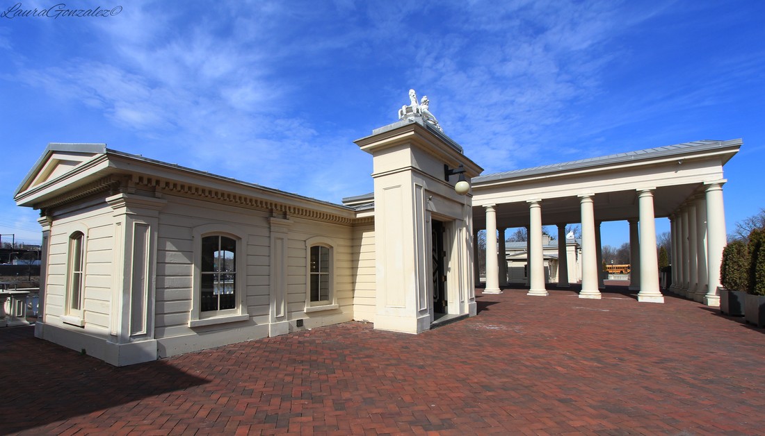 Today the water works buildings now house the Fairmount Water Works Interpretive Center and offers interactive exhibits, lectures, events, and school programs. 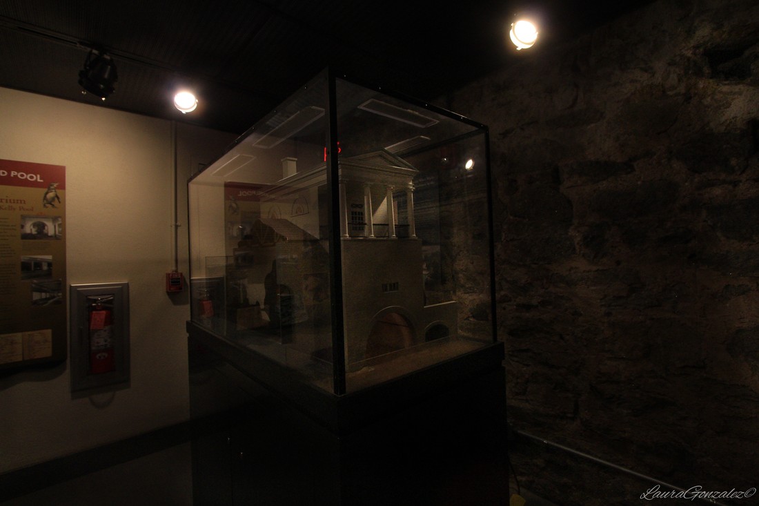 More Photos: 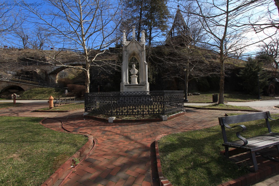 Frederick Graff Memorial 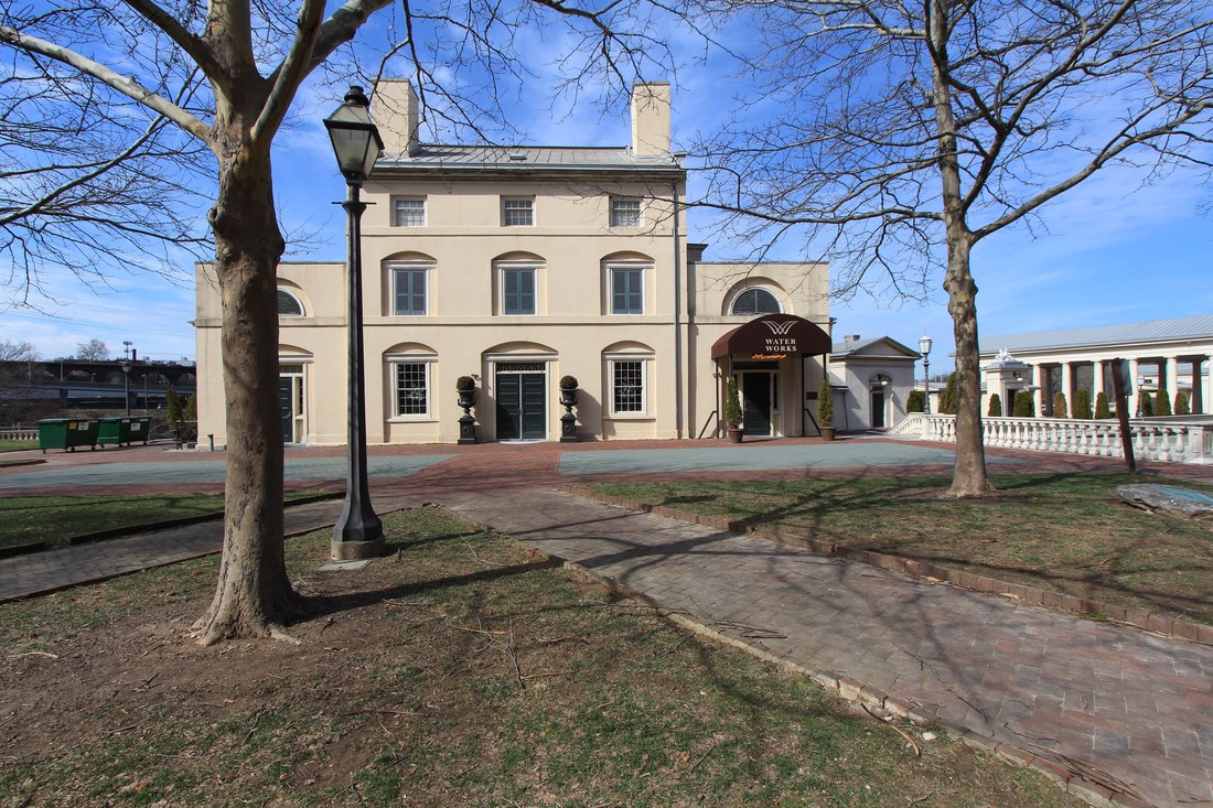 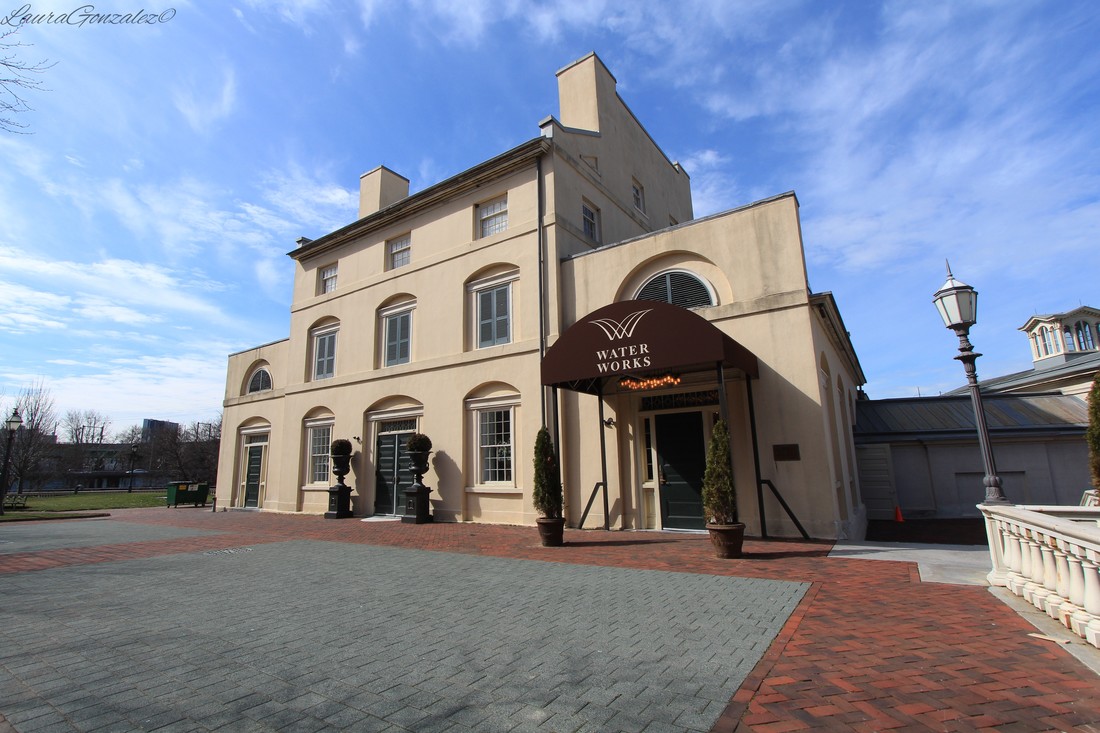 On the outskirts of Suffern, on the southern end of the Ramapo Pass along the west side of the Thruway, is Hillburn, a late nineteenth century hamlet originally called "Woodburn". 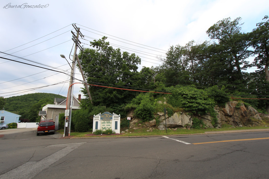 Its beginnings date back to 1773, when John Suffern settled nearby establishing a tavern and small farm and eventually a sawmill on the Ramapo. His son, James Suffern, would eventually add a ironworks and later a rolling mill. The works was abandoned in 1872. 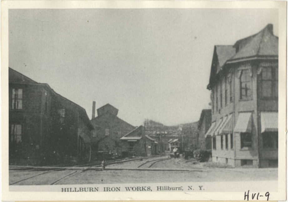 Hillburn Iron Works Source: hrvh.org William Wait Snow is the one credited with the history of Hillburn as he, along with his partners George Coffin and George Church, established the Ramapo Wheel and Foundry Company, in 1866. He envisioned a company town far superior to the Hamlet of Ramapo and in 1872, purchased property from James Suffern. The company began laying out streets and homes and called the tiny hamlet “Woodburn”. Water service would come to town the following year. 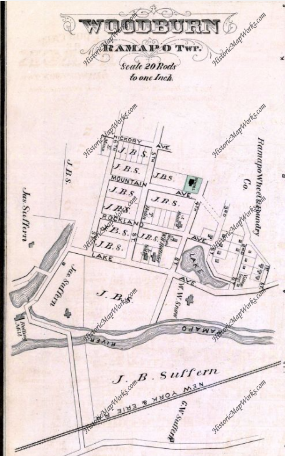 From Rockland County 1876, New York Published by F. A. Davis & Co. in 1876 The hamlet was renamed Hillburn in 1882, when it applied for a post office, and it was found there was already a Hillburn in the state of New York. William Snow was the first post master. 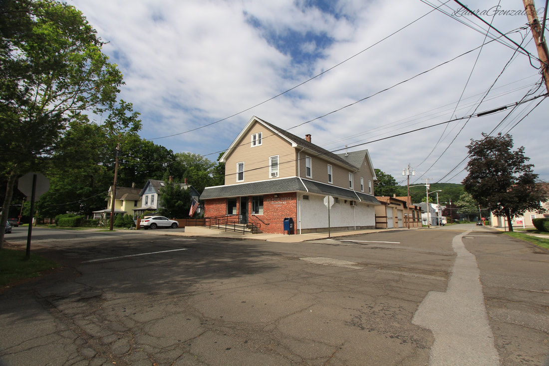 William Wait Snow was born in Heath, Massachusetts on July 17, 1828. He attended school and went on to his first job as a bookbinder, but grew disinterested after a few years and became the foreman for his brothers foundry in Woodsocket, Rhode Island. After gaining more experience in the field, he opened a car wheel foundry with Partner Isaac Stanton in Newburgh, calling it Stanton & Snow. The business went under in 1857 during the Panic of 1857. After a few years of being in charge of the Union Car Wheel Works in Jersey City, he opened the Ramapo Wheel and Foundry Company. By 1906, the company was combined with the American Brake Shoe & Foundry Company. When he retired he divided his assets among his children. 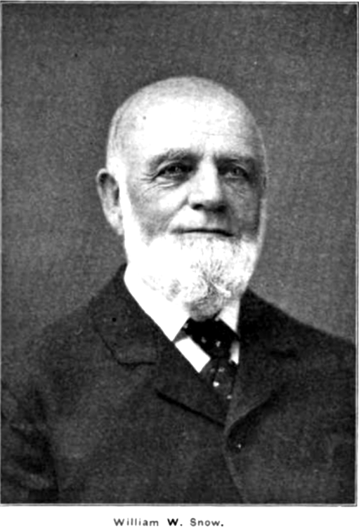 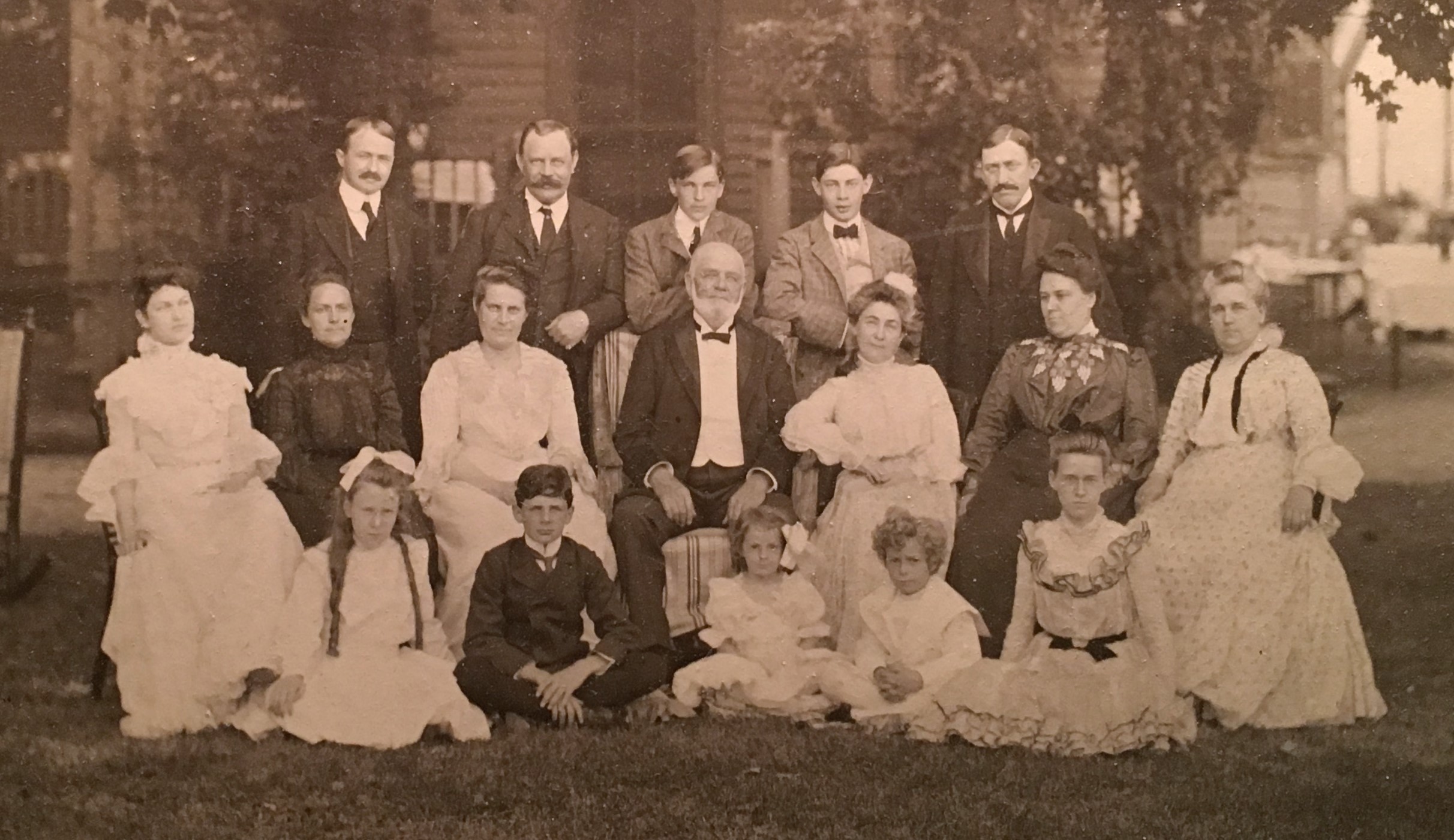 Snow family Source: www.findagrave.com He married Olive Amanda Estes on Aug 28,1849 at Cumberland, Rhode Island and they had four children, Homer A Snow, Fred W Snow, Nora E Snow, and Clara Amanda Snow. 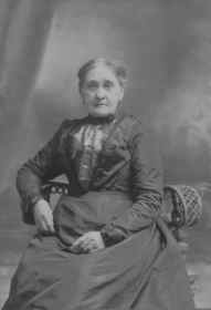 Olive Amanda Estes Snow, Wife of William Snow Source: findagrave.com 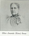 Source: geni.com His son, Fred W Snow, succeeded as President of the Ramapo Wheel and Foundry Company when Wm. Snow resigned. 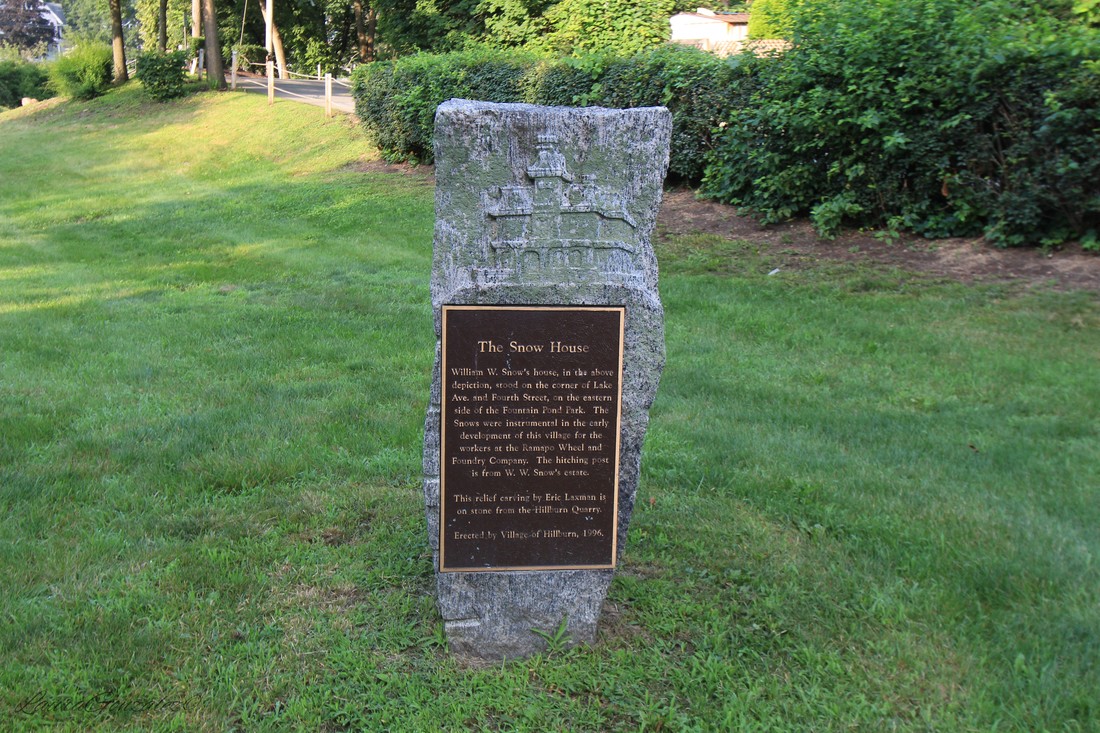 The Snow houses in Hillburn were located on the corner of Lake and 4th Street. The homes were destroyed when the N.Y. Thruway was built. A marker was placed in the park across the street to pay tribute to Mr. Snow in 1996. 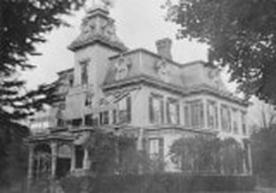 The plaque is in the Veterans Memorial Park . 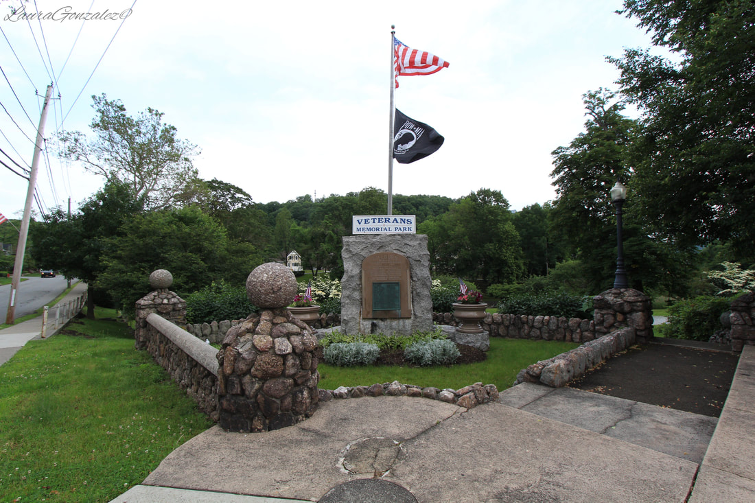  Veterans Memorial Park Orange and Rockland County had a large black population and the Ramapo Ironworks had recruited black workers in the area to fill some of its lower-paying and labor-intensive positions. Between 1880 and 1900, Rockland County’s African-American population grew from 816 to 2,060. Hillburn’s black community began to grow steadily as they settled in an area known as “the Hollow” in the west part of town. This area became known as the Brook Community, named after a small brook in the area. 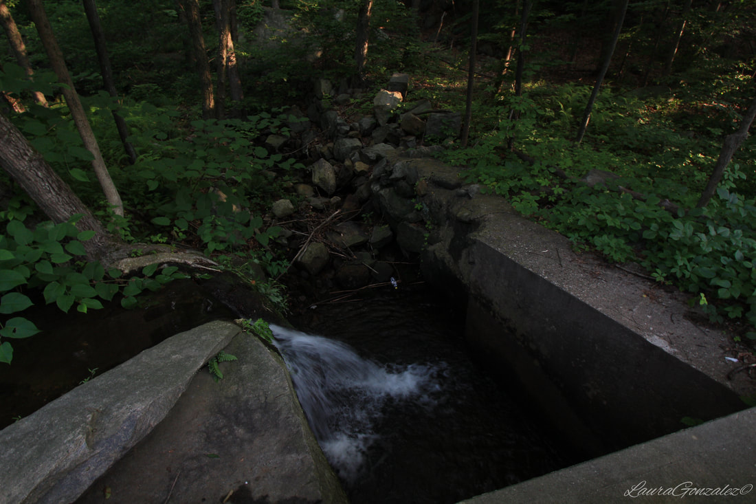 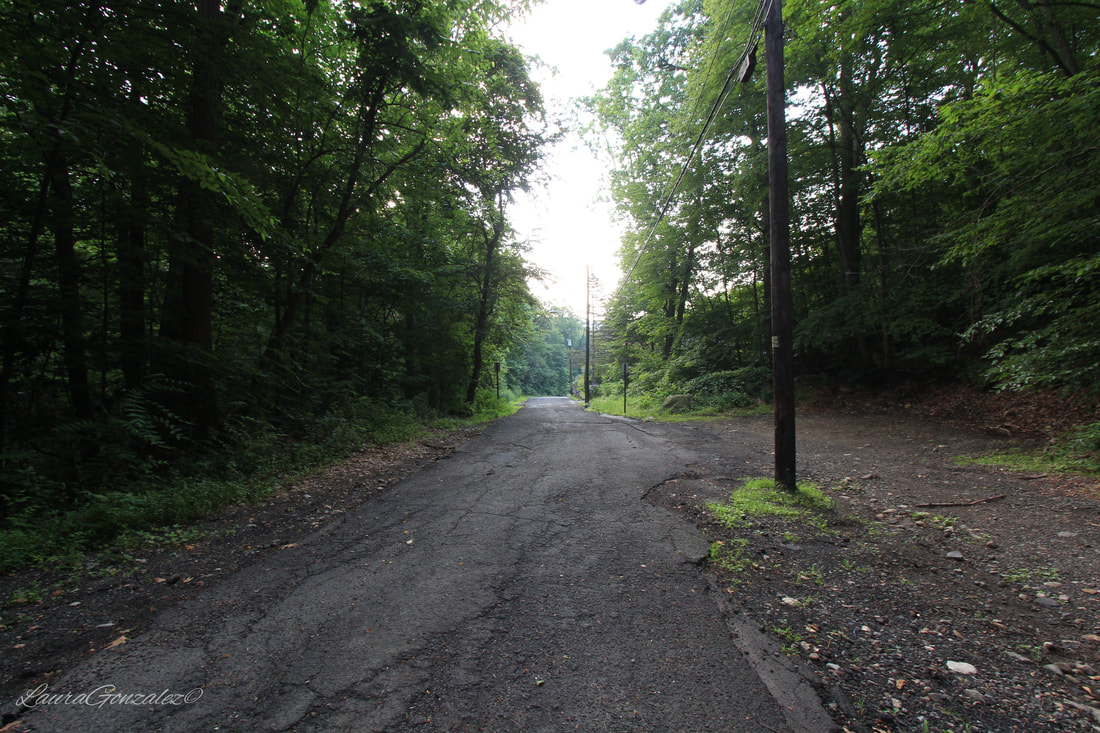 In this area, the Brook School and Brook Presbyterian Church would be located. 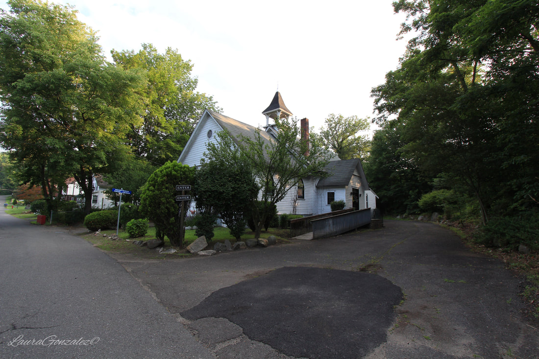 Brook Chapel Brook Chapel was built in 1893. The Brook School is where "colored" students were sent and was notably smaller than the school designated for the whites. The school was located next to the Brook Chapel Until it burned down leaving only stone foundations. Before the school was built, Brook Chapel was used as a school during the week.  On Mountain Avenue is “Main School” which is a two-story hollow tile and concrete building covered in stucco and set on a raised basement built in 1912. When it first opened, it originally housed eight classrooms, and was a segregated school that served only white students. Main School was located where the white families lived. The school contained a library, playground and indoor plumbing. It replaced a one room school building which was constructed in 1880. 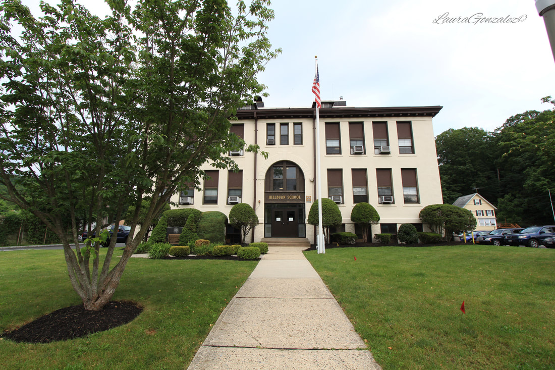 As the years passed, Brook School began to get less and less attention from the school board. With such a high number of students, two students had to share the same seat and parents began to call the building a fire trap with inadequate exits. By the time Route 17 passed through town, it had cut through the school property, destroying its former playground. Hillburn’s black parents started fighting to integrate the schools. On September 8, 1943, the first day of school, only a handful of students showed up at Brook School in protest of the segregated schools. The parents called the NAACP for help and that's when Thurgood Marshall was sent in. Marshall, an NCAAP attorney set out to change the "Jim Crow” or “separate but equal” education practices at the schools In Rockland County. The end result was black children granted the right to attend the “Main School,” making New York one of the first states to integrate its schools. Hillburn has gone down as the first place that a 1938 law overturning Jim Crow laws in education was tested and upheld. 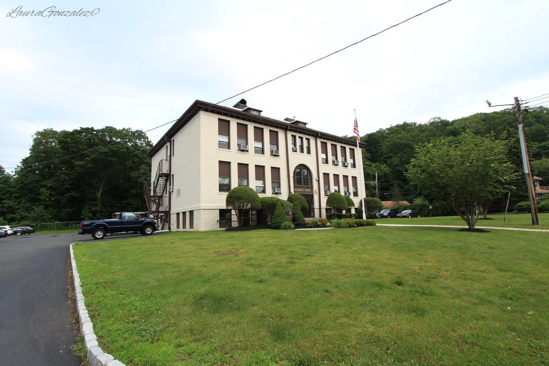 Main School The documentary "Two Schools in Hillburn" recounts the 1943 desegregation battle in Hillburn. The issue of segregation wasn't the only controversy to come to Hillburn. 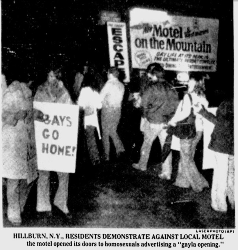 Perched atop the tiny village is Mt Fuji, aka "Motel on the Mountain", designed by American architect Harwell Hamilton Harris and later the Japanese architect, Junzo Yoshimura. In the 70's, it was transformed into a gay weekend retreat and was met with opposition from the locals. It eventually closed down in 1978. 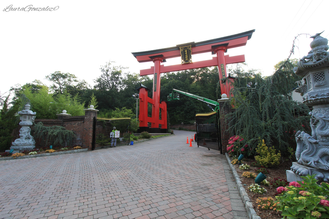 Then Tony Fujita entered the picture. Tony was a Gold medalist at the 1962 Asian Olympics for Greco Roman Wrestling and also placed fourth at the 1964 Tokyo Olympics. He opened the shuttered resort and turned it into a elegant wedding and event catering facility and it is now known for its breathtaking views of the Ramapo Valley. Tony Fujita passed away on August 7, 2011 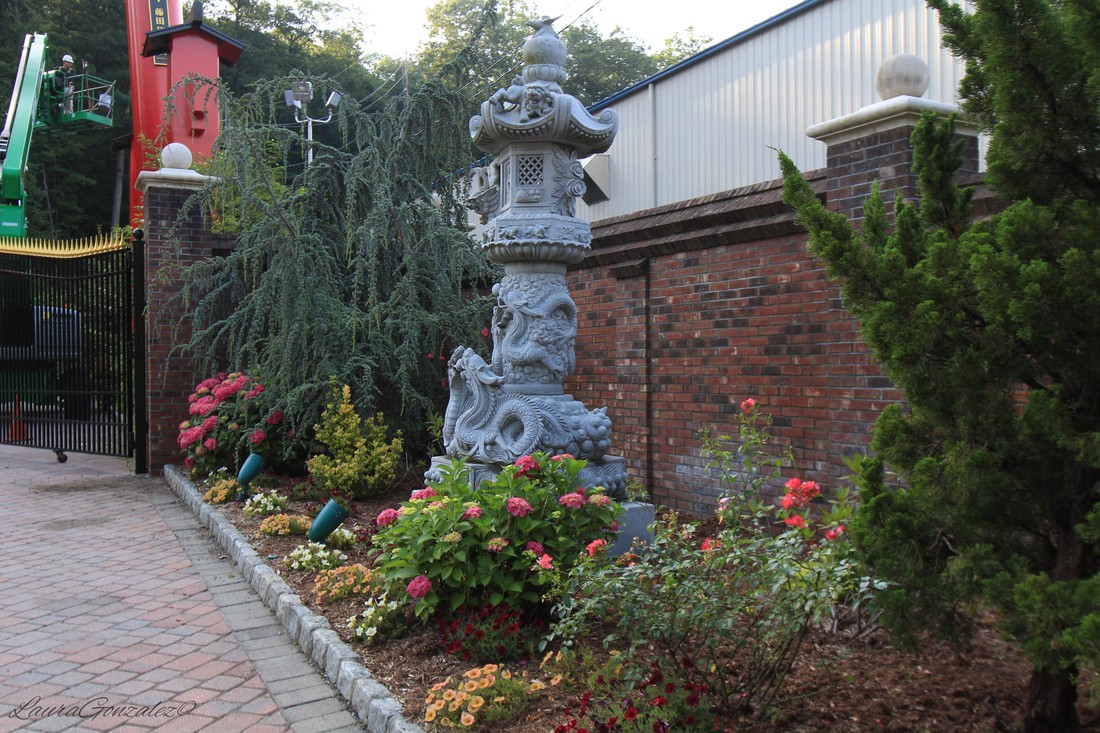 Heres some other pictures from Hillburn NY    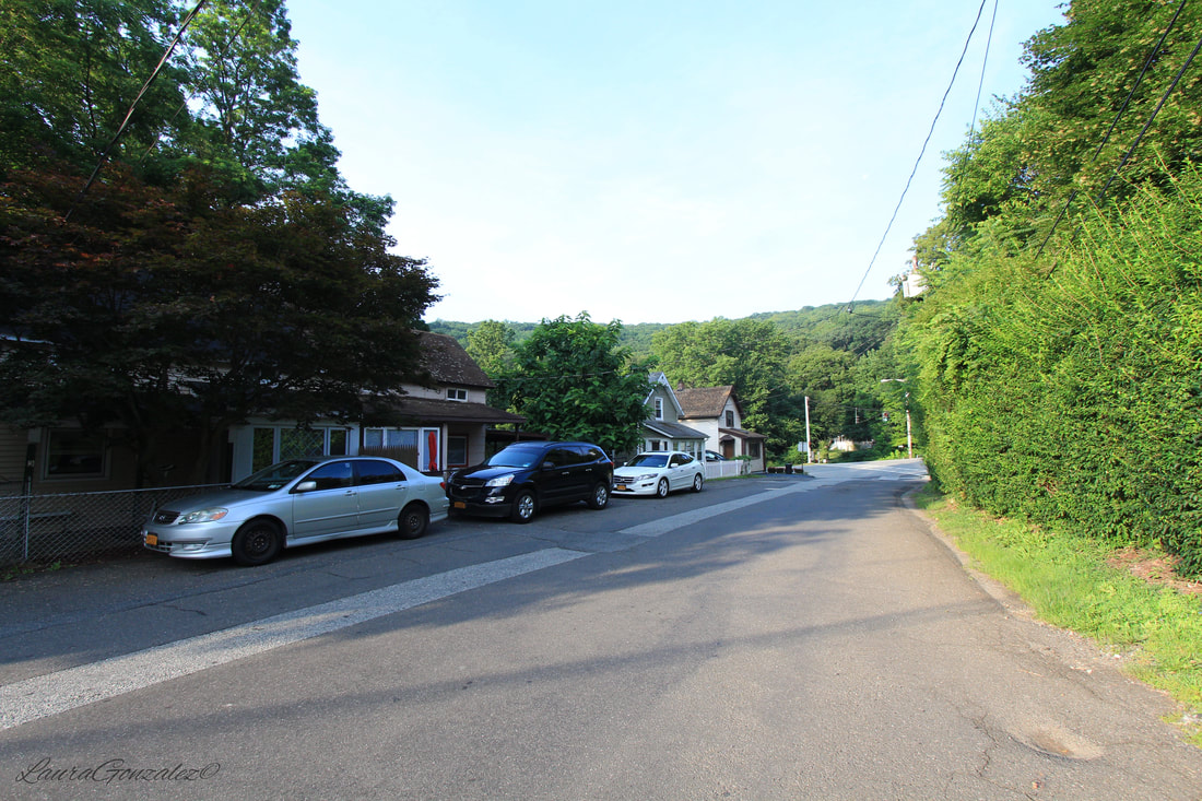 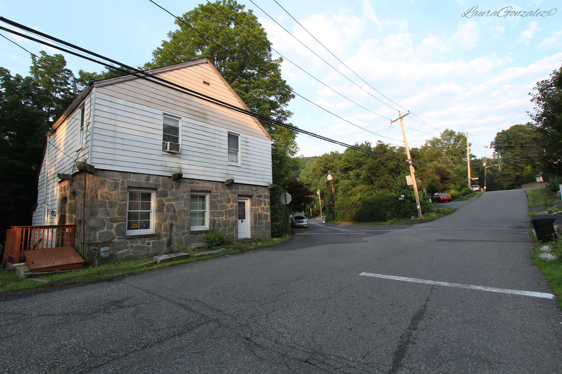 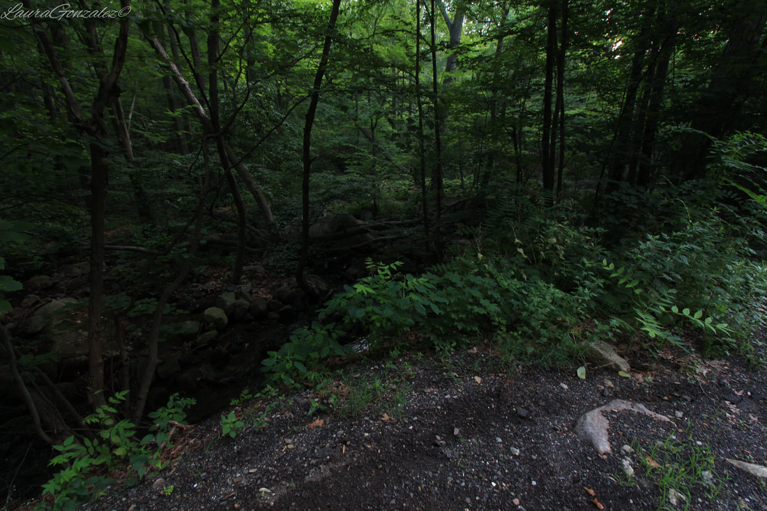 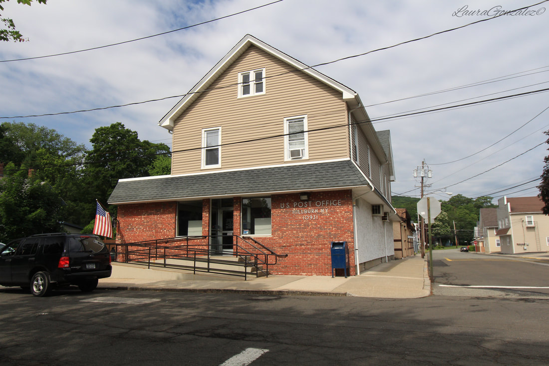 The tiny cluster of structures on Main Street near Walpack Flatbrook road is no larger than a quarter of a mile, but seems to invoke visions of forgotten towns and ghost stories in visitors when they come upon it . Walpack became part of Sussex County when Sussex County was formed on June 8, 1753. Walpack Center was never a big town and mostly served the needs of the farms that surrounded it. When the automobile reached new heights in popularity, some thought the town would expand, but instead it took a completely opposite turn. The farmers could then drive to the stores in the areas further out to meet their needs. After 1910, no new structures were built. One by one the the people of the tiny town began to move elsewhere. 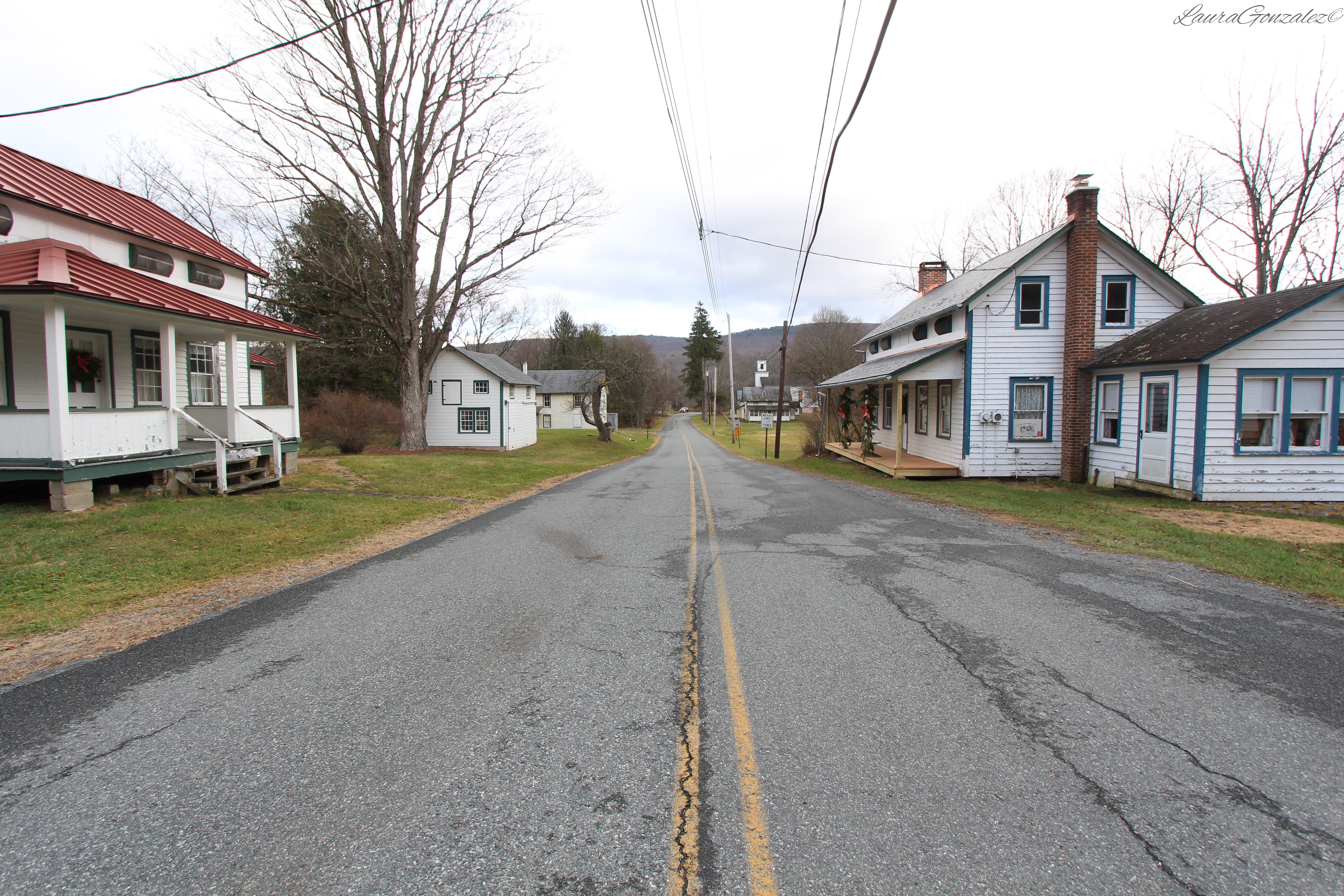 In 1962, the Tocks Island Dam was authorized by Congress. The project was to construct a huge dam about 160 feet above the river and between 400 and 900 feet wide, to create a 12,100-acre reservoir that would extend 37 miles in order for flood control and water and hydroelectric power. This decision further vacated the town by condemning the properties of Walpack Center. In the end, the federal government acquired 72,000 acres on both sides of the river displacing about 8,000 people.  www.nps.gov Due to strong public protest resulting from local media coverage, the project was eventually de-authorized. This left Walpack an empty ghost town.  The towns luck turned around in 1965, when Walpack Center became part of Delaware Water Gap National Recreation Area. Attention has been given by The National Park Service who have taken an interest in preserving Walpack Center for all to enjoy by utilizing the buildings as employee residences to prevent further vandalism. Walpack Historical Society is also using one building as their museum and headquarters.  In the beginning of town is the Walpack General Store, which is also known as the post office. The post office in Walpack Center was established on Jan. 21, 1854, with Jasper Rundle as its first postmaster. In 1893, the post office was officially re-designated "Walpack Center." In 1915, the general store burned down and a new general store was built at the same site. This post office closed in May 1988 and mail is now handled in Layton. 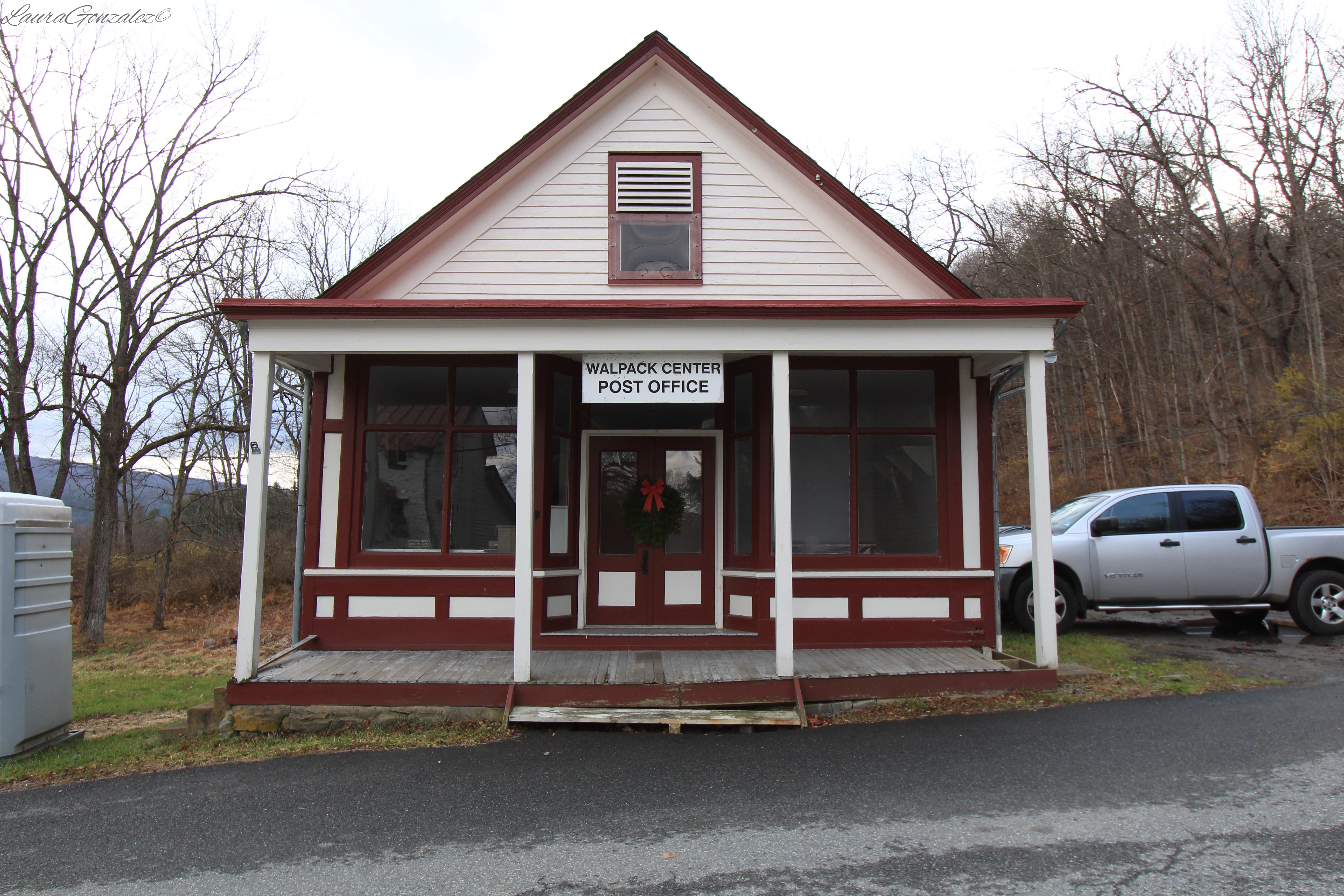 Built in 1840, this is the first Robbins House. 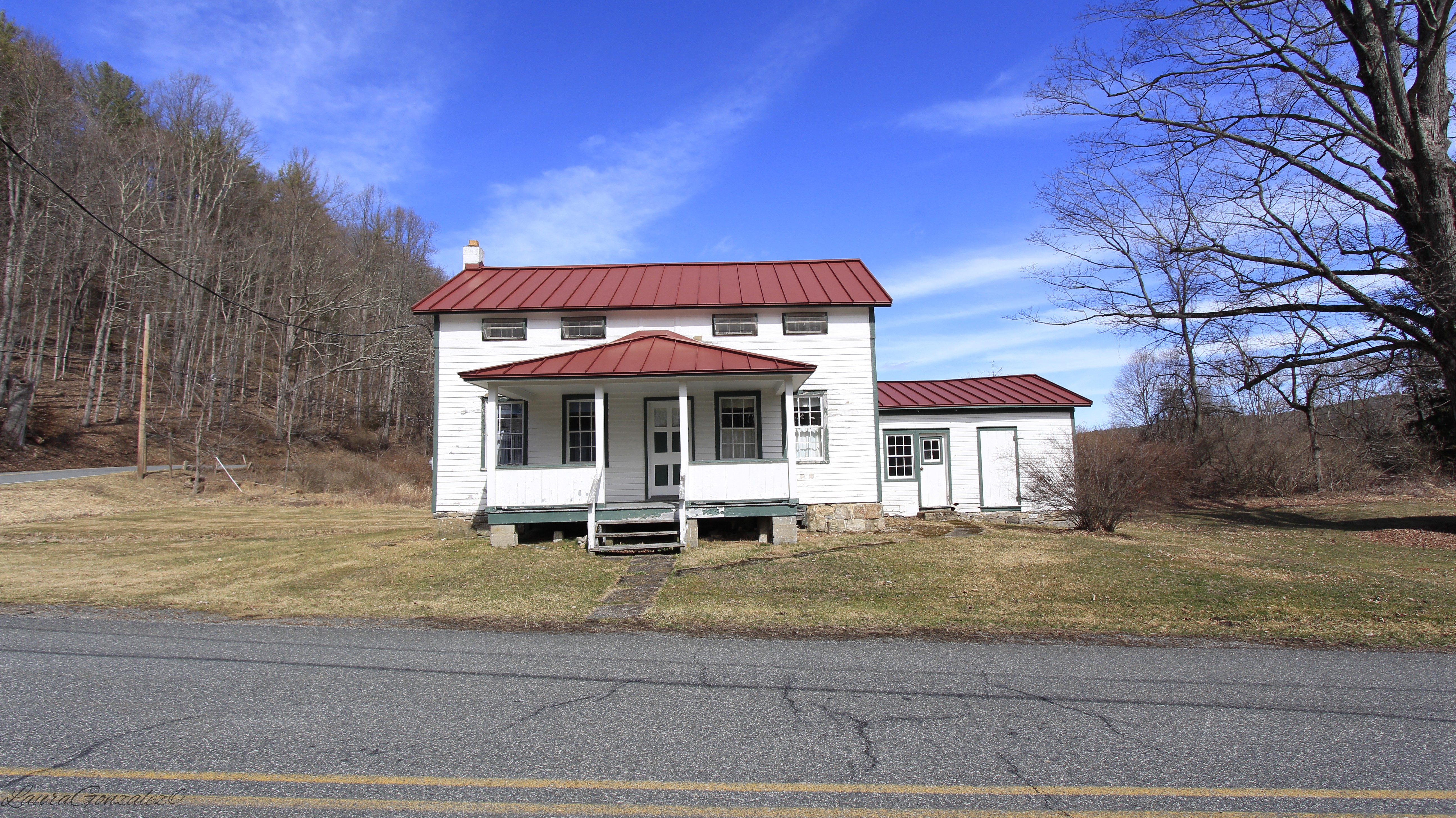 First Robbins House; Built ca. 1840 One of the oldest buildings in Walpack Center is the Rosenkrans House. It was built in 1850 by Jasper Rundle. 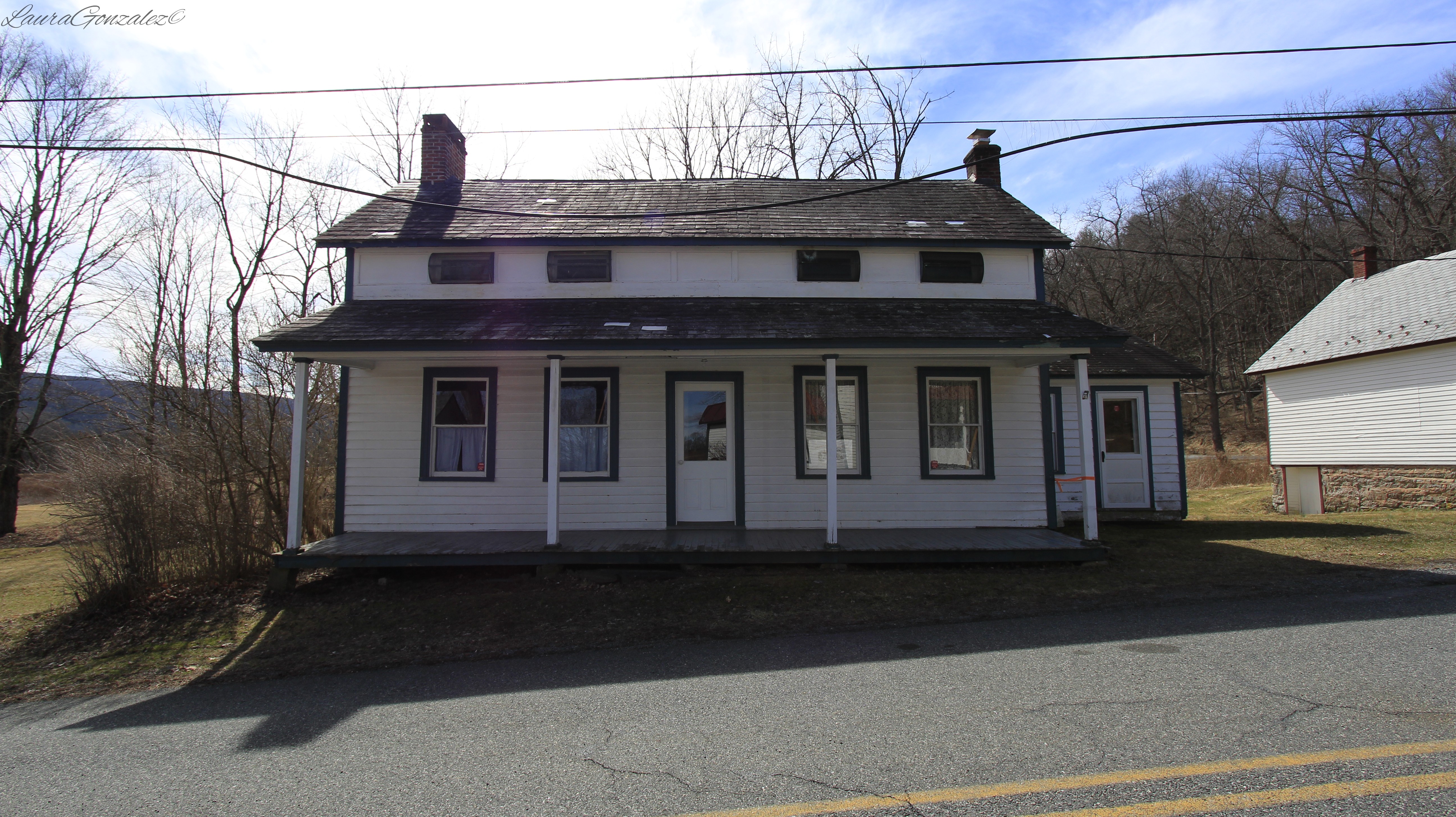 Rosenkrans House The white Victorian Walpack Methodist Church was built in 1871, replacing an 1837 stone structure. 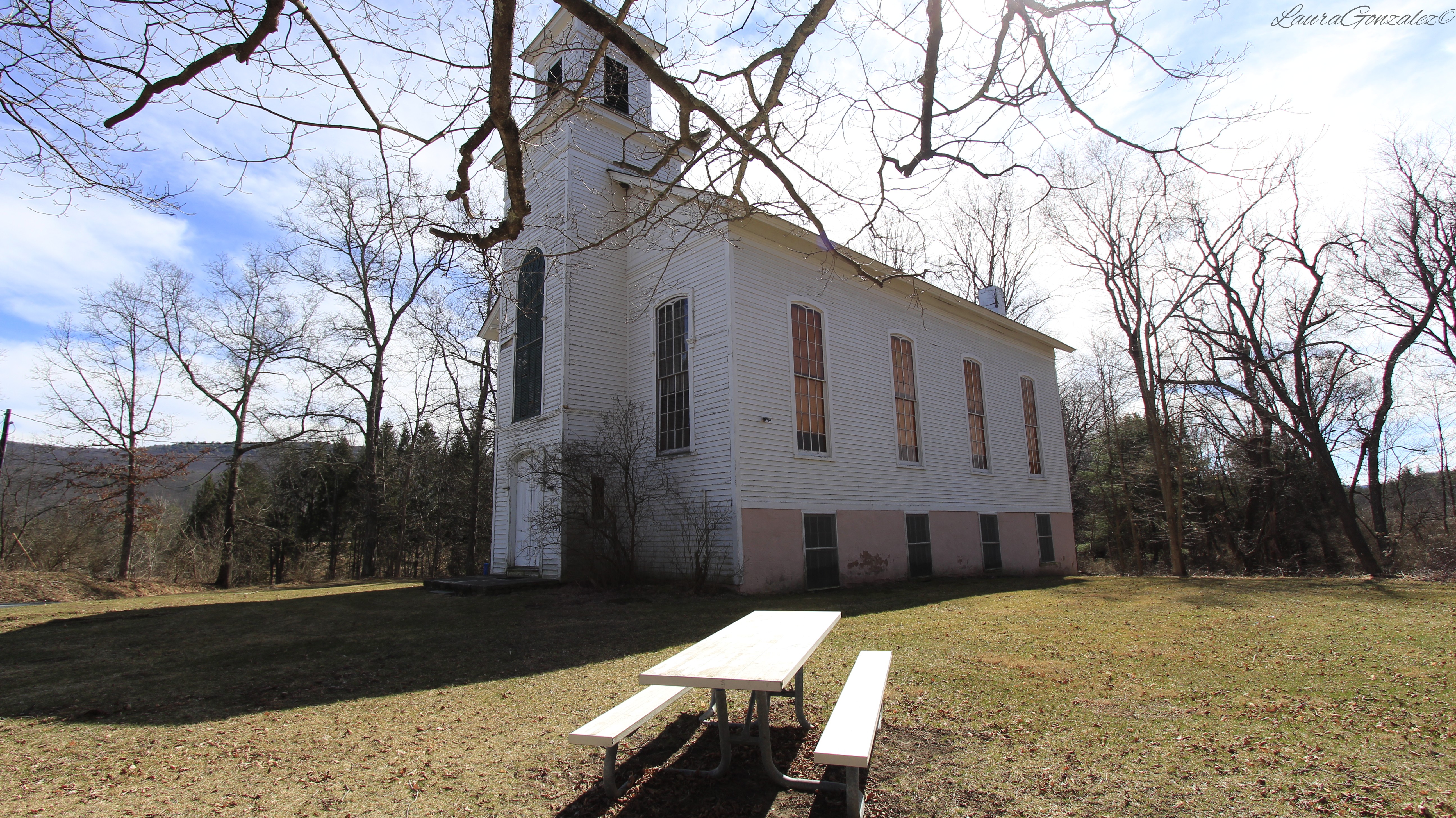 Victorian Walpack Methodist Church Next door to the church is the Christie House, which was built in 1910. 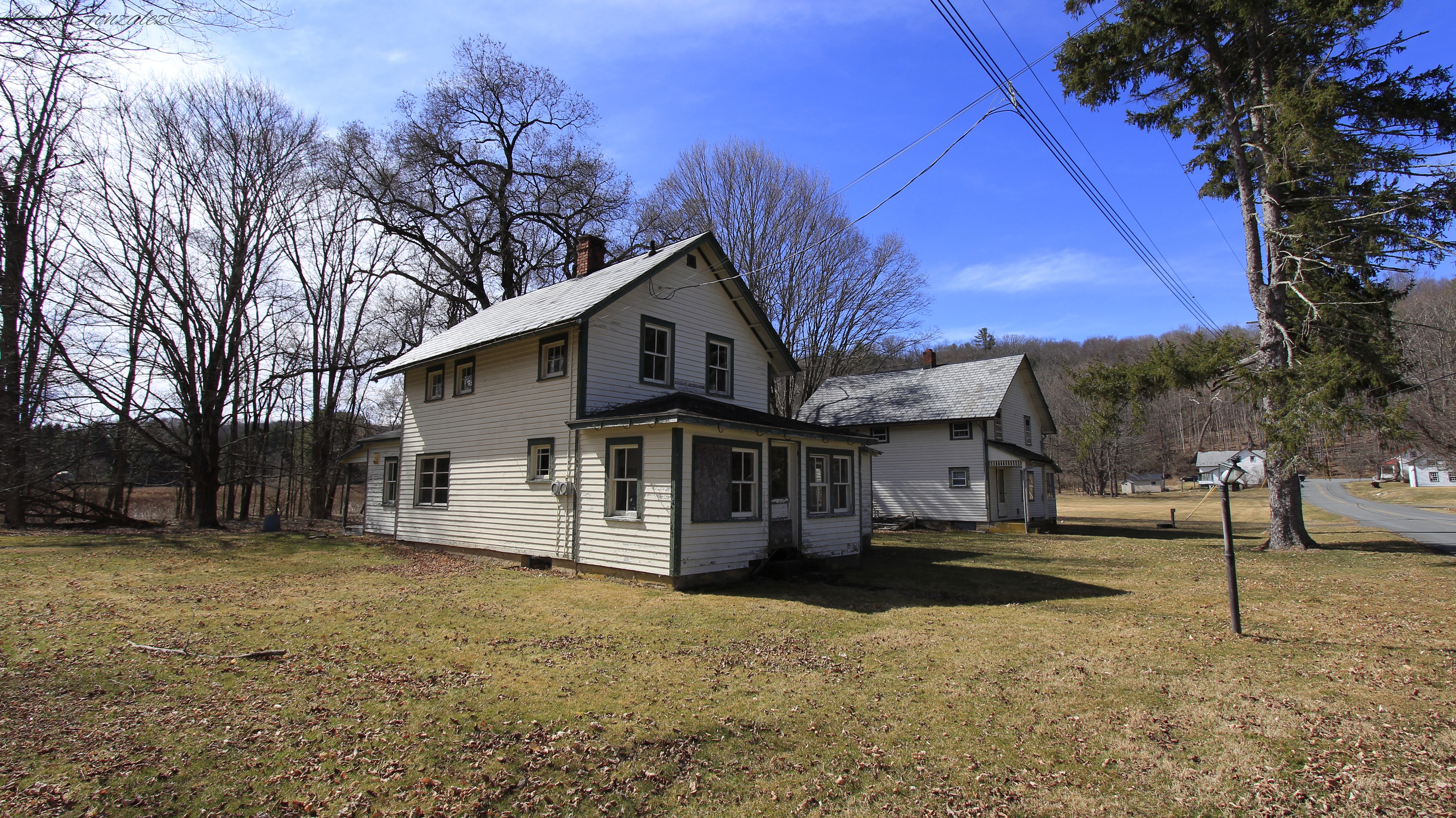 Christie House The two-story gable facade structure built in 1910 is the Hendershot House. 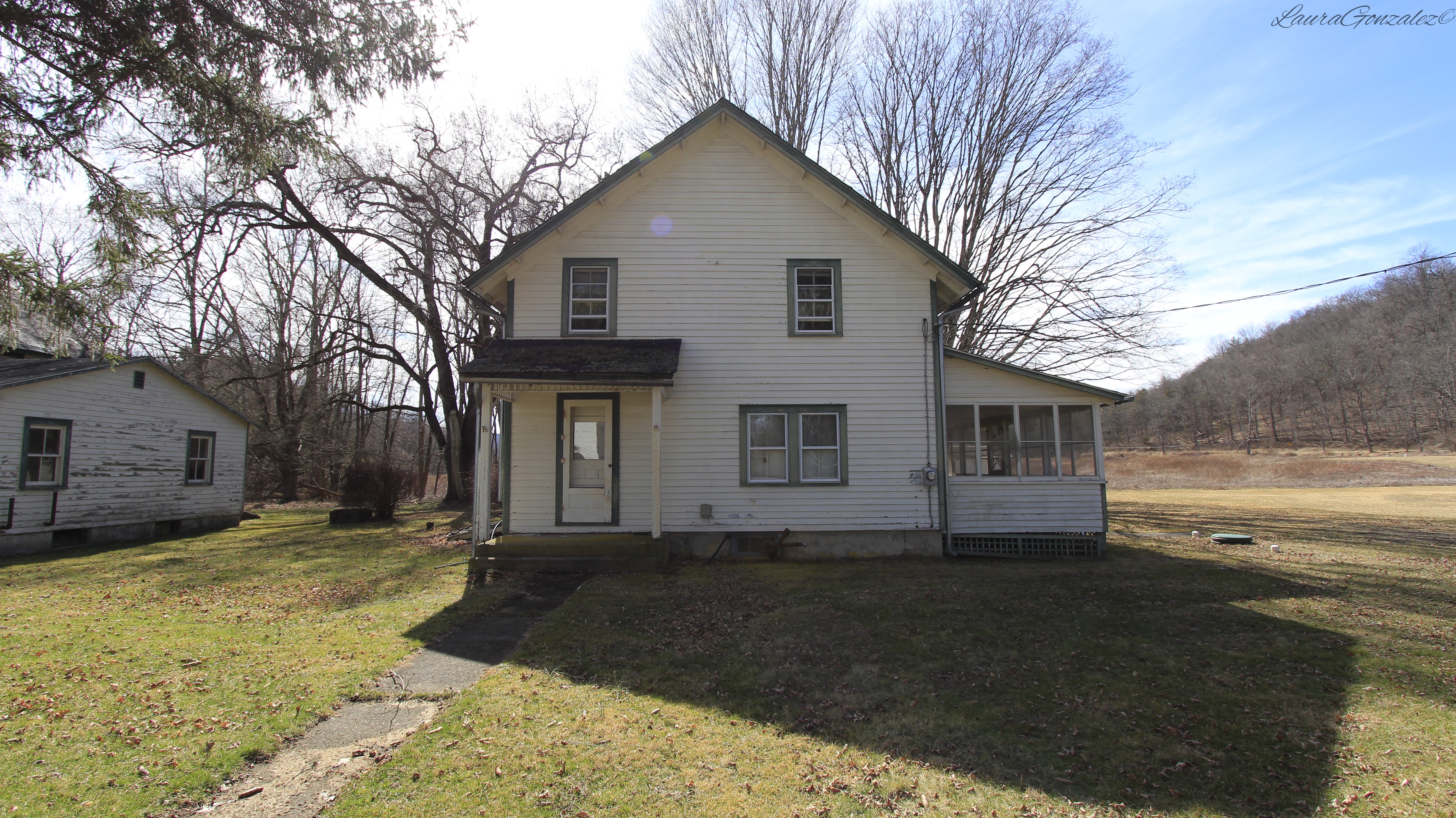 Second Rosenkrans House is shown below. 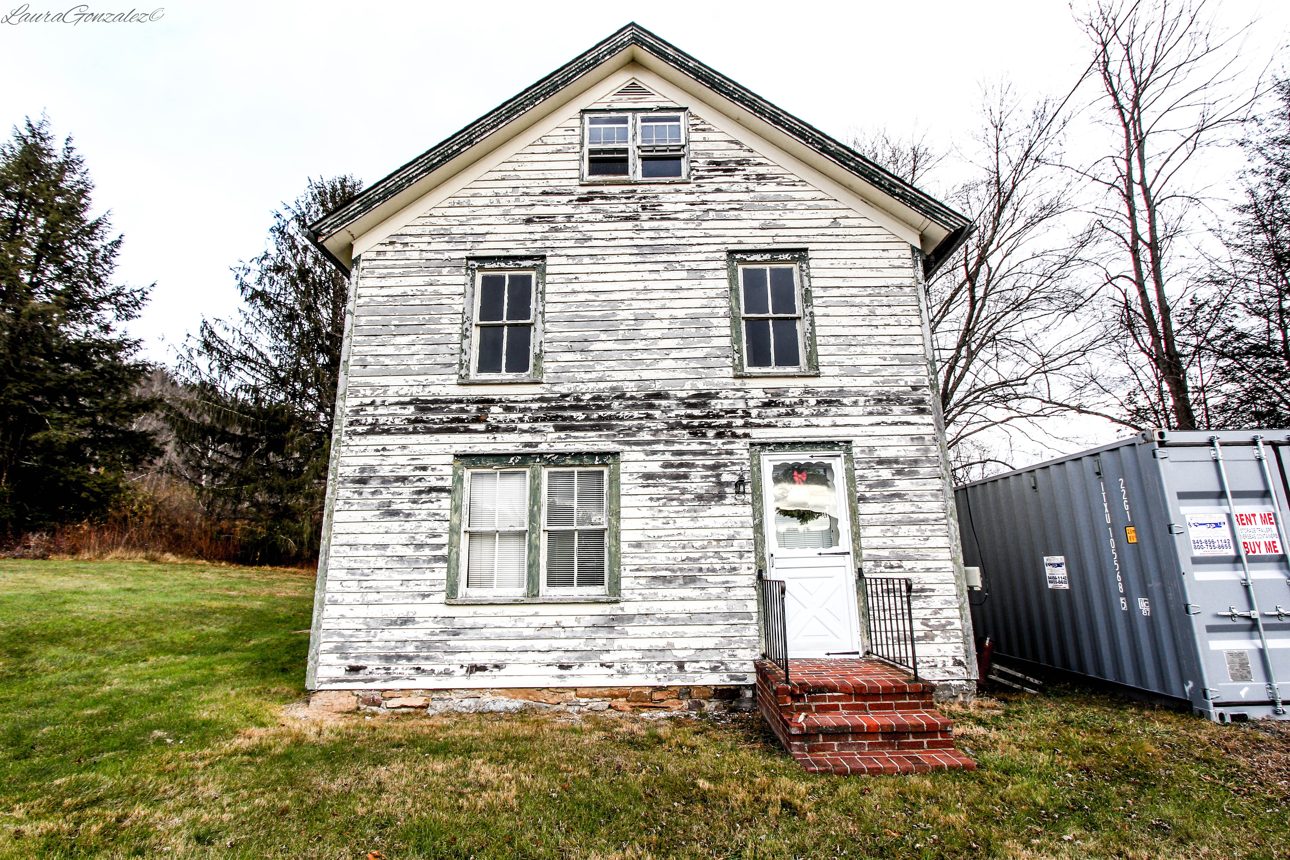 The Walpack Center Schoolhouse, which is located at the end of the block, was built in 1856 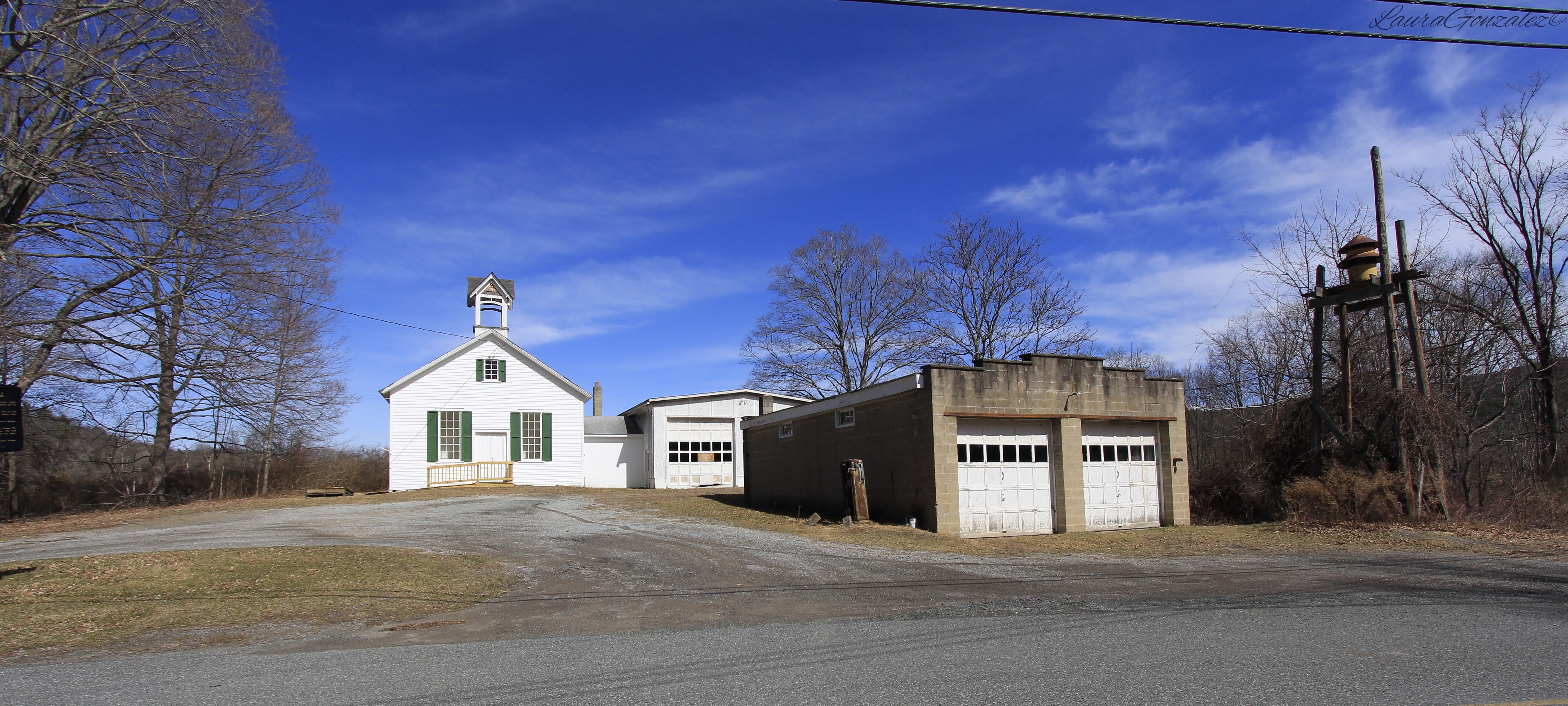 Thirty years have passed since the Walpack Historical Society was organized and Walpack Center now serves as a walk through museum to a era passed with historical society members acting as tour guides to help the memory of the area's rich history live on.
North of the old Barrytown Station is Blithewood, the historic country estate of National Guard captain and real estate mogul Andrew C. Zabriskie. 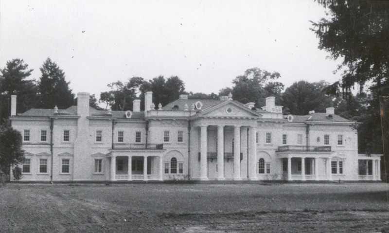 Source: http://hcap.artstor.org The story of the grounds goes back to 1835, when a North Carolina gentleman, named Robert Donaldson, Esq., purchased the land and named the grounds "Blithewood". He hired architect Alexander Jackson Davis, and landscape architect Andrew Jackson Downing to fix up the home and grounds. Sometime after that ownership was transferred to Mr. John Bard. After the death of Mr. Bard the estate was sold to St. Stephen's College.  American architect Alexander Jackson Davis Source: Wikipedia In 1899, ownership passed to Zabriskie. 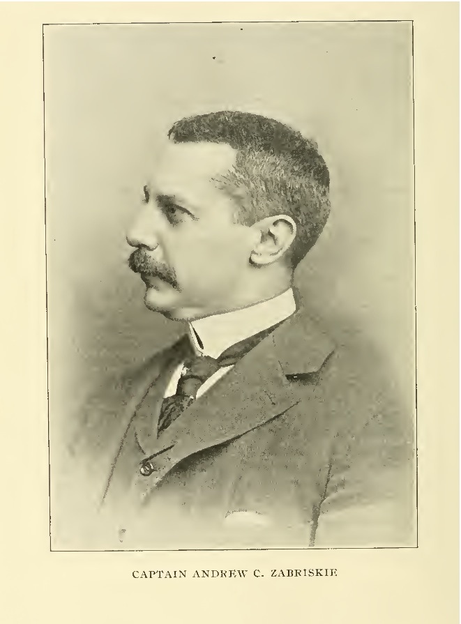 Source: Ancestry.com Andrew C. Zabriskie was born in New York City to Christian A. Zabriskie and Sarah J. Titus on May 30th, 1853. The Zabriskie family is of Noble Protestant Polish descent, going back hundreds of years when his ancestor, escaping the political and religious oppression of his own land, emigrated to America in 1662. The family became deeply involved in the real estate business. The family is connected in various ways with the history of Bergen County, New Jersey since its earliest days. 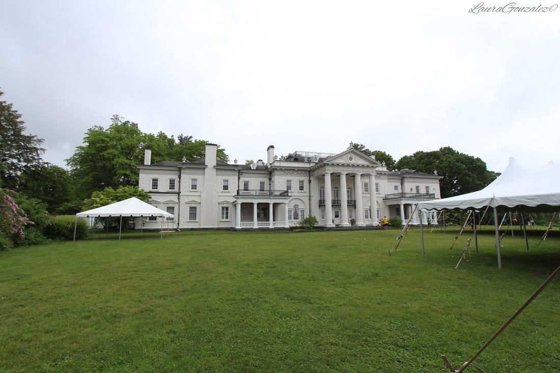 After being educated in private schools and Columbia College, he Inherited large real estate properties and began devoting himself to the business connected with those interests. In 1895, Captain Zabriskie married Frances, the youngest daughter of the late Charles F. Hunter, who was President of the People's Bank of New York City. They had two children, Julia Romeyn and Christian Andrew. Julia was married to Captain Edward Powis Jones in 1918. 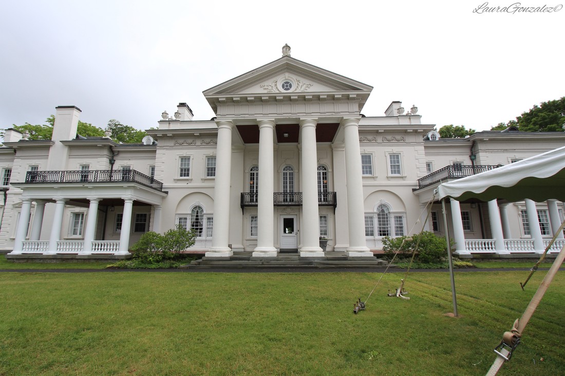 In 1899, Captain Andrew C. Zabriskie purchased the estate and hired Francis Hoppin, of the architectural firm McKim, Mead & White, to design a manor house and garden to replace the old house on the property (Not to be confused with Blithewold in Rhode Island which was designed by Francis Hoppin). Hoppin designed a grandiose mansion and Italian style garden that reflected the architectural elements of English mansion design, according to the tastes and trends of the Gilded Age. The result is the grand Beaux-Arts mansion which you see today. The house and its traditional Italian garden were donated to Bard College in 1951. 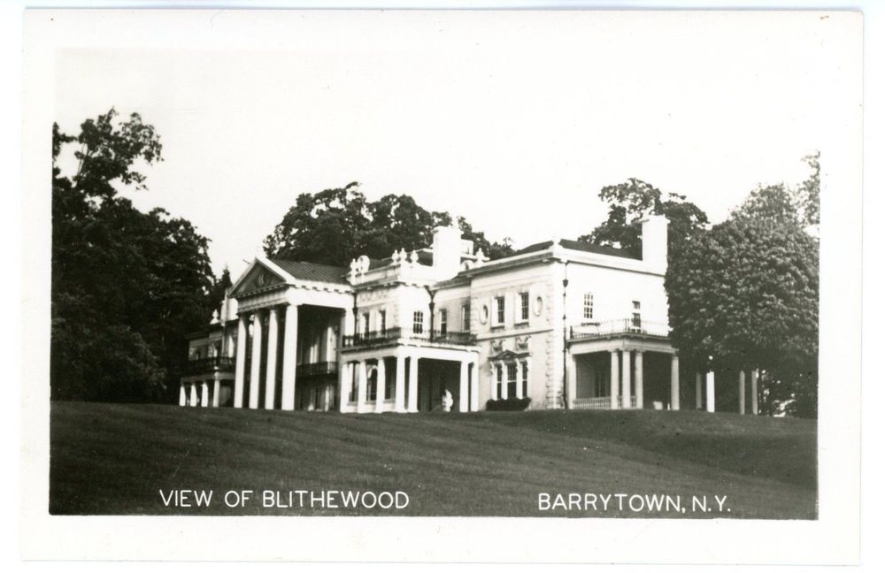 Rumours have circulated that the mansion is currently haunted by the spirit of his daughter who either fell or jumped to her death out the window of their New York apartment. 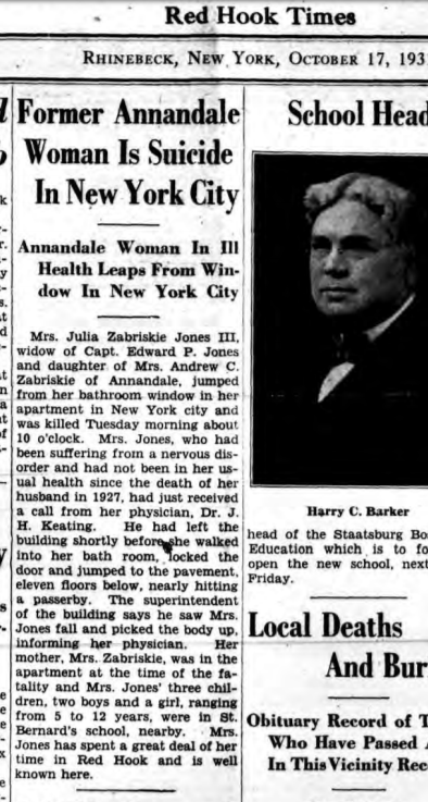 There seems to be many versions circulating about the haunting. One legend states that before her death, Capt. Zabriskie commissioned a sculptor to create 4 statues of his daughter, for each 3 years of her life up to the age of 12, in the gardens. But, to this day, only three statues are present, along with an empty pedestal for the fourth one. In another version, 4 statues were made, one for each daughter, which would mean he had four daughters. The second version seems less believable as according to my research Zabriskie only had two children. 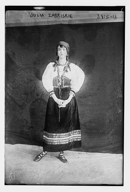 Source: http://www.loc.gov/pictures/resource/ggbain.21465/ 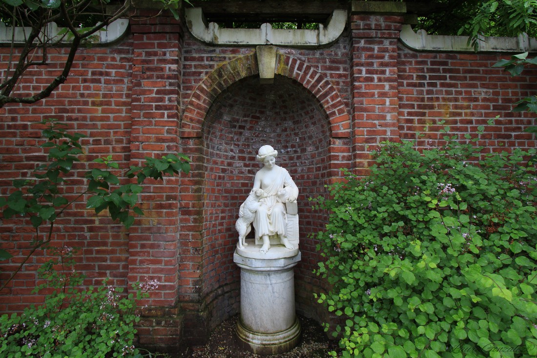 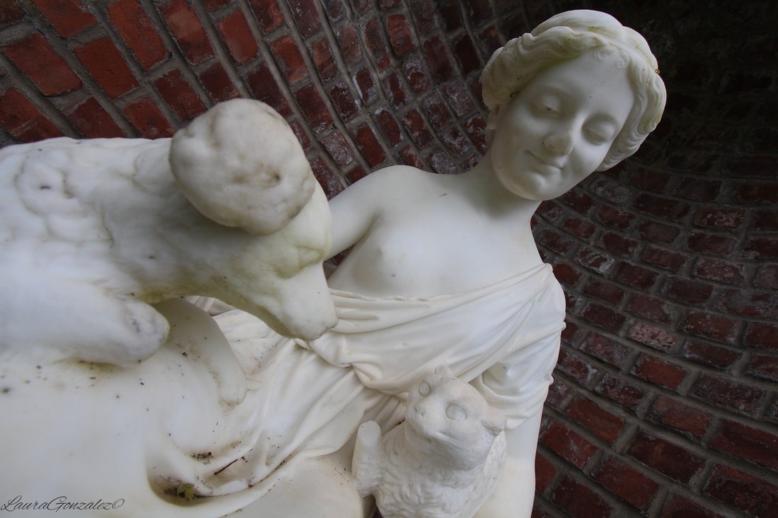 Today the grounds can be visited and the Mansion and Grounds are considered outstanding examples of the Country Place Era residences of the Hudson Valley’s social and political elite. Further Reading:
https://familysearch.org/photos/artifacts/10535956 http://www.loc.gov/pictures/resource/ggbain.21465/ Recently, I headed back to Long Island to the shore of the Huntington Harbor to visit a 40 room, 30,000-square-foot medieval French château with cone-shaped roofs built for pharmaceutical magnate George McKesson Brown in 1912.  "Founded as Olcott & McKesson by Charles Olcott and John McKesson in New York City in 1833, the business began as an importer and wholesaler of botanical drugs. In 1853, the name was changed following the death of Olcott and the joining of a new partner, , Daniel Robbins. Today the company is one of the largest in the United States and is a leader in pharmaceutical distribution and healthcare IT. McKesson's descendants also hold a large portion of shares in the company." Wikipedia  Designed by architect Clarence Luce, the estate was originally called West Neck Farms, and was modeled after a chateau in the south of France. The French Chateau style is a mix of late French Gothic and Renaissance Revival style design elements, which was popular in the early twentieth century. Despite having the title as one of the original Gold Coast Mansions with extensive land at 33 acres today, Coindre Hall once boasted fifty-four acres. Brown used it as his summer home for him and his wife Pearl. The estate would operate year round as a farm. 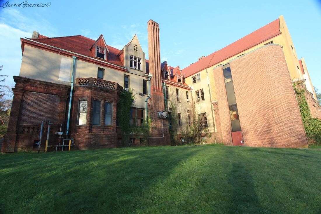 During World War 1, the estate became Brown’s year-round home. 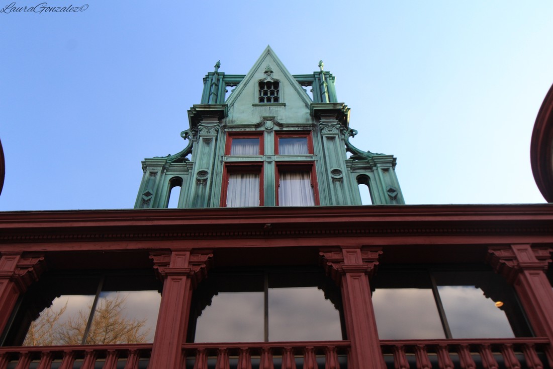 With the stock market crash and the Great Depression, Brown lost ownership after his finances began to suffer. 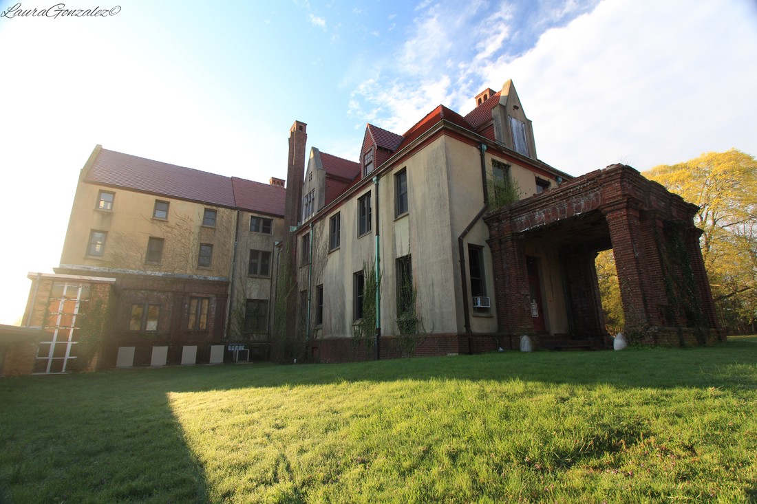 The home was put on the market and the Brown’s moved into the Gate House which still exists today and is located next door .  The Brothers of the Sacred Heart purchased the estate and renamed it Coindre Hall, in honor of the founder, André Coindre, and operated the property as a boarding school. 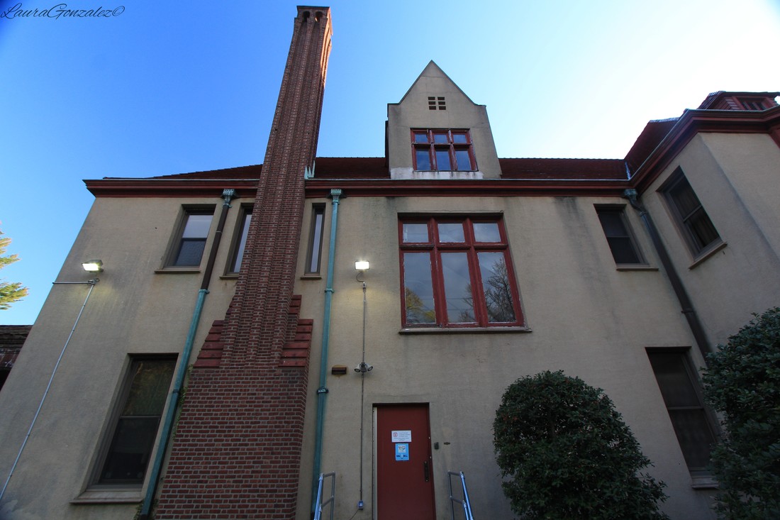 Father André Coindre was born February 26, 1787 in Lyon, France and died May 30, 1826 in Blois, France. Father André Coindre was founder of the Fratres a Sacratissimo Corde Iesu (Brothers of the Sacred Heart), a Roman Catholic religious order primarily devoted to high school and elementary school education; the brotherhood is also a missionary society. The Brothers of the Sacred Heart named a boarding school Coindre Hall in honor of the order's founder. The school operated in Huntington, New York from 1939 to 1971. he was the founder of the Brothers of The Sacred Heart, who re-founded St Columba's College in St Albans 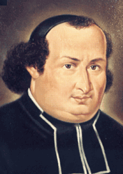 Citing bankruptcy, the school closed in 1971. The estate sat abandoned for a decade, before given life again with the signing of a lease to the Eagle Hill School, which was a private coeducational boarding school for students with learning disabilities from 1982-1990. 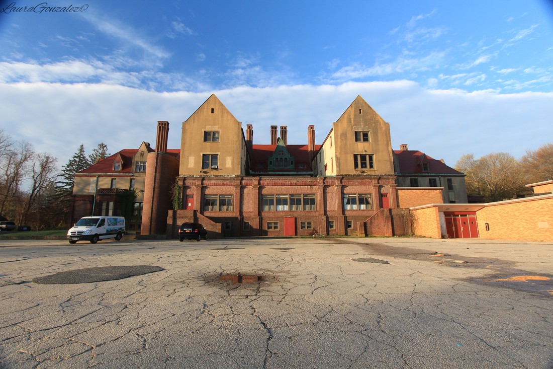 By 1991, the Alliance for the Preservation of Coindre Hall Park was organized to preserve, protect and restore this property. In 1995, the mansion was officially designated “The Museum of Long Island’s Gold Coast”. Today the estate offers tours and is one of only estates in the Gold Coast area that still has a large amount of acreage.
Built by the infamous Grosvenor Atterbury in 1917 for Lousine Peters and her husband, Harold Weekes, is Wereholme, a 28 room mansion on the South Shore of Long Island which was inspired by a French chateau of the same name. 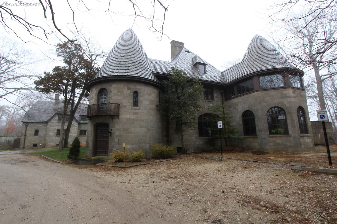 Atterbury is known for his work with weekend houses for wealthy industrialists. Born in Detroit, MI in 1869, educated at Yale University, he would go to work in the offices of McKim, Mead & White. He is known as the mastermind of the well to do neighborhood of Forest Hills in Queens New York. 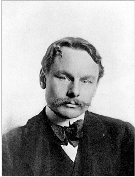 Grosvenor Atterbury; Source: New York Times In the early part of the 20th century, the estate was part of a 300-acre "gentleman's farm", called "Windholme Farm", which was owned by Samuel and Adaline Peters. Mr. Peters was a coal broker who, with his partner Richard Williams, founded Williams and Peters coal brokers. In 1880, he purchased 300 hundred acres of waterfront property on the Great South Bay on Long Island’s Gold Coast. The estate had pigs, chickens, and cows, a private fishing camp, a stable of polo ponies, a kennel of top-notch Foxhounds and Gundogs, and spectacular formal gardens. He spent his summers with his family boating and fishing on the Great South Bay. Mr Peters died of heart disease at his home in Islip, NY, after a long illness, at the age of 67. 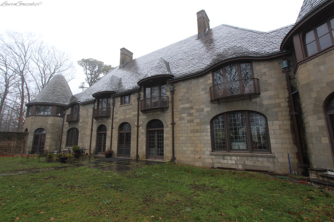 The property would soon be divided by South Bay Avenue and each side was given to one of their two children, Harry and Lousine. Harry took 200 acres to the east and Lousine the 70 acres to the west. Harry was very much like his father and inherited his father’s interests all the way from fine art to coal. He was also a partner in William and Peters. His kennels, the Windholme Kennel, played a starring role in Greyhounds. 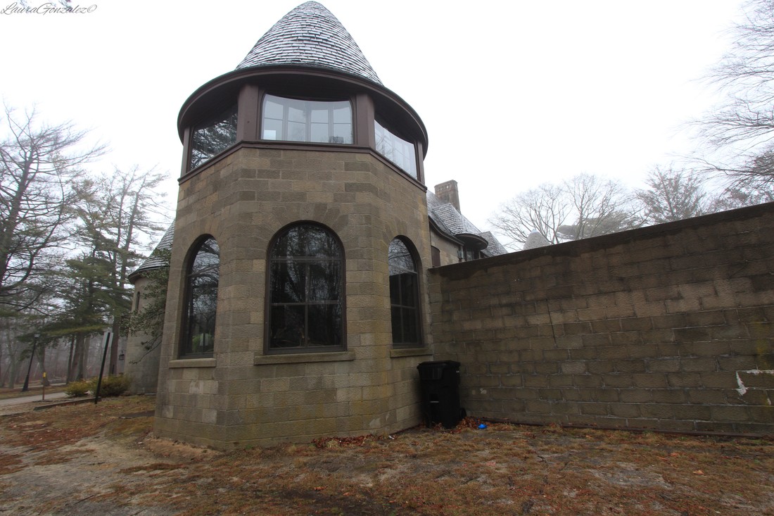 Peters was an avid sportsman, with a passion for hunting, horses, and dogs. In 1925 he became Co-Master of Foxhounds of the Meadow Brooke Hunt in Long Island, New York, a position he held into the 1940s. He was a member of the Westminster Kennel Club and often served as an exhibitor and judge at dog shows. He gave a lecture “Sport in Art through the Ages,” at the Metropolitan Museum of Art in (circa 1937-1940), and began drafting a full length work on the same topic that was never published. In 1935 he authored Just Hunting, which provides personal and historical perspectives on the subject with illustrations by Betty Babcock. Peters was an active member of the Grolier Club, American Antiquarian Society, and New-York Historical Society. He also participated in home defense activities, serving as a member of the Fuel Administration during World War I, and as Civilian Defense Director for Suffolk County during World War II. Peters retired from the coal business in 1945. He died in 1948 at age 66, survived by his wife Natalie (née Wells), his daughter Natalie Peters Webster, and his son Harry T. Peters, Jr. Source: Museum of the City of New York 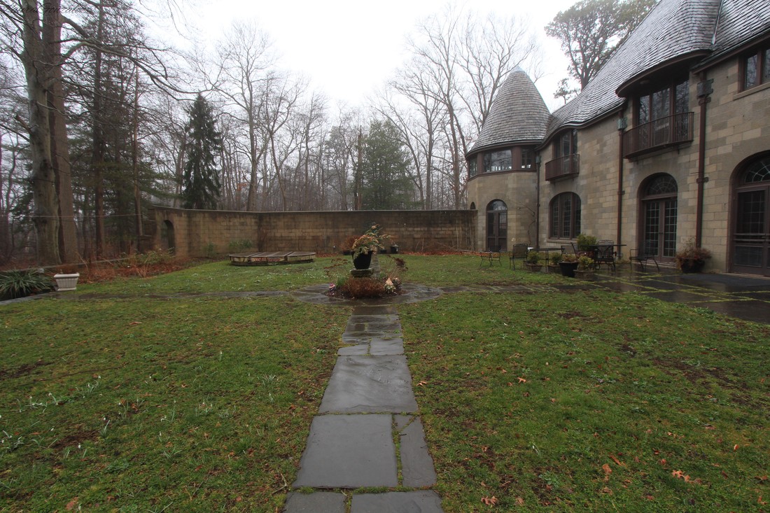 In 1917, Atterbury built the estate, which would become known as the Scully Estate or Wereholme. Louisine Peters only daughter Hathaway, also known as”Happy”, would inherit the property . 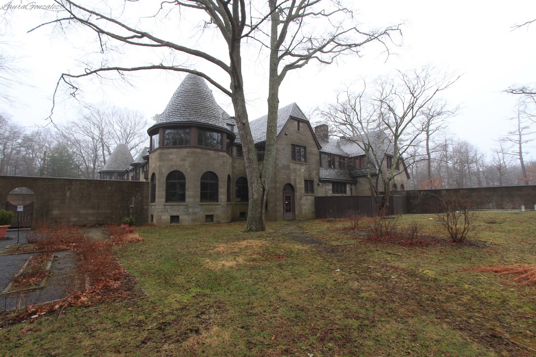 Although married several times, she produced no heirs of her own and by 1960 became committed to donating her property to the National Audubon Society. She said it was her "wish that the property be used as a wildlife sanctuary and nature center." 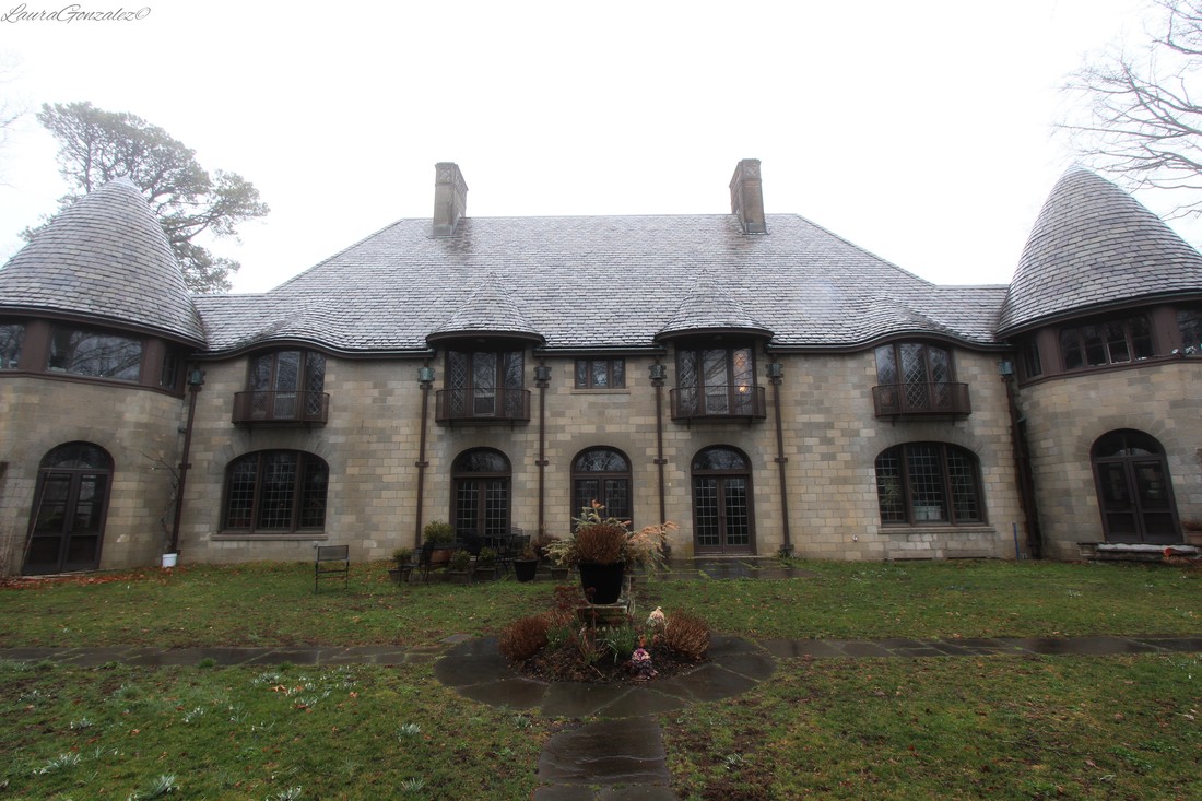 Across the street Natalie Peters Webster, Happy's first cousin, who had inherited the property, decided to do the same as she also had no heirs. Together the properties formed the Seatuck National Wildlife Refuge. Natalie's husband, Charles Webster, would later found the Seatuck Environmental Association to conduct education and research on the property. Upon her death in the 1980’s, the named was changed to the "Scully Sanctuary" and became the home of the Living Oceans Campaign. 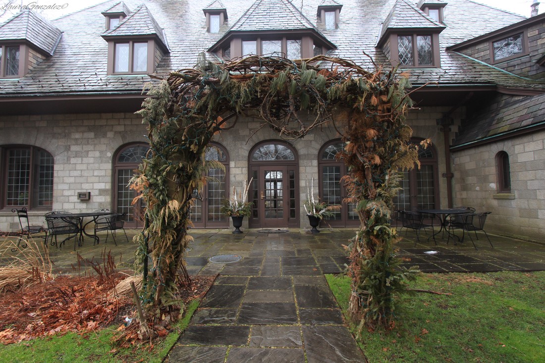  In June 2004, Suffolk County purchased the property and opened it to the public in April of 2010 as the Suffolk County Environmental Center.
On the Hudson River, north of Newburgh in Orange County, are a handful of homes and a church, all that remains of the forgotten brick making company town of Roseton which has almost been completely wiped off the map with the construction of generating stations. 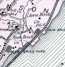 H. A. Mueller in 1903 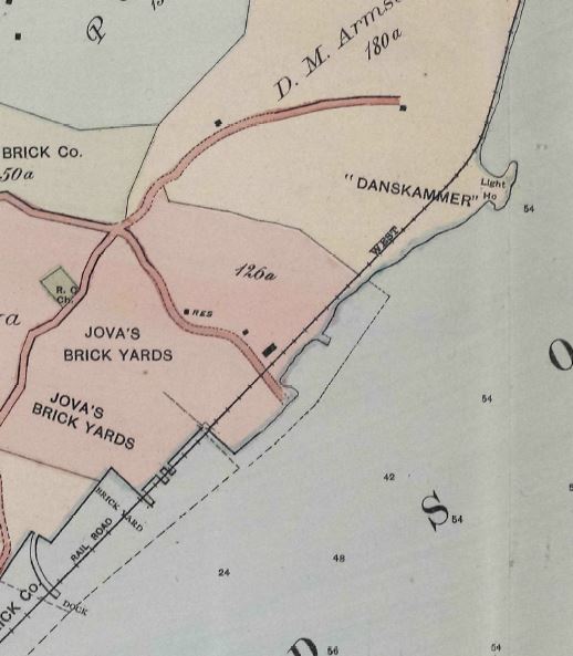 1891 Beers Born at Esopus, Ulster County, NY, John C. Rose would soon grow up and move to Haverstraw, New York and begin his venture into the brick making business with his brother, Hilend Rose. After selling out his half and traveling in Europe in order to combat bad health, he returned to NY and purchased three hundred acres of land and a Hudson River mansion once owned by Bancroft Davis, president of Newburgh and New York Railway Company. The area was known for its rich deposits of clay along the banks of the river and the transportation options of the great waterway made for a perfect business location to ship to nearby cities such as New York City. The clay bank at the Rose Site was 180 feet thick! He demolished the mansion and in its place, erected a brick yard which would have sixteen brick machines with a capacity of twenty-four thousand bricks per day, per each machine. The natural color of the clay is blue-grey and the firing turns it red because of the clay’s natural iron content. Wages back then for the brick industry were between $1.50-$2.00 a day for skilled and $1.00-$1.40 per day for unskilled with days consisting of 10 to 14 hours.  Source: Clay Record 1909 More and more workers began commuting to the area from surrounding towns and others began settling closeby to fill the positions at the brickyards, which the need for employees was growing as the business took off. 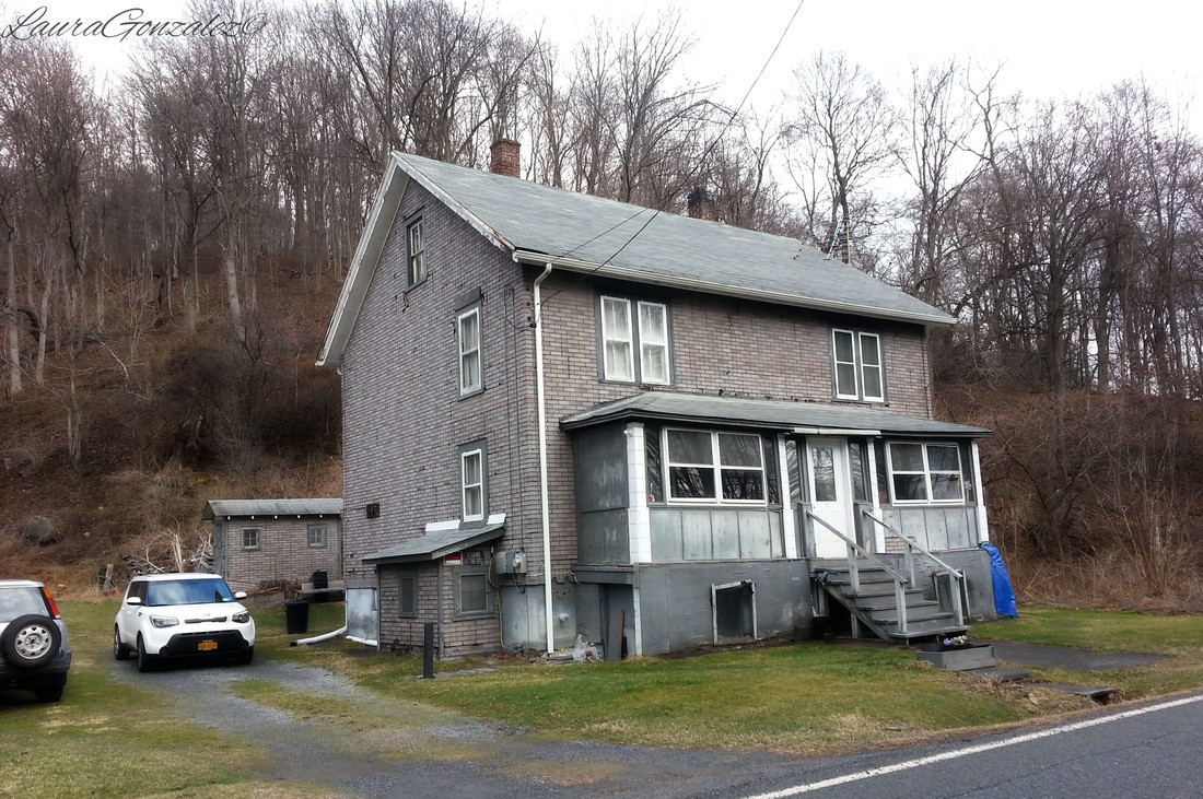 I wonder if this was once part of the company housing The need for housing became apparent, so the Rose Brick Co. built a company town and named it Roseton, complete with housing for workers, a grocery store, a school, post office and even an entertainment facility, known as Roseton Hall. Most of the buildings were of a rose hue. They knew that happy, skilled and rested workers (due to the housings proximity to the yards) would be the hardest workers and the best brickmakers. A section of housing near the brickyards was known as “The Hollow” by the workers and a road leading to the school was known as “Soap Hill”. At its peak, the company employed over 1000 workers. 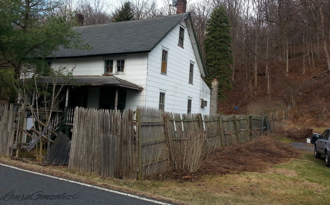 Or possibly this one? Along River Road is a home I recognized from a book on the history of Roseton. It's the home of the Rose Brick Company's assistant superintendent and later the home for the Roses household workers. 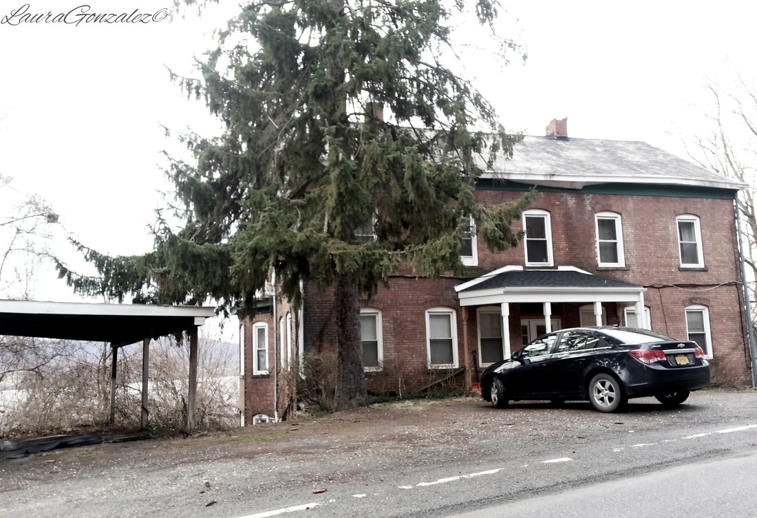 Home of the Rose Brick Company's assistant superintendent One of his four sons, John Bailey Rose, succeeded as the company’s president and turned the family company into an international empire. At its peak, the Rose Brick Company sold 400 million brick a year worldwide. The finished product was considered superior in building material and a prime choice for architects. Many were shipped downriver to New York City and a number of commercial structures in NYC still standing have the brick under its facade. 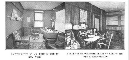 Bulletin, Volume 6 By Building Trades Employers' Association John C. Rose introduced the above deck shipping method that made it possible to carry as many as 600,000 brick in a single load. In 1908, John Bailey Rose built a 3-mile long electric railway with 50 cars, each with a carrying capacity of 15 tons to transport the clay to the brickmaking machines. 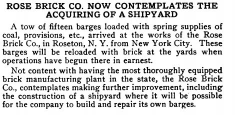 Clay Record, Volumes 35-36 1909-1910 Here's a lil clip on a biography of John Bailey Rose: 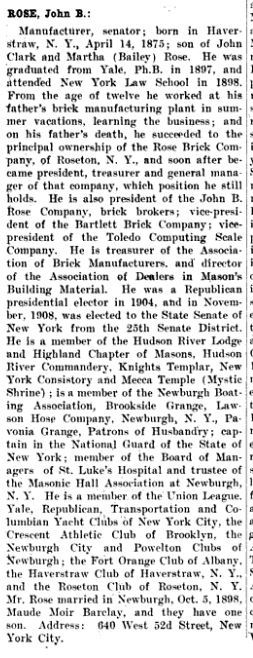 Source:Men and Women of America: A Biographical Dictionary of Contemporaries Not too far from the Rose brickyards, a sugar dealer from Cuba, Juan Jacinto Jova, had purchased the Danskammer mansion from the Armstrong family who ran the ARROW Brick Co., for his family, as a summer retreat. After seeing the success of his neighbors and a failed attempt to raise sugar cane, he tore the mansion down and began digging into the vast quantities of clay beneath it. He began employing many of the Irish and Hungarian Catholics in the area. His bricks are known for the initials J.J.J. inscribed on them. 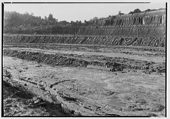 Jova Brick Works Clay bank; Library of Congress Prints and Photographs Division Washington, D.C. 20540 USA 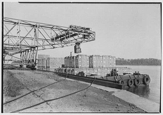 Jova Brick Works, Roseton, New York. Barge; Library Of Congress Juan Jacinta Jova was a devout Catholic and in 1891 the rustic style, Our Lady of Mercy was presented by the Jovas as a gift to the Archdiocese of New York and the brick workers of Roseton. The style is that of Hungarian-Slavonic churches. Many who attend the church come from families who have worshiped at the chapel since it first opened its doors. 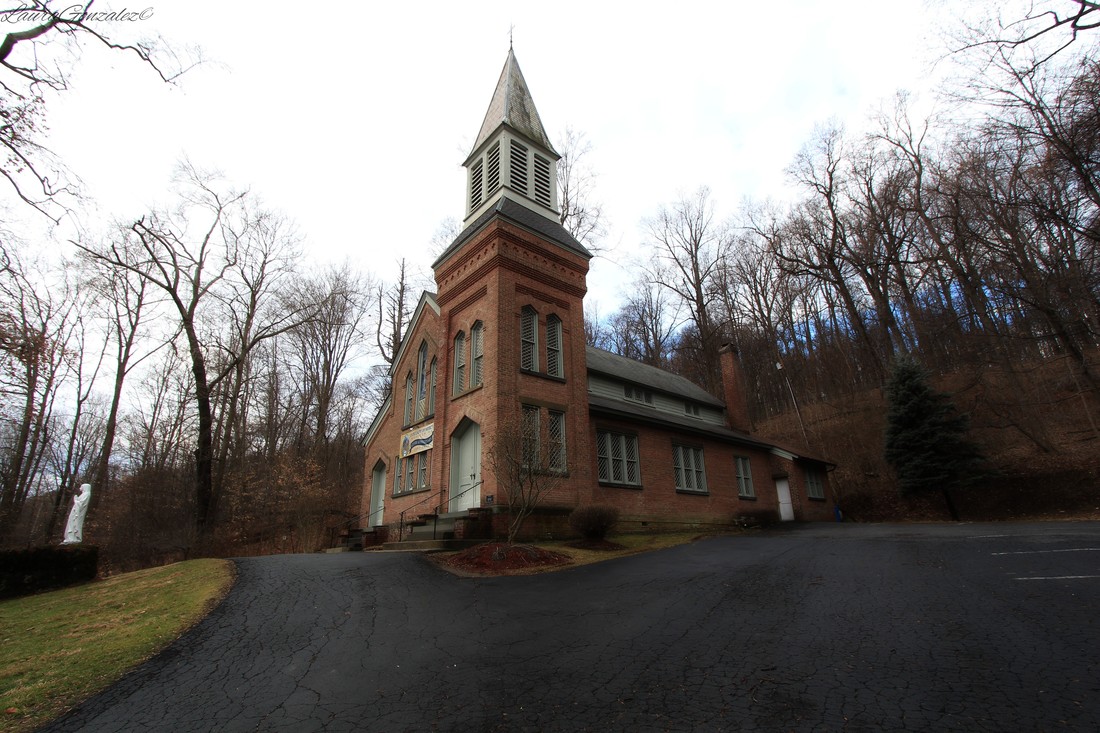 Our Lady of Mercy Soon homes using wood instead of brick were preferred and the brickyards eventually shut down.  American bankruptcy reports, Volume 47 In the 1930s, Central Hudson Gas & Electric Company purchased the land and the homes on River Road, and demolished most of the once thriving community and erected power generating stations on the brickyard sites.  Today one can get a glimpse of what the mansion at Danskammer looked like by visiting the Storm king Art center in Mountainville, as five of the columns are incorporated into the landscape.  |
ABOUT THE AUTHORLaura Gonzalez is a photographer, blogger and historian currently residing in Newark, New Jersey. Archives
April 2021
Categories
All
|
 RSS Feed
