|
Mount Holly is one of the oldest settlements in South Jersey. It found its beginning around 1677 when a gentleman by the name of Walter Reeves settled along the Rancocas. The geography of Mount Holly contributed to its growth through the almost three hundred years since its first settlement. The early town was located in the bottom of a valley on a winding creek which provided power for the early industries. An adjacent hill or mound gave the town a unique position along with its surrounding flat plains that were fine agricultural lands prior to suburbanization. 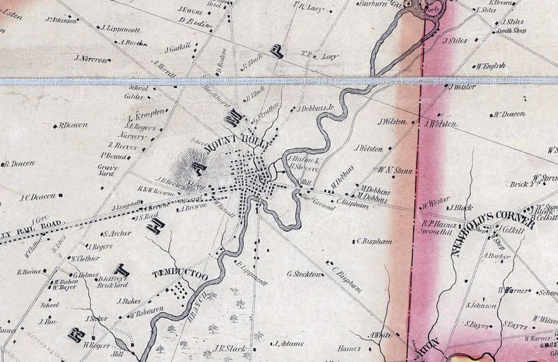 Mount Holly 1849 The commerce of Mount Holly grew from a center to which early settlers brought their produce, grain, lumber, and wool to be turned into items which were useful on their homesteads or were sold or traded for goods they were unable to produce. In time an important economy developed; farm goods were delivered for local resale and export; and manufactured items were imported for resale in local commercial houses. Among the early enterprises were the 1723 "Three Tuns Tavern," a tailor shop belonging to John Woolman, Quaker minister, a store belonging to Stephen Girard, Philadelphia financier. The Farmer's Bank organized in 1814 and is the second oldest bank in New Jersey. Two early newspapers of the community were the "Mount Holly Mirror," established in 1818, and the "Mount Holly Herald," in 1826. 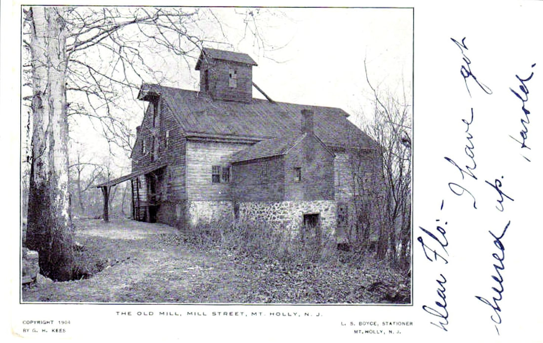 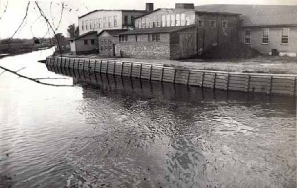 Mount Holly - Rancocas Creek and mill buildings Industry began with the 1720 sawmill, a grist mill in 1723, and an iron works and a fulling mill in 1730. Later industries were a paper mill, plush mill, tapestry will, dye mill, thread mill, carriage factory, and a turbine foundry. Mount Holly supplies some of the labor for the H.B. Smith Machine Company at Smithville, via the Bicycle Railway which ran from Mount Holly to Smithville. Transportation facilities had a definite influence on the growth of Mount Holly. The town, situated on the Rancocas Creek (North Branch), offered the advantage of an open waterway to the Delaware River. This made possible the exchange of commodities with the port of Philadelphia. In 1759 a stage wagon ran from Cooper's Ferry (Camden) to Mount Holly and on across the state to Middletown. The early roads began as bridle paths traveled by settlers on their way to Philadelphia, Burlington, Springfield, and the iron works, and later became streets in the growing town. By 1833 passengers could travel by stage to Burlington and board a boat for Philadelphia or a train to South Amboy. In 1849 train service was possible between Burlington and Mount Holly and in 1867 regular train service was established between Camden and Mount Holly. It is reported that in the busy season more than fifty trains a day stopped at the Mount Holly station. 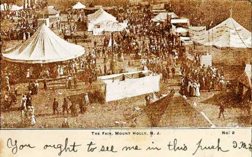 westjerseyhistory.org In 1847, the Burlington County Agricultural Society started the Mount Holly Fair. In 1856, the fairgrounds were built on Route 541 at Woodpecker Lane, what is now the Fairgrounds Plaza in Mount Holly. It featured a grandstand, exhibition buildings and a half-mile racetrack. It was considered the premier fairgrounds on the East Coast, attracting thousands of visitors each year. In 1870, a two-tier grandstand -- the largest in the eastern United States at the time -- was erected and the fair became a popular destination for thousands. It was even visited by presidents and vice presidents, according to the booklet. The fair was discontinued in 1926. It eventually found a new home on the Village Green in Lumberton. It would remain in Lumberton for 53 years, until moving to the then newly created Burlington County Fairgrounds in 2011. 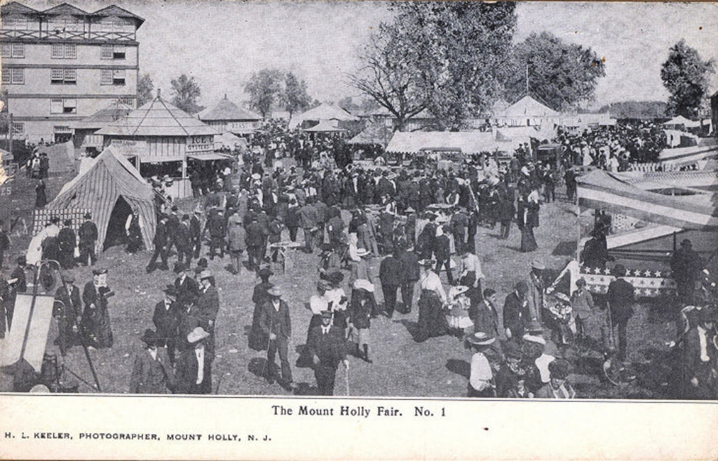 westjerseyhistory.org 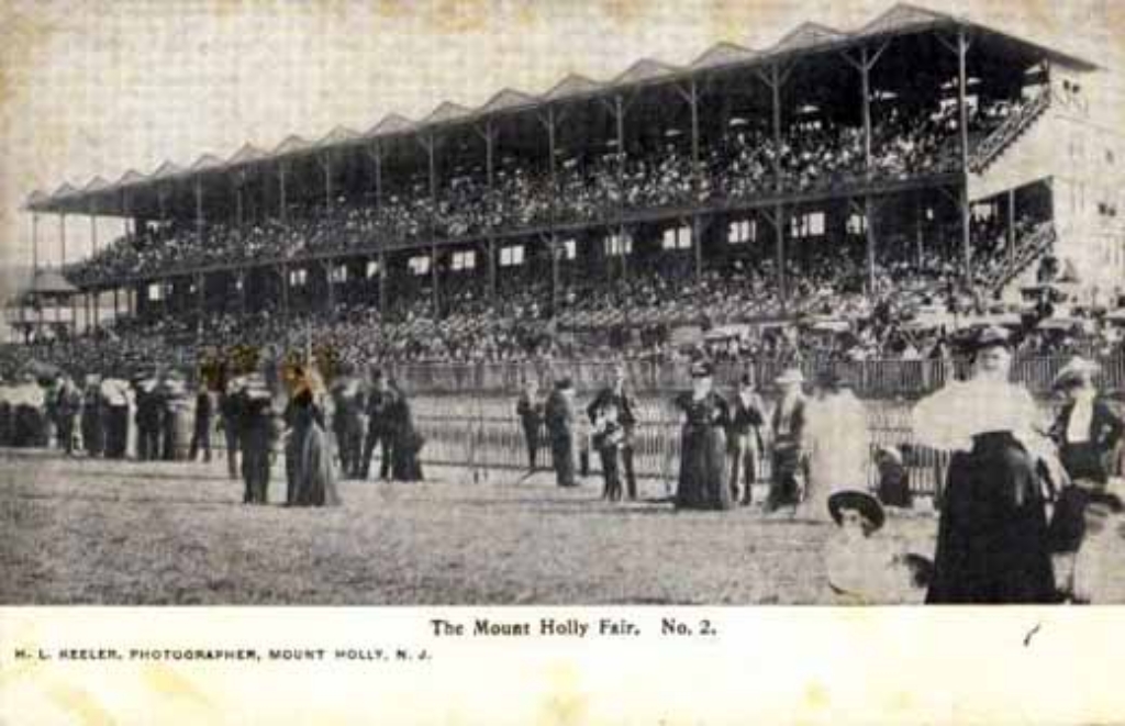 westjerseyhistory.org On September 13, 1892, the Mount Holly and Smithville Bicycle Railroad opened. It was developed by Arthur E. Hotchkiss. In 1892, Arthur Hotchkiss received a patent for a bicycle railroad and contracted with the H. B. Smith Machine Company to manufacture it. The purpose of the railway was to transport Smith Company employees from Mount Holly, via bicycles specifically designed to glide, similar to a monorail, to Smithville . The initial track ran 1.8 miles from Smithville, in a nearly straight line, crossing the Rancocas Creek 10 times, and arrived at Pine Street, Mount Holly. It was completed in time for the Mount Holly Fair in September, 1892, and the purpose of the railway was supposed to have been enabling employees to commute quickly from Mount Holly to the factory at Smithville. Monthly commuter tickets cost $2.00 (equivalent to $57 today). The record speed on the railway was 4.5 minutes , and the average trip took 6–7 minutes. The railway was exhibited at the World's Columbian Exposition in 1893. It only had one track so that it was impossible to pass another rider, and if riders travelling in opposite directions met, one had to pull off onto a siding. By 1897 ridership had declined, and the railway fell into disrepair. 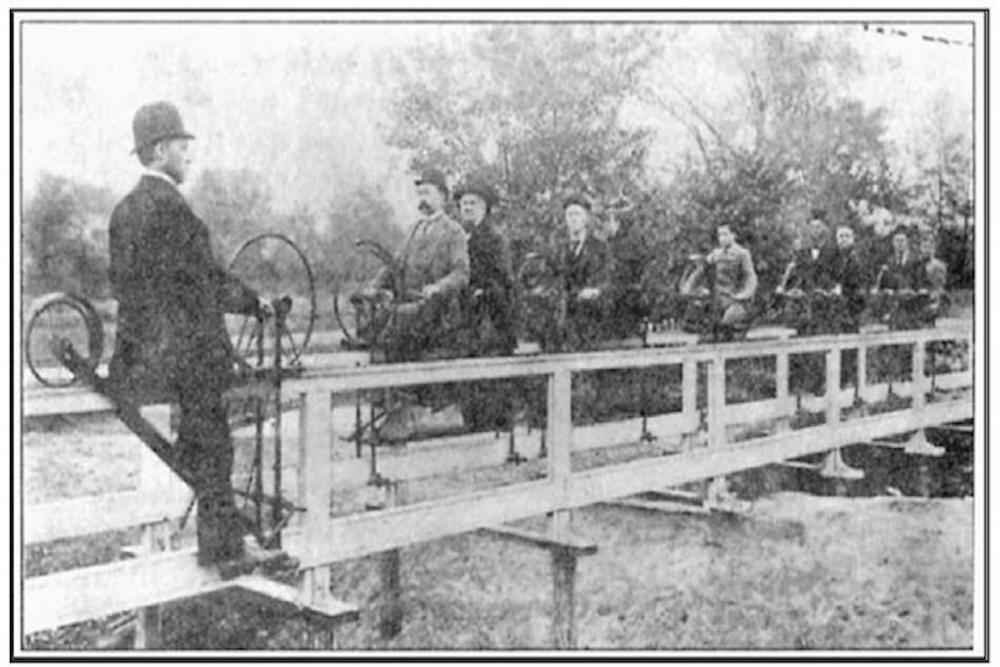 www.veloramaroute.nl  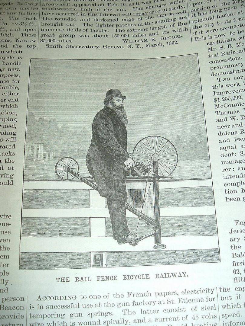 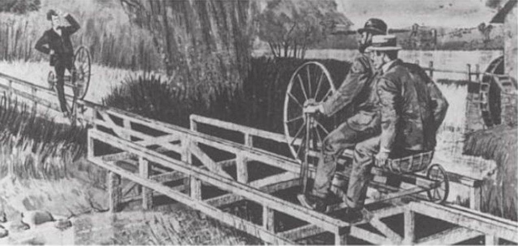 The Burlington & Mount Holly Railroad and Transportation Company, was incorporated in 1836. The railroad ran 7.2 track miles from Burlington, New Jersey to Mount Holly Township, New Jersey. July 4, 1863 Burlington & Mount Holly Railroad & Transportation Company renamed Burlington County Railroad Company. In 1895, the Pennsylvania Railroad used the Burlington & Mount Holly tracks to experiment with 500 volt DC trolley wire; trolley pole electric operation, with two motor passenger cars built by Jackson and Sharp Company at Wilmington, Del. This service was discontinued on October 29, 1901, after the electrical powerhouse in Mount Holly burned. In April 1902, PRR orders demolition of Mount Holly power house and ends experiment of electric trolley operation between Burlington and Mount Holly. This line was the first electrified PRR branch in New Jersey. The Burlington & Mount Holly line was abandoned by the PRR in 1927. County Route 541 in Burlington County is on and or follows the Burlington & Mount Holly Railroad and Transportation Company's right of way.  https://www.sjrail.com/wiki/index.php?title=Burlington_&_Mount_Holly_Railroad_and_Transportation_Company Speaking of rails in Mount Holly, I recently had an opportunity to check out the Mount Holly Rail Trail which is located in Creek Island Park. 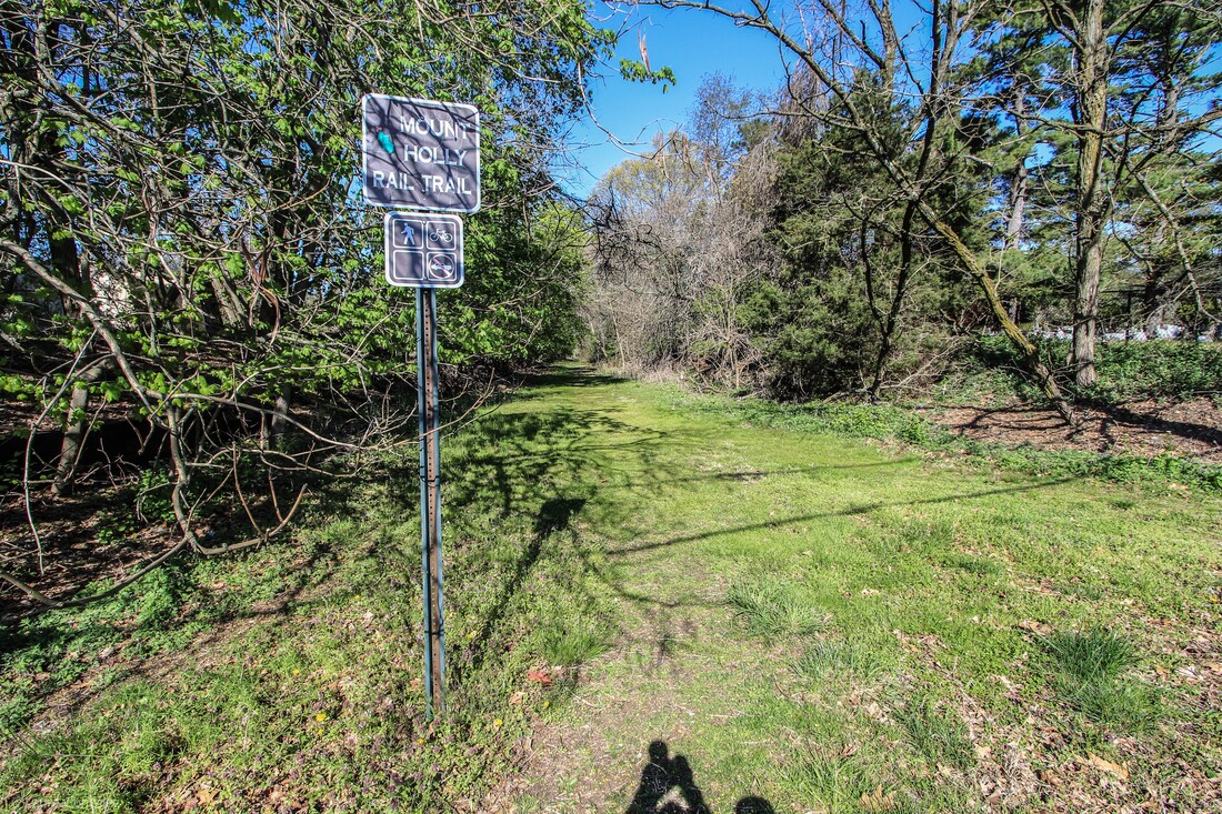 Mount Holly Rail Trail 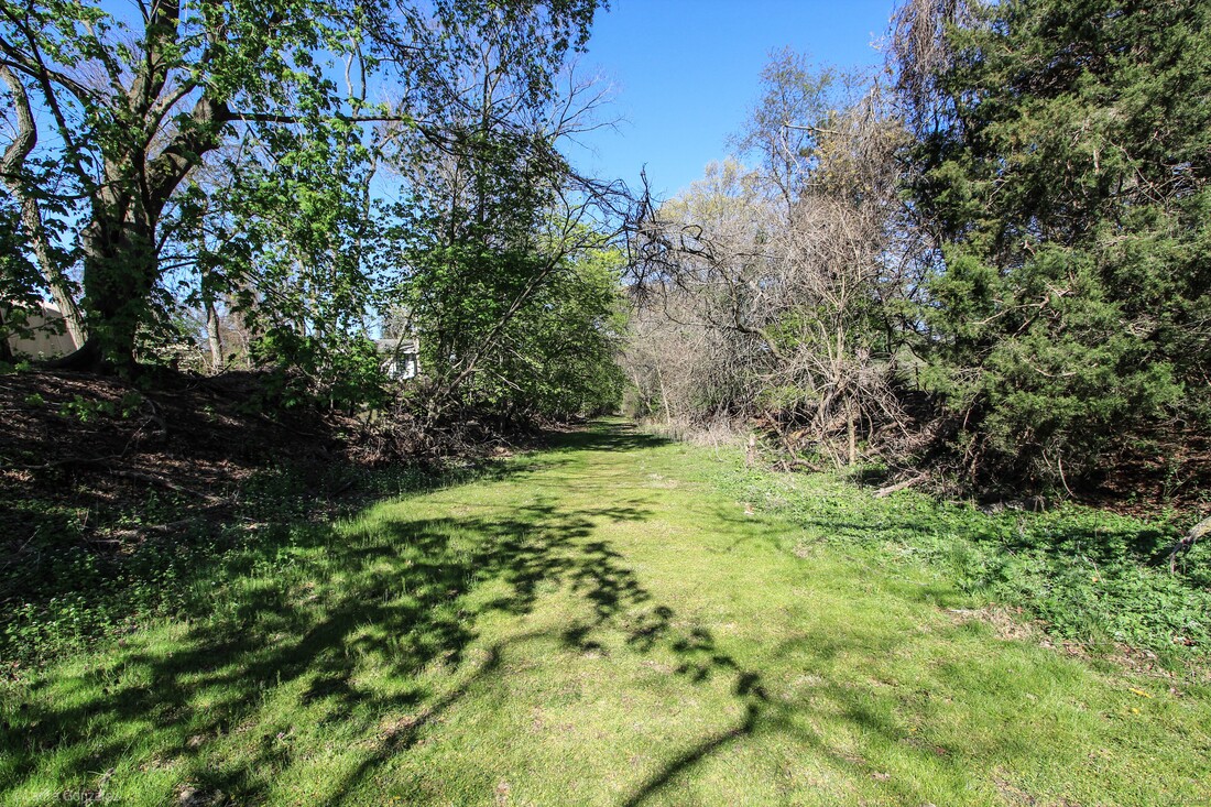 Mount Holly Rail Trail 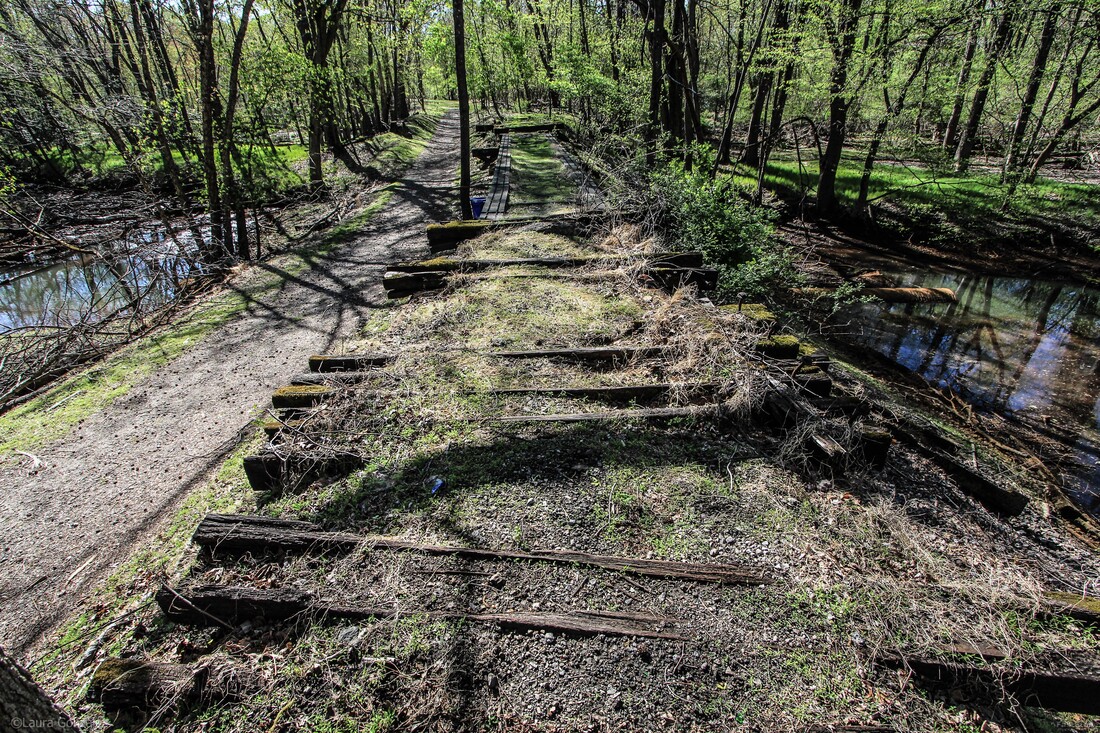 Mount Holly Rail Trail 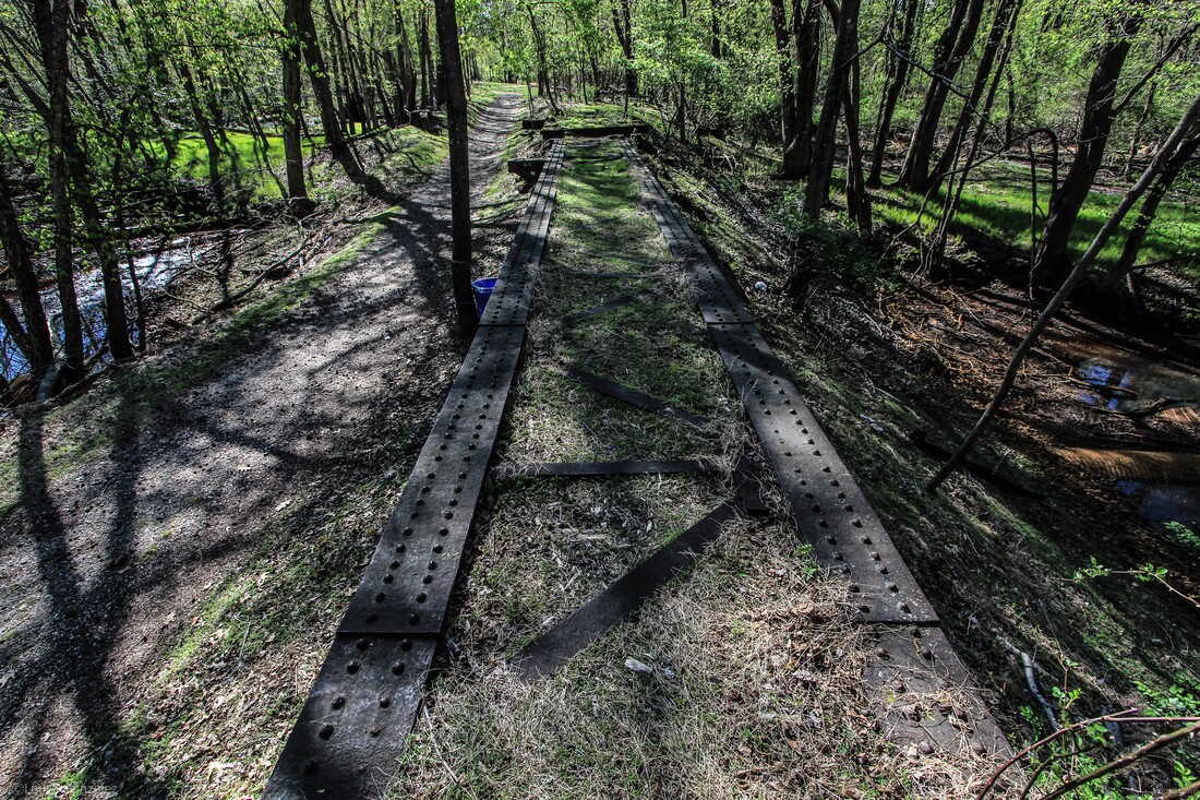 Mount Holly Rail Trail Trailheads at Madison Ave. This hike isn’t very long, about 1/2 mile. There is plenty of interesting stuff to see at this trailhead. 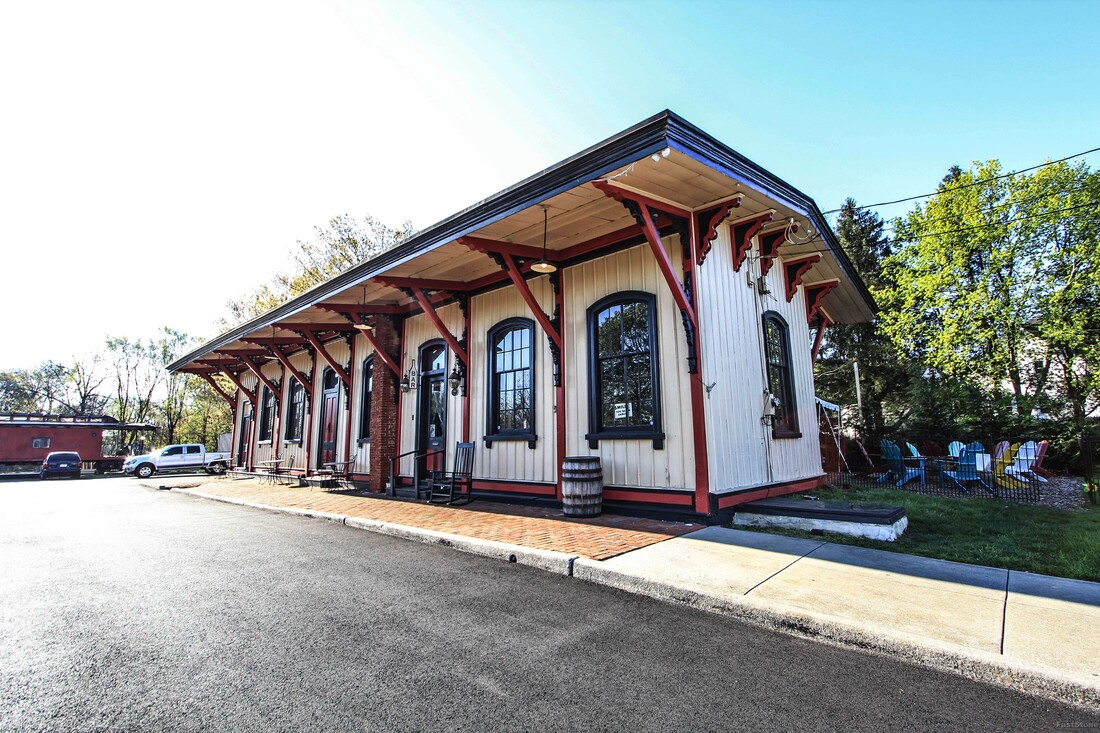 Train Wreck Distillery 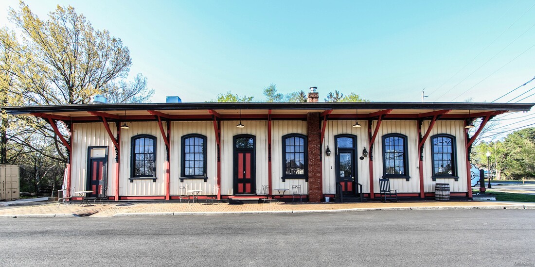 Train Wreck Distillery 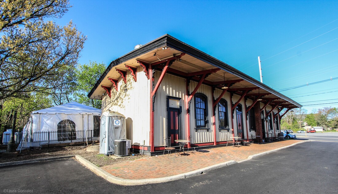 Train Wreck Distillery 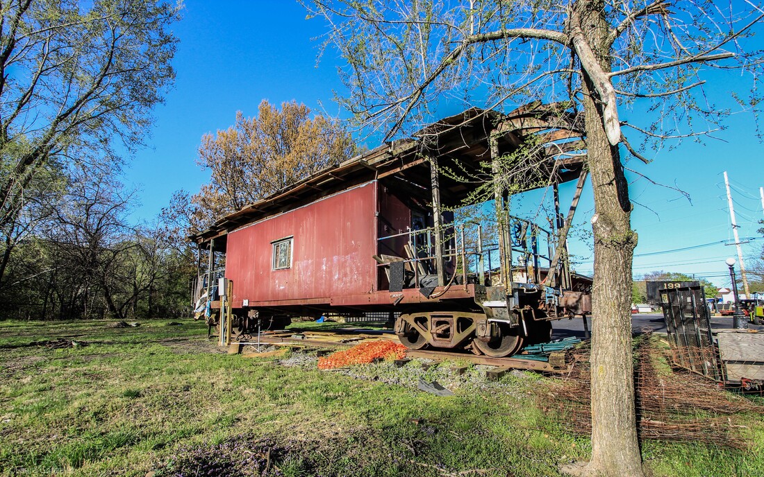 Trailheads at Madison Ave 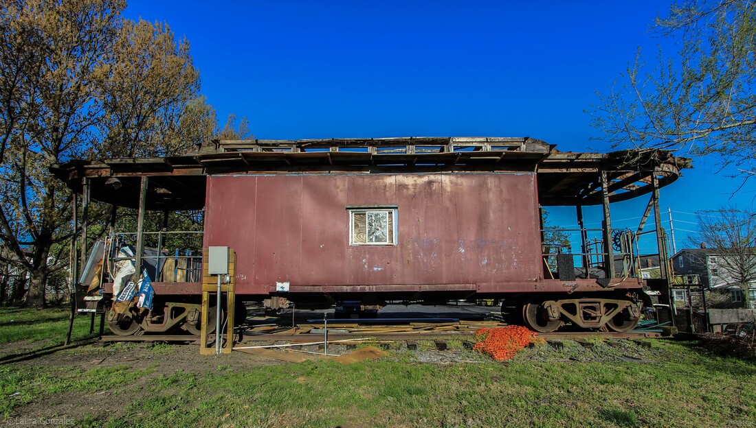 Trailheads at Madison Ave 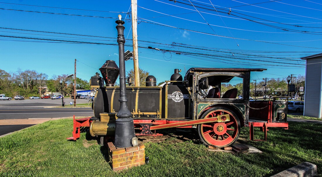 Trailheads at Madison Ave 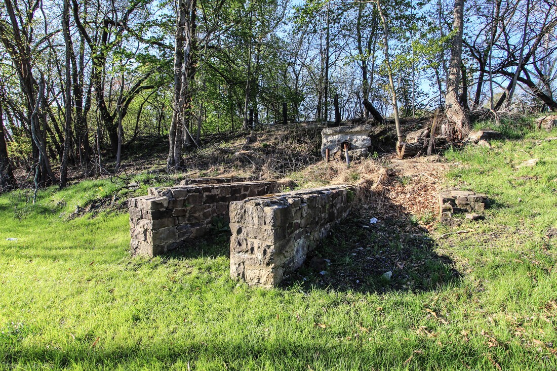 Trailheads at Madison Ave 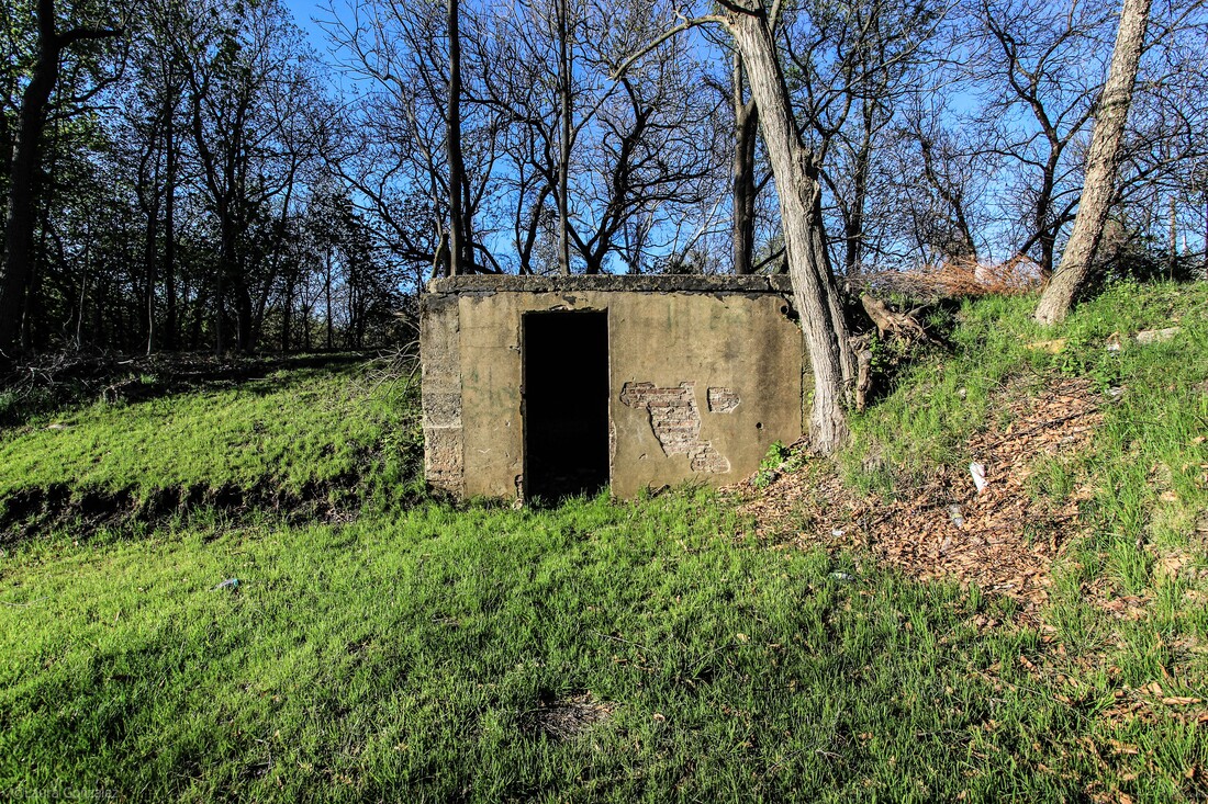 Trailheads at Madison Ave 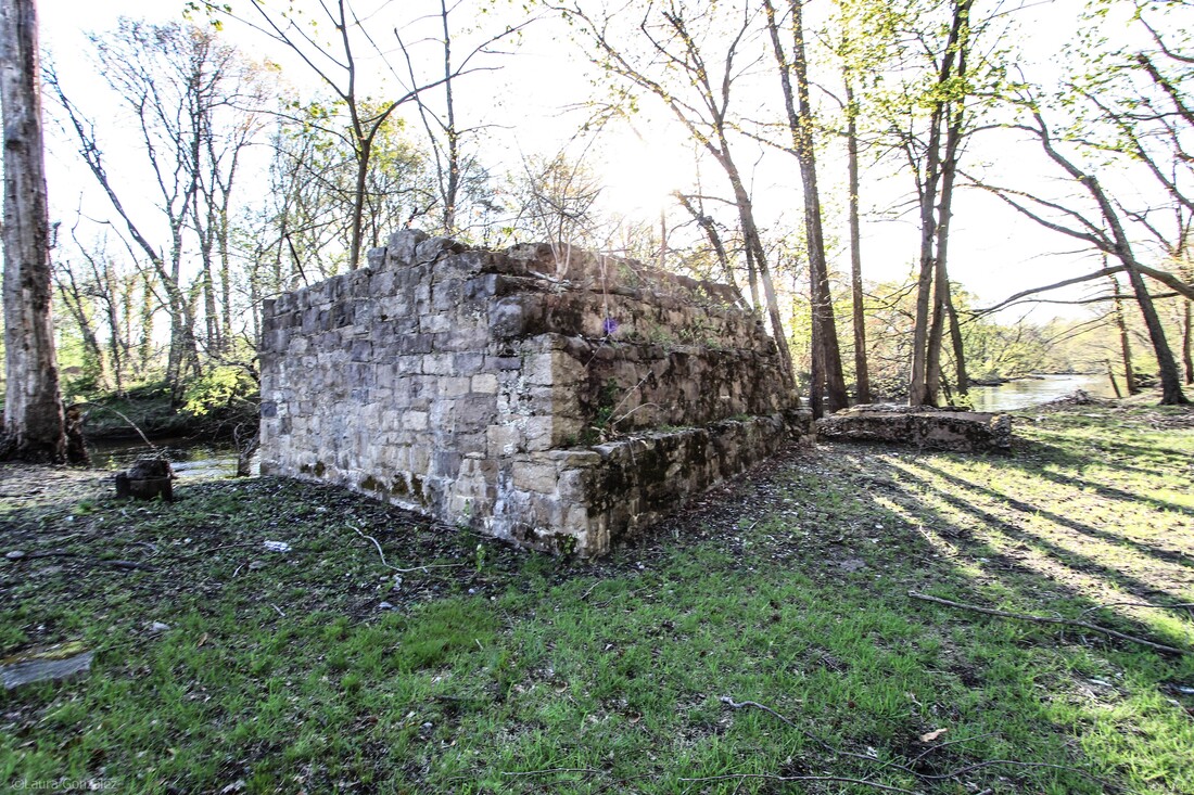 Trailheads at Madison Ave After a nice hike on the rail trail, I decided to check out the sights of Mount Holly. 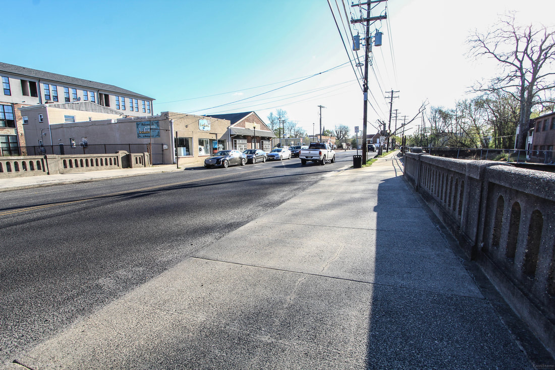 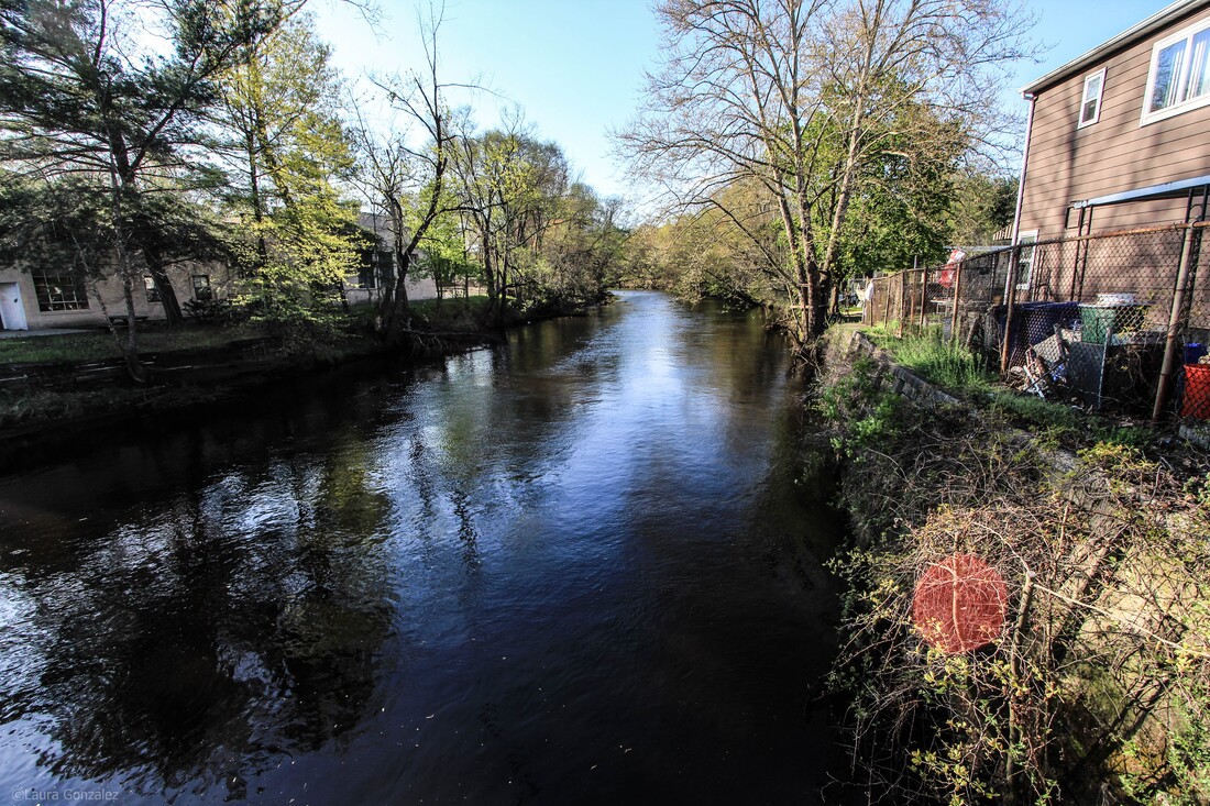 North Branch Rancocas Creek 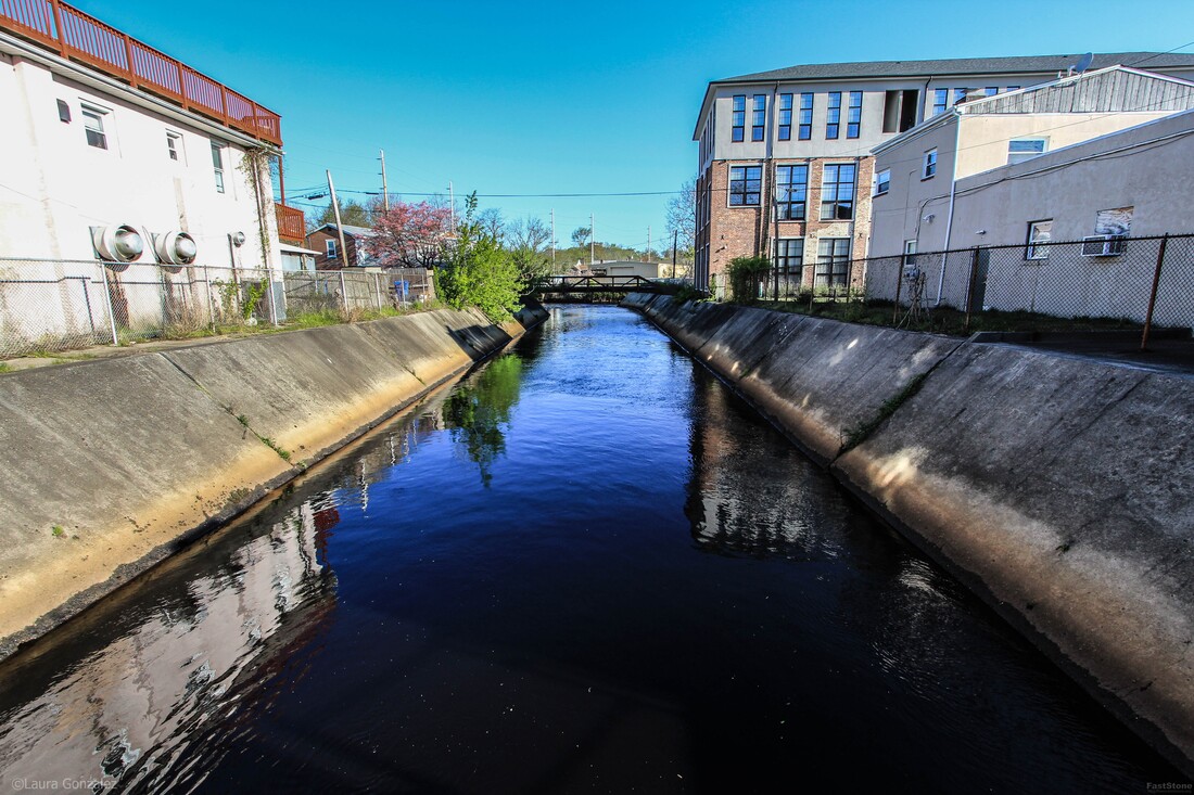 North Branch Rancocas Creek 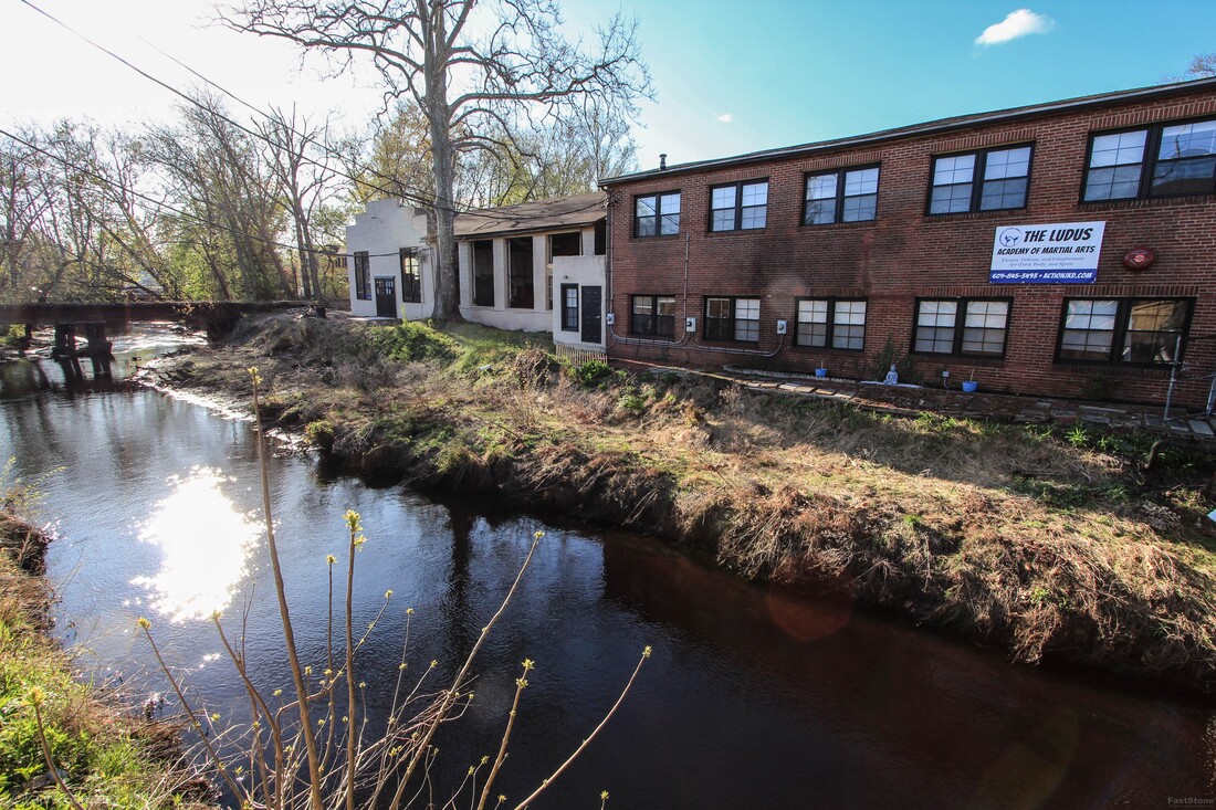 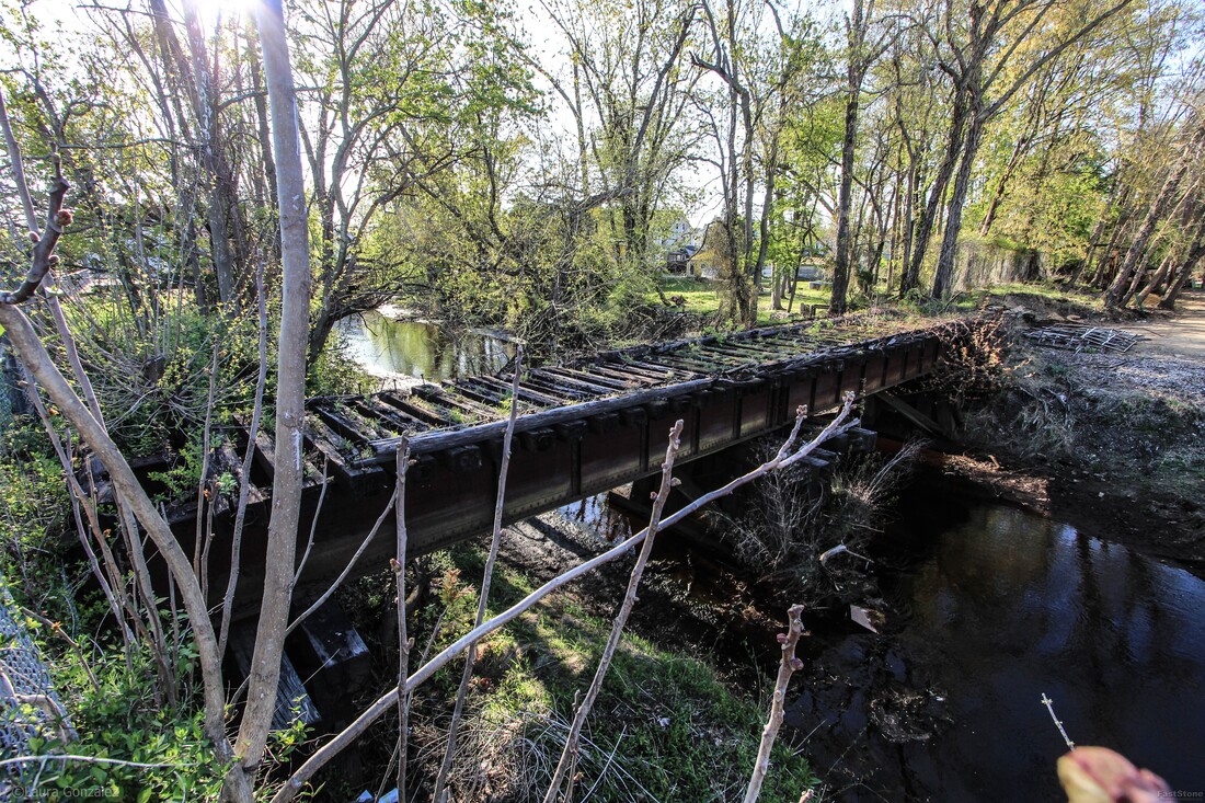 Bridge Ruins  Mount Holly Homes 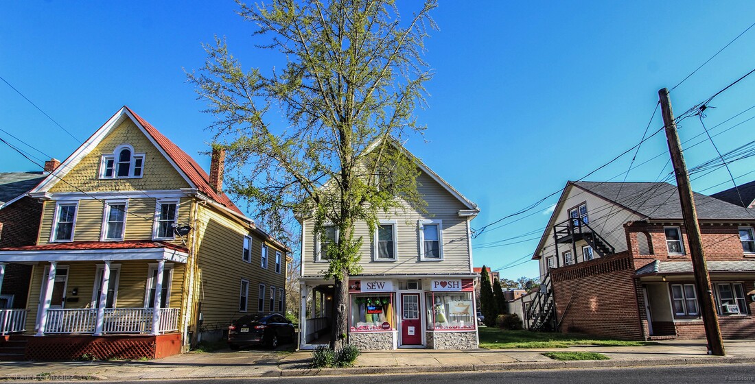 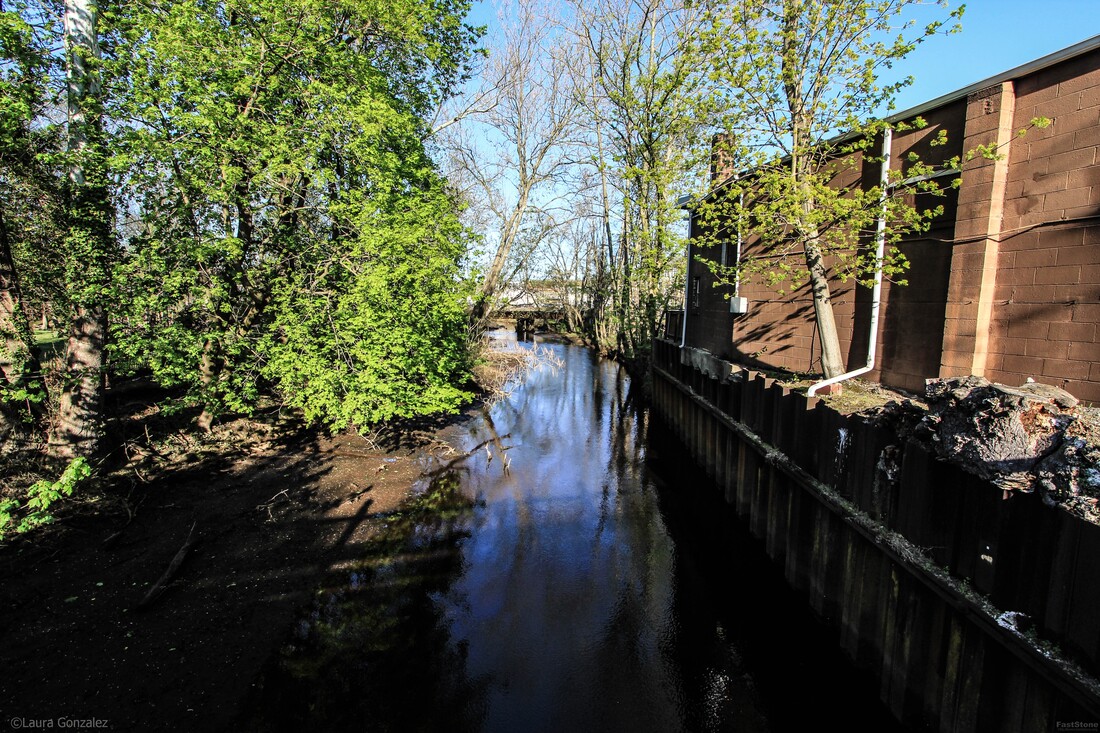 North Branch Rancocas Creek "The North Branch Rancocas Creek is a 31-mile-long tributary of Rancocas Creek in southwestern New Jersey. The creek starts in the Pine Barrens of Brendan T. Byrne State Forest and Fort Dix Military Reservation, near Browns Mills. From its confluence with Rancocas Creek, tidewater extends upstream to the upper end of Mount Holly. The North Branch Rancocas Creek drains an area of 167 square miles. The creek is among the more developed portions of the Rancocas Creek watershed."- wikipedia 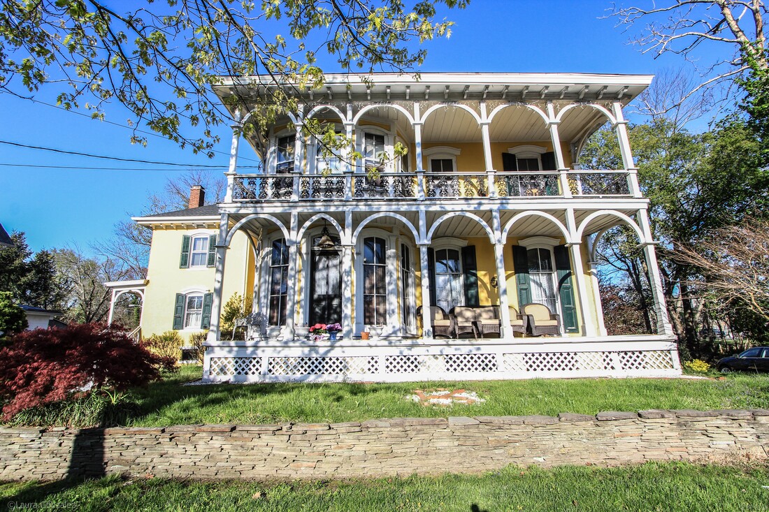 The Frederick Schrayshuen Mansion The Frederick Schrayshuen Mansion C 1870 ....10 Bispham Street Two story central block with one wing, 4/4 windows, floor depth, with Gothic arch; high stone foundation; two story porch, six bay, with cast iron balusters, fancy pierced; plain ashlar simulated walls over brick; inside end and interior chimneys; hip roof on wing and gable roof on central block; scrolled bracket cornices; irregular Z-shaped floor plan. 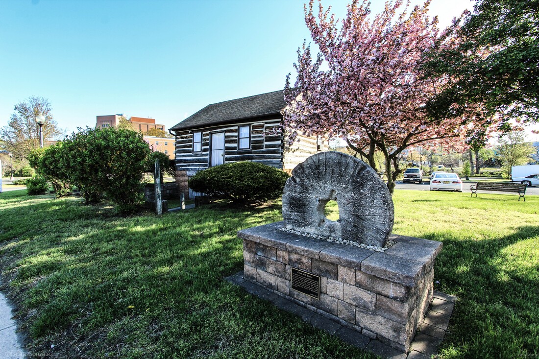 Shinn Log House The Shinn Curtis Log House lies in the heart of an historic section of Mount Holly. The early settler's home of hand-hewn logs originally built in 1712 was encased in a house and was uncovered in 1967 when the surrounding house was demolished. It was in the possession of the Curtis family for 147 years, since 1802, and is now owned by the Mount Holly Historical Society. The building was relocated from what had been Water Street and renamed Rancocas Road. 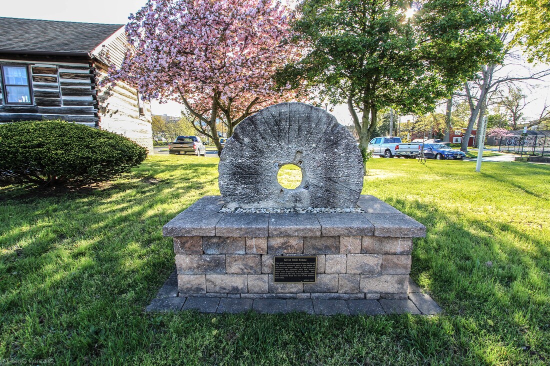 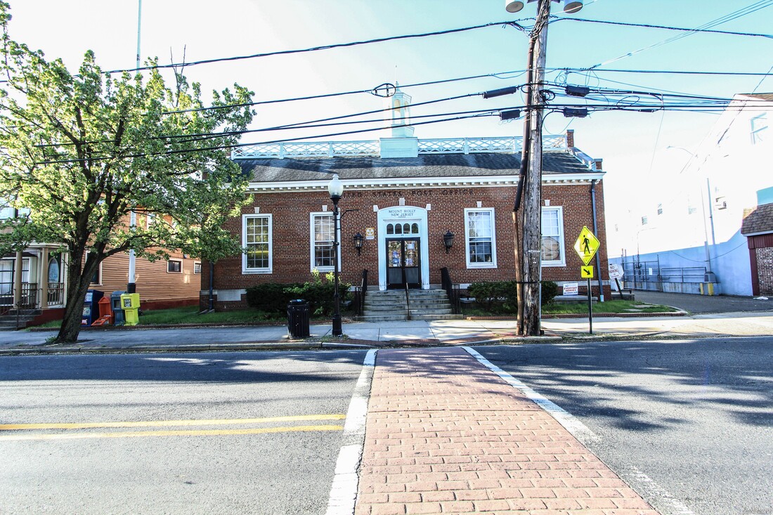 1790 Post Office The inside of this post office is vintage. The foyer looks like a turn of the century train ticket office complete with old wood, trimmed to the hilt, glass windows, stained dark. 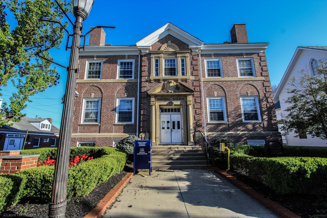 Mount Holly Police The police department faces a side alley, to the rear of the municipal center. There were a bunch of cruisers parked back there. The original structure was built in 1930, and is an amazingly interesting and architecturally relevant structure which is why it is a contributing structure to the historic district. 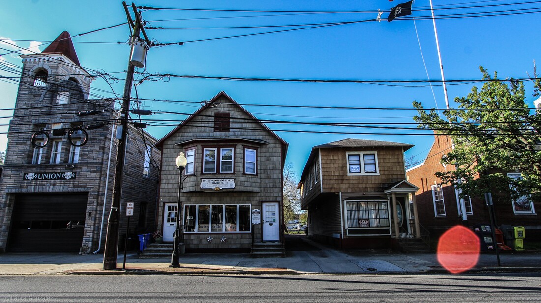 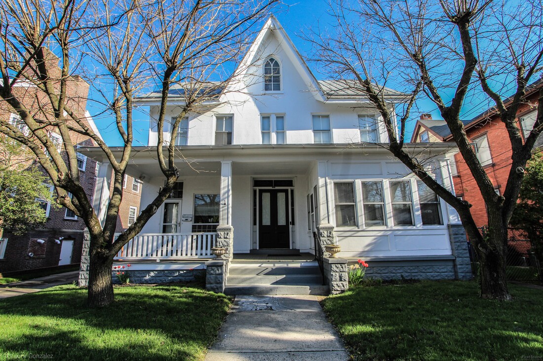 Mount Holly Home 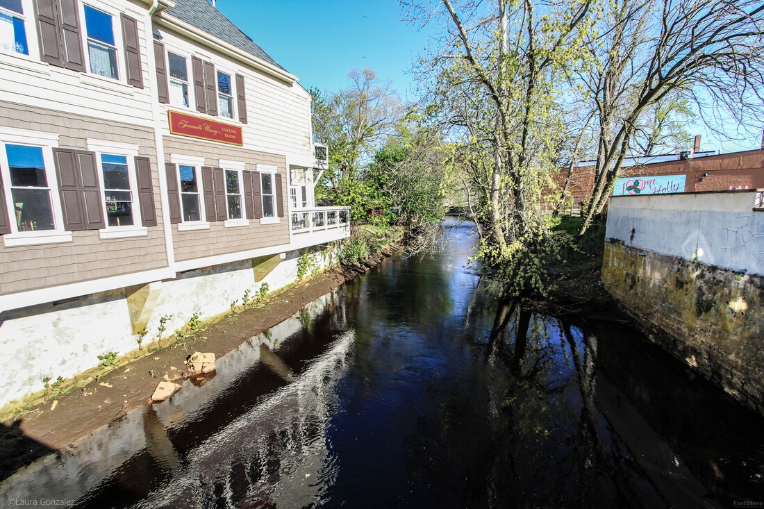 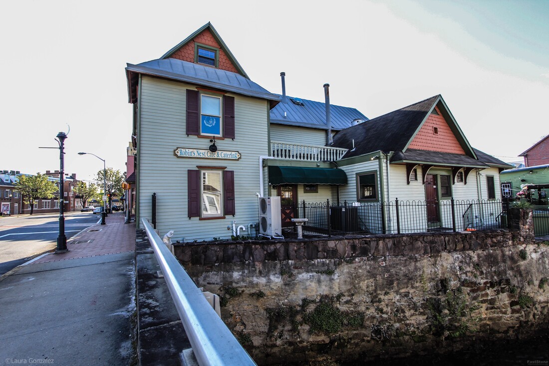 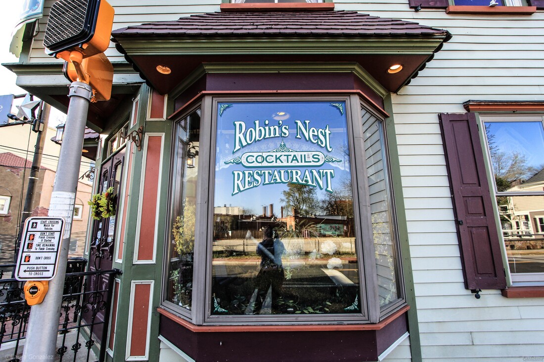 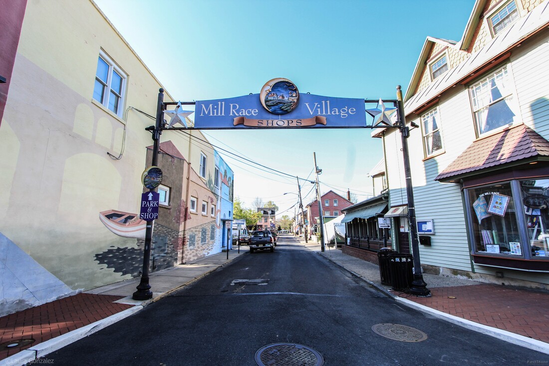 Mill Race Village Shops 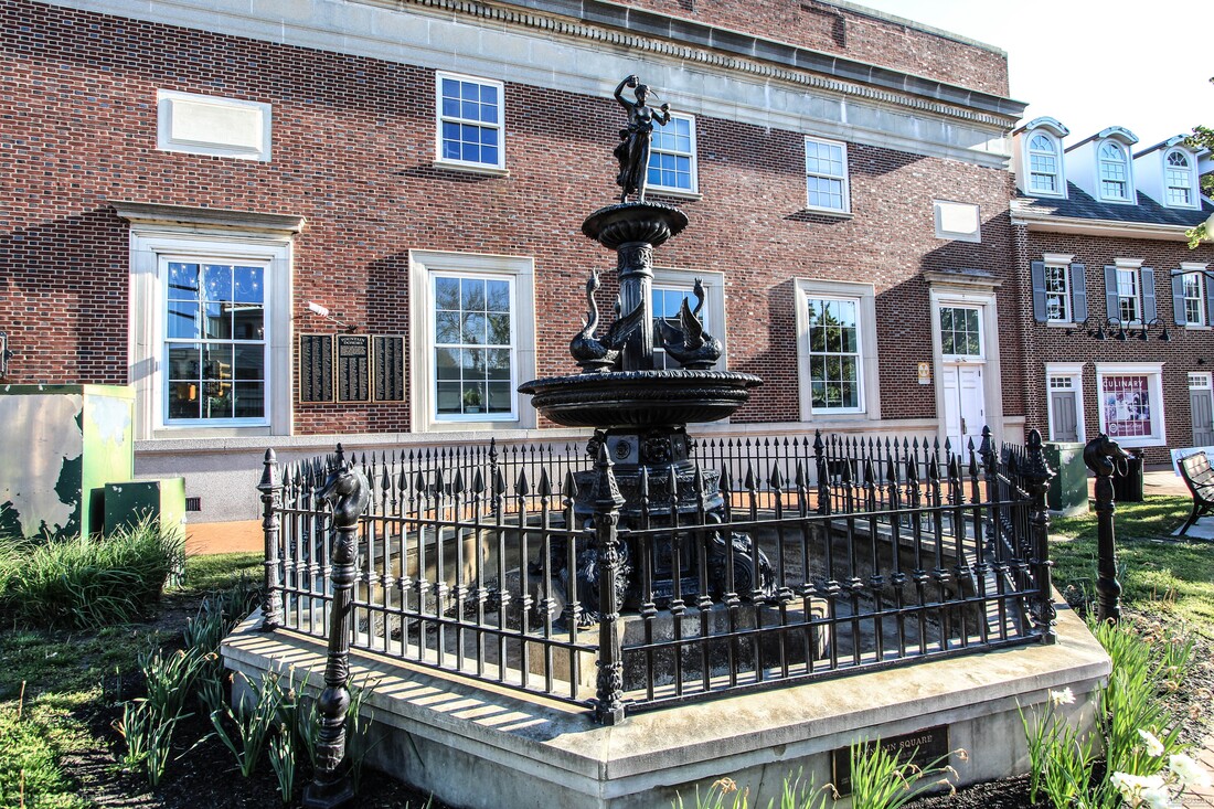 Fountain 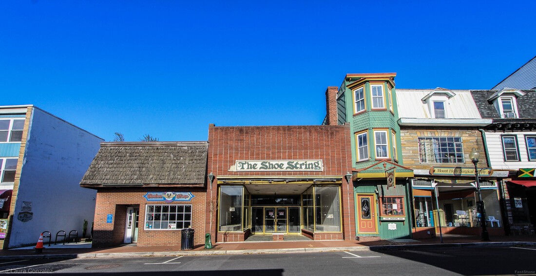 Daniel Smith House The green building to the right of The Shoe String is the Daniel Smith House, Navigator Circa 1790. 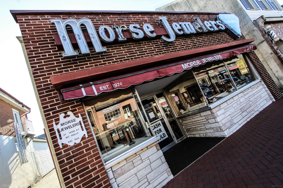 Morse Jewelers 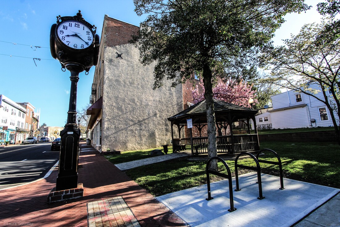 Town Clock The Mount Holly Preservation Society, commissioned a replica town clock. It was placed where the original once stood. 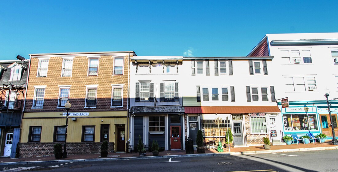 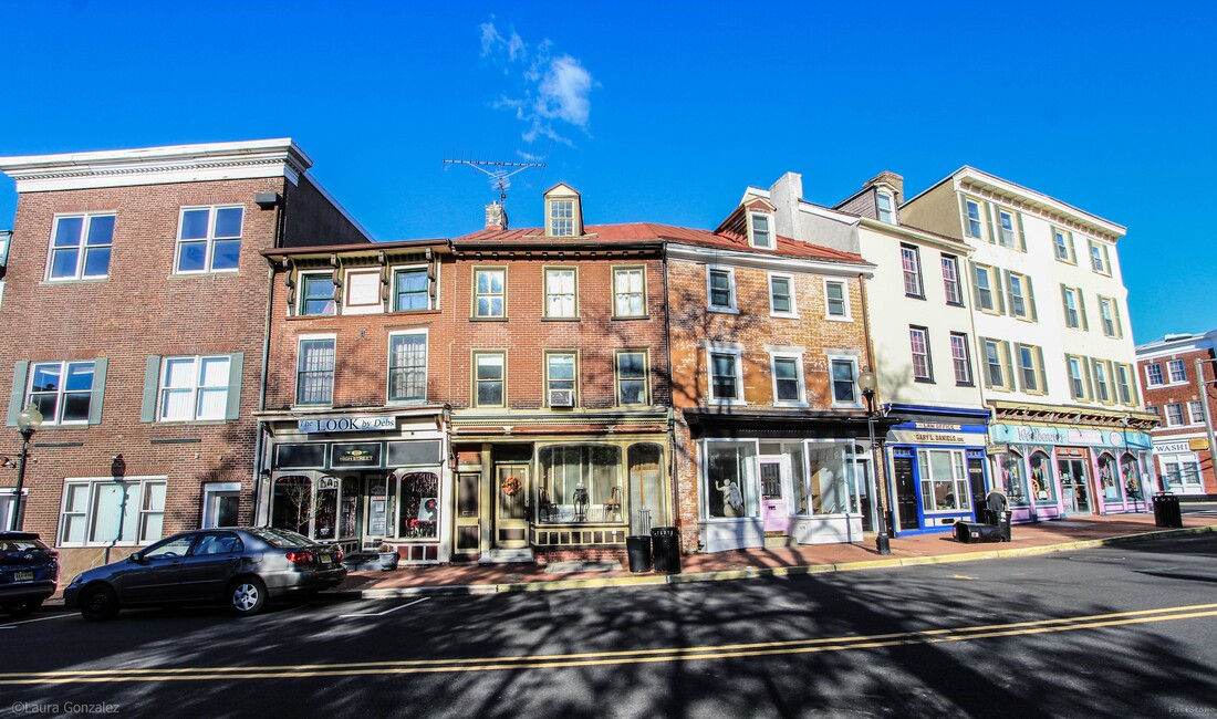 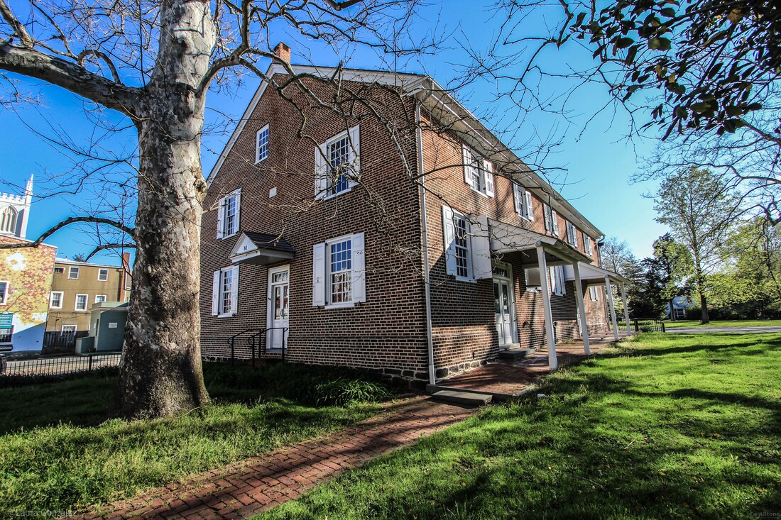 Mount Holly Quaker Meeting House This Friends Meeting House was built in 1775, and so was here at the time of the Battle of Iron Works Hill on December 23, 1776. "The British army occupied Philadelphia from September 26, 1777 until June 18, 1778. Philadelphia had been serving as the American capital, and the British occupation forced Congress to move to York, Pennsylvania, which had a demoralizing effect on the Americans. During that same winter of 1777, General George Washington and his Continental (American) army were camped about twenty miles away from Philadelphia in Valley Forge, Pennsylvania. Valley Forge provided a good strategic location for the army's winter quarters; It was close enough to keep an eye on the British troops in Philadelphia, but in a strong defensive position should the British decide to attack. In early June 1778, the British forces in Philadelphia decided to abandon Philadelphia and march towards New York City, the main British stronghold in America. British forces under General Henry Clinton began their trip on June 18, 1777, when they crossed over the Delaware River into New Jersey, landing at Coopers Ferry (now Camden). Over the following days, they marched through Haddonfield, Cherry Hill, Mount Laurel, and Moorestown. On June 20 they arrived at Mount Holly where they remained until the morning of June 22. While here, their commissary department used the Friends Meeting House. During this time, General Washington and his Continental Army were also on the move. After hearing of the British evacuation of Philadelphia, Washington made the decision to leave Valley Forge. On June 20, they crossed into New Jersey at Coryell's Ferry and marched in pursuit of the British troops, keeping a path miles to the north of them. From Mount Holly, the British troops moved on through Bordentown and Crosswicks. On June 28, they would meet the Continental Army at Monmouth Courthouse, and fight the Battle of Monmouth, the longest continuous battle of the war." -revolutionarywarnewjersey 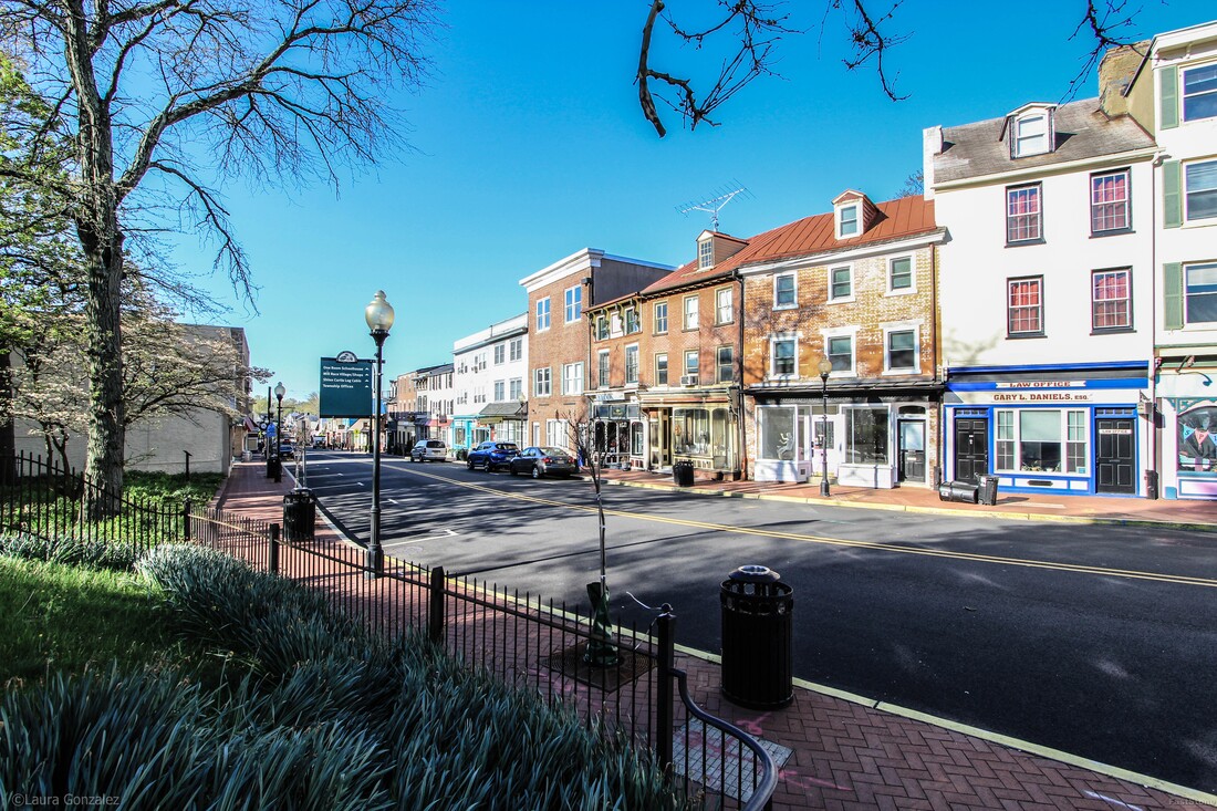 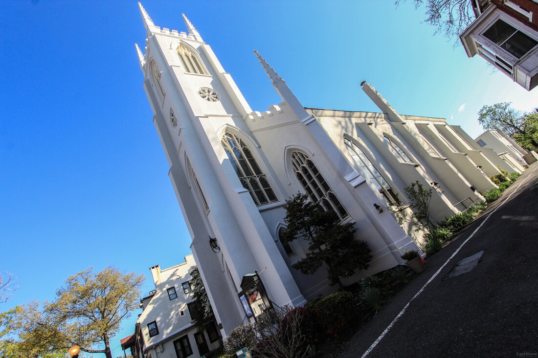 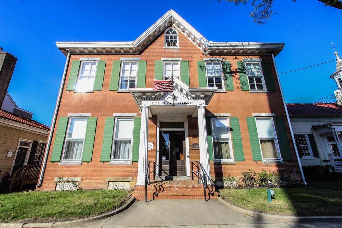 Elks Home This Elks Home lodge is in a Victorian-era home built in 1856.  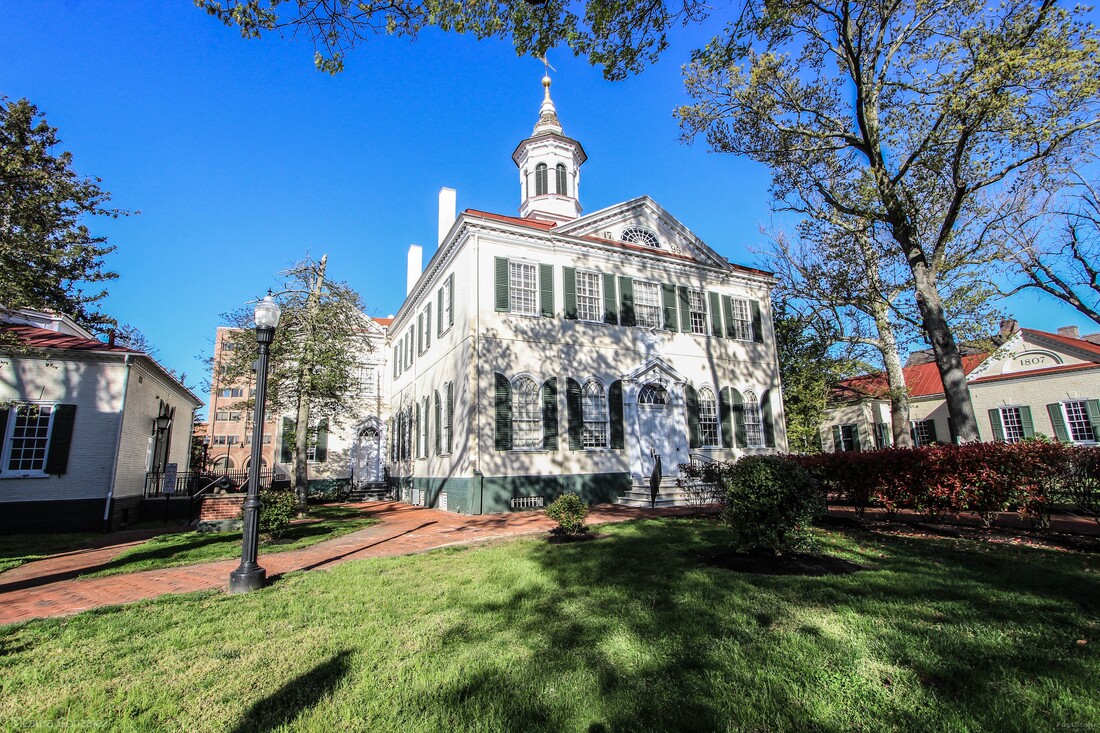 Burlington County Court House This old court House was built in 1796 and modeled after Congress Hall in Philadelphia. It was used full-time until 1959 when a new County office building was opened which included court facilities. The courthouse continues to handle judicial proceedings. 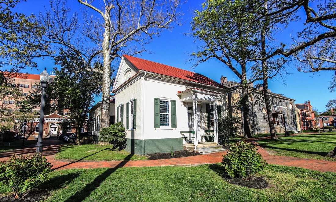 Surrogate's Office and Collector's Office This is one of the smallest government buildings you might ever find. The building is a single room structure painted to resemble the historic 18th century courthouse to the left of it. From the Nomination Form: 15. SURROGATE'S OFFICE AND COLLECTOR'S OFFICE ....1807 ....High Street Two identical one story rectangular offices constructed of Flemish bond brick with moulded brick water tables over brick foundations; one bay entrance porch on each; keystones over 9/9 windows, flanked by paneled shutters; gable roof over box cornices with carved and shaped dentils with moulded architrave frieze same as court house; full length return under gable at sides of buildings from front to back 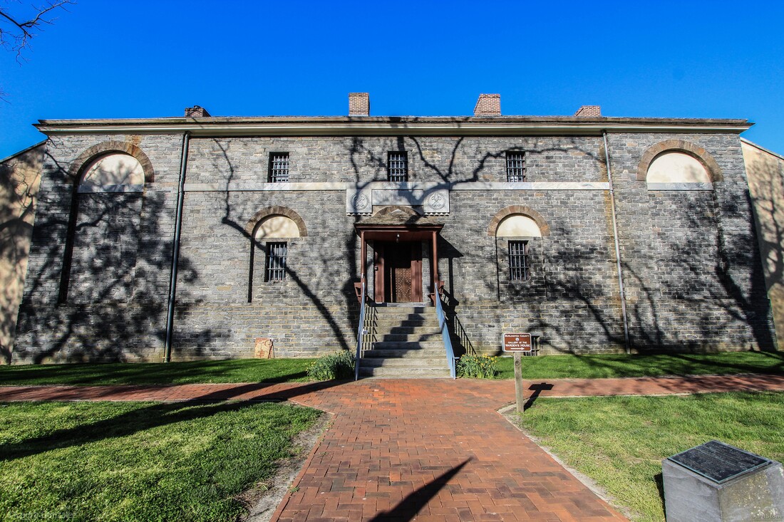 Burlington County Prison The Burlington County Prison Museum is a National Historic Landmark located in historic Mount Holly. Designed by Robert Mills, one of America 's first native-born and trained architects, the Burlington County Prison was completed in 1811. One of Robert Mills' first designs as an independent architect, the interior vaulted ceilings of poured concrete and brick and stone construction made the building virtually fireproof. In fact, it was so well constructed that it remained in constant use until 1965.  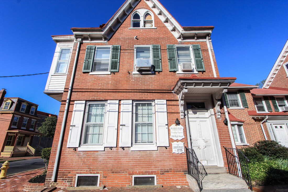 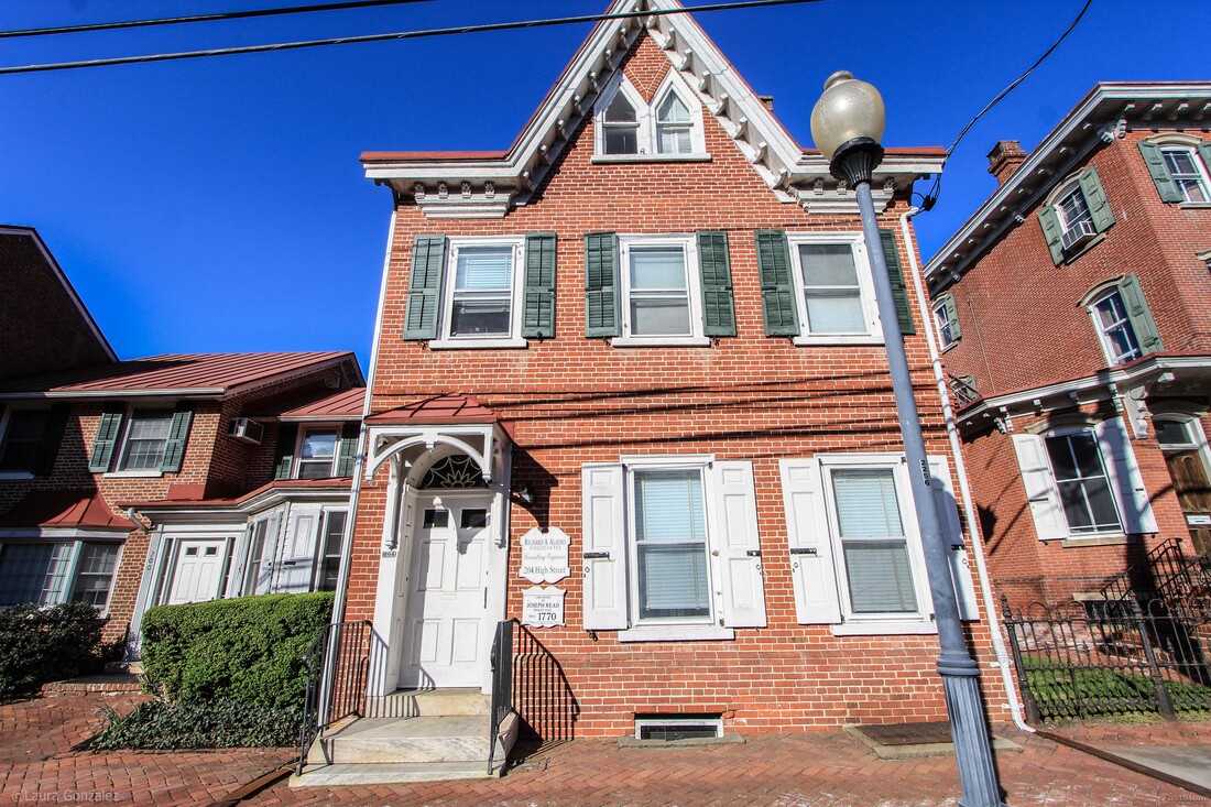 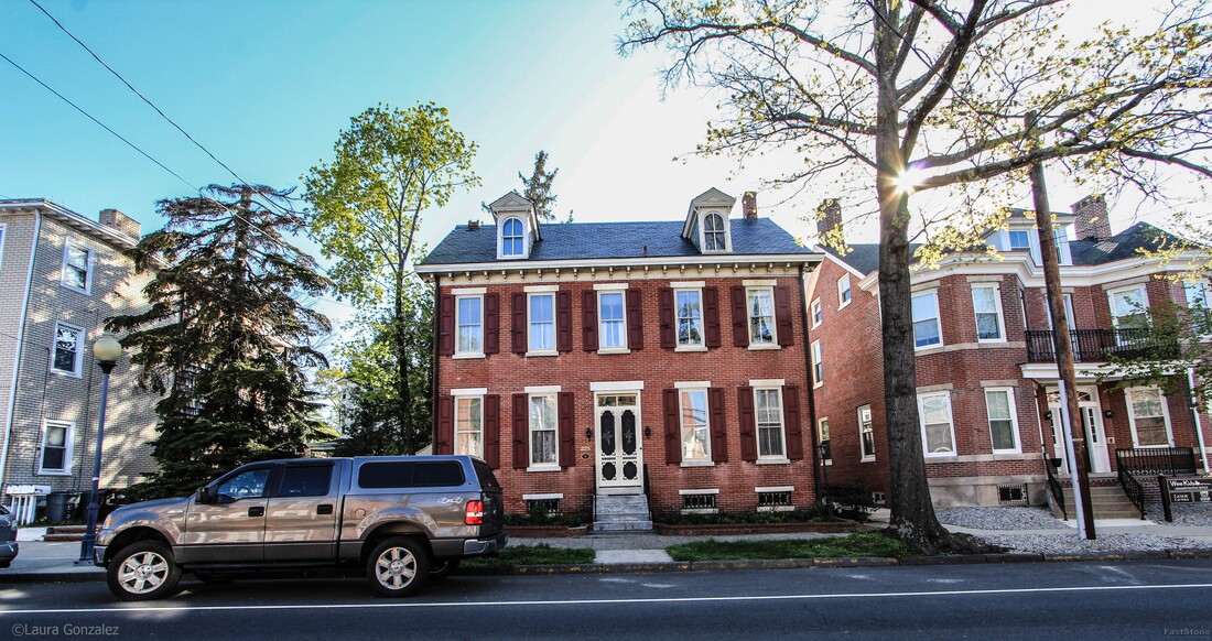 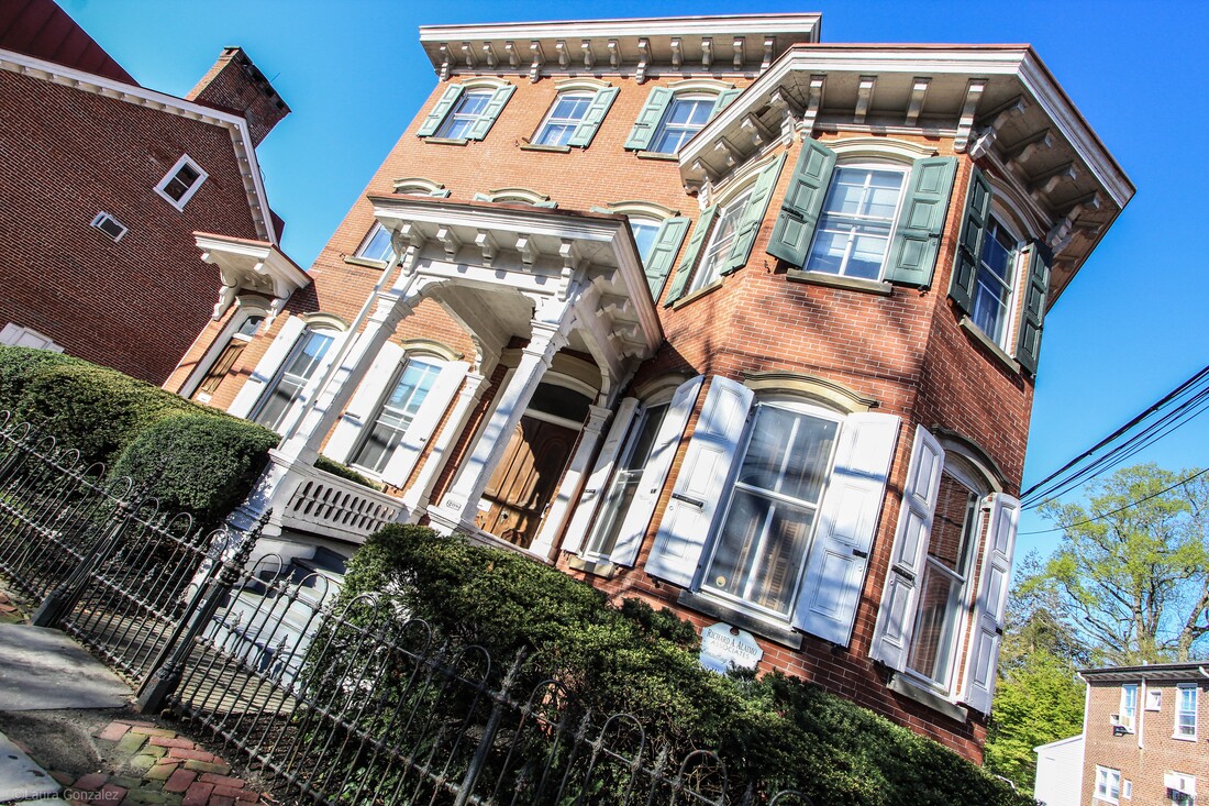 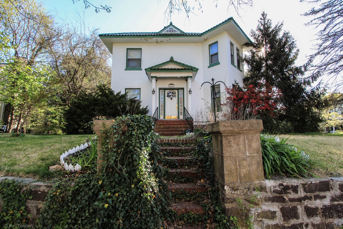 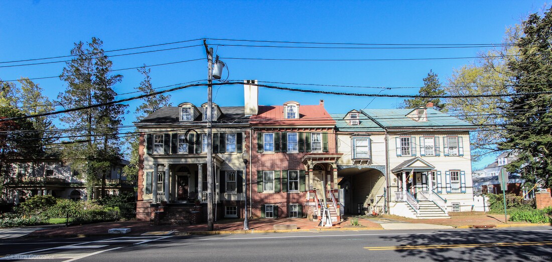 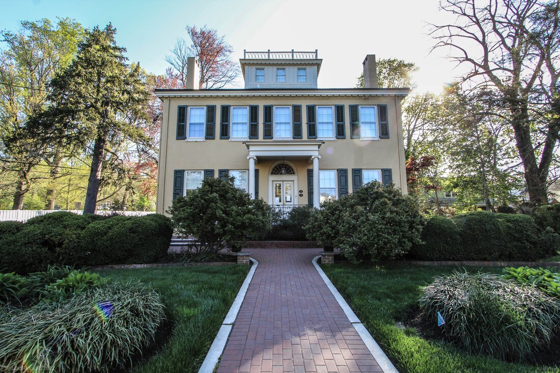 James Langstaff Mansion (Langleland) (1832) 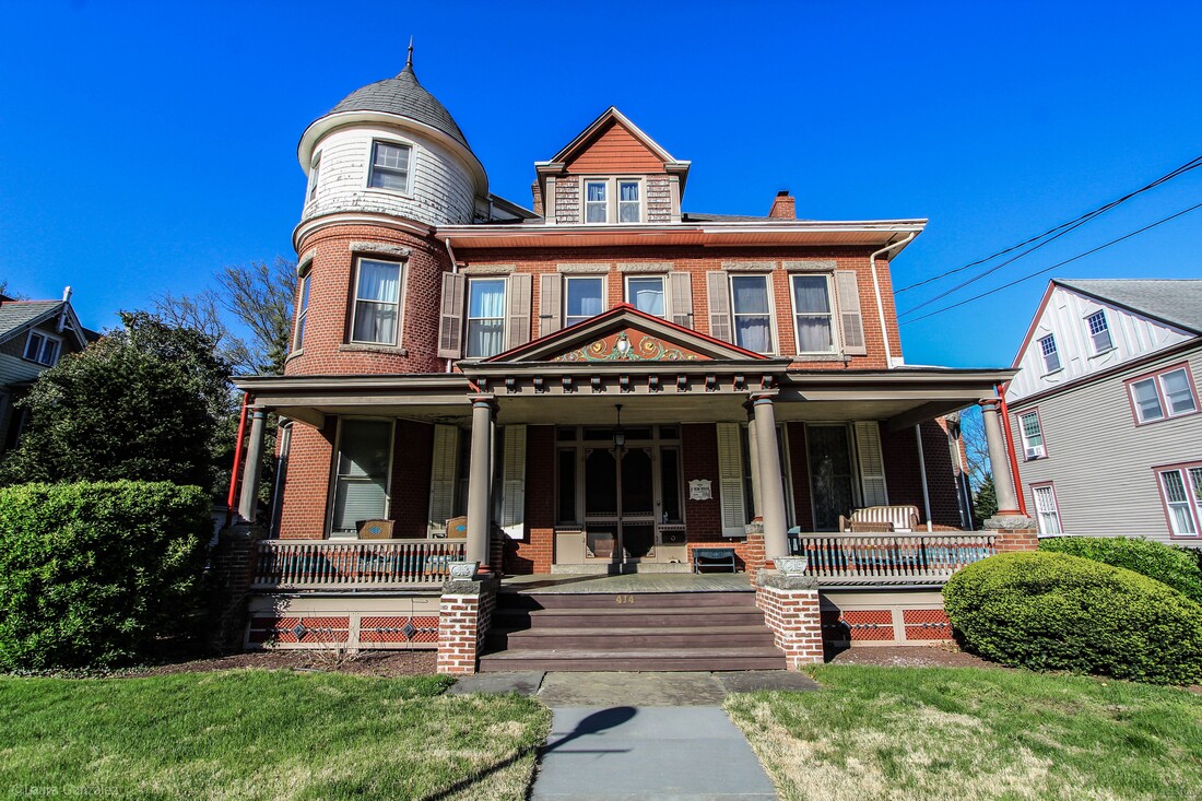 W. Budd Deacon House 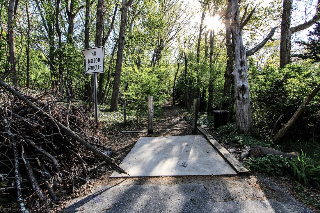 The Mount 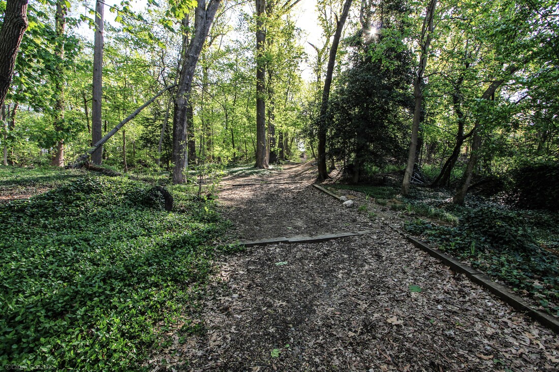 The Mount, Lovers Lane 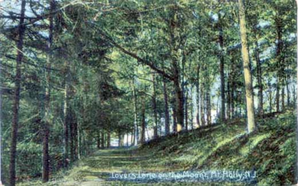 The Mount, Lovers Lane; www.westjerseyhistory.org 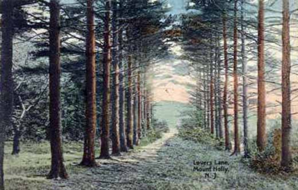 The Mount, Lovers Lane; www.westjerseyhistory.org 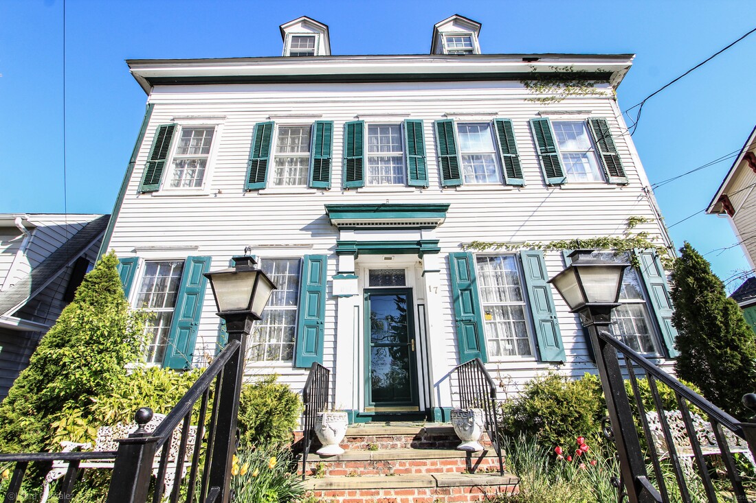 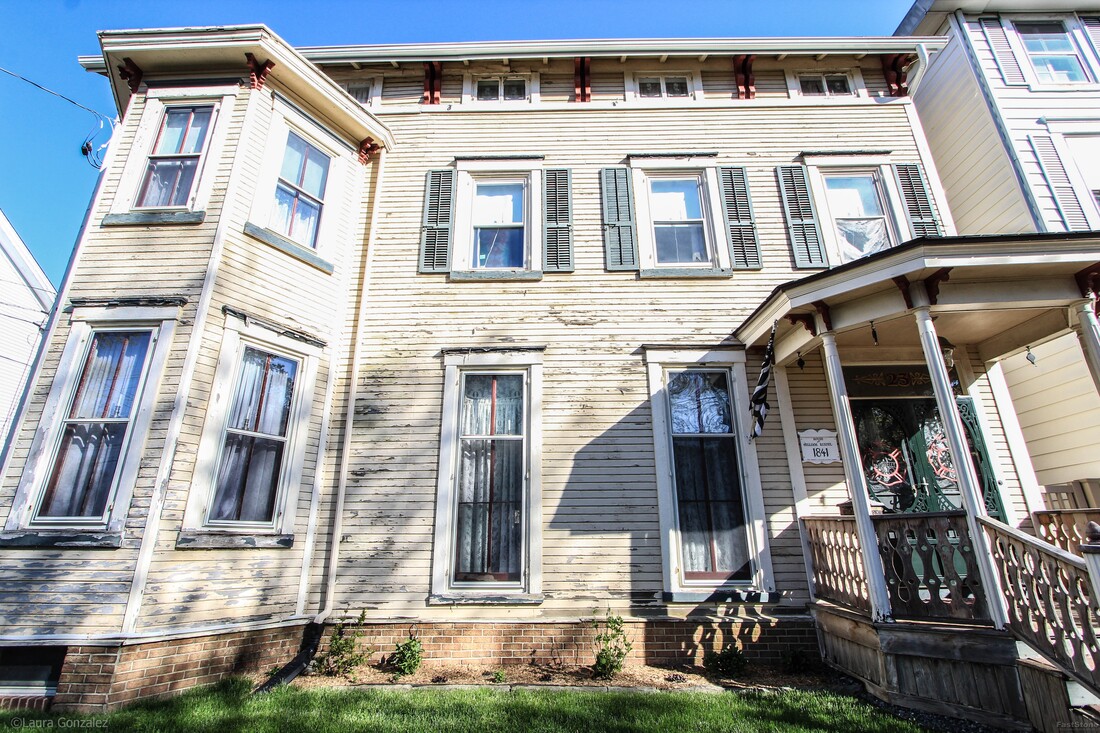 William Rossell House  House of Samuel Shreve ; Manufacturer 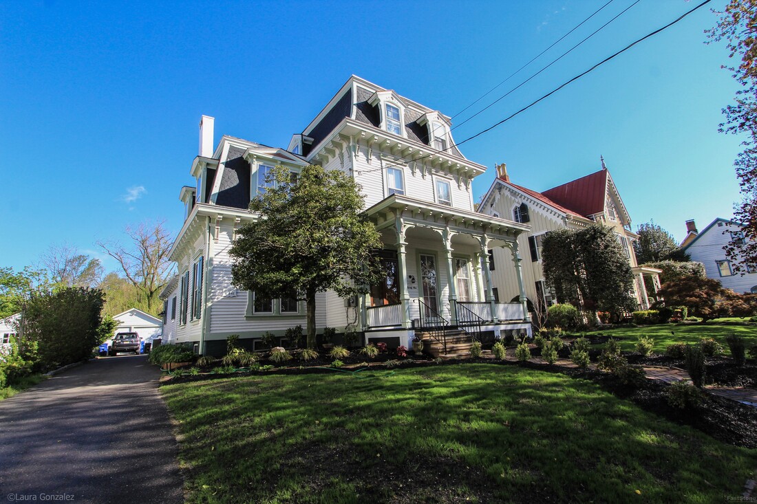 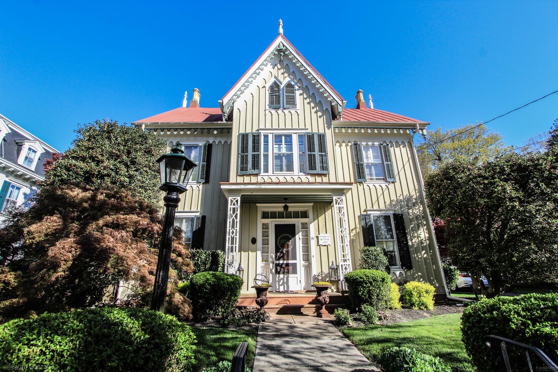 Joseph Head c1854 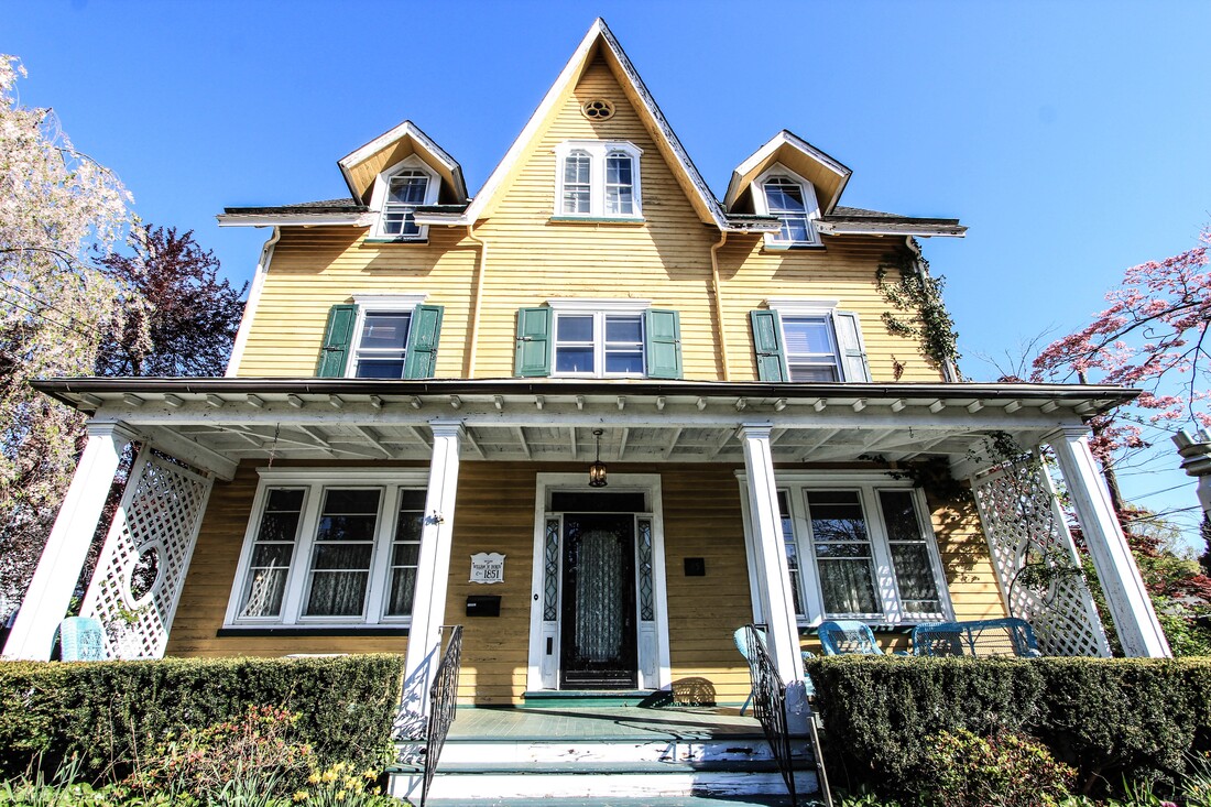 William W. Doren; Candle & Soap Factory Circa 1851 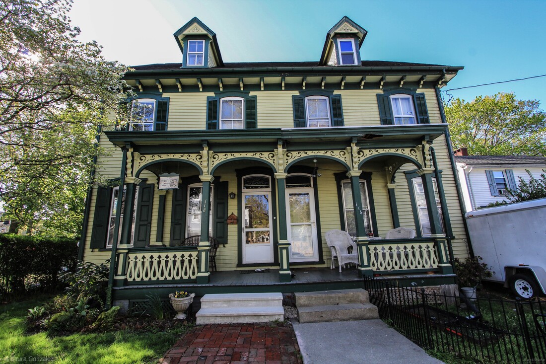 Samuel White; Master carpenter C.1875 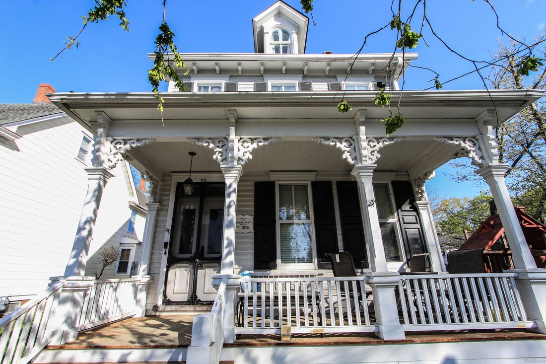 House of Jeremiah H. Colkitt; Banker Circa 1878 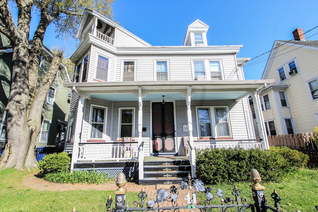 House of Craig Moffett; Pharmacist 1885 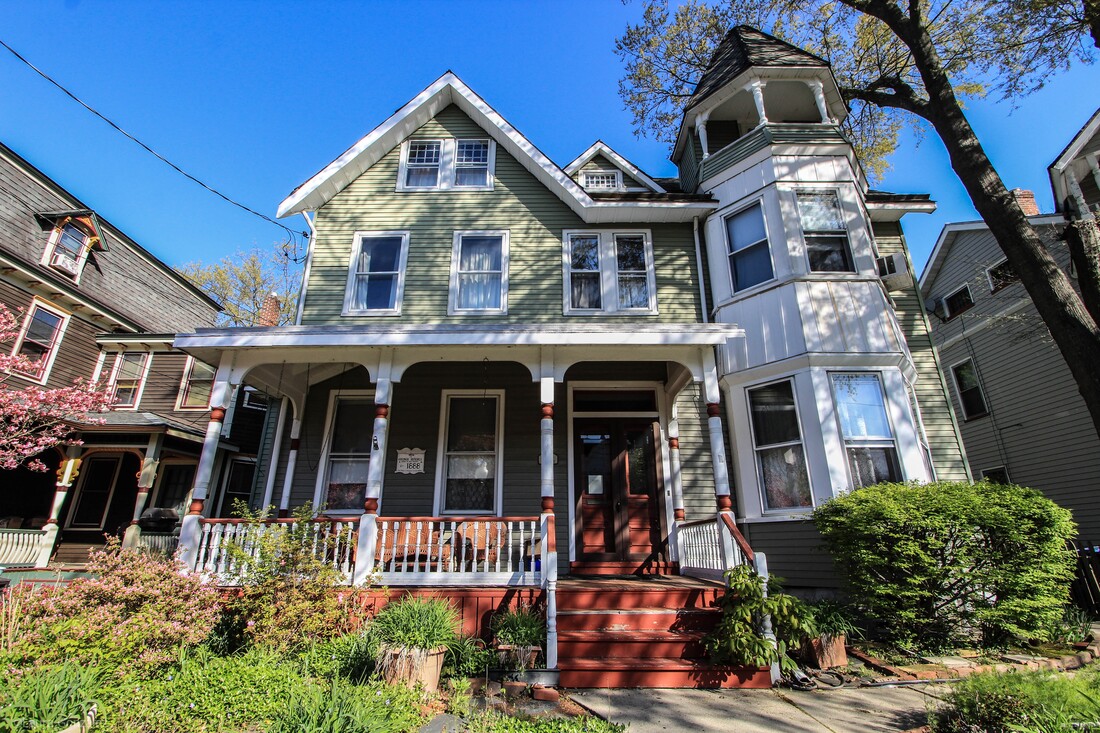 George Rendell 1888 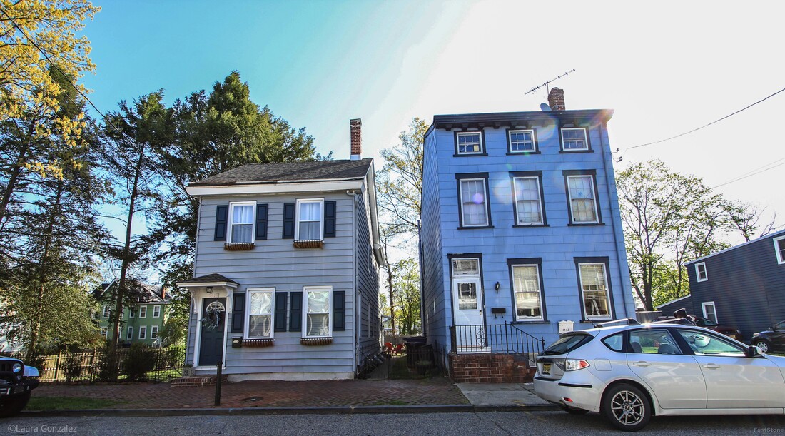 Mount Holly Homes 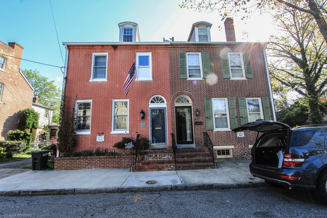 (Left) Absalom E Merritt; Carpenter 1833 ( Right) Samuel F Miller 1833 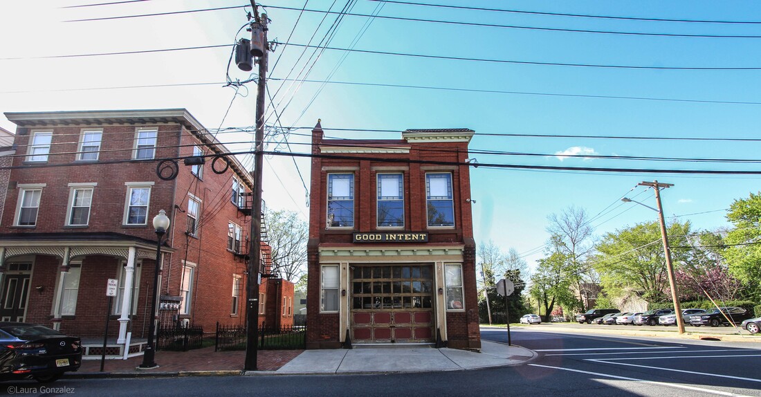 Good Intent Firehouse 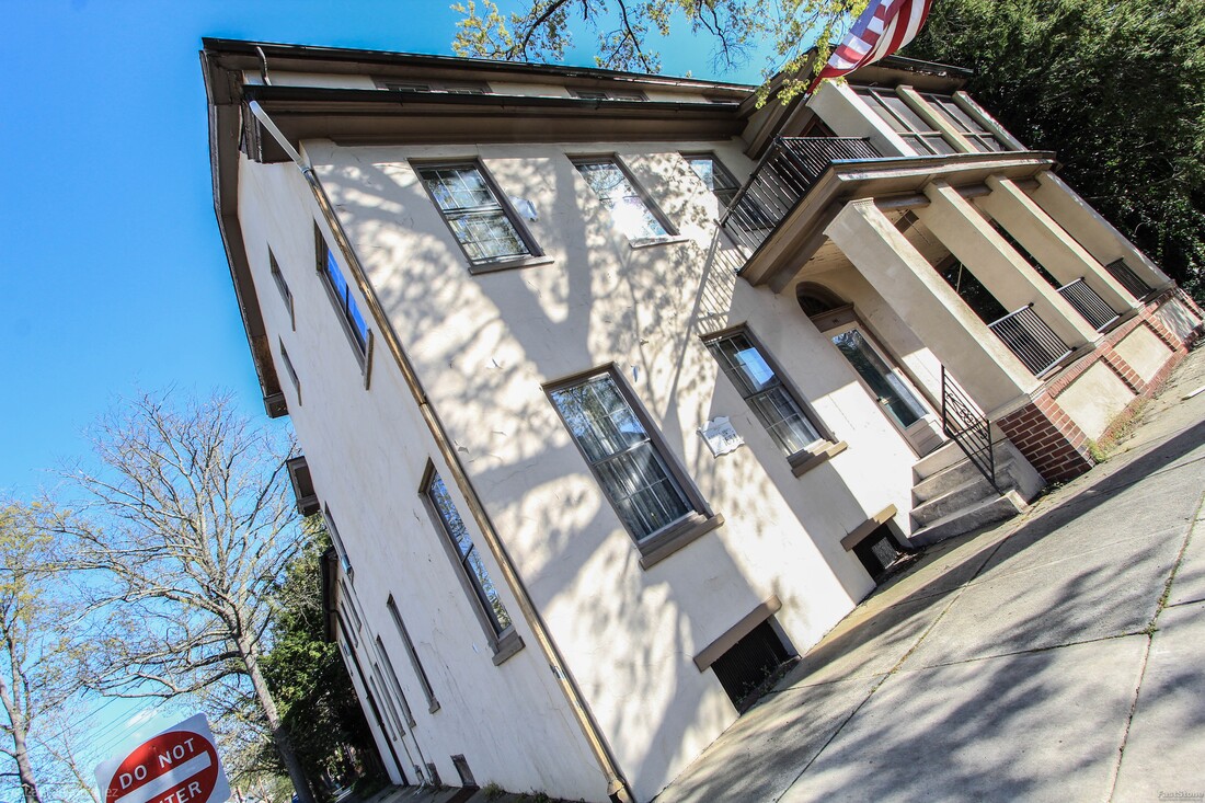 Aquilla S Ridgway; Builder 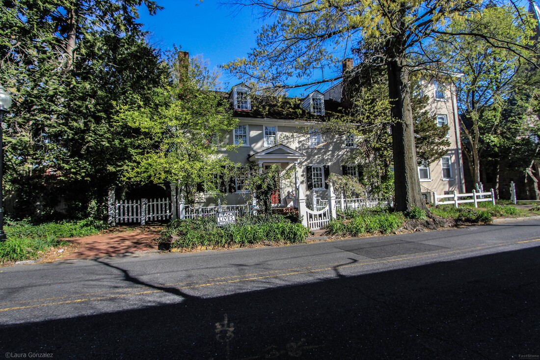 The Carr House 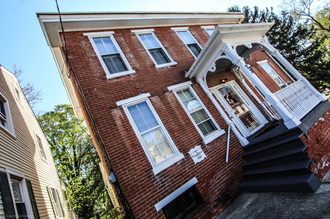 House of Charles Kopcke; Brickmaker C1866 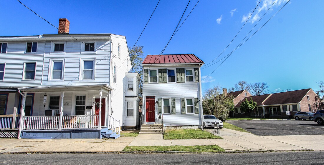 Mount Holly Home 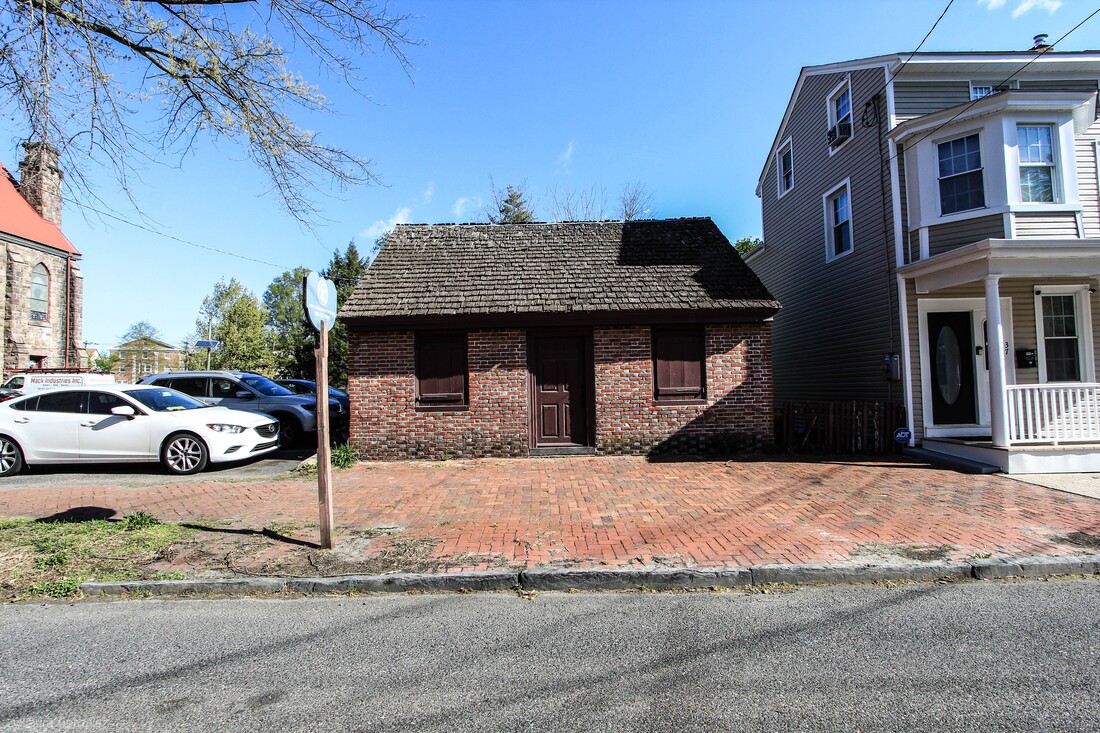 Brainerd Schoolhouse The Brainerd Schoolhouse is a one room schoolhouse, located in Mount Holly Township, Burlington County, New Jersey, United States. Built in 1759, it is the oldest building of its type in the state and now a museum. It is a contributing property to the Mount Holly Historic District. It is owned and operated by The National Society of the Colonial Dames of America 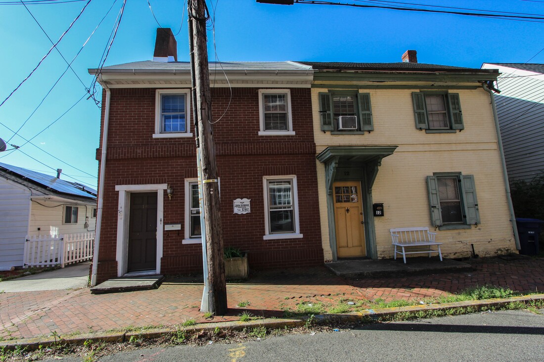 House of John Dobbins, Circa 1782 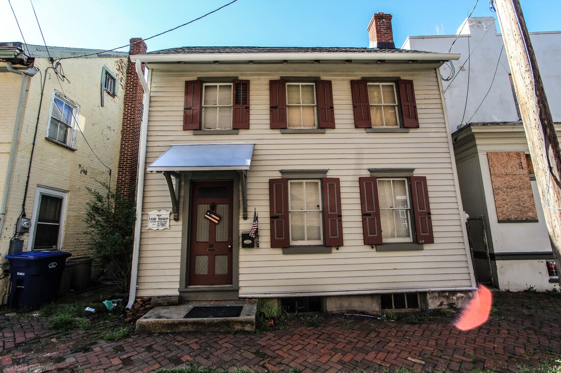 House of John Ridgway; West Jersey Surveyer General; Circa 1760  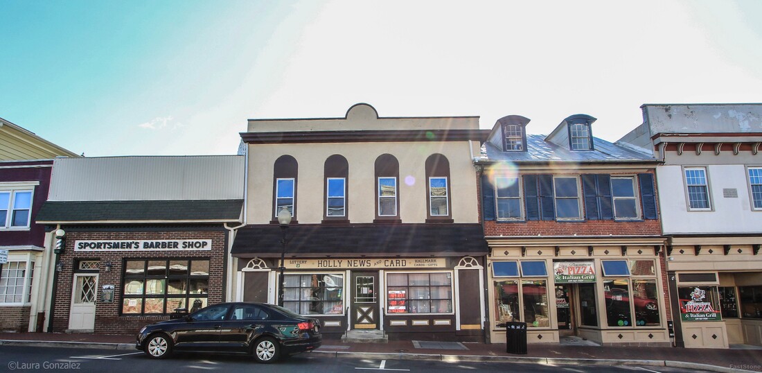 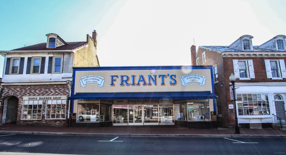 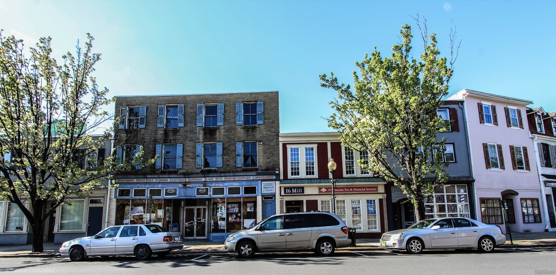 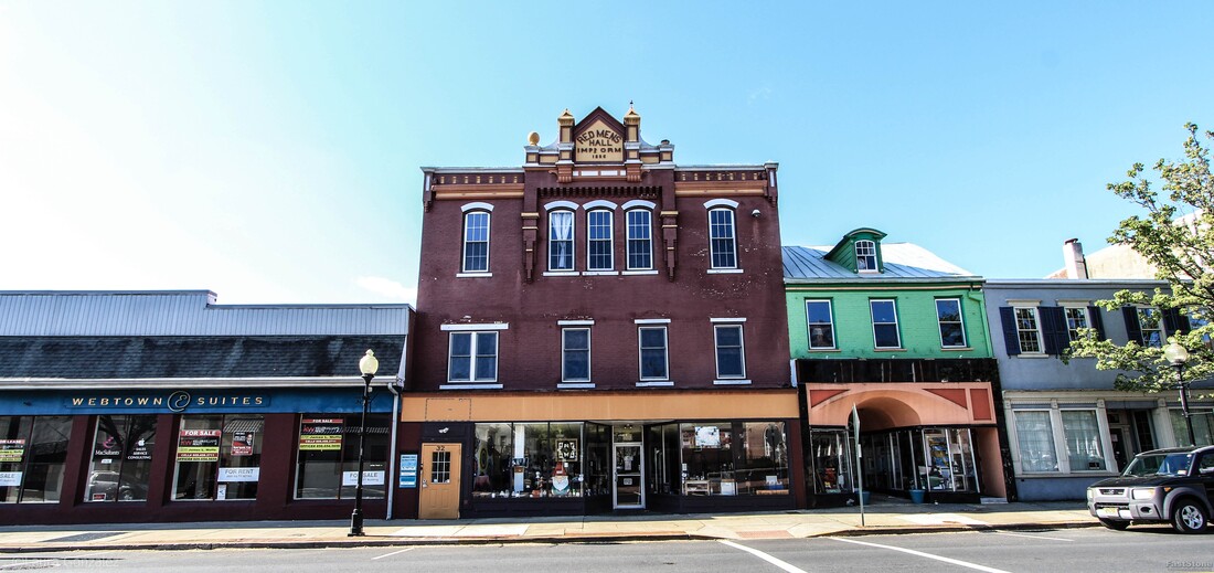 Red Mans Hall 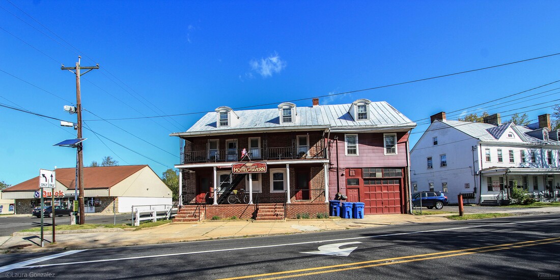 Three Tuns Tavern Located at the intersection of Mill & Pine Streets, the Mill Street Tavern (also known as) is the oldest standing building in town. It has been a tavern & hotel since it opened in 1723. Rumours state it is haunted. Built in 1723 by Samuel Bryant. It has been used as a tavern for the past 250 years. There is some Revolutionary War history connected with this site as well as the Court of Admiralty met here during the last year of the Revolutionary War. The Mill Street Tavern was built about forty years after the first settlers arrived in Mount Holly. There appeared to be a need for a place to rest and libation, so the Three Tuns Tavern was built near the mill in Mount Holly, at that time called Bridgetown because of all the bridges over the various feeders to the Rancocas Creek. Samuel Brian Was the first owner and innkeeper, and few changes have been made to the building since his time. it is of course the oldest Inn in Mt. Holly and was grabbed as quarters by the Hessian soldiers during their occupation here in 1776, the DAR reports. The Mill Street Tavern was built about forty years after the first settlers arrived in Mount Holly. There appeared to be a need for a place to rest and libation, so the Three Tuns Tavern was built near the mill in Mount Holly, at that time called Bridgetown because of all the bridges over the various feeders to the Rancocas Creek. Samuel Brian Was the first owner and innkeeper, and few changes have been made to the building since his time. it is of course the oldest Inn in Mt. Holly and was grabbed as quarters by the Hessian soldiers during their occupation here in 1776, the DAR reports. 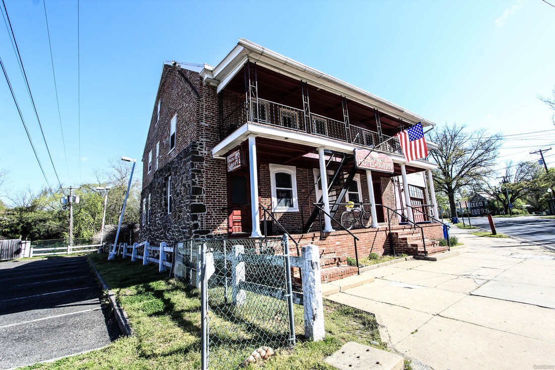 Three Tuns Tavern 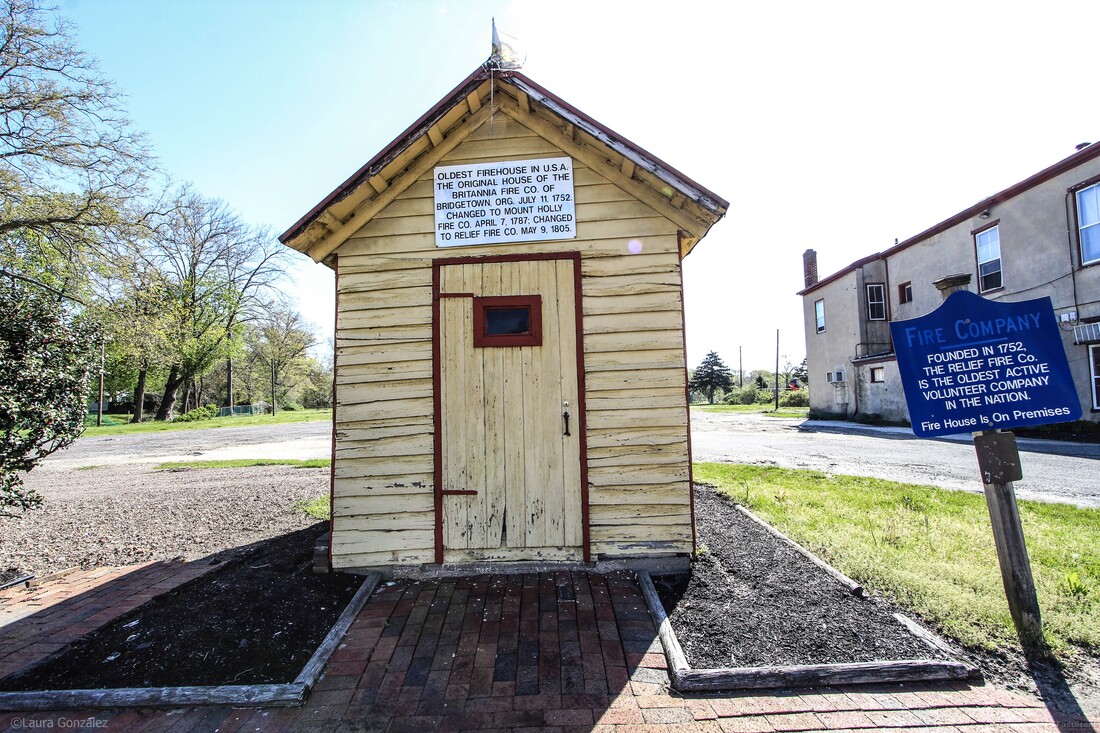 Fire Department Building on Pine Street 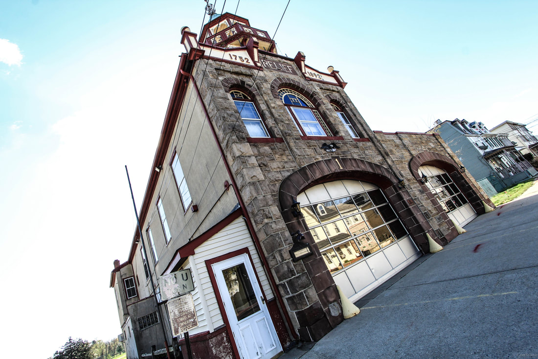 Relief Fire Engine Company No.1 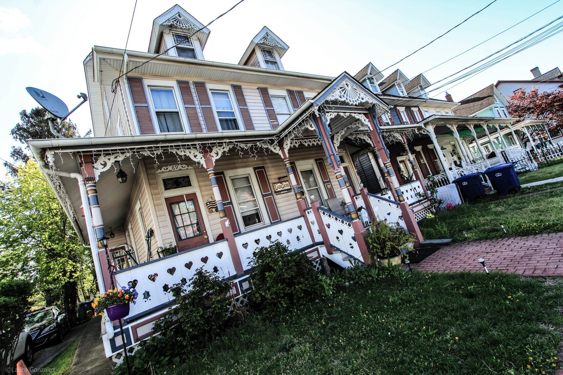 Lady Jane 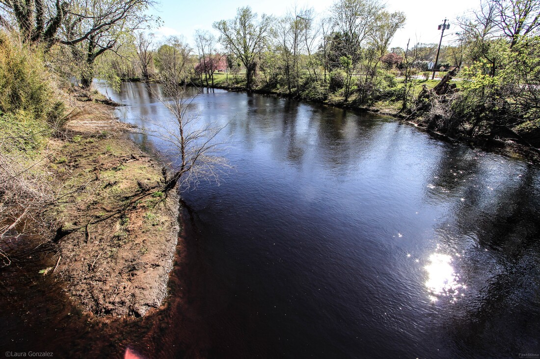 North Branch Rancocas Creek 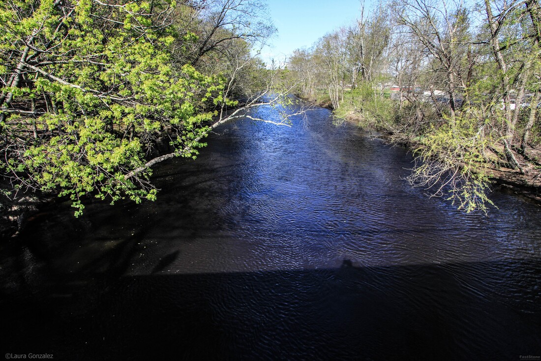 North Branch Rancocas Creek 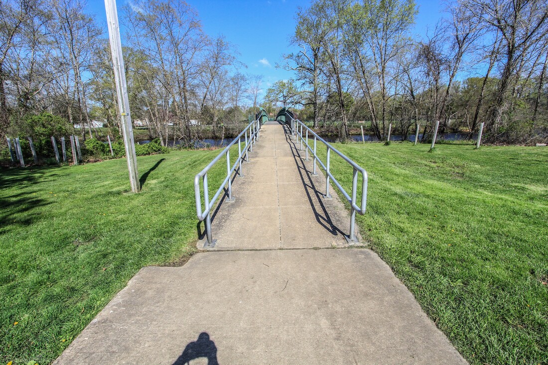 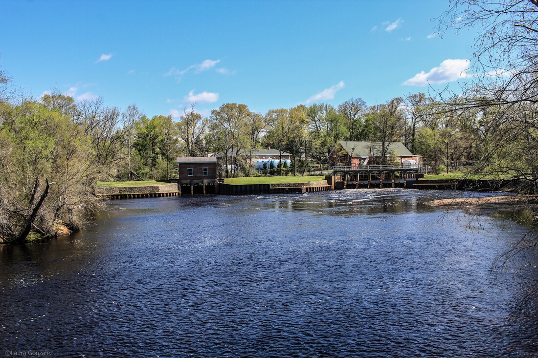 Mill Dam Park & Iron Works Park 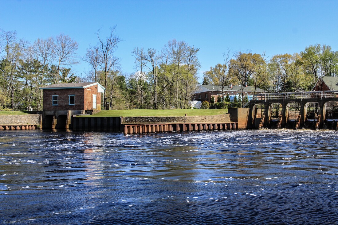 Mill Dam Park & Iron Works Park References:
Facebook Page More Photos Of Mount Holly and Burlington County https://www.livingplaces.com/NJ/Burlington_County/Mount_Holly_Township/Mount_Holly_Historic_District.html westjerseyhistory www.southjersey.com www.burlingtoncountytimes.com https://www.burlingtoncountytimes.com/article/20161026/NEWS/310269672 https://www.burlingtoncountytimes.com/news/20171103/discover-mystery-of-revolutions-mount-holly-widow Forgotten Towns Of Southern New Jersey More Forgotten Towns of Southern New Jersey www.veloramaroute.nl https://en.wikipedia.org/wiki/Hotchkiss_Bicycle_Railroad Burlington and Mount Holly Railroad and Transportation Company https://www.millraceshops.com
0 Comments
Located in Somerset County of New Jersey is the small rural community of East Millstone. Located along the Delaware and Raritan Canal, the town grew and prospered during the 19th Century. It was originally called Johnsville, but that was later changed to East Millstone. The original manufacturer of famous Fleishman's Yeast was located here.  Built in 1752 by Cornelius Van Liew is the Franklin Inn, also known as the Van Liew Tavern is the oldest structure in East Millstone. It is located on Amwell Road, close to the canal. and was an important stopover for canal workers, boatmen and other travelers who utilized the canal system. It was recently operated as a used book store. Despite flooding due to Hurricanes Floyd in 1999 and Irene in 2011, the building still stands in excellent condition.  The Franklin Inn The Millstone Township First Aid Squad has been around since 1954. 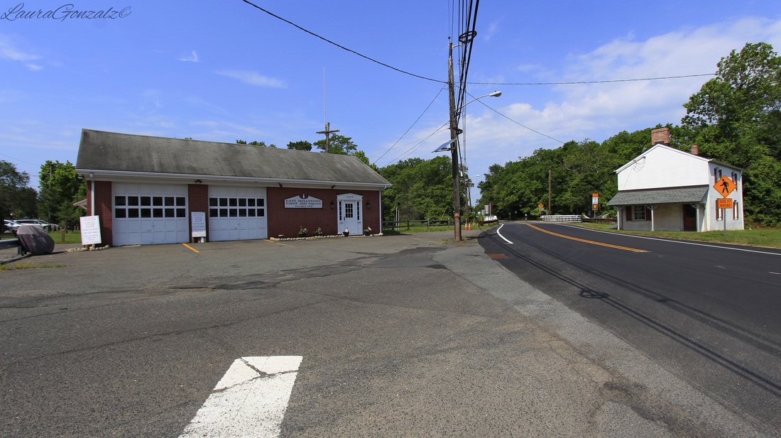 Left:Millstone Township First Aid Squad Right:East Millstone Bridge Tender's House Sitting beside the Delaware and Raritan Canal since 1834 is the East Millstone Bridge Tender's House which housed workers who opened the swing bridge of the canal. It was renovated and repainted in 2010. 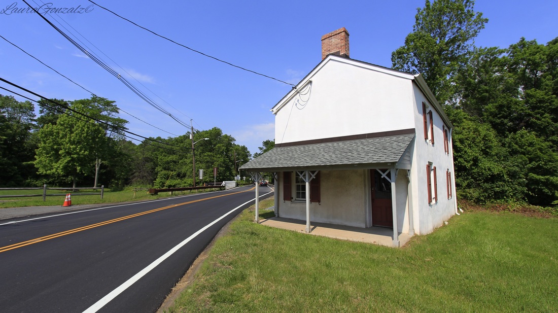 East Millstone Bridge Tender's House The Millstone and New Brunswick Railroad once ran through town but the tracks have since been removed. The coming of the railroads was the reason the town changed its name. 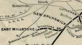 The Millstone Branch as shown on a map created by the Pennsylvania Railroad in 1911 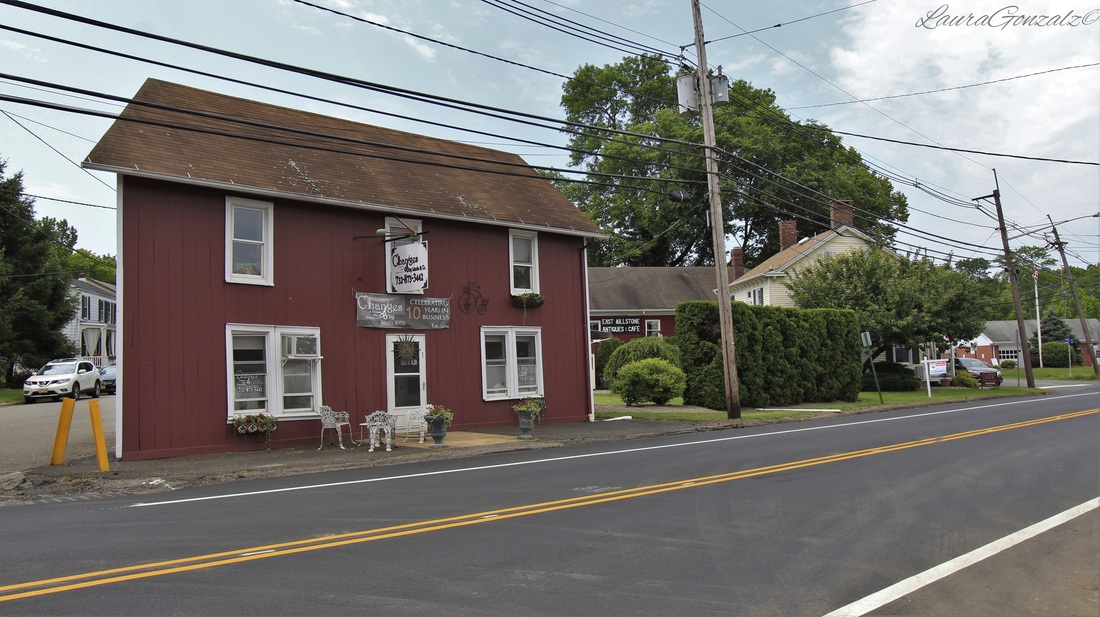 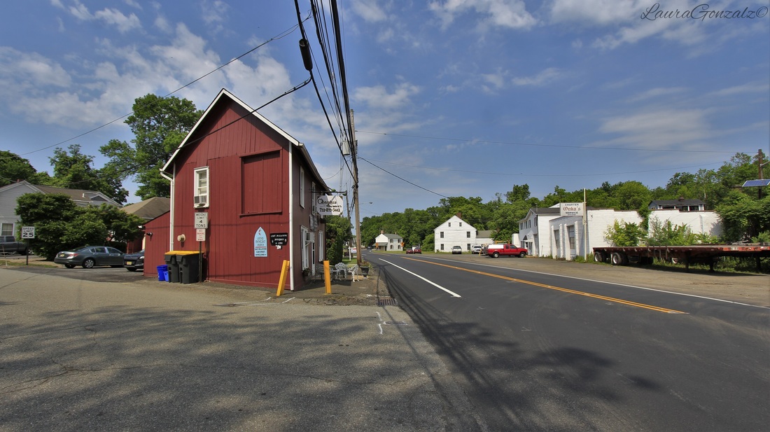 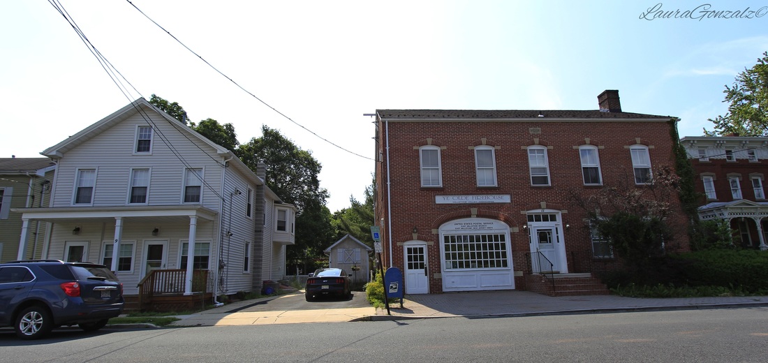 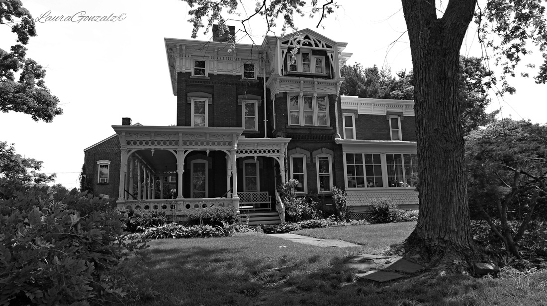 The Wilson House The Wilson House (pictured above) is an example of High Victorian Eclecticism. 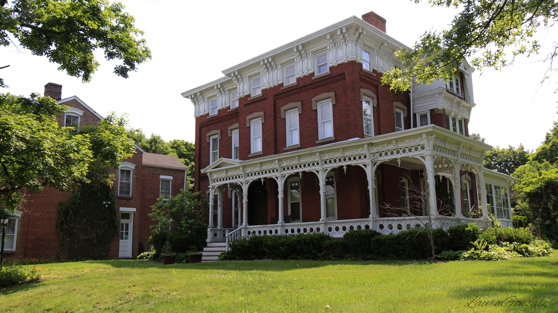 The Wilson House The house was built by Nathanial Wilson, a local entrepreneur who operated a hardware store across Market Street from the canal basin. 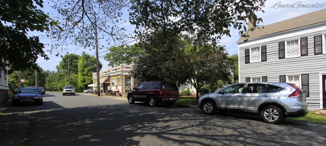  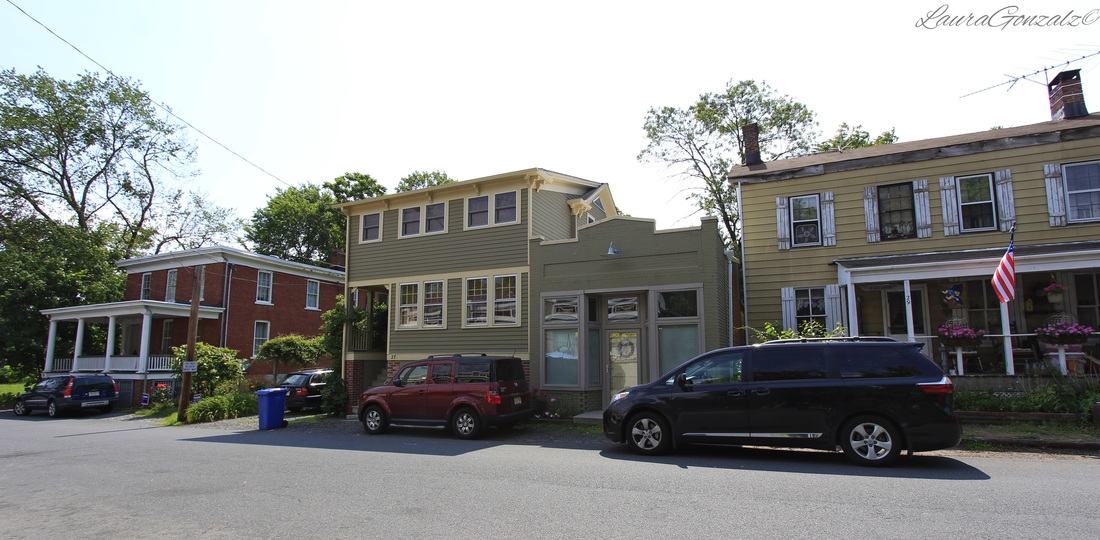   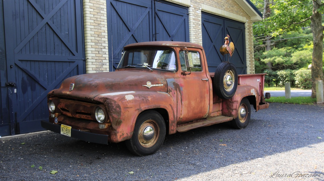 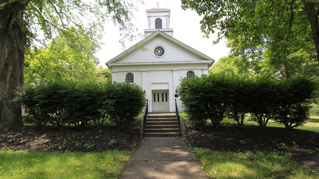 There's five churches in this little town, a big surprise when you take into account the town is comprised of just six or seven short streets of houses.  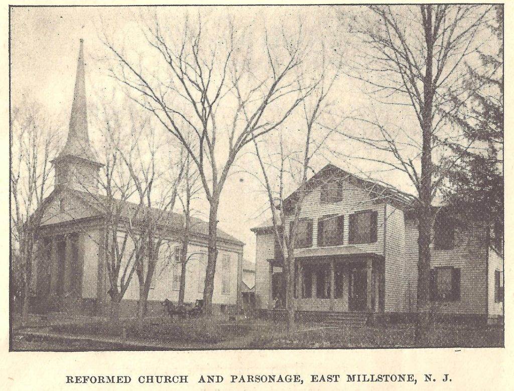 http://www.calvaryem.org/ 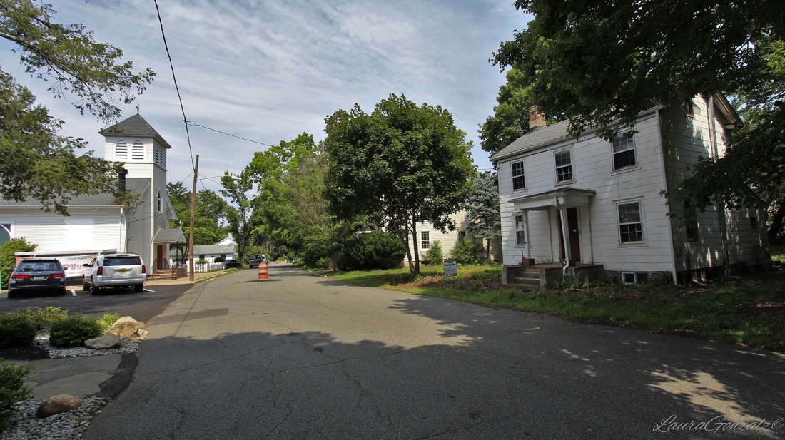 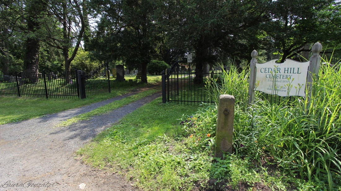 Cedar Hill Cemetery is a small cemetery located off of Wortman Street. 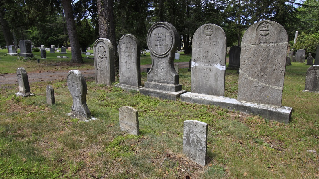   At the far western side of New Jersey is the small community of Brainards, which was once known as Martin's Creek. Martin's Creek takes its name from the stream that empties out just across the Delaware on the Pennsylvania side, that area is also known as Martin's Creek. In New Jersey the railway station was also called Martin's Creek. Martin's Creek was the junction point of the Pennsylvania railroad. 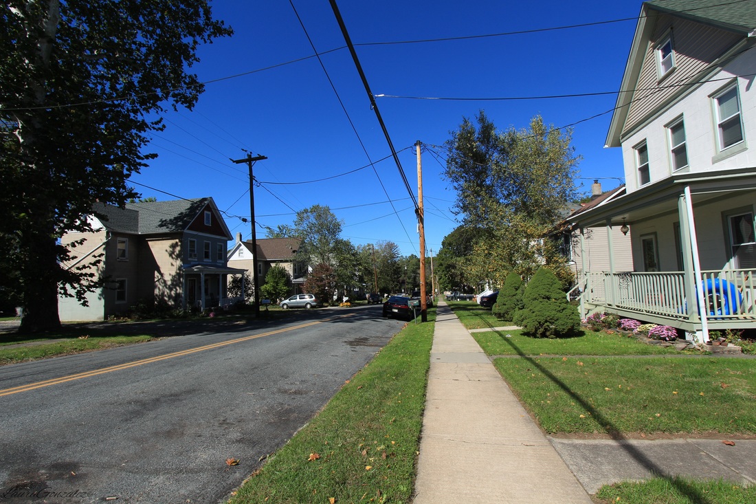 The name Brainards is taken from David and John Brainerd, who had their cabin across the river. The Brainerds were a missionary to the Lene lenape that occupied the area in the 1790s. The area has since changed to Brainards instead of Brainerds. Named after missionaries, one would expect to at least find one church in town, this is not the case in Brainards. 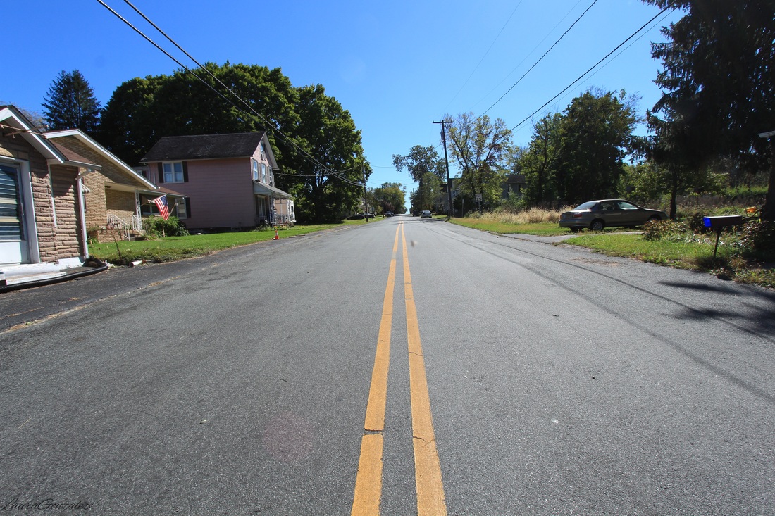 “David Brainerd was born at Haddam, Connecticut, in 1718. He was educated at Yale, licensed to preach in 1742, and was appointed missionary to the Indians within the Forks of the Delaware by the "Society for Propagating Christian Knowledge." He began his mis- sionary labors among the Indians in the Forks of the Delaware early in the summer of 1744. On the 13th of May, 1744, he came to Sakhauwotung (Martin's Creek) within the forks, and was respectfully re- ceived by the Indian king, who permitted him to preach most of the summer at his house.” 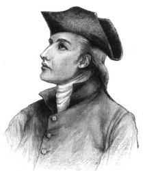 Warren County, at one time, had large cement mills in active operation which helped in growing the towns up around them. The mills of the Alpha Cement Company helped to make the small town of Brainards grow by building company housing to attract the many Slavic immigrants arriving to become workers. The workers would then walk to work on the railroad bridge which crossed the Delaware River to Martin's Creek. Before this time the area had been mostly vacant and nothing which resembled a town or village. 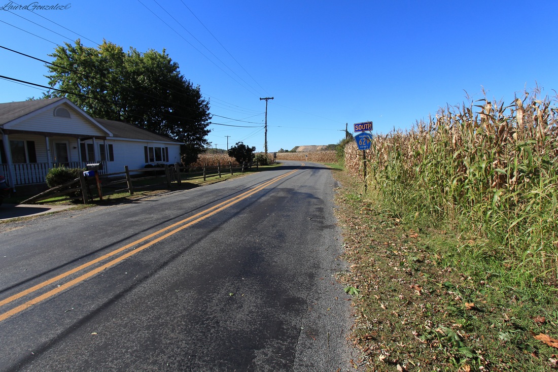 Broad Street is Brainard's main thoroughfare. It is lined with former company housing. Alpha would rent the homes to the workers for 9 dollars a month. For single men there were the boarding houses which were run by widows of factory workers who had died. By the time the 1960s rolled around, the cement companies decided operating elsewhere would be more cost effective. They sold the company housing to those who wished to stay for $900 a home or $1200 for a home with plumbing. Company housing is usually recognized when viewing the landscape as a whole in the little variation from house to house and simple architectural styling. I noticed this when i first visited Brainards, before i knew it had been a company town. Some of the Alpha company’s houses are on property formerly a part of the lot of George Depue who lived in a stone house one-eighth of a mile south of the station from 1850 until his death in 1897. 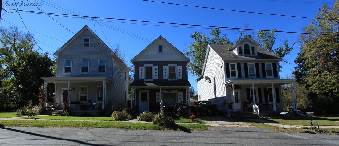 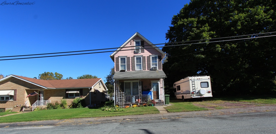 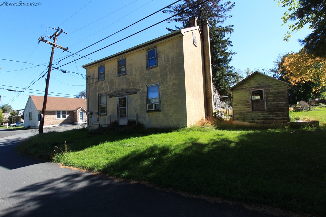 The Bangor & Portland Railway delivered slate from quarries in northern Northampton County, Pennsylvania, to the Delaware, Lackawanna & Western Railroad junction at Portland. In 1885, a branch line was built to connect with the Pennsylvania Railroad at Brainards, New Jersey which at that time was called Martin's creek as well. The name was eventually changed to distinguish it from the Martin's Creek located across the water. 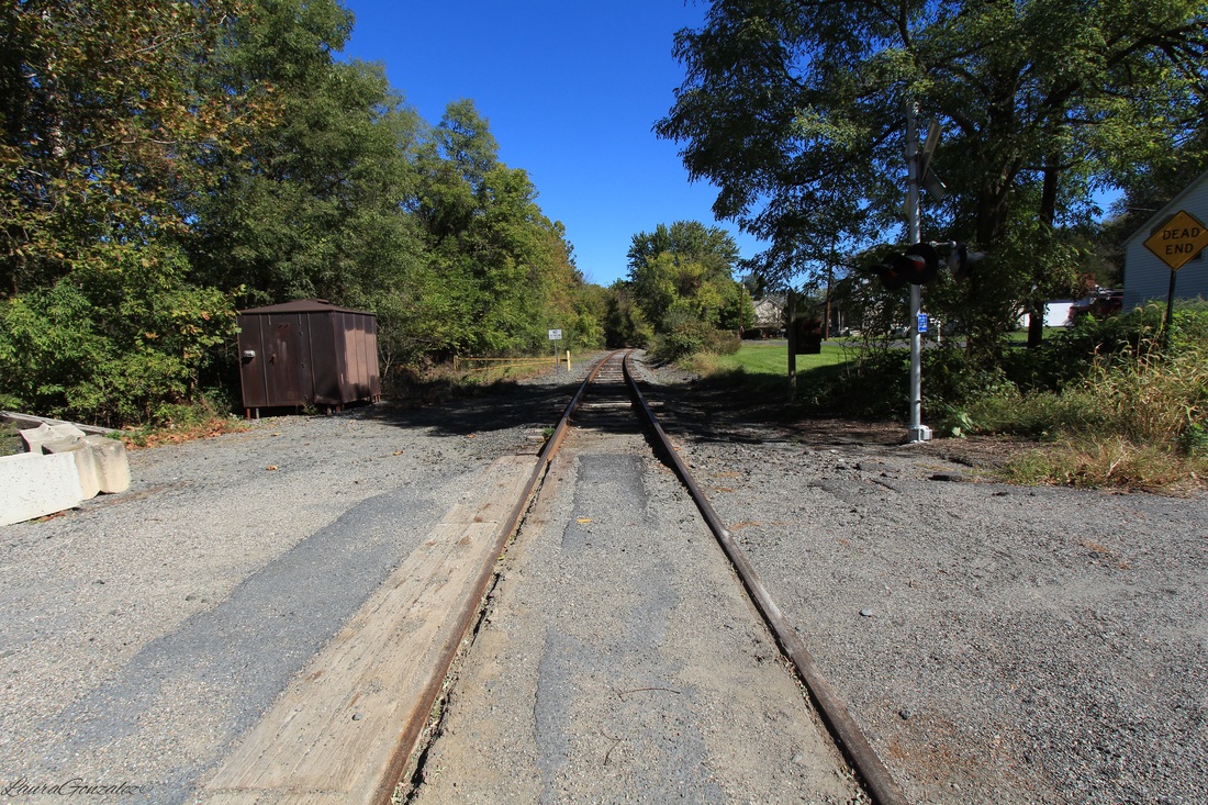 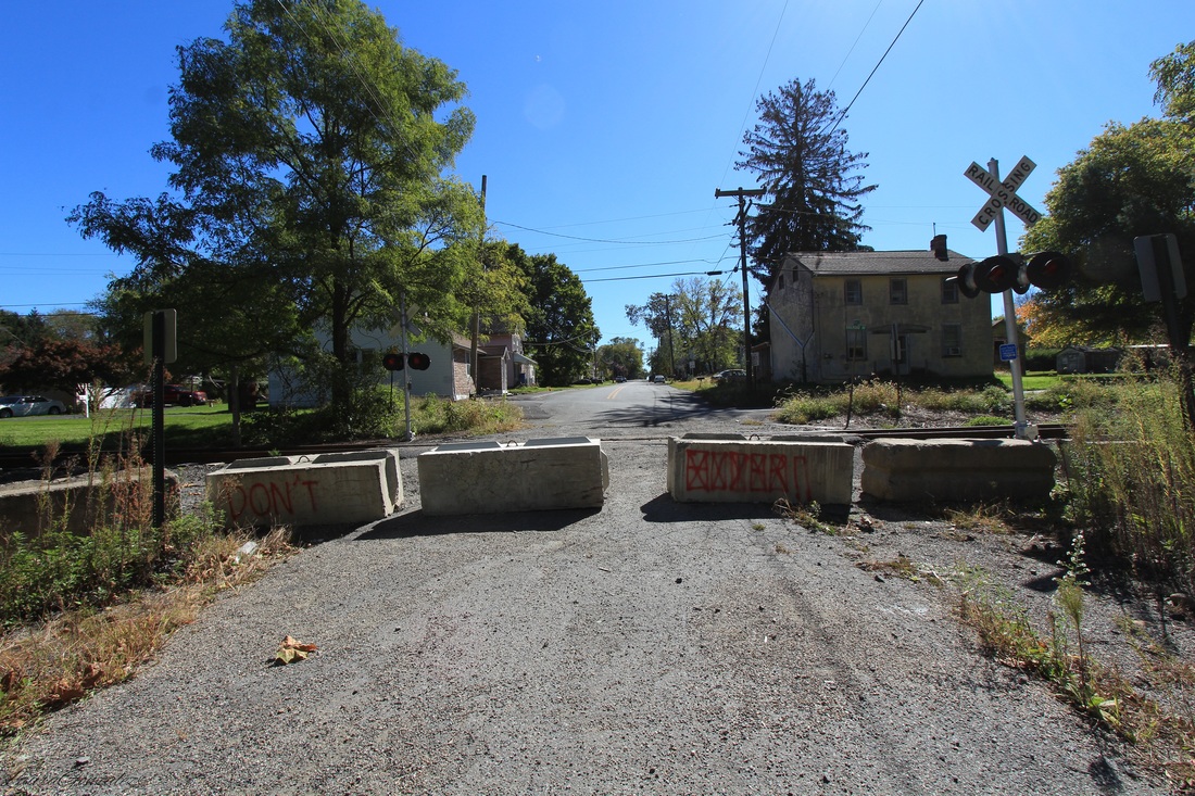 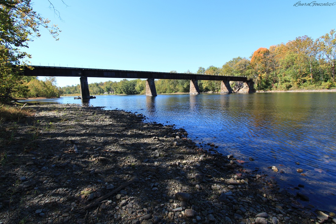 The town also would have its dark times.... On April 29, 1911, disaster struck the the area of Martins Creek when a Utica teacher's excursion train carrying 169 Up-State school teachers and friends were on the way to Washington, New Jersey. The train was hurled down a forty-foot embankment at Martin's Creek, where it crashed and caught fire killing 12 people and injuring 101 others 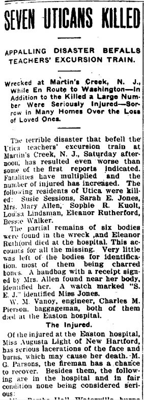 On March 26, 1942 an explosion at the Lehigh Portland Cement Co. in Easton took 31 lives, many had been residents of Brainards. The cement company gave deceased workers' widows only $11 per month for about six years as compensation for the loss of their husbands. 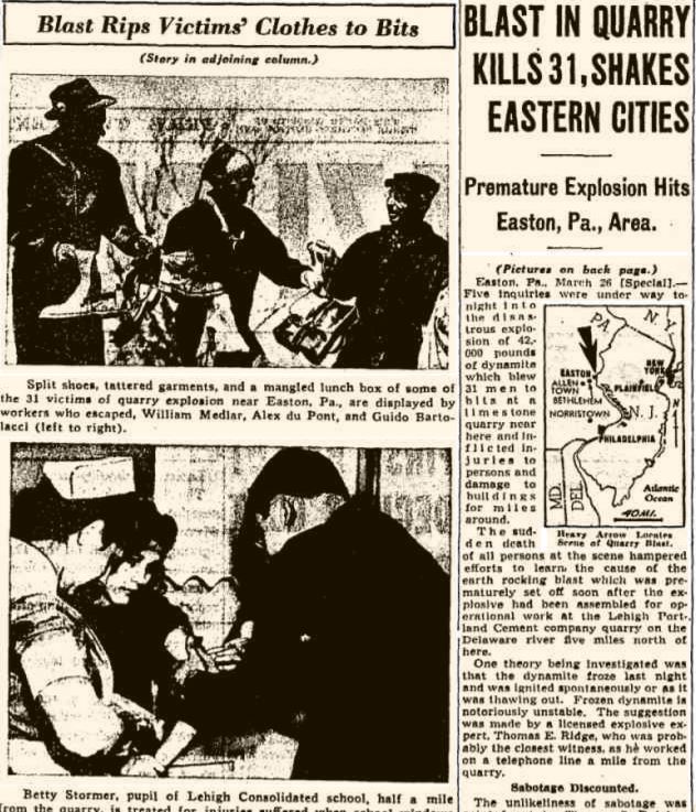 In 1945, it was the scene of a shooting after a fugitive escaped custody after being apprehended for the brutal slaying of his wife. Ernest Rittenhouse, 30, war plant worker had been a resident of the area and escaped back to his hometown to hideout after he murdered his wife with an ax and disappeared. The officers caught up to him and he somehow managed to wrestle the gun from the officers and shoot them both dead and jumped into the Martin's Creek to escape. 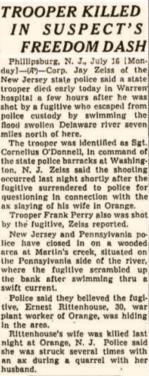 Now that the industry of the area is gone the town of Brainards is awaiting its next step, which is the development of its vacant parcels that line the Delaware River to spark life back into the once prosperous area.
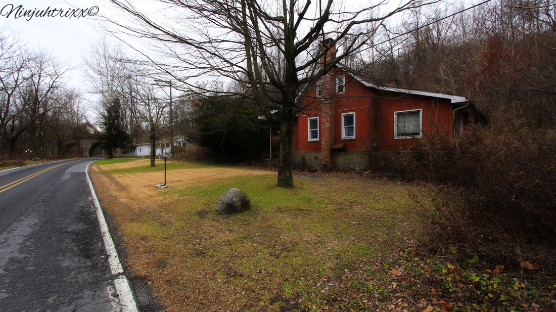
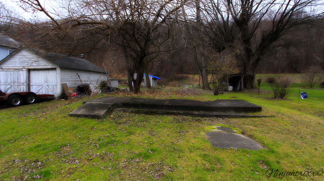
Along the Pequest River and U.S. Route 46 in White Township within Warren County, New Jersey is Buttzville which is frequently listed on lists of odd and unusual place names. 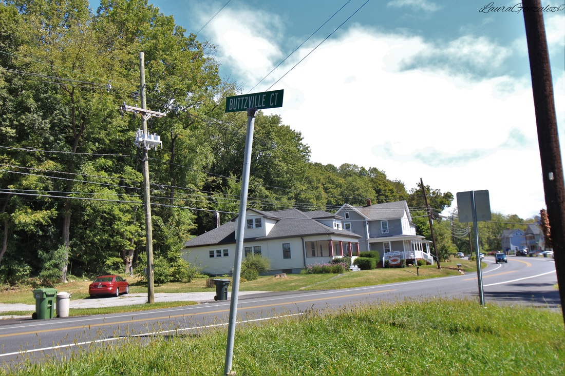 Buttzville was not known as Buttzville until 1839, when Micheal Robert Buttz purchased the land from a miller who had used the property for a gristmill in its past. He soon opened a hotel and his descendants lived and worked in the town. Michael Robert Buttz named this little settlement Buttzville and that is still the name today. 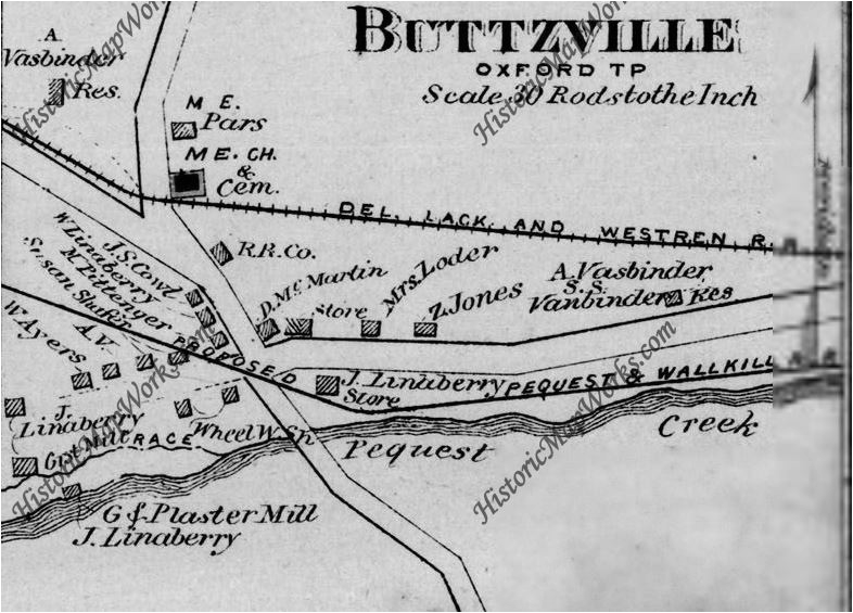 1874 Before Michael Buttz had come to Buttzville, he had a teaching gig near his former residence along the Delaware River before buying property in New Market and opening a saw mill, hotel and apple and rye distillery. He was also a justice of the peace and in the army. He sold it all in 1831 to George and John Troxall. He then took his chances in Politics and was elected on the Democratic ticket but finally gave up due to financial reasons. He next took his chances in Easton but again grew restless and made his final move to the Pequest River where he opened a grist mill, plaster mill and a general store. 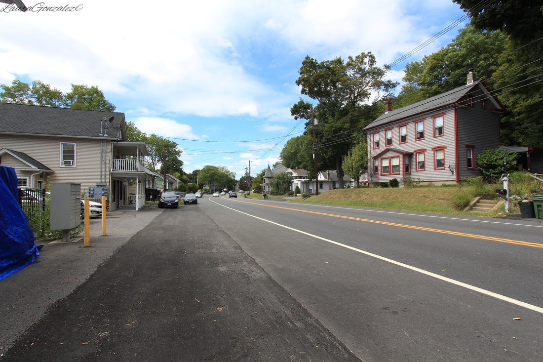 By 1854, he sold the mill property to Elisha Kirkhuff. It, then, later passed hands to Linaberry and Anderson and then to Thomas Craig. Buttzville United Methodist Church Buttzville United Methodist Church in Belvidere just commemorated 175 Years last year He would die there at the age of 72 and was buried in the M.E. cemetery. 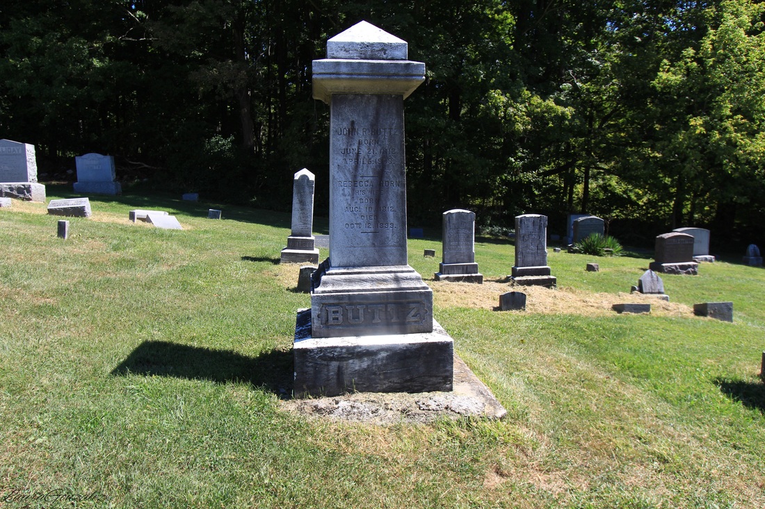 Thomas A. Edison once had a manufacturing plant and quarry in the area. Edison would often stop at Craig's Store in Buttzville. He and Tom Craig(also owned a store in addition the mill) became good friends. The original homes which were built in the last century are located off a street called Mill Street. 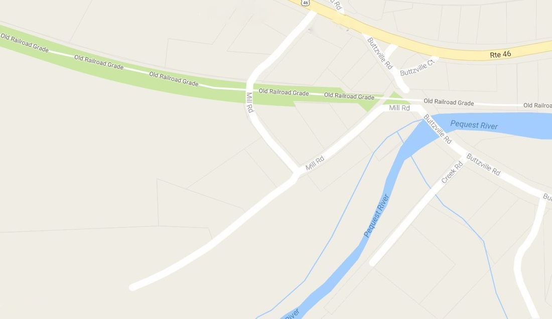 Location of Mill Street No members of the Buttz family live here today, although the name remains and many people still pass through and remark on the odd naming of the town.
Located in Northampton County, Pennsylvania is the small quiet town of Slateford, which is located on the edge of the Northampton Slate Belt. Many, many years ago, slate quarries were set up and the town was named Slateford. Immigrants from Wales and England came in the 19th century to work in the quarries. At its peak, in the first decade of the twentieth century, the Slate Belt accounted for about half of the slate produced in the United States.
A local historian, Matthew S. Henry, writing in 1851, stated that a slate quarry "At the northern line of the Township along the Delaware River at the Gap" was incorporated on April 16, 1808, under the title "the President Managers & Co for the purpose of obtaining Slate from quarries within the County of Northampton." This title was changed on April 1, 1836, and again on February 22, 1853, to the Kittatinny Slate Company. The organization of this company was believed to be the first attempt at quarrying slate "in this Country."
Delaware Water Gap , Historic Resource Study
The small Slateford settlement consisted of twelve houses at first, which were erected in 1805 by Hon. James M. Porter, the owner of the Pennsylvania Slate Company. The people of the village were quarry employees as the quarry was located about half a mile northwest of the village. In 1877, ownership of the quarry was transferred to J. L. Williams. When the railroad came to town, 26 homes were in existence. The last quarry closed in 1917.
As I walk down the main road something catches my eye, the foundation of the Union church. Most of the stones were moved to Riverview Cemetery when the railroad was put in but somehow these ones were left behind.
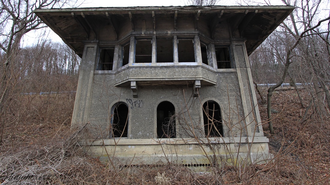
The town is home to Slateford Junction which connected the Lackawanna Railroad to the Lackawanna Cut-Off. The site had an interlocking tower (which still stands) and a small turntable, which didn't get much use. The Slateford turntable was dismantled in the 1930s and filled in after.
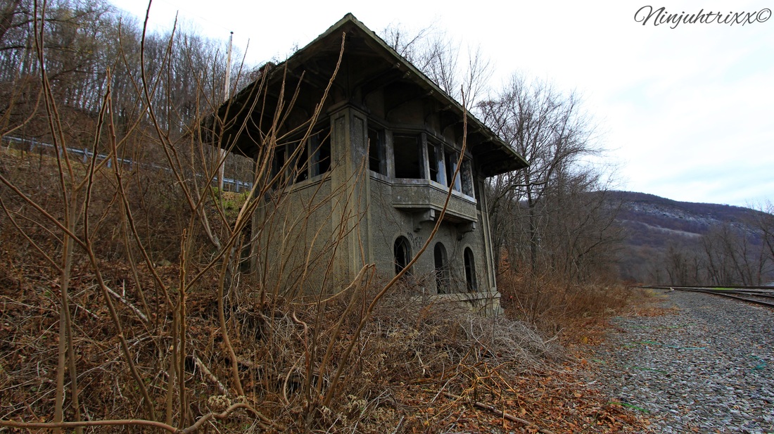
The tower opened on December 20, 1911 and closed on January 11, 1951; its operations were shifted to the tower at East Stroudsburg.
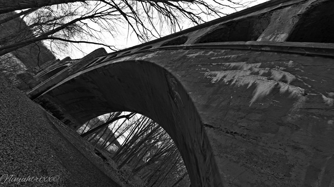
Not to far from the junction is the Delaware River Viaduct.
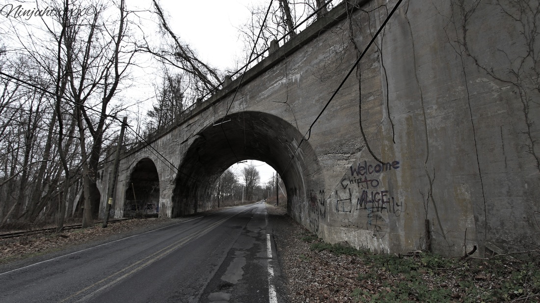
Constructed between August of 1908 to December of 1911, it is often called "Alice in Wonderland", "Alice", or "Wonderland" to those in the urbex community. Standing at 65 feet tall, the structure offers amazing views of the Delaware to those who venture to see it. The inside of one of the chambers is called "Hitlers Closet", which one makes a choice of two views at different heights . Of the four concrete arch viaducts constructed by the Delaware, Lackawanna & Western Railroad on straightening projects during the early twentieth century, the Delaware River Viaduct is the only one with a curving, skew alignment. Smith & McCormick of Easton, Pa was the builder.
From Wikipedia:
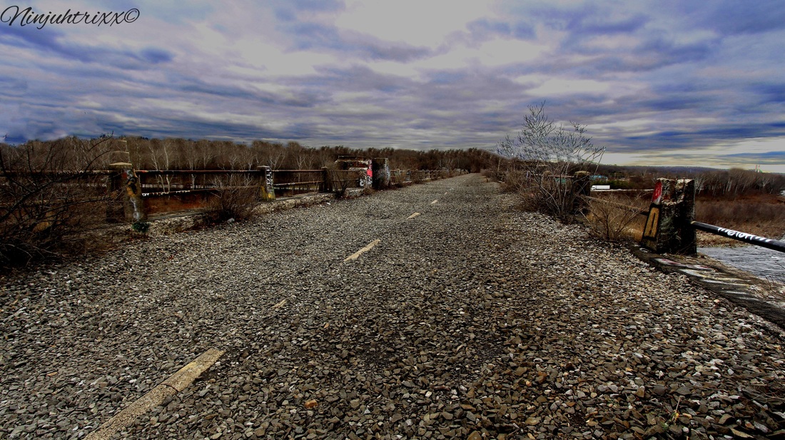
The Lackawanna Cut-Off (also known as the New Jersey Cut-Off or Hopatcong-Slateford Cut-Off) is a railroad line that was built by the Delaware, Lackawanna & Western Railroad (DL&W) between 1908 and 1911. Noted for its large cuts and fills, and two large concrete viaducts, the line was part of a 400-mile (640 km) main line between Hoboken, New Jersey, and Buffalo, New York. The Cut-Off ran west for 28.5 miles (45.9 kms) from Port Morris Junction — near the south end of Lake Hopatcong in New Jersey, about 45 miles (72 km) west-northwest of New York City — to Slateford Junction near the Delaware Water Gap in Pennsylvania.The Cut-Off was 11 miles (18 km) shorter than the Lackawanna Old Road, the rail line it superseded; it had a much better grade profile (0.55% vs. 1.1%); and it had 42 fewer curves, with all but one permitting passenger train speeds of 70 mph (110 km/h) or more.The Cut-Off also had no railroad crossings at the time of its construction. All 73 structures on the line were constructed of reinforced concrete, which was considered a pioneering use of the material. The construction of the roadbed required the movement of millions of tons of fill material using techniques similar to those used on the Panama Canal. 

Although the tales of the NJ viaducts being haunted have run rampant, I have found no known evidence to support the legend that a worker, or workers, fell into the concrete during construction and could not be extracted because of the need to keep pouring. It is often confused with the Paulinskill Viaduct, although it is lower and longer in length. It takes the title for the largest reinforced concrete structure built with a continuous pour process. It went through a series of changes in ownership, including the DL&W's merger with the Erie Railroad in 1960, acquisition by a Norfolk & Western Railroad subsidiary in 1968, and by 1976 it was transferred to Conrail where it was abandoned and the tracks ripped up in 1989. It has deteriorated since then and at a faster rate than the Paulinskill.
In the area is also the waterfalls of Slateford. Im told this where the quarry was, although I see no evidence of it existing besides the slate and cuts in the rocks.
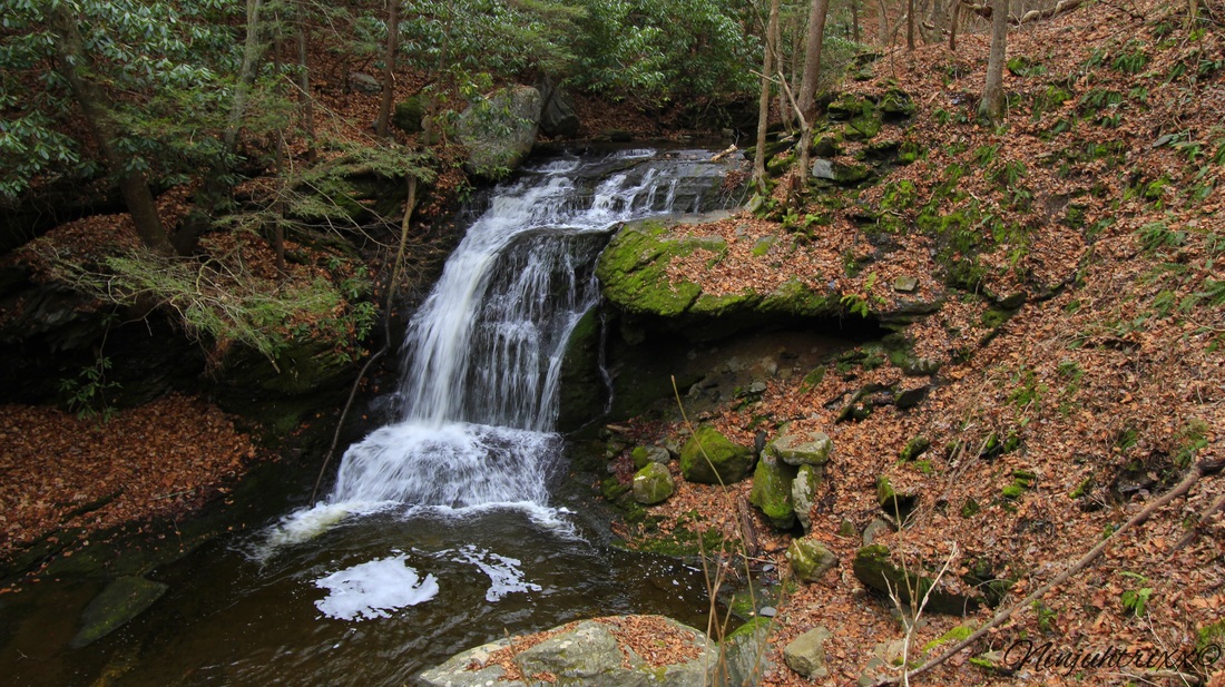
Slateford is a cute small Delaware River town and the waterfalls make it a great day trip. Please note, I do NOT condone trespassing on private property.
More pictures on my flickr!!
Laura Gonzalez
December 16 2015 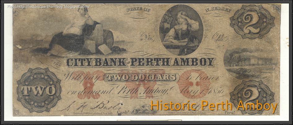 Perth Amboy was founded in 1683 and today is 4.7 square miles in size. It served as a capital of the Province of New Jersey from 1686 until 1776. In 1684, Perth Amboy became the capital of East Jersey and remained the capital until the union of East and West Jersey in 1702. It, then, became an alternate colonial capital with Burlington until 1776. Being situated on the waterfront, it has a long maritime and fishing history, and was also big during the Industrial Revolution. It played a major part on New Jersey history as immigrants flocked to fill the factory jobs and to avoid strict immigration inspection laws of New York. With the coming of the railroad also came major growth. It was the tidewater terminal for the Lehigh Valley Railroad and a coal shipping point. It was once home to one of the largest and oldest Jewish communities in the state, but since the 1950’s an exodus of the Jewish population occurred. 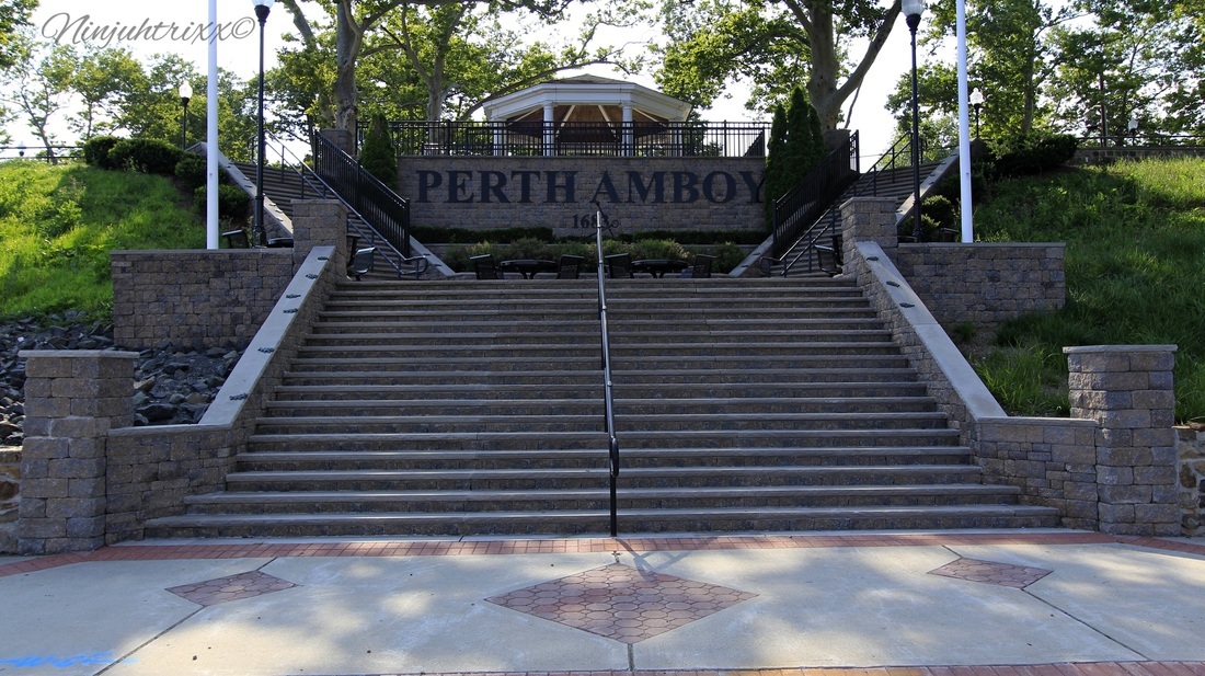 I visited Perth Amboy over the course of a few days in the early days of the summer, each day taking in a different part of this historic city with its rich history. Being that it's a fairly large city, I've decided to break it up into sections and with this walk I'm focusing on the waterfront surrounding the city and the historic area near City Hall.  To the read the full story click here....
|
ABOUT THE AUTHORLaura Gonzalez is a photographer, blogger and historian currently residing in Newark, New Jersey. Archives
April 2021
Categories
All
|
 RSS Feed
