|
Located in Somerset County of New Jersey is the small rural community of East Millstone. Located along the Delaware and Raritan Canal, the town grew and prospered during the 19th Century. It was originally called Johnsville, but that was later changed to East Millstone. The original manufacturer of famous Fleishman's Yeast was located here. 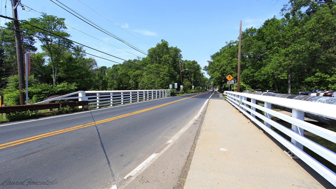 Built in 1752 by Cornelius Van Liew is the Franklin Inn, also known as the Van Liew Tavern is the oldest structure in East Millstone. It is located on Amwell Road, close to the canal. and was an important stopover for canal workers, boatmen and other travelers who utilized the canal system. It was recently operated as a used book store. Despite flooding due to Hurricanes Floyd in 1999 and Irene in 2011, the building still stands in excellent condition. 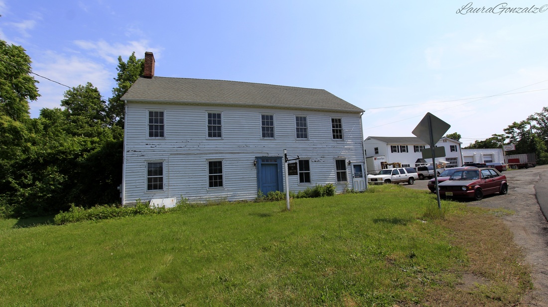 The Franklin Inn The Millstone Township First Aid Squad has been around since 1954. 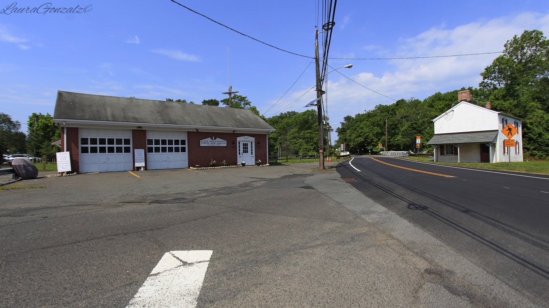 Left:Millstone Township First Aid Squad Right:East Millstone Bridge Tender's House Sitting beside the Delaware and Raritan Canal since 1834 is the East Millstone Bridge Tender's House which housed workers who opened the swing bridge of the canal. It was renovated and repainted in 2010. 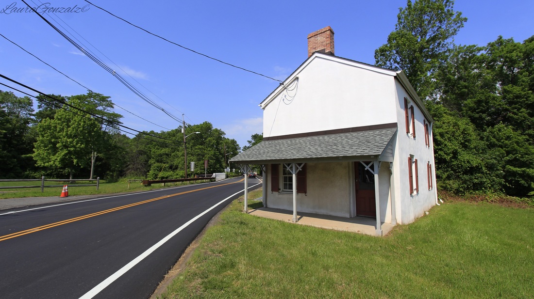 East Millstone Bridge Tender's House The Millstone and New Brunswick Railroad once ran through town but the tracks have since been removed. The coming of the railroads was the reason the town changed its name. 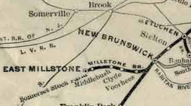 The Millstone Branch as shown on a map created by the Pennsylvania Railroad in 1911 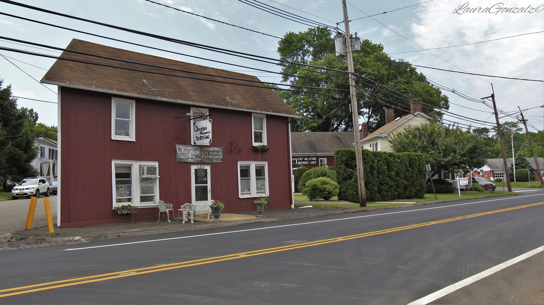 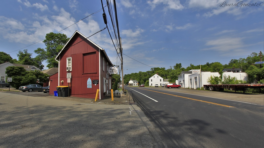 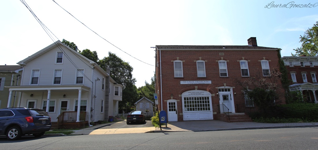 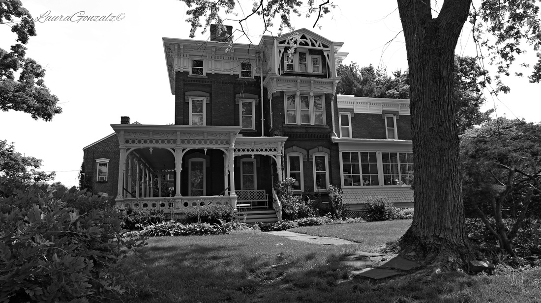 The Wilson House The Wilson House (pictured above) is an example of High Victorian Eclecticism. 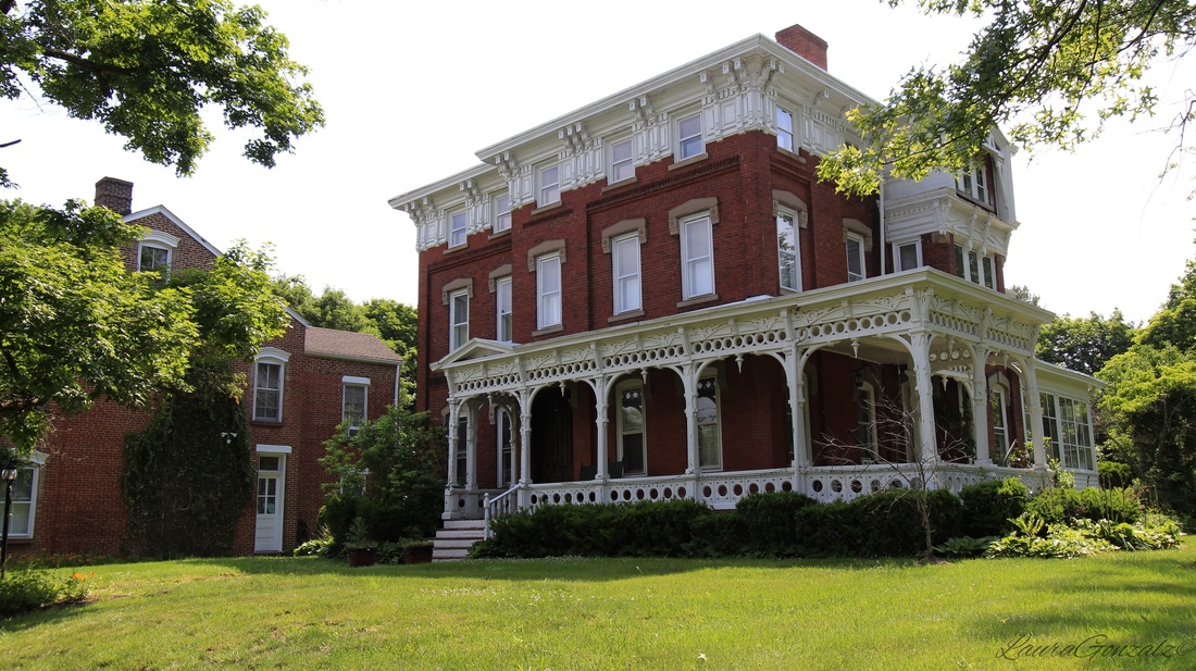 The Wilson House The house was built by Nathanial Wilson, a local entrepreneur who operated a hardware store across Market Street from the canal basin.    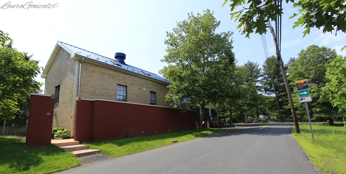   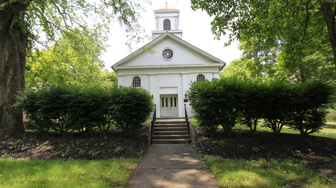 There's five churches in this little town, a big surprise when you take into account the town is comprised of just six or seven short streets of houses.  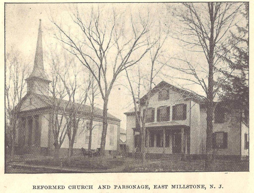 http://www.calvaryem.org/ 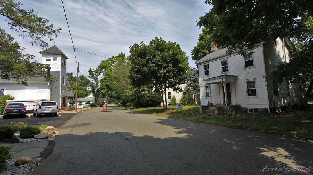 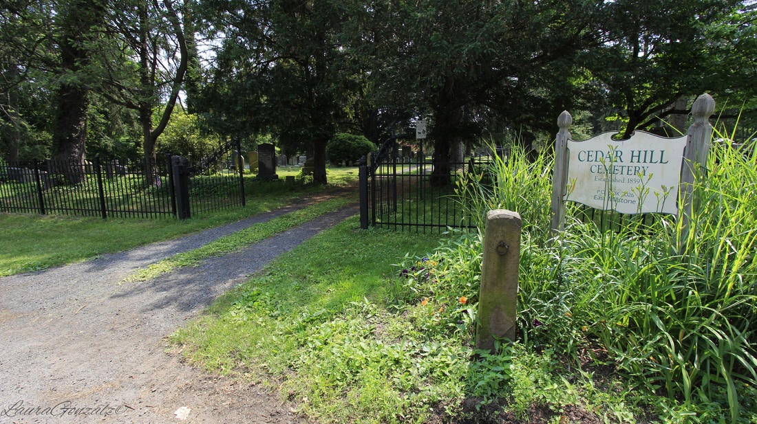 Cedar Hill Cemetery is a small cemetery located off of Wortman Street. 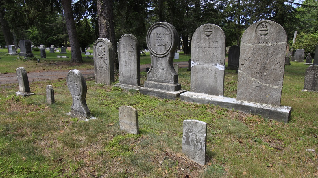 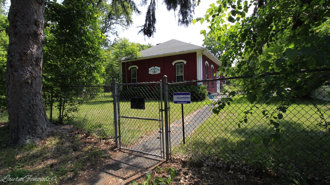 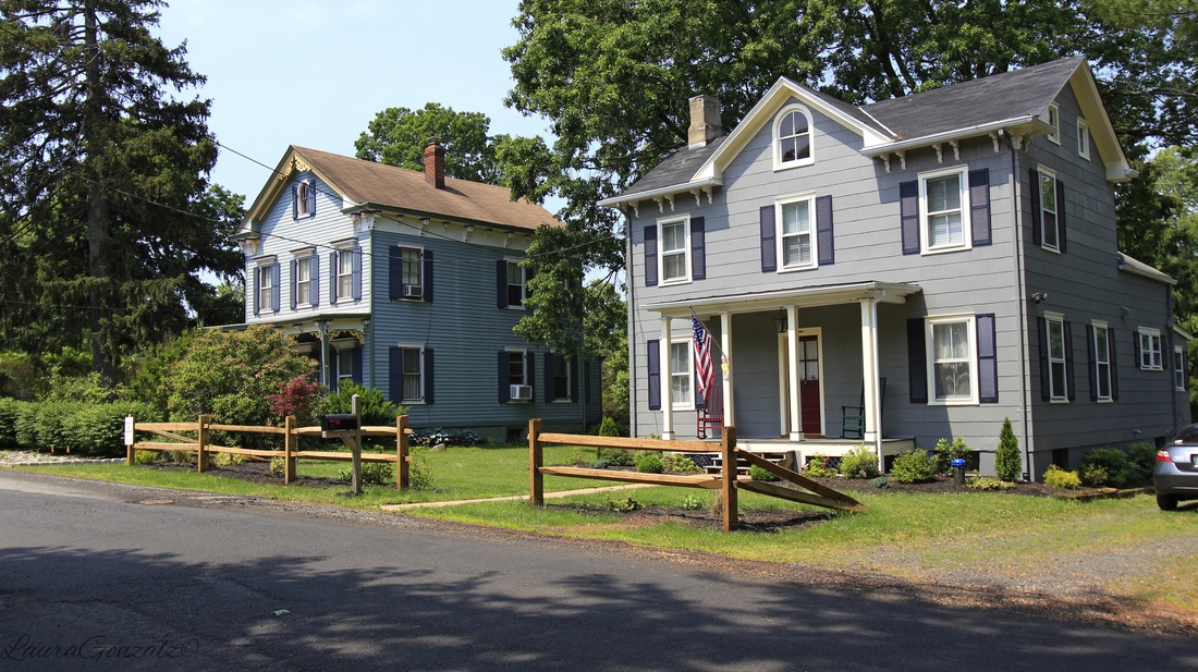
0 Comments
At the far western side of New Jersey is the small community of Brainards, which was once known as Martin's Creek. Martin's Creek takes its name from the stream that empties out just across the Delaware on the Pennsylvania side, that area is also known as Martin's Creek. In New Jersey the railway station was also called Martin's Creek. Martin's Creek was the junction point of the Pennsylvania railroad.  The name Brainards is taken from David and John Brainerd, who had their cabin across the river. The Brainerds were a missionary to the Lene lenape that occupied the area in the 1790s. The area has since changed to Brainards instead of Brainerds. Named after missionaries, one would expect to at least find one church in town, this is not the case in Brainards.  “David Brainerd was born at Haddam, Connecticut, in 1718. He was educated at Yale, licensed to preach in 1742, and was appointed missionary to the Indians within the Forks of the Delaware by the "Society for Propagating Christian Knowledge." He began his mis- sionary labors among the Indians in the Forks of the Delaware early in the summer of 1744. On the 13th of May, 1744, he came to Sakhauwotung (Martin's Creek) within the forks, and was respectfully re- ceived by the Indian king, who permitted him to preach most of the summer at his house.”  Warren County, at one time, had large cement mills in active operation which helped in growing the towns up around them. The mills of the Alpha Cement Company helped to make the small town of Brainards grow by building company housing to attract the many Slavic immigrants arriving to become workers. The workers would then walk to work on the railroad bridge which crossed the Delaware River to Martin's Creek. Before this time the area had been mostly vacant and nothing which resembled a town or village. 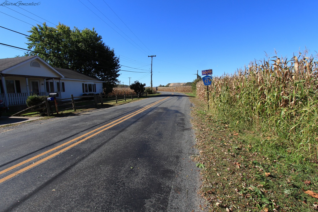 Broad Street is Brainard's main thoroughfare. It is lined with former company housing. Alpha would rent the homes to the workers for 9 dollars a month. For single men there were the boarding houses which were run by widows of factory workers who had died. By the time the 1960s rolled around, the cement companies decided operating elsewhere would be more cost effective. They sold the company housing to those who wished to stay for $900 a home or $1200 for a home with plumbing. Company housing is usually recognized when viewing the landscape as a whole in the little variation from house to house and simple architectural styling. I noticed this when i first visited Brainards, before i knew it had been a company town. Some of the Alpha company’s houses are on property formerly a part of the lot of George Depue who lived in a stone house one-eighth of a mile south of the station from 1850 until his death in 1897. 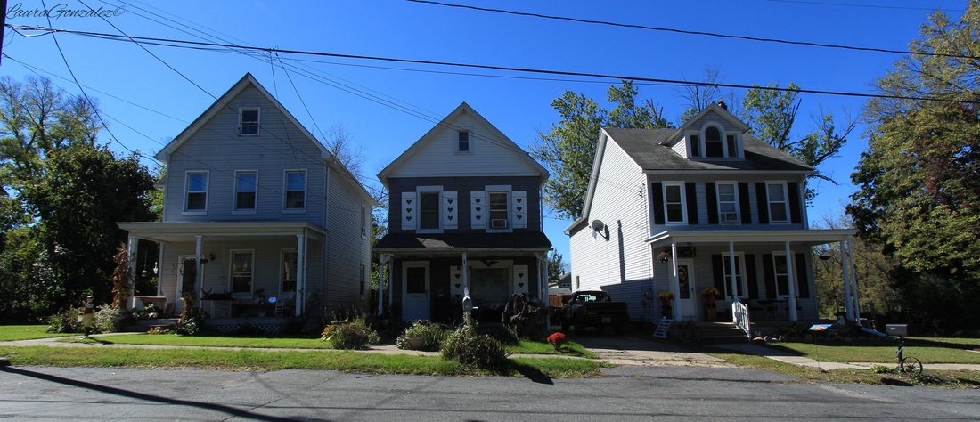 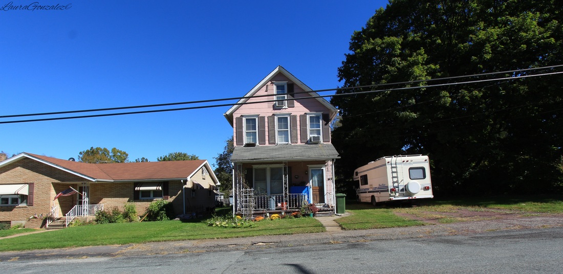 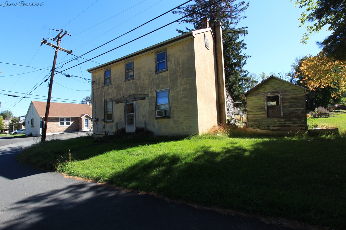 The Bangor & Portland Railway delivered slate from quarries in northern Northampton County, Pennsylvania, to the Delaware, Lackawanna & Western Railroad junction at Portland. In 1885, a branch line was built to connect with the Pennsylvania Railroad at Brainards, New Jersey which at that time was called Martin's creek as well. The name was eventually changed to distinguish it from the Martin's Creek located across the water. 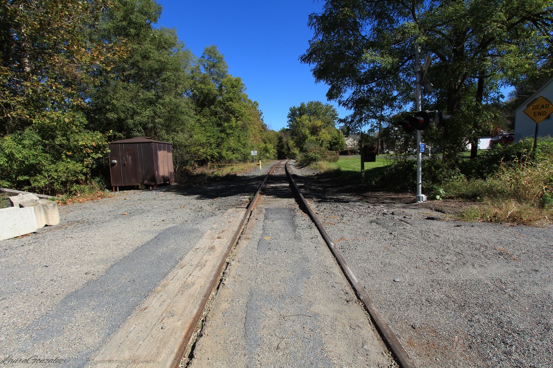 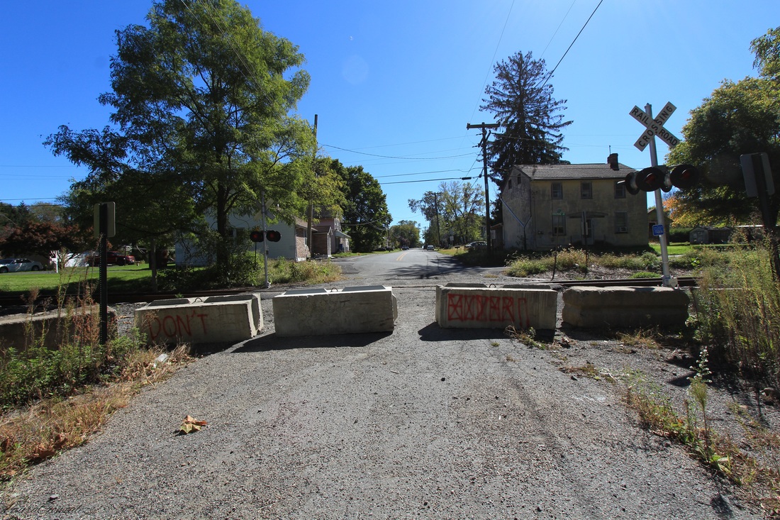 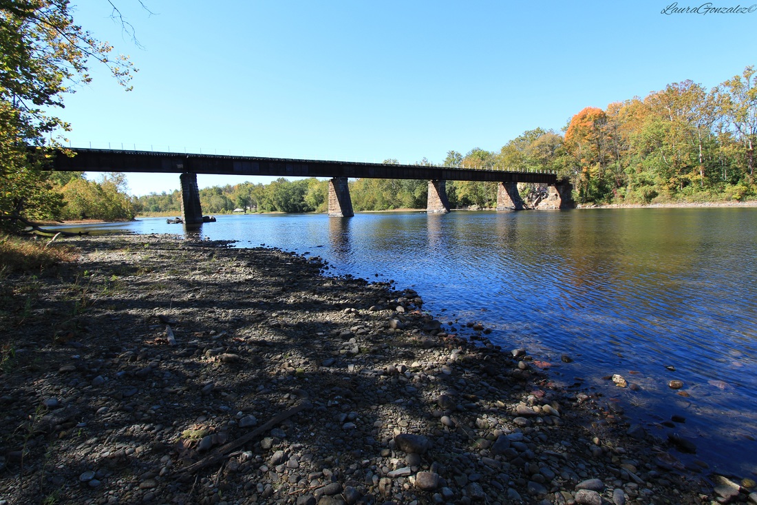 The town also would have its dark times.... On April 29, 1911, disaster struck the the area of Martins Creek when a Utica teacher's excursion train carrying 169 Up-State school teachers and friends were on the way to Washington, New Jersey. The train was hurled down a forty-foot embankment at Martin's Creek, where it crashed and caught fire killing 12 people and injuring 101 others 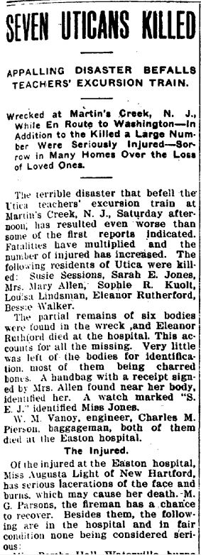 On March 26, 1942 an explosion at the Lehigh Portland Cement Co. in Easton took 31 lives, many had been residents of Brainards. The cement company gave deceased workers' widows only $11 per month for about six years as compensation for the loss of their husbands. 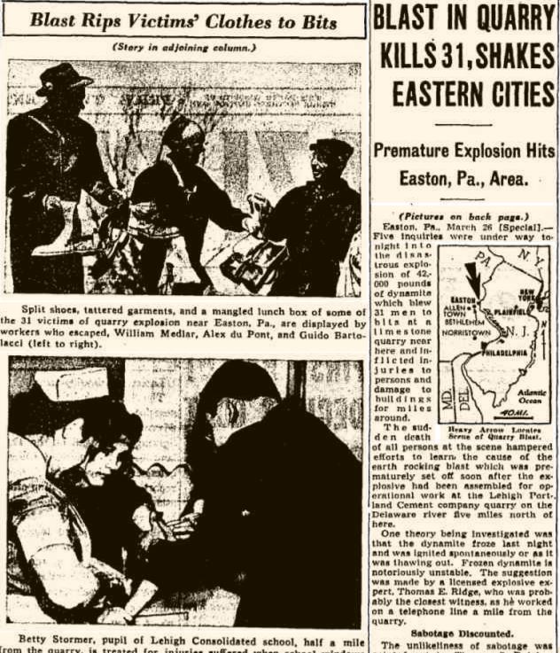 In 1945, it was the scene of a shooting after a fugitive escaped custody after being apprehended for the brutal slaying of his wife. Ernest Rittenhouse, 30, war plant worker had been a resident of the area and escaped back to his hometown to hideout after he murdered his wife with an ax and disappeared. The officers caught up to him and he somehow managed to wrestle the gun from the officers and shoot them both dead and jumped into the Martin's Creek to escape. 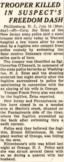 Now that the industry of the area is gone the town of Brainards is awaiting its next step, which is the development of its vacant parcels that line the Delaware River to spark life back into the once prosperous area.
Along the Pequest River and U.S. Route 46 in White Township within Warren County, New Jersey is Buttzville which is frequently listed on lists of odd and unusual place names. 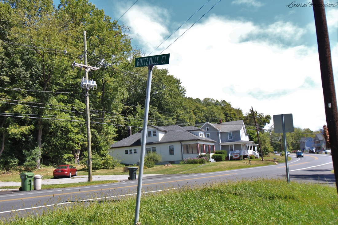 Buttzville was not known as Buttzville until 1839, when Micheal Robert Buttz purchased the land from a miller who had used the property for a gristmill in its past. He soon opened a hotel and his descendants lived and worked in the town. Michael Robert Buttz named this little settlement Buttzville and that is still the name today. 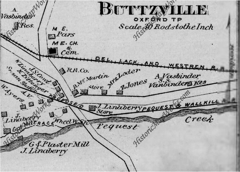 1874  Before Michael Buttz had come to Buttzville, he had a teaching gig near his former residence along the Delaware River before buying property in New Market and opening a saw mill, hotel and apple and rye distillery. He was also a justice of the peace and in the army. He sold it all in 1831 to George and John Troxall. He then took his chances in Politics and was elected on the Democratic ticket but finally gave up due to financial reasons. He next took his chances in Easton but again grew restless and made his final move to the Pequest River where he opened a grist mill, plaster mill and a general store.  By 1854, he sold the mill property to Elisha Kirkhuff. It, then, later passed hands to Linaberry and Anderson and then to Thomas Craig.  Buttzville United Methodist Church Buttzville United Methodist Church in Belvidere just commemorated 175 Years last year He would die there at the age of 72 and was buried in the M.E. cemetery. 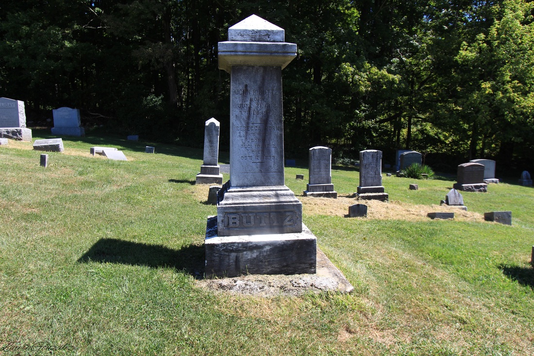  Thomas A. Edison once had a manufacturing plant and quarry in the area. Edison would often stop at Craig's Store in Buttzville. He and Tom Craig(also owned a store in addition the mill) became good friends. The original homes which were built in the last century are located off a street called Mill Street. 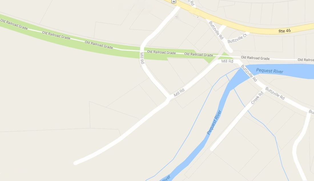 Location of Mill Street  No members of the Buttz family live here today, although the name remains and many people still pass through and remark on the odd naming of the town.
One of northwestern New Jersey's oldest communities, is Johnsonburg once known as "Log Gaol" , which means log jail due to it being the location of jail which was erected in 1753. It was once the seat of newly formed Sussex County in the 1750s before joining Warren County. The log jail was the first county building erected for Sussex.County. The town was renamed Johnsonburg after a store owner who had been of the Johnson family. 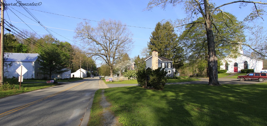 I found myself driving out to Warren County in New Jersey once again to see the small town which still retains its original general stores, mill and hotel. At one time in the 19th century, it was a place of importance, a place where horse-drawn carriages moved up and down the streets and the tavern became was an important meeting place where court meetings and elections would be held. 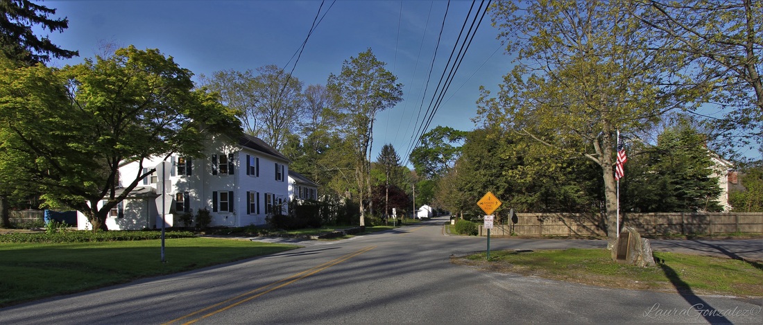 Originally a stagecoach stop in which an east-west route carried mail from Dover, New Jersey to Stroudsburg, Pennsylvania, and a north-south route which carried mail from Albany, New York to Philadelphia, Pennsylvania, the routes crossed through here and the town grew.  But the 19th century saw a new era, the age of canals and trains, which didn't make its way through Johnsonburg. The result was a town which grew little and remained stuck in the past. Many of the buildings were built in the 1800’s. 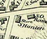 Map depicting Hardens Store in 1874 Upon entering the town I am greeted by the Hardin's Store, which dates to 1871 when is was built by Samuel Hardin, who had ownership of the mill at the time.  Hardin's Store The wheelwright shop still stands on Allamuchy Road.  At the end of the road is the Johnsonburg Hotel with a store on its left. I had a nice talk with the man who currently owns the hotel and hes been in the process of renovating it for quite some time.  Next to the hotel is the Old Stone Episcopal Church.  Old Stone Episcopal Church Drake & Mackey store is pictured below, which was built in 1860. 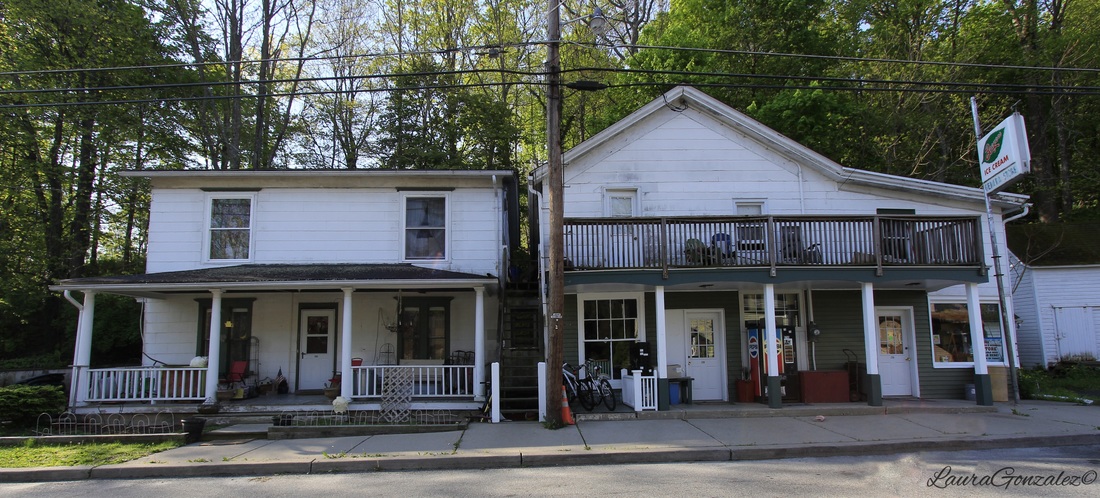 Drake & Mackey store Frelinghuysen Township Hall which is housed in the former Presbyterian Chapel. 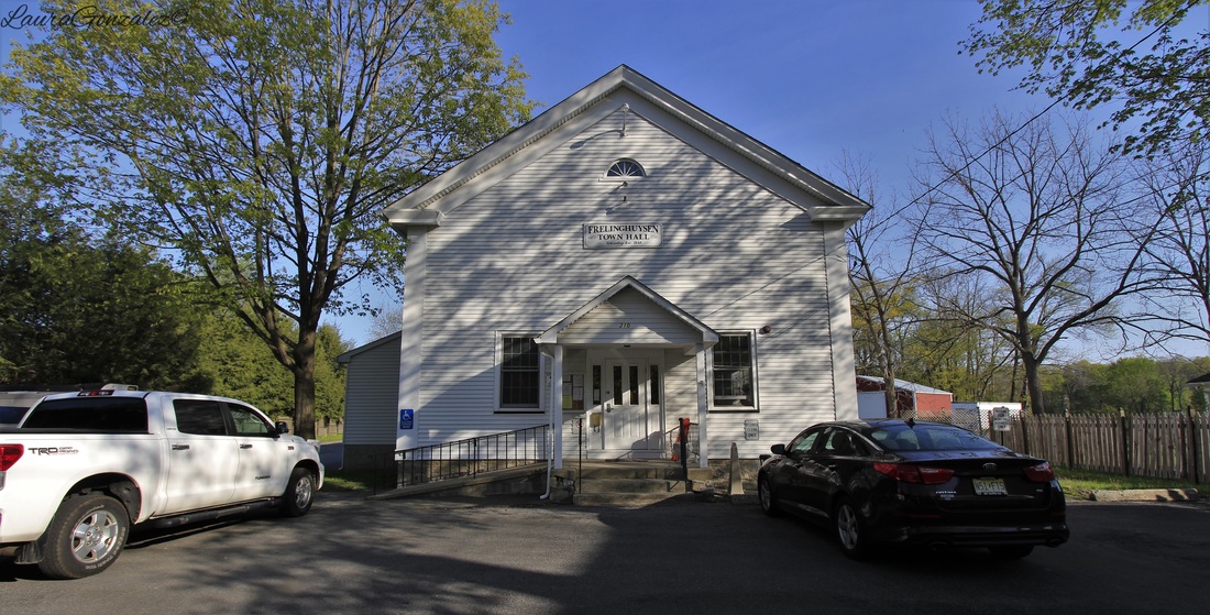 Former Presbyterian Chapel On the western edge of town is an old barn. 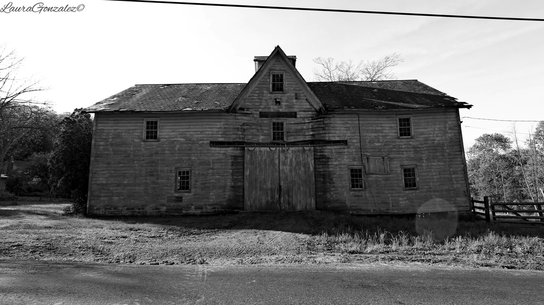 Old Barn Below is the Armstrong-Blair house. The home first was owned by William Armstrong and then was was acquired in the 1840s by James Blair. William Armstrong was a principal landowner at the time in the area and had control over the gristmill, tavern and a store. Blair is responsible for the Greek Revival remodeling of the home. The wagon house of the property sits on the site of the old jail. 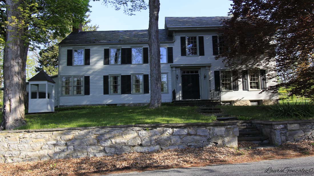 Armstrong-Blair house William Armstrong was known as the village's pioneer merchant. 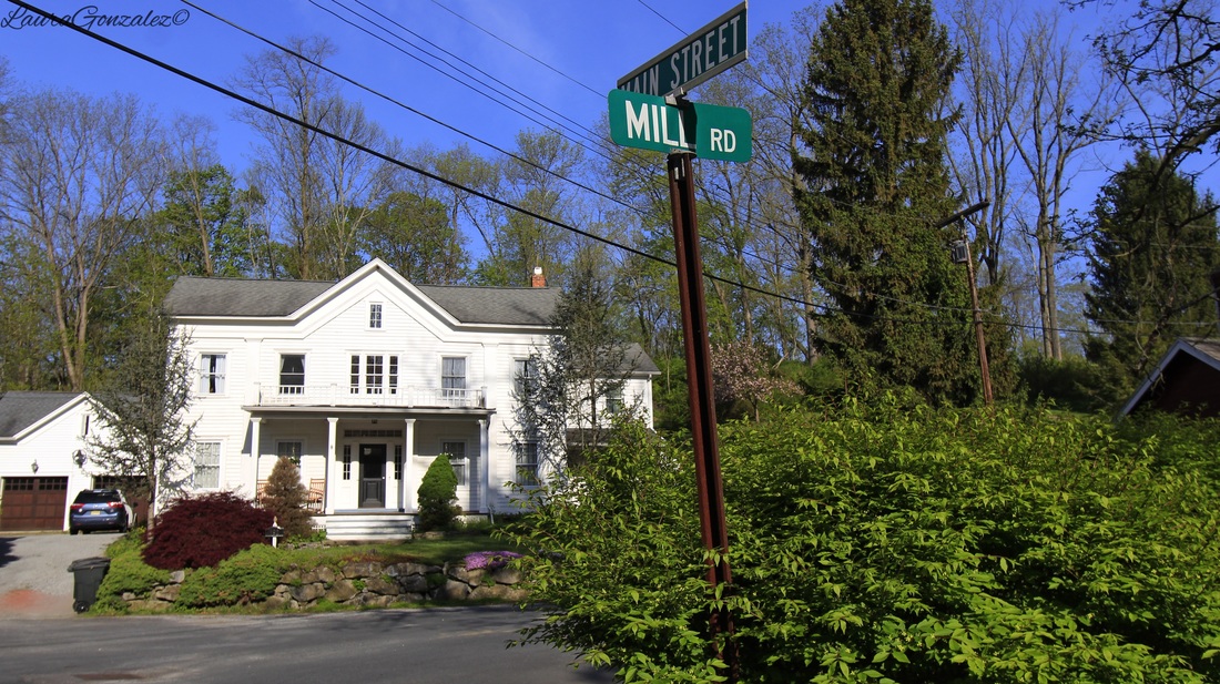 On Route 661 , I come to the mill which has been a focal point in the town since the 18th century. It ceased operation in 1937. The large mill pond to the north was created by damming Bear Creek and connected to the mill by a short head race while an underground tail race returns water to the creek. 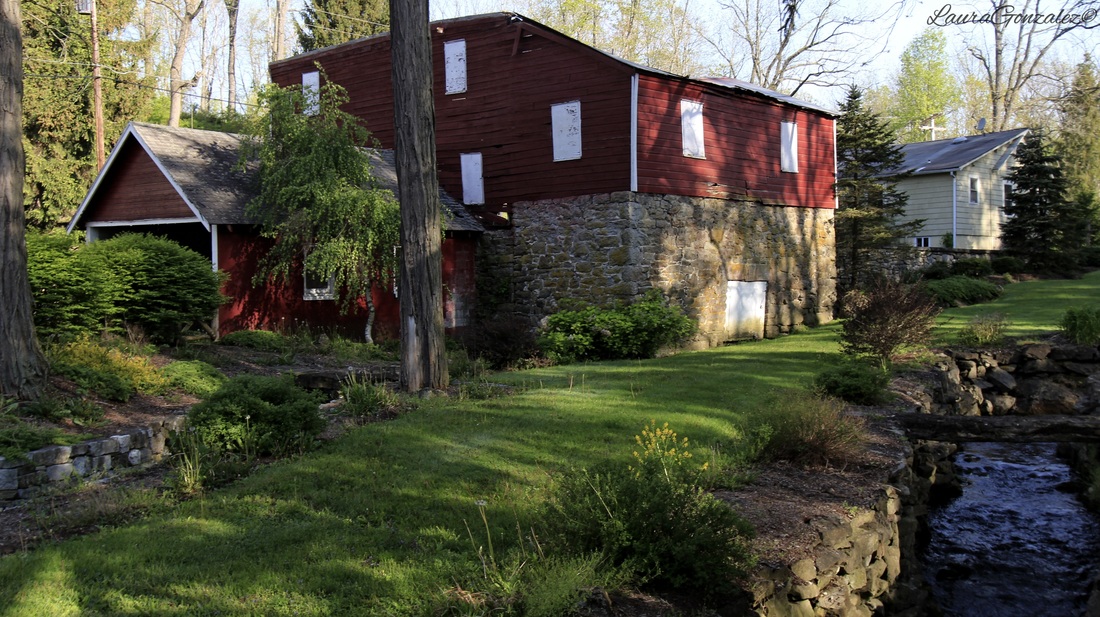 Mill At the end of the town on the western side of Route 661 are the ruins of the Van Horn Farm which sits upon the site of the Petite tavern which was operated by Jonathan Pettit as early as 1753. This was definitely a surprising find after reading a 1874 map of the area. The site was destroyed by a fire.  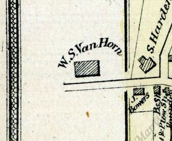 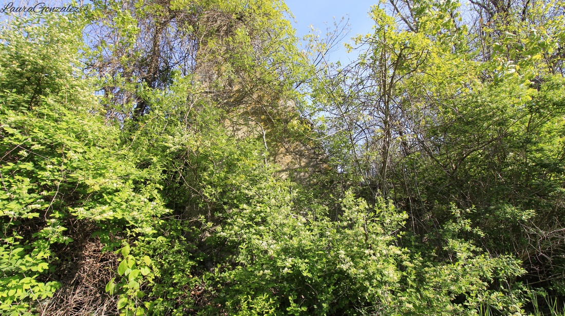 Covered by overgrowth, ruins of the Farm 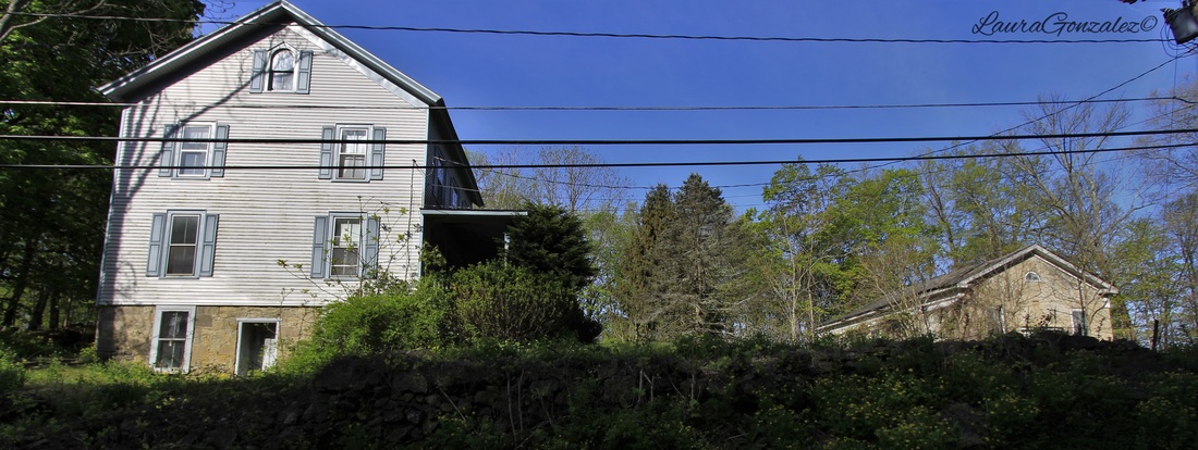 On Allamuchy Road is the small Johnsonburg Christian Church Cemetery which was established in the mid 19th century, and contains a variety of 19th and early 20th-century grave stones. 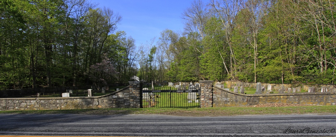 Johnsonburg Christian Church Cemetery 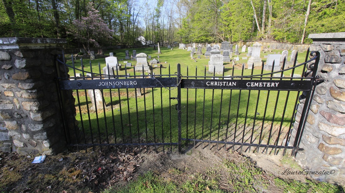 Johnsonburg Christian Church Cemetery 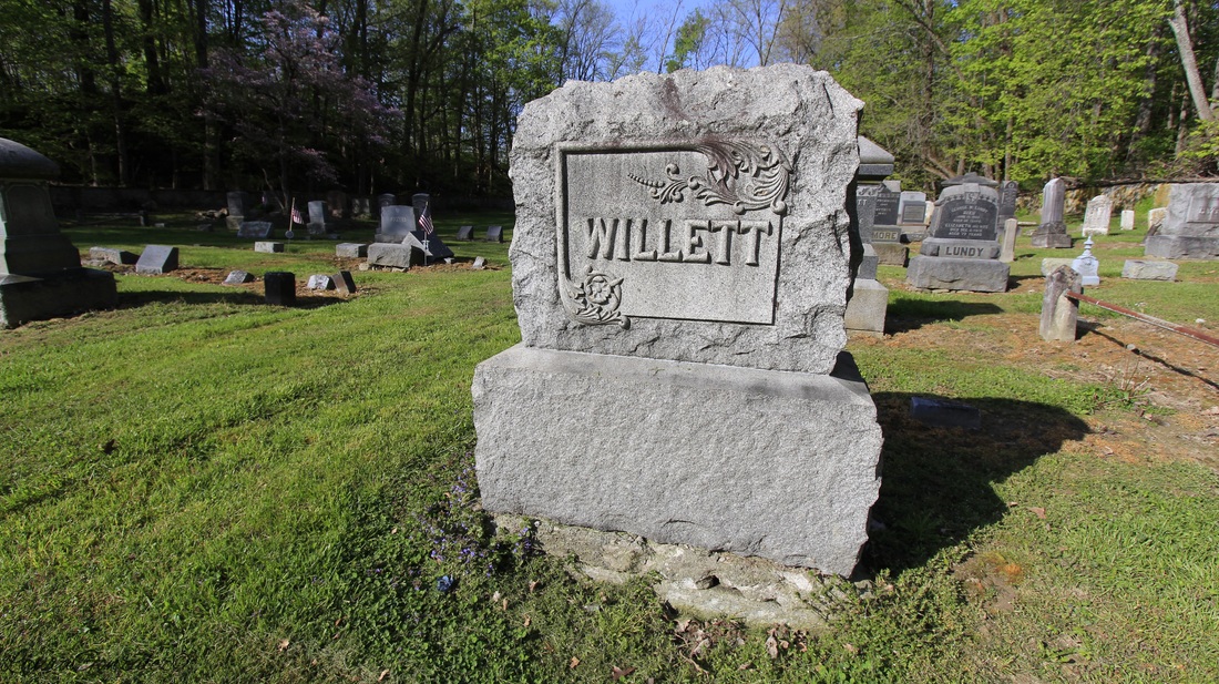 Johnsonburg Christian Church Cemetery 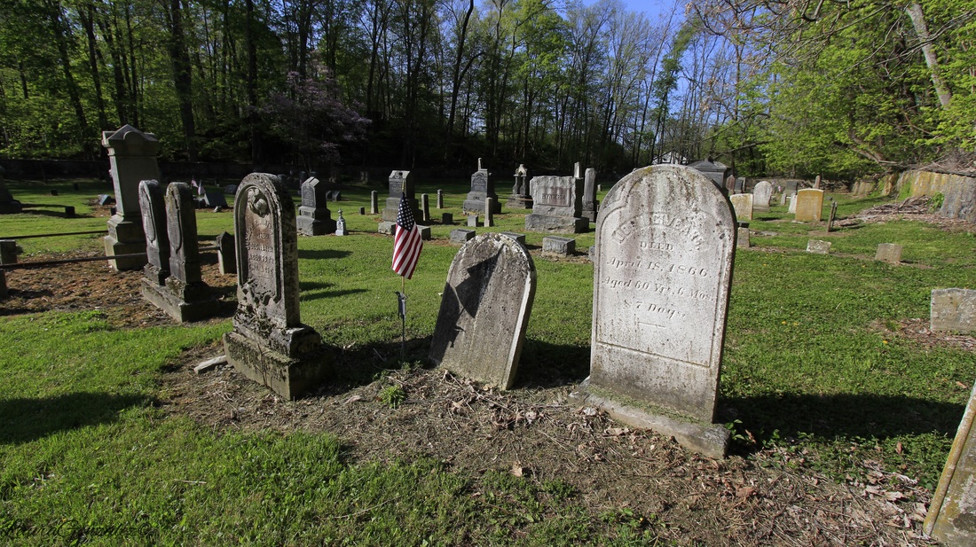 Johnsonburg Christian Church Cemetery 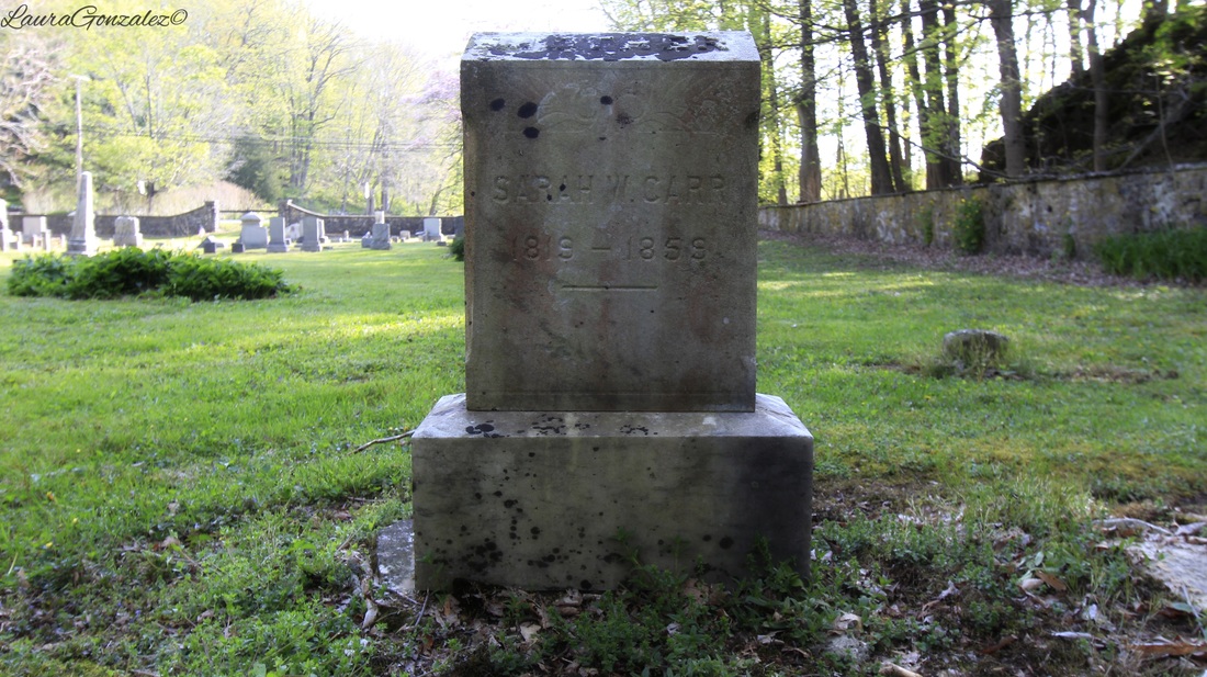 Johnsonburg Christian Church Cemetery Johnsonburg today is a quiet residential neighborhood.
Located on New Jersey's Lawrence Brook is the small-town of Milltown, which is the only municipality in Middlesex County to see a population drop from 1980 to 2014.  The history of Milltown is so named for it being a “mill town” for as long as we can go back in its history. The earliest written documentation of a mill in Milltown is in 1769, when Fulcard Van Nordstrand advertises for sale a gristmill with 2 pair of grist stones, a fulling mill and a press house standing on a constant stream with 2 dwelling houses on 112 acres of land, 3 miles from New Brunswick, on the northwest bank of the Lawrence Brook. 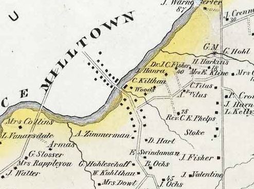 Map of East Brunswick 1876 First owned by Fulcard Van Nordstrand, then Ferdinand Schuurman, ownership changes many times before finally falling into the possession of Jacob Bergen in 1811. The town is soon named “Bergens Mill“ but is advertised in a local paper as “Milltown”. After the death of Jacob Bergen, the mill ceases operation, apparently due to a fire. This is when Christopher Meyer acquires the property and its fame as a town for manufacturing rubber is put in history with the formation of The Meyer Rubber Company. The name “Milltown” is used hereafter. 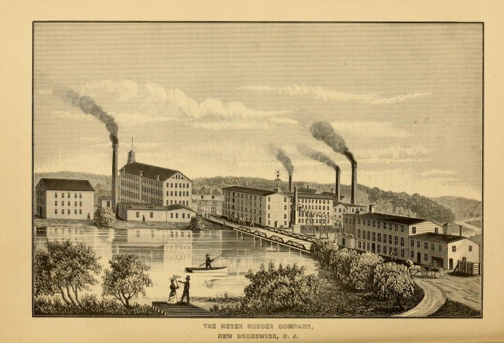 http://milltownhs.ning.com/ A fire, yet again, damages the mill and a John R Ford comes forward with his own finances and puts the mill back into motion. This is where Ford street gets its name from; after Ford & Co. . German immigrants soon arrive in Milltown from New York City after suffering from poverty and general hardship. After experiencing the opportunities of the mill some workers return to Germany to bring friends and family back putting German Phillip Kuhlthau as leader and role model of the German population of the town. 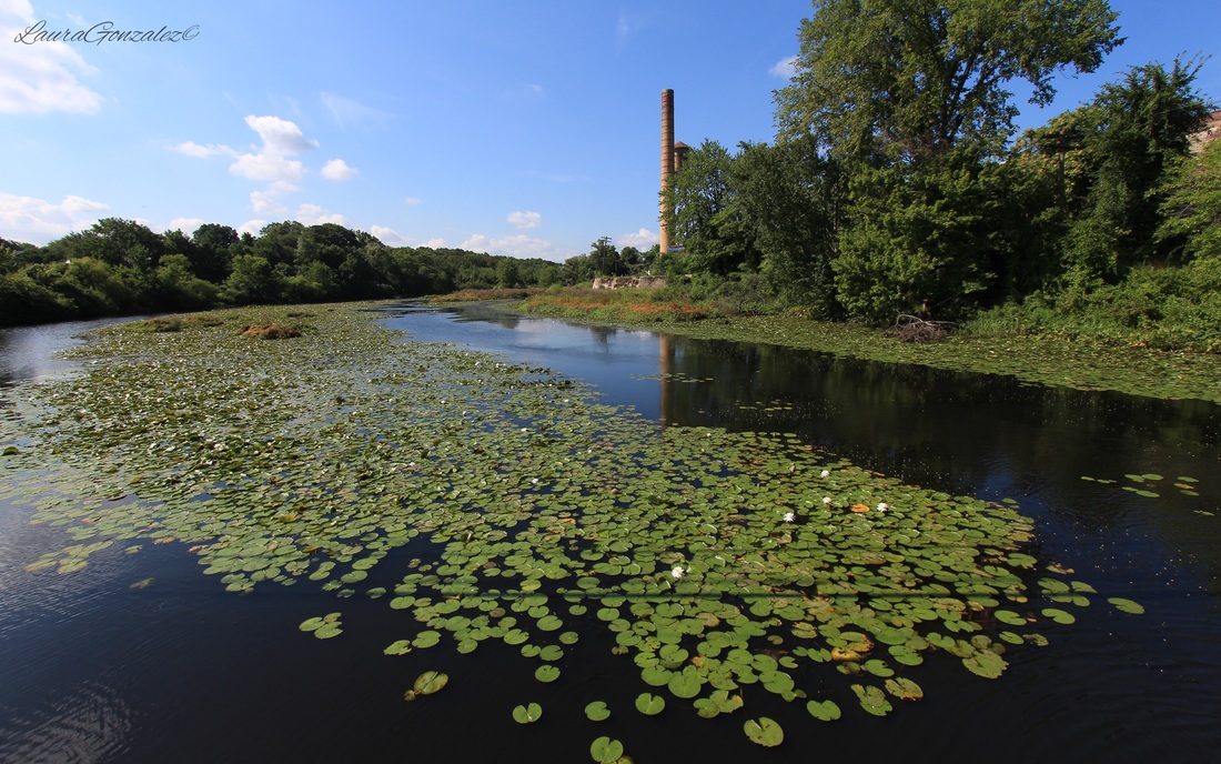 By 1852, the factory suffers another fire is rebuilt as The Ford Rubber Co. Before changing back to the Meyer Rubber Company, then India Rubber Company followed by international Rubber Co. and finally in 1907 the the Michelin Tire Company comes from France. 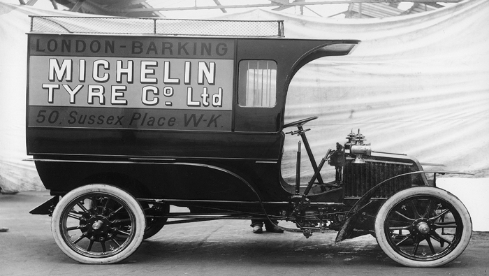 www.michelinman.com J. Habette-Michelin, of New Brunswick, was given the job of resident vice-president, and R. B. Meyers, industrial manager. New buildings were soon erected. 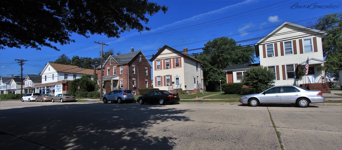 In 1919, Michelin built 53 bungalows in town, which would later increase to 200, to house their employees. Michelin was so successful it would eventually employ more than 2000 men and women. When the depression rolled around Michelin was forced to cease operations and move back to France. 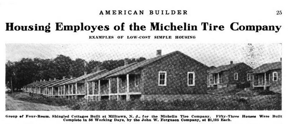 Many of the company homes can still be seen. One such street is Riva Avenue.  In an Issue of American Builder we can see the streets of the original homes. 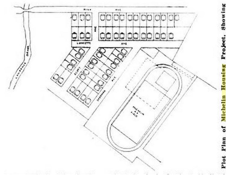 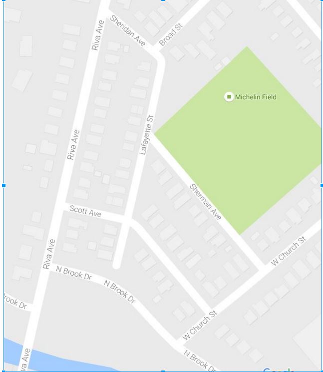 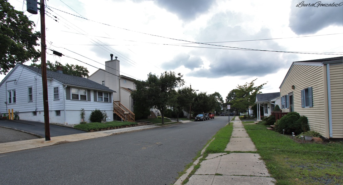 The seventeen-foot Victorian-style street clock placed at the intersection of Main Street and Washington Avenue was funded by private sponsorships and was dedicated at a ceremony on July 2 in 2010. 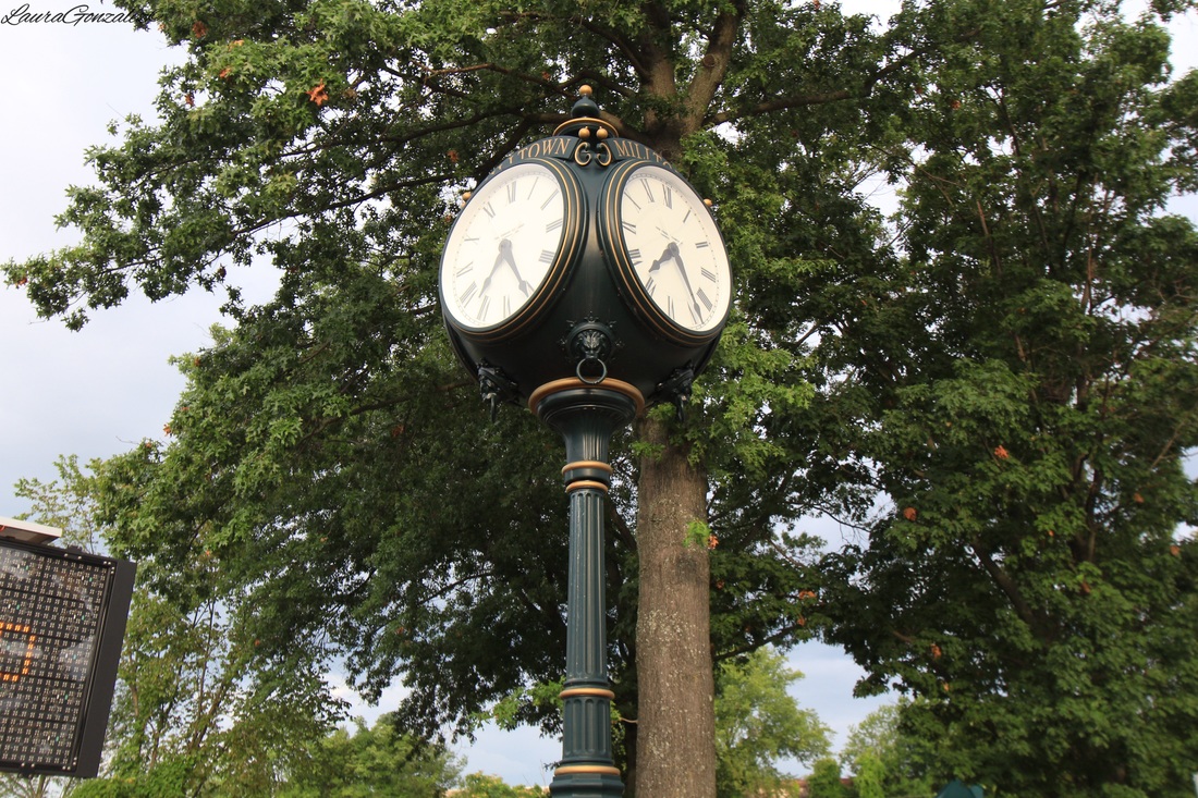 The large Italianate Industrial building on Washington Avenue has housed many businesses, one including the Russell Playing Card Co. which was opened in 1906 by Willis W. Russell. In 1936, Russell Playing Card Co. moved to Ohio after acquisition by the United States Playing Card Co. It was constructed in 1899 as the Milltown India Rubber Company factory. It is now “The Mill” Condominiums. 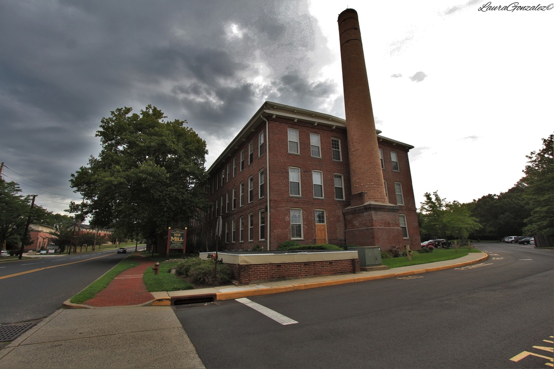 Russell Playing Card Co. 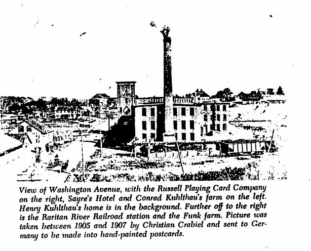 Source: NRHP Nomination Form, originally from "This Is Milltown" 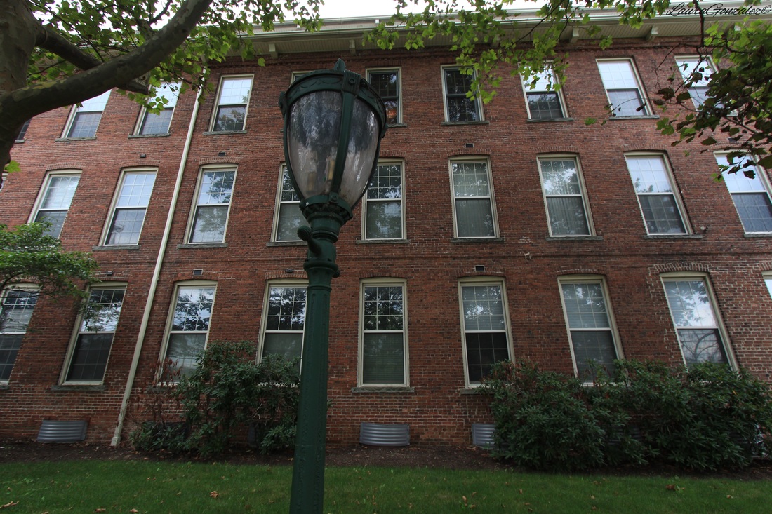 Russell Playing Card Co. 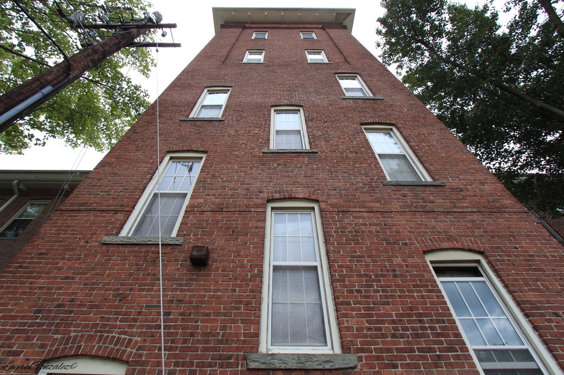 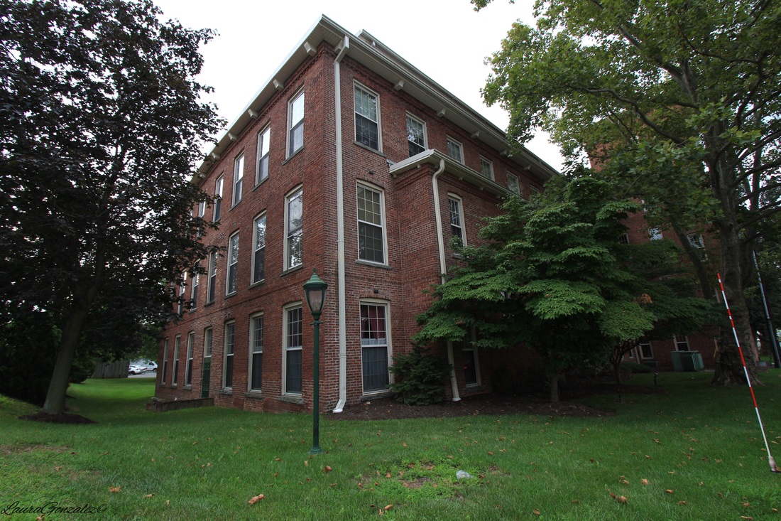 Across the street is Milltown Ice Cream Depot. 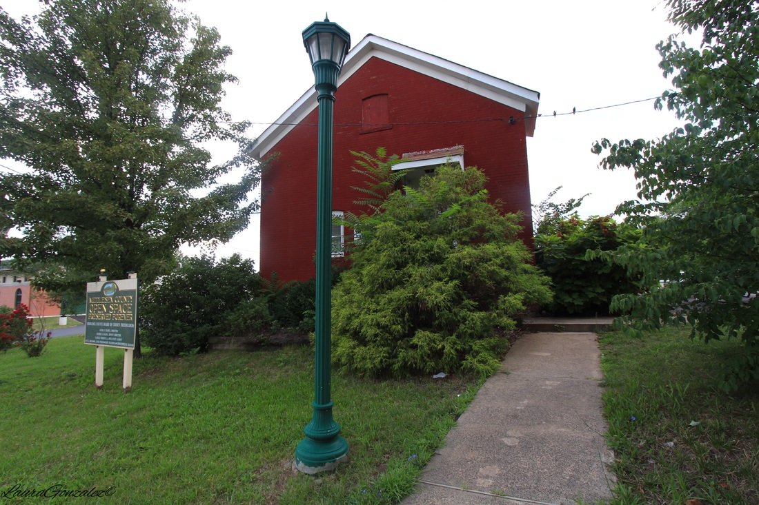 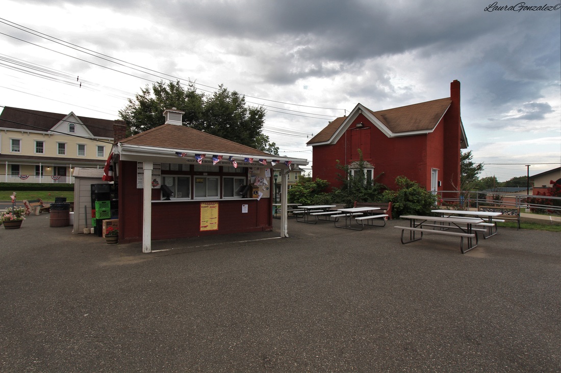 Milltown Ice Cream Depot. Milltown Freight Station is the only surviving station of the Raritan River Railroad with its first passenger train reaching Milltown in 1891. After the Great Depression, ridership decreased dramatically finally forcing the Raritan River Railroad to stop passenger service altogether in 1938 between South Amboy and New Brunswick. The Milltown Station would no longer service passengers. 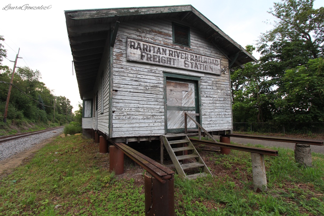 Milltown Freight Station After passenger service ended, the station building was moved slightly down the tracks and the platform height was raised so that the building could be utilized for freight service. Eventually even the express freight would not pass through the station. 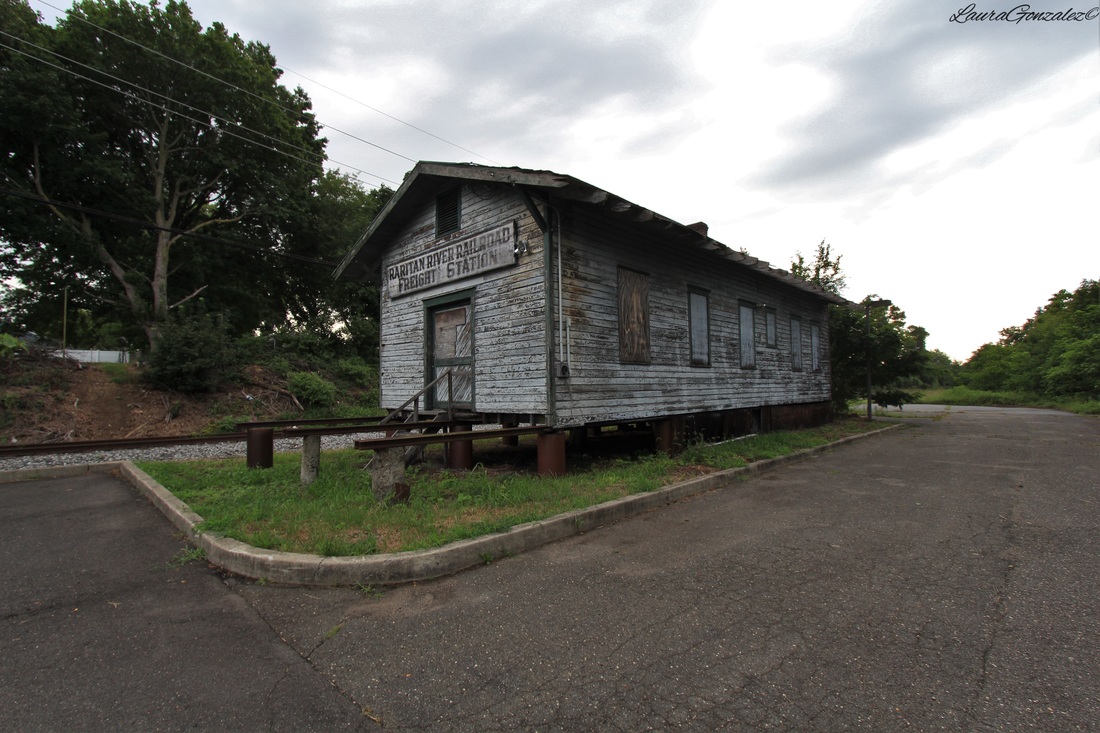 Milltown Freight Station As of June 2016, Tom Reynolds, the president, and Kenneth Durrua, the vice president, of the Raritan River Chapter of the National Railway Historical Society working with the Milltown Historical Society have raised enough money to restore the Raritan River Freight Station to its former glory and hope to complete it by 2017. 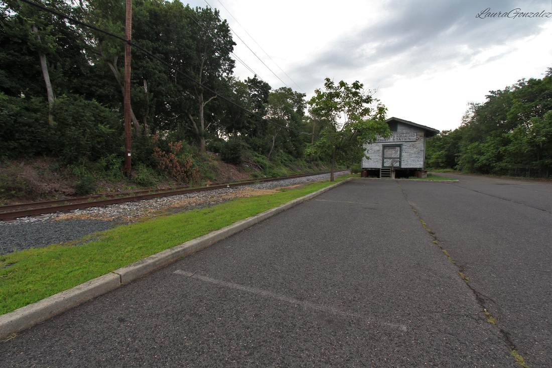 Milltown Freight Station On the corner of J F Kennedy Drive and Washington is a Bell AH-1F Cobra, which is a two-blade, single engine attack helicopter manufactured by Bell Helicopter. In an effort to honor its war veterans, the Joyce Kilmer American Legion Post 25 put it on display. 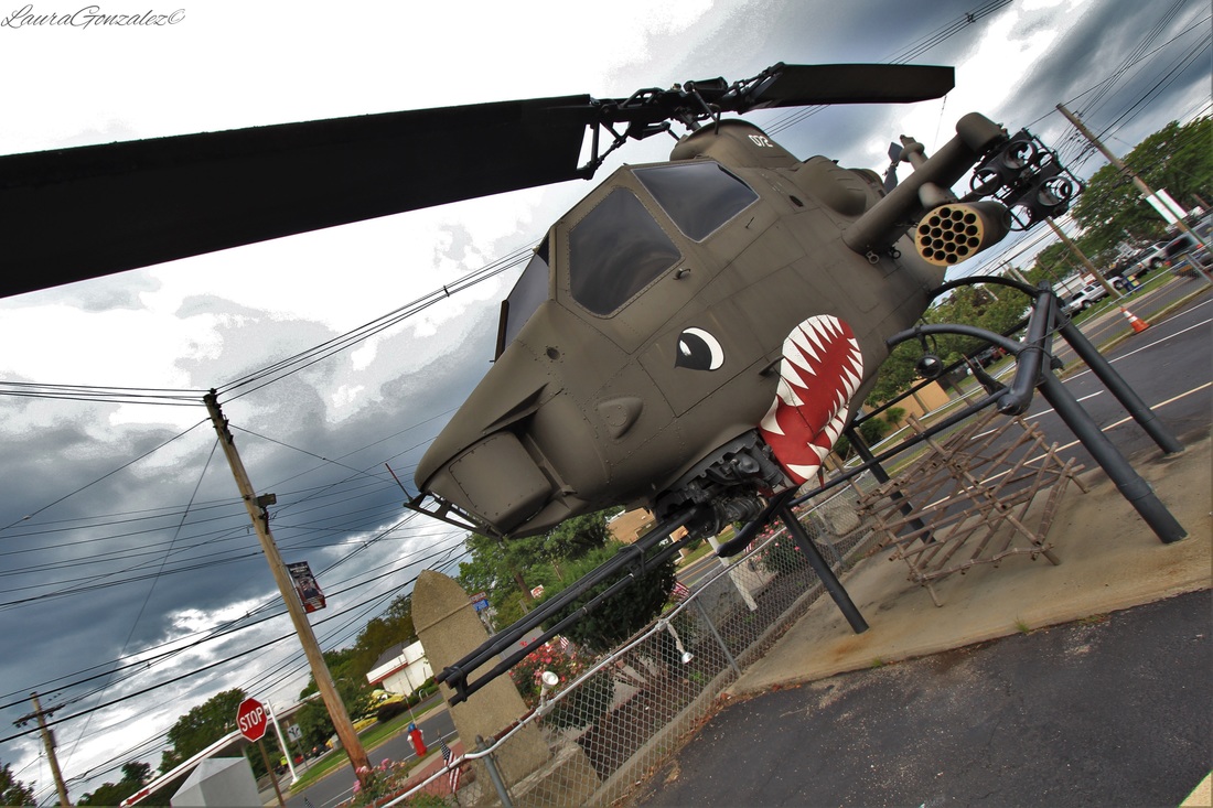 Bell AH-1F Cobra The Golden Lion (structure in left of picture) was once Hotel Marguerite which was built in 1905. It was also Findon's Tavern through the 1940's and 1950's. 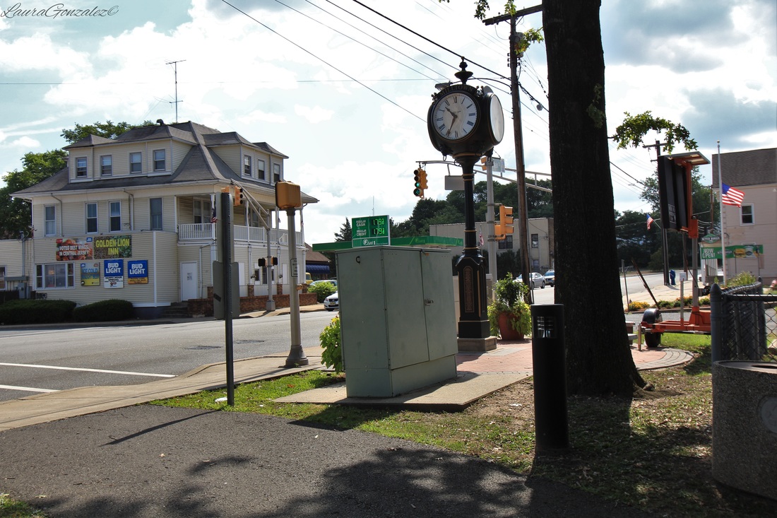 Golden Lion on left 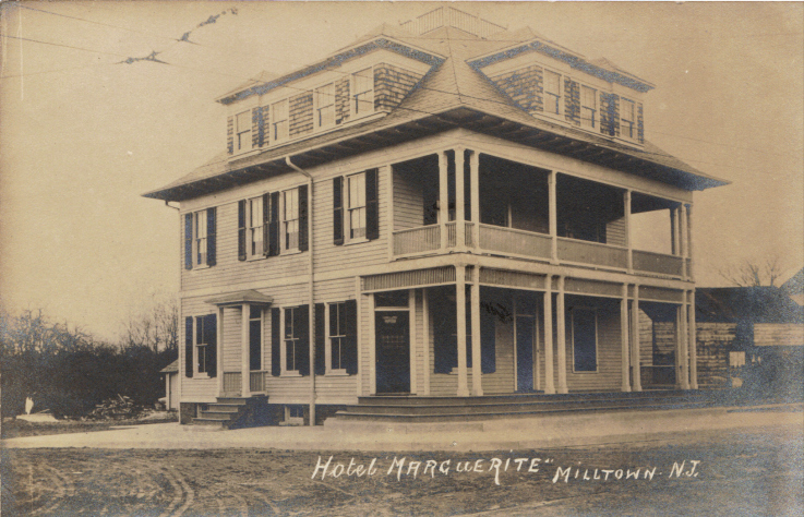 Source:http://milltownhs.ning.com Main Street has numerous shops and places to eat. 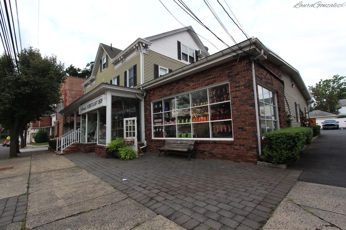 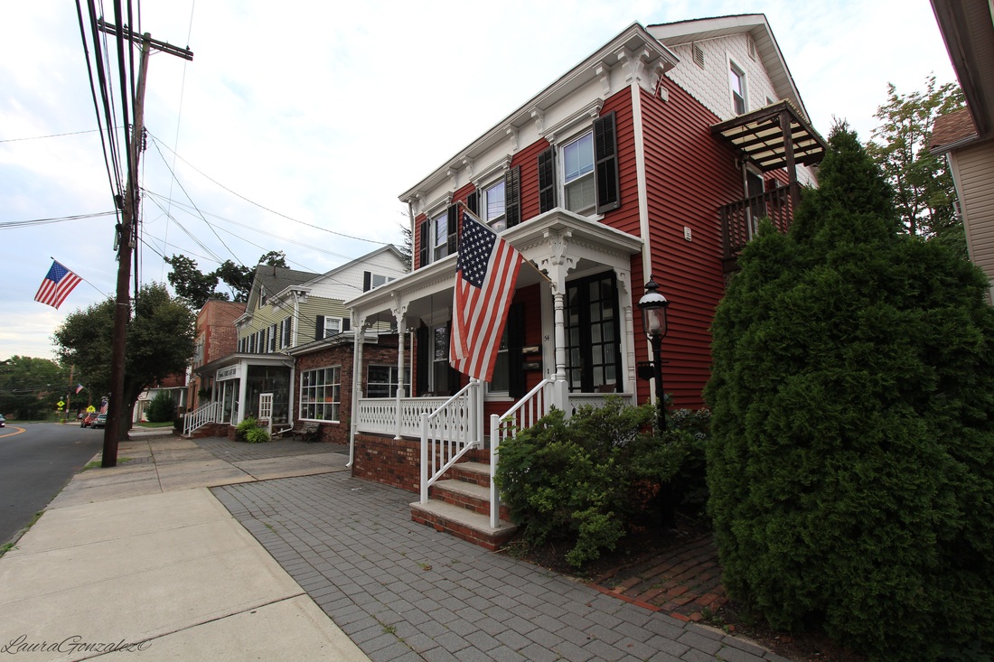 The Milltown Lodge No. 294, Free and Accepted Masons, is over 50 years old. 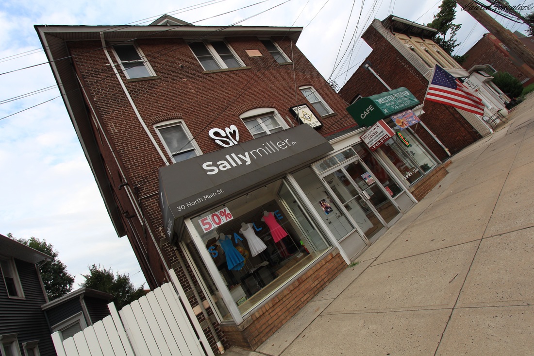 Milltown Lodge No. 294 Revilla Grooves and Gear which is owned and operated by Darren Revilla who got his start selling records online via Ebay. 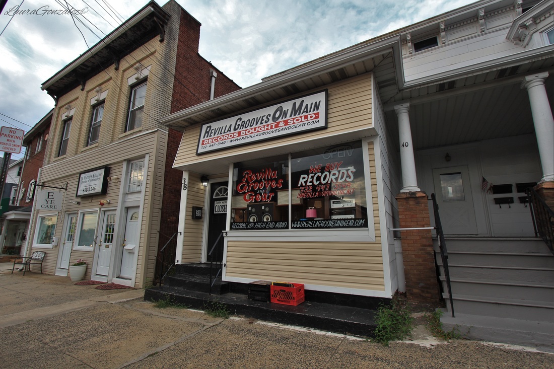 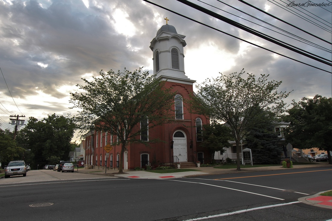 United Methodist Church In the center of town is the Mill Pond. 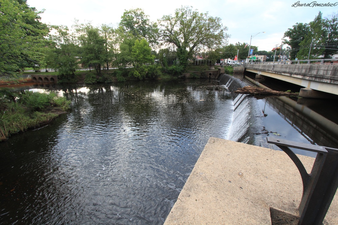 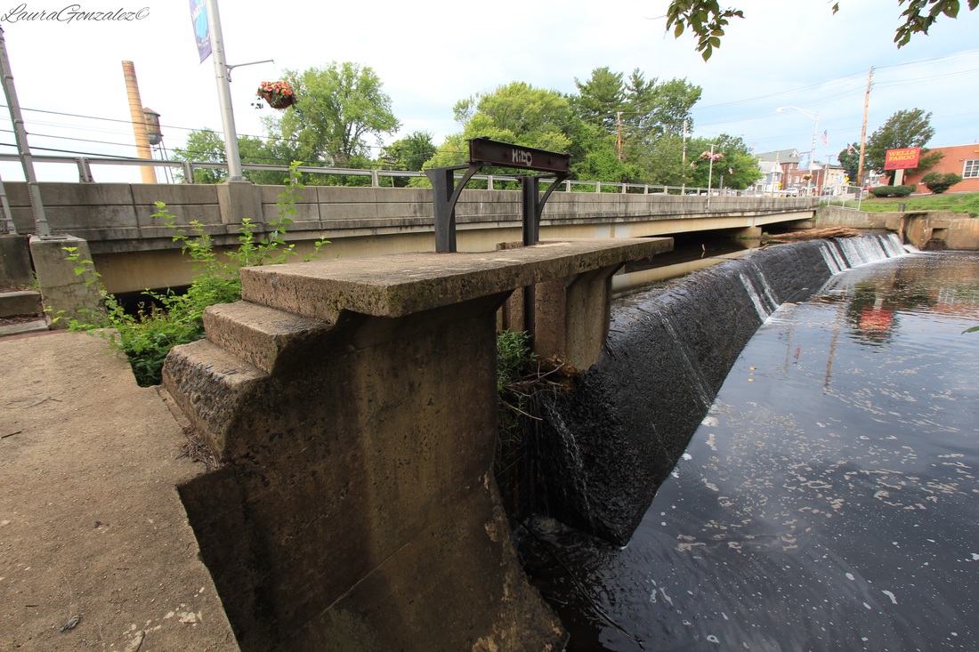  Railroad Tracks run over the pond. And this post wouldn't be complete without talking about the fate of the Milltown Michelin Site which was in the process of being demolished the day I went to take my final pictures. 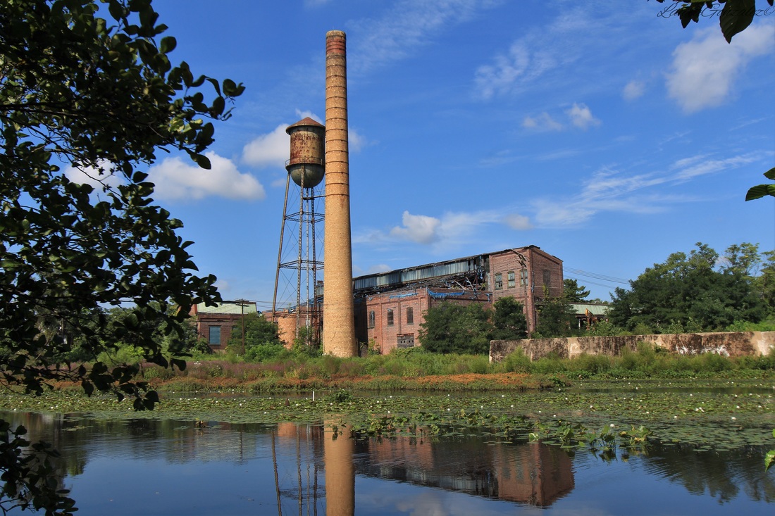 They were hoping to save water tower and smokestack but the Environmental Protection Agency wanted them to come down. Several businesses used the factory after Michelin left including Chicopee of J&J, Heidingsfeld Printing Co., Algro Knitting Mills and Alphaduct Wire. 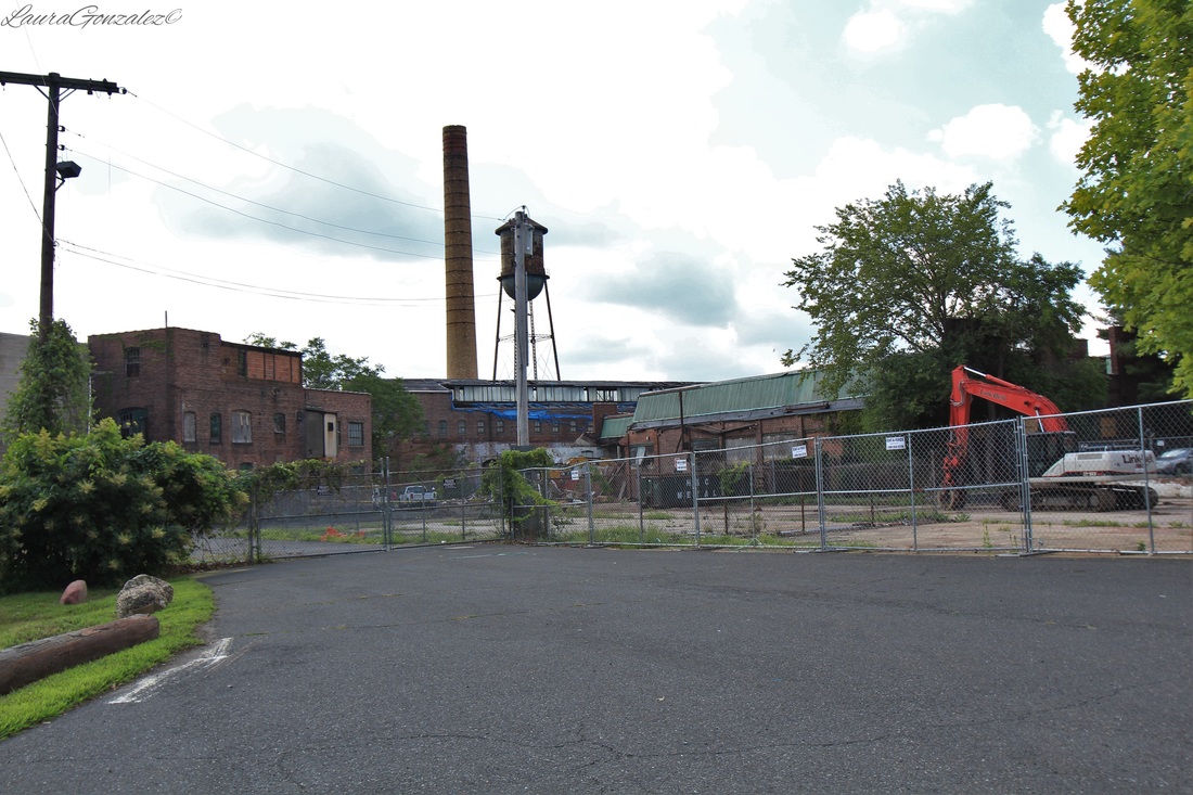 Buildings along Ford Avenue being demolished. Laura Gonzalez
Located in Northampton County, Pennsylvania is the small quiet town of Slateford, which is located on the edge of the Northampton Slate Belt. Many, many years ago, slate quarries were set up and the town was named Slateford. Immigrants from Wales and England came in the 19th century to work in the quarries. At its peak, in the first decade of the twentieth century, the Slate Belt accounted for about half of the slate produced in the United States.
A local historian, Matthew S. Henry, writing in 1851, stated that a slate quarry "At the northern line of the Township along the Delaware River at the Gap" was incorporated on April 16, 1808, under the title "the President Managers & Co for the purpose of obtaining Slate from quarries within the County of Northampton." This title was changed on April 1, 1836, and again on February 22, 1853, to the Kittatinny Slate Company. The organization of this company was believed to be the first attempt at quarrying slate "in this Country."
Delaware Water Gap , Historic Resource Study
The small Slateford settlement consisted of twelve houses at first, which were erected in 1805 by Hon. James M. Porter, the owner of the Pennsylvania Slate Company. The people of the village were quarry employees as the quarry was located about half a mile northwest of the village. In 1877, ownership of the quarry was transferred to J. L. Williams. When the railroad came to town, 26 homes were in existence. The last quarry closed in 1917.
As I walk down the main road something catches my eye, the foundation of the Union church. Most of the stones were moved to Riverview Cemetery when the railroad was put in but somehow these ones were left behind.
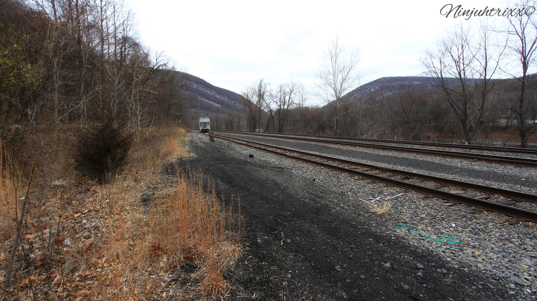
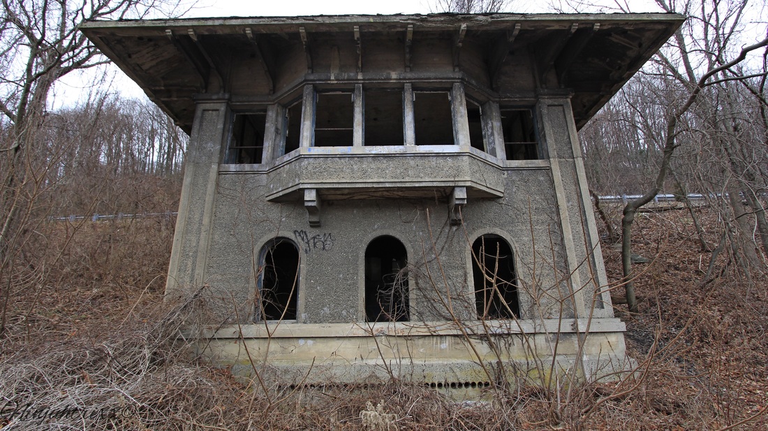
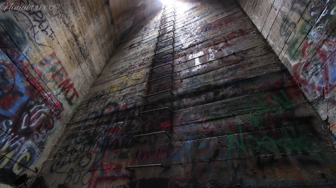
The town is home to Slateford Junction which connected the Lackawanna Railroad to the Lackawanna Cut-Off. The site had an interlocking tower (which still stands) and a small turntable, which didn't get much use. The Slateford turntable was dismantled in the 1930s and filled in after.
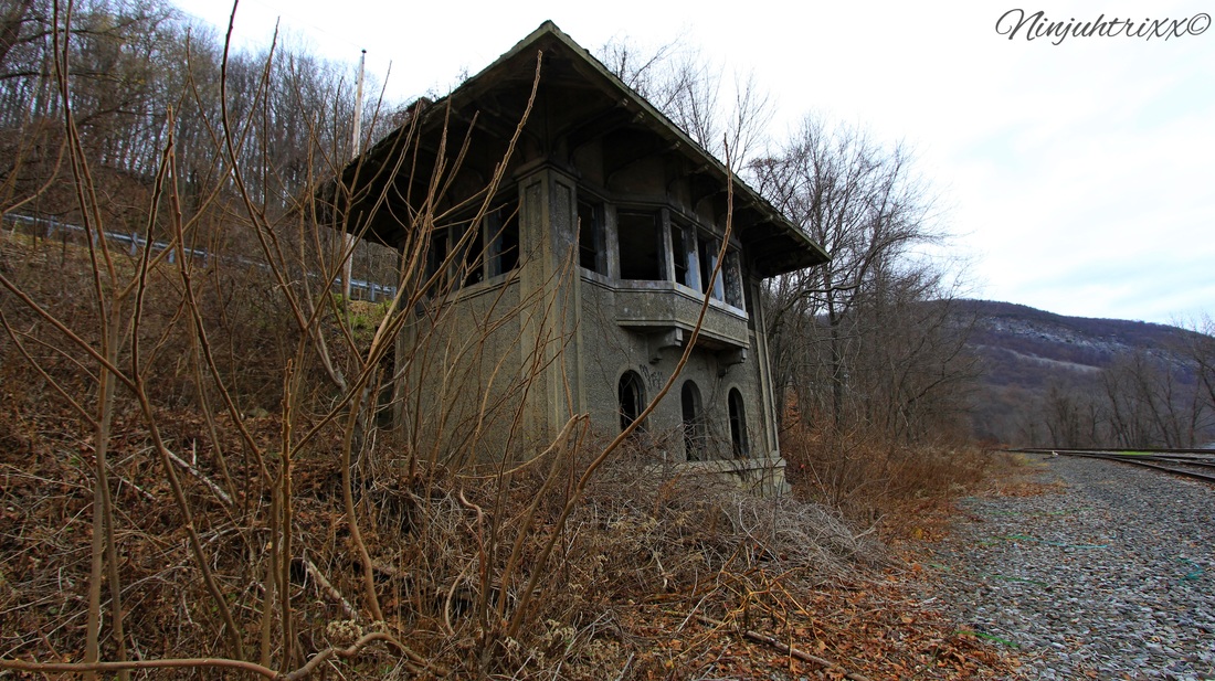
The tower opened on December 20, 1911 and closed on January 11, 1951; its operations were shifted to the tower at East Stroudsburg.
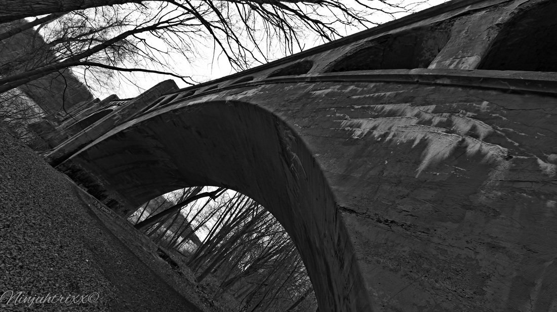
Not to far from the junction is the Delaware River Viaduct.
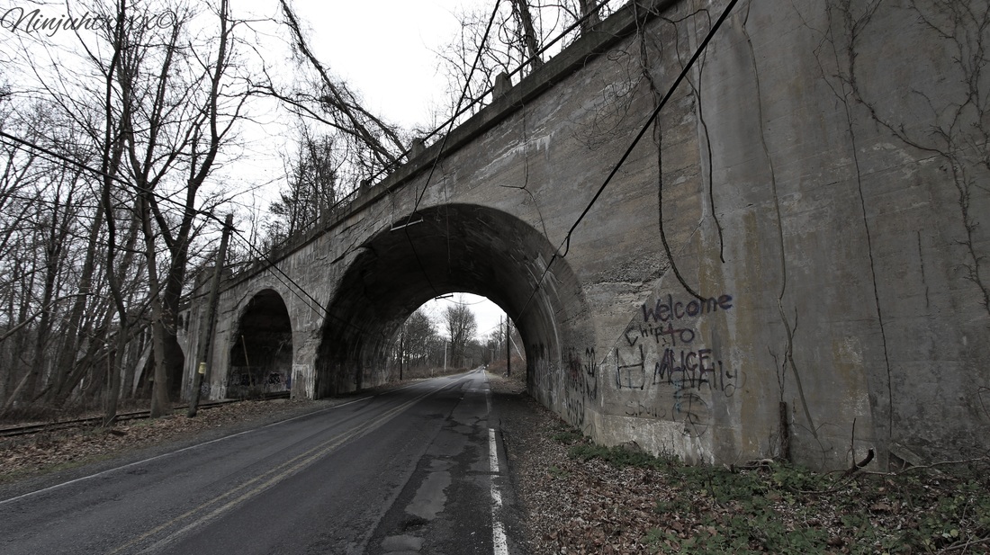
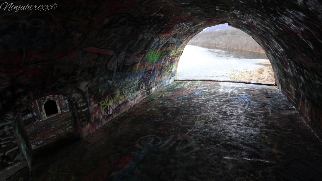
Constructed between August of 1908 to December of 1911, it is often called "Alice in Wonderland", "Alice", or "Wonderland" to those in the urbex community. Standing at 65 feet tall, the structure offers amazing views of the Delaware to those who venture to see it. The inside of one of the chambers is called "Hitlers Closet", which one makes a choice of two views at different heights . Of the four concrete arch viaducts constructed by the Delaware, Lackawanna & Western Railroad on straightening projects during the early twentieth century, the Delaware River Viaduct is the only one with a curving, skew alignment. Smith & McCormick of Easton, Pa was the builder.
From Wikipedia:
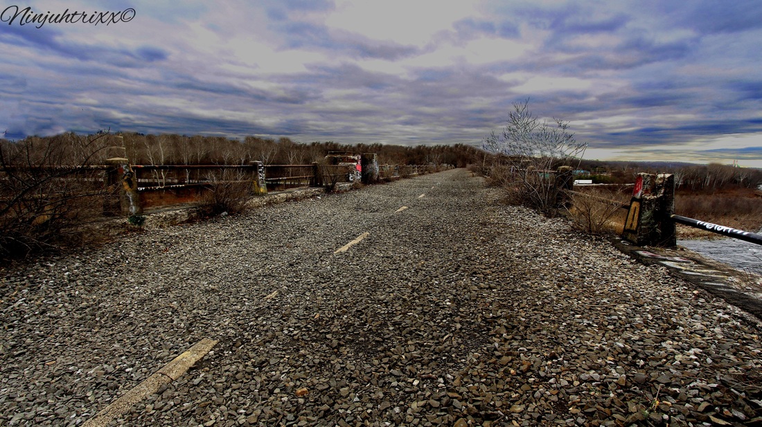
The Lackawanna Cut-Off (also known as the New Jersey Cut-Off or Hopatcong-Slateford Cut-Off) is a railroad line that was built by the Delaware, Lackawanna & Western Railroad (DL&W) between 1908 and 1911. Noted for its large cuts and fills, and two large concrete viaducts, the line was part of a 400-mile (640 km) main line between Hoboken, New Jersey, and Buffalo, New York. The Cut-Off ran west for 28.5 miles (45.9 kms) from Port Morris Junction — near the south end of Lake Hopatcong in New Jersey, about 45 miles (72 km) west-northwest of New York City — to Slateford Junction near the Delaware Water Gap in Pennsylvania.The Cut-Off was 11 miles (18 km) shorter than the Lackawanna Old Road, the rail line it superseded; it had a much better grade profile (0.55% vs. 1.1%); and it had 42 fewer curves, with all but one permitting passenger train speeds of 70 mph (110 km/h) or more.The Cut-Off also had no railroad crossings at the time of its construction. All 73 structures on the line were constructed of reinforced concrete, which was considered a pioneering use of the material. The construction of the roadbed required the movement of millions of tons of fill material using techniques similar to those used on the Panama Canal. 
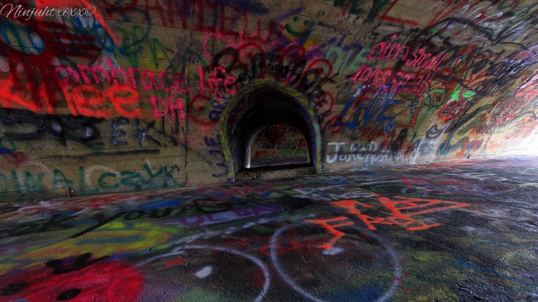

Although the tales of the NJ viaducts being haunted have run rampant, I have found no known evidence to support the legend that a worker, or workers, fell into the concrete during construction and could not be extracted because of the need to keep pouring. It is often confused with the Paulinskill Viaduct, although it is lower and longer in length. It takes the title for the largest reinforced concrete structure built with a continuous pour process. It went through a series of changes in ownership, including the DL&W's merger with the Erie Railroad in 1960, acquisition by a Norfolk & Western Railroad subsidiary in 1968, and by 1976 it was transferred to Conrail where it was abandoned and the tracks ripped up in 1989. It has deteriorated since then and at a faster rate than the Paulinskill.
In the area is also the waterfalls of Slateford. Im told this where the quarry was, although I see no evidence of it existing besides the slate and cuts in the rocks.
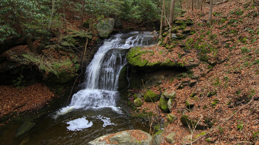
Slateford is a cute small Delaware River town and the waterfalls make it a great day trip. Please note, I do NOT condone trespassing on private property.
More pictures on my flickr!!
Laura Gonzalez
December 16 2015 |
ABOUT THE AUTHORLaura Gonzalez is a photographer, blogger and historian currently residing in Newark, New Jersey. Archives
April 2021
Categories
All
|
 RSS Feed
